- Orange, California
-
City of Orange — City — Orange Plaza, 2005

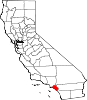
SealMotto: A Slice of Old Town Charm Location of Orange within Orange County, California.
Coordinates: 33°48′11″N 117°49′57″W / 33.80306°N 117.8325°WCoordinates: 33°48′11″N 117°49′57″W / 33.80306°N 117.8325°W Country  United States
State  California
County Orange Founded 1869 Incorporated April 6, 1888 Government – Type Council–Manager – City Council Mayor Carolyn V. Cavecche[1]
Teresa "Tita" Smith
Mark A. Murphy
Jon Dumitru
Denis Bilodeau– City Treasurer Helen Walker – City Clerk Mary E. Murphy Area[2] – Total 25.240 sq mi (65.371 km2) – Land 24.797 sq mi (64.224 km2) – Water 0.443 sq mi (1.147 km2) 1.75% Elevation 195 ft (59 m) Population (2010) – Total 136,416 – Rank 6th in Orange County
41st in California
181st in the United States– Density 5,404.8/sq mi (2,086.8/km2) Time zone PST (UTC-8) – Summer (DST) PDT (UTC-7) ZIP code 92856 – 92869 Area code(s) 657, 714 FIPS code 06-53980 GNIS feature ID 1652765 Website www.cityoforange.org The city of Orange is located in Orange County, California. It is approximately 3 miles (4.8 kilometers) north of the county seat, Santa Ana. Orange is unusual in that many of the homes in its Old Town District were built prior to 1920; whereas many other cities in the region demolished such houses in the 1960s, Orange decided to preserve them. The small affluent city of Villa Park is surrounded by the city of Orange. The population was 136,416 at the 2010 census.
Contents
History
 View of the early rural farm community in the town of Orange. The railroad that used to transport citrus crops and livestock to Orange can be seen on the left.
Members of the Tongva and Juaneño/Luiseño ethnic group long inhabited this area. After the 1769 expedition of Gaspar de Portolà, an expedition out of San Blas, Nayarit, Mexico, led by Father Junípero Serra, named the area Vallejo de Santa Ana (Valley of Saint Anne). On November 1, 1776, Mission San Juan Capistrano became the area's first permanent European settlement in Alta California, New Spain.
In 1801, the Spanish Empire granted 62,500 acres (253 km2) to José Antonio Yorba, which he named Rancho San Antonio. Yorba's great rancho included the lands where the cities of Olive, Orange, Villa Park, Santa Ana, Tustin, Costa Mesa and Newport Beach stand today. Smaller ranchos evolved from this large rancho, including the Rancho Santiago de Santa Ana.
Don Juan Pablo Grijalva, a retired Spanish soldier and the area's first landowner, was granted permission in 1809 by the Spanish colonial government to establish a rancho in "the place of the Arroyo de Santiago."
After the Mexican–American War, Alta California was ceded to the United States by México with the signing of the Treaty of Guadalupe Hidalgo in 1848, and though many Californios lost titles to their lands in the aftermath, Grijalva's descendants retained ownership through marriages to Anglo-Americans.
Since at least 1864, Los Angeles attorneys Alfred Chapman and Andrew Glassell together and separately, held about 5,400 acres (22 km2) along both sides of the Santiago Creek (Glassell also had a 4,000-acre (16 km2) parcel where Costa Mesa is today). Water was the key factor for the location of their townsite. Glassell needed a spot he could irrigate, bringing water down from the Santa Ana Canyon and the quality of the soil may have influenced his choice. Originally the community was named Richland, but in 1873 Richland got a new name. In the book, "Orange, The City 'Round The Plaza" by local historian Phil Brigandi, it states, "In 1873 the town had grown large enough to require a post office, so an application was sent to Washington. It was refused, however, as there was (and is) already a Richland, California in Sacramento County. Undaunted, the Richlanders proposed a new name - Orange."
The small town was incorporated on April 6, 1871, under the general laws of the state of California. Orange was the only city in Orange County to be planned and built around a plaza, earned it the nickname Plaza City.[3] Orange was the first developed town site to be served by the California Southern Railroad when the nation's second transcontinental rail line reached Orange County.[4]
The town experienced its first growth spurt during the last decade of the 19th century (as did many of the surrounding communities), thanks to ever-increasing demands for California-grown citrus fruits, a period some refer to as the "Orange Era." Southern California's real estate "boom" of 1886-1888, fueled by railroad rate wars, also contributed to a marked increase in population. Like most cities in Orange County, agriculture formed the backbone of the local economy, and growth thereafter was slow and steady until the 1950s, when a second real estate boom spurred development. Inspired by the development of a region-wide freeway system which connected Los Angeles' urban center with outlying areas like Orange, large tracts of housing were developed from the 1950s to the early 1970s, and this continues today, albeit at a much slower pace, at the eastern edge of the city.
Geography
The city has a total area of 25.2 square miles (65 km2), 24.8 square miles (64 km2) of which is land and 0.4 square miles (1.0 km2) of which is water. The total area is 1.75% water.
Climate
Orange, California Climate chart (explanation) J F M A M J J A S O N D 3.269473.170482.871500.774520.375560.17960083630.184640.383630.480581.274511.87046Average max. and min. temperatures in °F Precipitation totals in inches Source: Weather.com / NWS Metric conversion J F M A M J J A S O N D 81218772197122101723116.424132.826160.52817329188.628179.1271430231145218Average max. and min. temperatures in °C Precipitation totals in mm Southern California is well-known for year-round pleasant weather:
- On average, the warmest month is August.
- The highest recorded temperature was 110 °F (43 °C) in 1985.
- On average, the coolest month is December.
- The lowest recorded temperature was 22 °F (−6 °C) in 1950.
- The maximum average precipitation occurs in January.[5]The period of April through November is warm to hot and dry with average high temperatures of 74 - 84 °F (29 °C) and lows of 52 - 64 °F (18 °C). Due to the moderating effect of the ocean, temperatures are cooler than more inland areas of Orange County, where temperatures frequently exceed 90 °F (32 °C) and occasionally reach 100 °F (38 °C). The period of November through March is somewhat rainy, as shown in the table to right.[6]
The Orange County area is also subject to the phenomena typical of a microclimate. As such, the temperatures can vary as much as 18 °F (10 °C) between inland areas and the coast, with a temperature gradient of over one degree per mile (1.6 km) from the coast inland. California also has a weather phenomenon called "June Gloom or May Gray", which sometimes brings overcast or foggy skies in the morning on the coast, but usually gives way to sunny skies by noon, during late spring and early summer.
The Orange County area averages 15 inches (385 mm) of precipitation annually, which mainly occurs during the winter and spring (November thru April) with generally light rain showers, but sometimes as heavy rainfall and thunderstorms. Coastal Torrance receives slightly less rainfall, while the mountains receive slightly more. Snowfall is extremely rare in the city basin, but the mountains within city limits typically receive snowfall every winter.
Cityscape
 Orange City Hall, circa 1921. This building was razed in 1964 and is the site of the current Orange City Hall.
Old Towne, Orange Historic District, a one square-mile around the original plaza, contains many of the original structures built in the period after the city's incorporation. It is a vibrant commercial district, containing Orange County's oldest operating bank and the oldest operating soda fountain. The Historic District was listed on the National Register of Historic Places in 1997,[7] and is the largest National Register District in California. The Old Towne Preservation Association is a non-profit organization dedicated to maintaining the district.
Orange is unique among the region and the state in that it has the second largest concentration of historic buildings.[8] A list of all of the buildings and sites in Orange appears in the National Register of Historic Places.[7][9][10]
Architectural styles in Old Towne Orange
- Bungalow[11]
- Craftsman Bungalow[12]
- Arts and Crafts Movement[13]
- Hip roof cottage[14]
- Mediterranean Revival architecture[15]
- Prairie Style architecture[16]
- Spanish Colonial Revival architecture[17]
- Victorian architecture[18]
Demographics
2010
The 2010 United States Census[19] reported that Orange had a population of 136,416. The population density was 5,404.7 people per square mile (2,086.8/km²). The racial makeup of Orange was 91,522 (67.1%) White, 2,227 (1.6%) African American, 993 (0.7%) Native American, 15,350 (11.3%) Asian, 352 (0.3%) Pacific Islander, 20,567 (15.1%) from other races, and 5,405 (4.0%) from two or more races. Hispanic or Latino of any race were 52,014 persons (38.1%).
The Census reported that 130,163 people (95.4% of the population) lived in households, 2,587 (1.9%) lived in non-institutionalized group quarters, and 3,666 (2.7%) were institutionalized.
There were 43,367 households, out of which 16,303 (37.6%) had children under the age of 18 living in them, 23,572 (54.4%) were opposite-sex married couples living together, 5,260 (12.1%) had a female householder with no husband present, 2,424 (5.6%) had a male householder with no wife present. There were 2,442 (5.6%) unmarried opposite-sex partnerships, and 373 (0.9%) same-sex married couples or partnerships. 8,480 households (19.6%) were made up of individuals and 3,115 (7.2%) had someone living alone who was 65 years of age or older. The average household size was 3.00. There were 31,256 families (72.1% of all households); the average family size was 3.42.
The population was spread out with 32,096 people (23.5%) under the age of 18, 16,420 people (12.0%) aged 18 to 24, 39,574 people (29.0%) aged 25 to 44, 33,698 people (24.7%) aged 45 to 64, and 14,628 people (10.7%) who were 65 years of age or older. The median age was 34.8 years. For every 100 females there were 101.5 males. For every 100 females age 18 and over, there were 99.7 males.
There were 45,111 housing units at an average density of 1,787.3 per square mile (690.1/km²), of which 26,319 (60.7%) were owner-occupied, and 17,048 (39.3%) were occupied by renters. The homeowner vacancy rate was 1.1%; the rental vacancy rate was 5.1%. 77,179 people (56.6% of the population) lived in owner-occupied housing units and 52,984 people (38.8%) lived in rental housing units.
2000
 Peters Canyon Park in east Orange
As of the census[20] of 2000, there were 128,821 people, 40,930 households, and 30,165 families residing in the city. The population density is 5,506.4 inhabitants per square mile (2,126.5/km²). There were 41,904 housing units at an average density of 1,791.2 per square mile (691.7/km²).
The racial makeup of the city is 80.50% White, 0.29 African American, 0.78% Native American, 10.5% Asian, 0.23% Pacific Islander, 6.82% from other races, and none from two or more races. 10.16% of the population are Hispanic or Latino of any race.
There are 40,930 households, out of which 37.1% have children under the age of 18 living with them, 57.1% are married couples living together, 11.6% have a female householder with no husband present, and 26.3% are non-families. 19.5% of all households are made up of individuals, and 6.6% have someone living alone who is 65 years of age or older. The average household size is 3.02 and the average family size is 3.43.
The population is spread out with 26.7% under the age of 18, 9.9% from 18 to 24, 33.3% from 25 to 44, 20.5% from 45 to 64, and 9.6% who are 65 years of age or older. The median age is 33 years. For every 100 females, there are 100.8 males. For every 100 females age 18 and over, there are 98.7 males.
The median income for a household in the city is $58,994, and the median income for a family is $64,573 (these figures had risen to $75,024 and $85,730 respectively as of a 2007 estimate[21]). Males have a median income of $42,144 versus $34,159 for females. The per capita income for the city is $24,294. 10.0% of the population and 6.8% of families are below the poverty line. Out of the total population, 12.5% of those under the age of 18 and 7.5% of those 65 and older are living below the poverty line.
Politics
In the state legislature Orange is located in the 33rd Senate District, represented by Republican Mimi Walters, and in the 60th, 71st, and 72nd Assembly District, represented by Republicans Curt Hagman, Jeff Miller, and Chris Norby, respectively. Federally, Orange is located in California's 40th congressional district, which has a Cook PVI of R +8[22] and is represented by Republican Ed Royce. There has recently been a heated battle between the entrenched citizens of Orange and, mainly, the college students that attend Chapman University about a new law that allows Orange police to issue violations to any dwelling that has three or more non-residents in it. This is fiercely being fought by not only Chapman students but other citizens of Orange.
Economy

According to the City's 2009 Comprehensive Annual Financial Report,[23] the top employers in the city are:
# Employer # of employees 1 UC Irvine Medical Center 3,986 2 St. Joseph Hospital 3,909 3 Children's Hospital of Orange County 2,314 4 Orange County Transportation Authority 1,000 5 City of Orange 869 6 Chapman University 800 7 Children and Families Commission of Orange County 700 8 St. Joseph's Health System 550 9 CaliforniaChoice 500 10 National Oilwell Varco 500 11 Word & Brown 500 People and culture
Points of interest
 A view of the fountain currently located at the center of the Orange Plaza, dedicated on December 1, 1937. The original fountain had been erected on this spot in 1886. A plaque at the fountain's base proclaims "Whoever passes here, let him remember the brave men of the Orange community who have in all times gone to the defense of their country."
Orange is home to parks, lakes, a small zoo, a university, and a wildlife sanctuary.
The Block at Orange, a large, outdoor shopping and entertainment center, is located on the western edge of the city. It features Old Navy, Hollister, Ann Taylor Factory Store, and Saks Fifth Avenue OFF 5th as well as high quality entertainment venues including AMC Theatres, Dave & Buster's, Vans Skatepark and Lucky Strike Bowling Center.
Historically, the plaza has been primarily home to a wide variety of antique shops—and has become a well known destination amongst antique collectors. A more recent trend has brought clothing boutiques, and several casual and upscale restaurants. It also features two Starbucks locations, mirroring each other on opposite ends of the plaza, RadioShack, Wells Fargo bank, a Masonic lodge, and is within walking distance of Chapman University and the newly reconstructed public library. Films such as That Thing You Do starring Tom Hanks, Accepted starring Justin Long, and Big Momma's House were all filmed in the historical Old Town Orange [24].
The Woman’s Club of Orange[25] Organized February 1915, is located near the plaza in the Old Towne District. Their clubhouse, built in 1923-1924, is entered in the National Register of Historic Places.[26] In 2009 Woman's Club of Orange, a member of the General Federation of Women's clubs, is still a very active and vibrant club of 180 members. Their annual Flower Show, celebrating its 72nd year in April is a major city event.
For over 100 years, during Labor Day Weekend, the plaza plays host to the Orange International Street Fair. Friends, families and neighbors get together to experience a variety of food, music and dance from cultures around the world. The profits from the event go to non-profit charities that help people in the community.
The "Villa Park Orchards Association" packing house, located along the former Atchison, Topeka and Santa Fe Railway (now BNSF Railway) mainline, is the sole remaining fruit packing operation in Orange County.
The Lewis Ainsworth House is the city's only restored house museum.
Transportation
Automobile
Like most cities in Southern California, the primary means of transportation is the automobile. Orange is situated near many state freeways, as well as Interstate 5, also known as the Santa Ana Freeway. The junction of "the 5" with two state highways (SR 57 "Orange Freeway" and SR 22 "Garden Grove Freeway"), commonly called the "Orange Crush", is one of the busiest interchanges in Orange County, and is located on the southwestern edge of the city. The eastern areas of Orange are served by the Eastern and Foothill Toll Roads, two of California's first toll highways, which connect the city with the cities of Irvine and Rancho Santa Margarita. Most highways do not go through Orange but rather begin or end there. The 55 is born of the 91 in the northeast of the city, while the 22 and the 57 both spring from the southwest.
Rail
 The former Mediterranean Revival Style combination depôt of the Atchison, Topeka and Santa Fe Railway in Orange, California. The structure was dedicated on May 1, 1938, and was closed with the discontinuation of passenger service in 1971. The building was granted historic landmark status by the city on November 15, 1990. In July 2004, the facility was home to a Cask 'n Cleaver restaurant and was remodeled and reopened in 2011 as a Ruby's Diner.
The town's first rail service, the Santa Ana, Orange & Tustin Street Railway, was a 4.04-mile (6.5-km) long horsecar line that ran between Santa Ana and Orange, beginning in 1886. One year later, the Santa Ana & Orange Motor Road Company purchased the line, using a steam "dummy" car and a single gasoline motorcar as its means of conveyance. In 1906, Henry E. Huntington acquired the company under the auspices of the Los Angeles Inter-Urban Railway and electrified the line.
Passenger service over the new line operated by Huntington's Pacific Electric Railway began on June 8, 1914, originating at the PE's depot on Lemon Street. The route provided freight service to the local citrus growers, in direct competition with the Atchison, Topeka and Santa Fe Railway. Pacific Electric sold out in 1961 to the Southern Pacific Railroad, who ultimately abandoned the line in 1964.
The Santa Fe, under its affiliate the Southern California Railway, laid its first tracks through Orange in 1886, and established its first depot the following year. The route would become part of the railroad's famous "Surf Line", and by 1925, sixteen daily passenger trains (the Santa Fe's San Diegan) made stops in Orange. During peak growing seasons, as many as 48 carloads of citrus fruits, olives, and walnuts were shipped daily from the Orange depot as well.
Rail connections to Los Angeles, the Inland Empire, and Northern San Diego County by the Metrolink regional commuter rail network. The Orange Metrolink station's platform is situated adjacent to the former Santa Fe depot in the downtown Historic District, which is also home to an Orange County Transportation Authority (OCTA) bus station, is the second busiest station of the entire Metrolink train system due to its position serving as a transfer station for the Orange County and the IEOC Metrolink lines. The former Santa Fe mainline links the cities of Los Angeles, Riverside, and San Diego via a junction north of the station.
Airports
John Wayne Airport (SNA) in nearby Santa Ana, California, provides daily scheduled airline service for the area.
Schools, colleges and universities
- Chapman University — Home of the Panthers
- Santiago Canyon College — Home of the Hawks
- Orange High School — Home of the Panthers
- Villa Park High School (Villa Park, California) — Home of the Spartans
- El Modena High School — Home of the Vanguards
- Orange Unified School District — Public School District for Orange and surrounding areas
- Lutheran High School of Orange County — Home of the Lancers
- Eldorado Emerson Private School — preschool and K-12
Sports
In 1978 and 1979, the California Sunshine was a professional soccer team that played regular season games in Orange. The city roots for major league teams: the Los Angeles Angels of Anaheim of baseball and the Anaheim Ducks of ice hockey, across the Santa Ana River in Anaheim.
Notable natives and residents
- Toni Childs, singer
- Gaddi Vasquez, Orange High Class of 1973, former Orange County Supervisor and Director of the Peace Corps under George W. Bush.
- Don Aase, born in Orange, MLB player[27]
- Garrett Atkins, MLB player for the Baltimore Orioles and Colorado Rockies.
- James Blaylock, novelist and creator of the Steampunk genre.
- Bert Blyleven, MLB player who played in the California Angels and once owned a cafe in nearby Villa Park.
- Corrie ten Boom, a Dutch, Christian Holocaust survivor, best known for her autobiography The Hiding Place which was later made into a movie of the same name.
- Professional skateboarder Ronnie Creager was born in Orange and lives there.
- Bud Daley, MLB player for the Cleveland Indians, Kansas City Athletics, and New York Yankees
- Rob Deer, MLB player for the San Francisco Giants, Milwaukee Brewers, Detroit Tigers, Boston Red Sox, and San Diego Padres.
- Robby Gordon, NASCAR Sprint Cup Driver.
- Casey Janssen, MLB player, was born in Orange.
- Ruby Keeler, movie actress and part-time Orange resident, is buried in Holy Sepulcher Cemetery in Orange Park Acres, east of the city limits.
- Novelist Dean Koontz once resided in Orange Hills and set many of his novels, such as The Bad Place, in the area.
- Anna Leahy, poet.
- Jason Lee, actor and former professional skater.
- Justin Lehr, MLB player for the Cincinnati Reds, Oakland Athletics, and Milwaukee Brewers.
- Amber Lynn, adult films actress
- Hunter Mahan, PGA Tour golfer, was born in Orange.
- Scott McAdams, former mayor of Sitka, Alaska and Democratic nominee for U.S. Senate in Alaska in 2010, was born in Orange.[28]
- Mark Trumbo Professional MLB Baseball Player. Currently first baseman for Los Angeles Angels of Anaheim
- Abe Walsh, author and former publisher for the National Rifle Association was born in Orange.
Sister cities
Orange has five sister cities, as designated by Sister Cities International:
 Novo Kosino, Moscow, Russia
 Orange, Australia
 Orange, France
 Santiago de Querétaro, Mexico
 Timaru, New Zealand
Orange has two community partnerships with Utrecht, the Netherlands, and Santiago de Chile, Chile.
See also
References
- ^ Orange, California, Of City (2010). "City of Orange, CA - Mayor/City Council". http://www.cityoforange.org/council/default.asp. Retrieved 2010-02-07
- ^ U.S. Census
- ^ "The Plaza – History". City of Orange CA. http://www.cityoforange.org/localhistory/plaza/history.htm. Retrieved 2009-05-03.
- ^ According to company records[citation needed]
- ^ Orange, CA: Weather Facts Retrieved 2009-05-07
- ^ www.weather.com
- ^ a b "CALIFORNIA - Orange County, part2". National Register of Historic Places. http://www.nationalregisterofhistoricplaces.com/CA/Orange/state2.html. Retrieved 2009-05-10.
- ^ According to State Historic Resource Surveys.
- ^ "CALIFORNIA - Orange County, part1". National Register of Historic Places. http://www.nationalregisterofhistoricplaces.com/CA/Orange/state1.html. Retrieved 2009-05-10.[dead link]
- ^ "CALIFORNIA - Orange County, part3". National Register of Historic Places. http://www.nationalregisterofhistoricplaces.com/CA/Orange/state3.html. Retrieved 2009-05-10.
- ^ Bungalow Style 1910-1929
- ^ Craftsman Bungalow Style 1904-1921
- ^ Craftsman Style 1909-1918
- ^ Classical Revival and Hip Roof Cottage Styles 1904 - 1911
- ^ Mediterranean Style 1920 - 1935
- ^ Prairie Style 1916 - 1921
- ^ Spanish Colonial Style 1913 - 1931
- ^ Victorian Style 1886 - 1910
- ^ All data are derived from the United States Census Bureau reports from the 2010 United States Census, and are accessible on-line here. The data on unmarried partnerships and same-sex married couples are from the Census report DEC_10_SF1_PCT15. All other housing and population data are from Census report DEC_10_DP_DPDP1. Both reports are viewable online or downloadable in a zip file containing a comma-delimited data file. The area data, from which densities are calculated, are available on-line here. Percentage totals may not add to 100% due to rounding. The Census Bureau defines families as a household containing one or more people related to the householder by birth, opposite-sex marriage, or adoption. People living in group quarters are tabulated by the Census Bureau as neither owners nor renters. For further details, see the text files accompanying the data files containing the Census reports mentioned above.
- ^ "American FactFinder". United States Census Bureau. http://factfinder.census.gov. Retrieved 2008-01-31.
- ^ Orange 2007 Income Estimates
- ^ "Will Gerrymandered Districts Stem the Wave of Voter Unrest?". Campaign Legal Center Blog. http://www.clcblog.org/blog_item-85.html. Retrieved 2008-02-10.
- ^ City of Orange CAFR
- ^ http://www.imdb.com/title/tt0117887/trivia
- ^ Woman’s Club of Orange
- ^ #97000617
- ^ Reichler, Joseph L., ed (1979) [1969]. The Baseball Encyclopedia (4th ed.). New York: Macmillan Publishing. ISBN 0-02-578970-8.
- ^ (pdf) State of Alaska - Official Election Pamphlet - November 2, 2010 (Region I ed.). Juneau: State of Alaska Division of Elections. 2010. p. 17. http://www.elections.alaska.gov/doc/oep/2010/Region_01_oep.pdf. Retrieved October 15, 2010.
External links
- City of Orange official website
Municipalities and communities of Orange County, California Cities Aliso Viejo | Anaheim | Brea | Buena Park | Costa Mesa | Cypress | Dana Point | Fountain Valley | Fullerton | Garden Grove | Huntington Beach | Irvine | La Habra | La Palma | Laguna Beach | Laguna Hills | Laguna Niguel | Laguna Woods | Lake Forest | Los Alamitos | Mission Viejo | Newport Beach | Orange | Placentia | Rancho Santa Margarita | San Clemente | San Juan Capistrano | Santa Ana | Seal Beach | Stanton | Tustin | Villa Park | Westminster | Yorba Linda
CDPs Unincorporated
communitiesAnaheim Island | Modjeska Canyon | Orange Park Acres | Santa Ana Heights | Santiago Canyon | Silverado | Trabuco Canyon
Mayors of cities with populations exceeding 100,000 in California - Antonio Villaraigosa
(Los Angeles) - Jerry Sanders
(San Diego) - Chuck Reed
(San Jose) - Edwin M. Lee
(San Francisco) - Ashley Swearengin
(Fresno) - Kevin Johnson
(Sacramento) - Bob Foster
(Long Beach) - Jean Quan
(Oakland) - Harvey Hall
(Bakersfield) - Tom Tait
(Anaheim) - Miguel A. Pulido
(Santa Ana)
- Ronald O. Loveridge
(Riverside) - Ann Johnston
(Stockton) - Cheryl Cox
(Chula Vista) - Bob Wasserman
(Fremont) - Sukhee Kang
(Irvine) - Pat Morris
(San Bernardino) - Jim Ridenour
(Modesto) - Thomas E. Holden
(Oxnard) - Acquanetta Warren
(Fontana) - William H. Batey II
(Moreno Valley)^ - John Drayman
(Glendale)
- Joe Carchio
(Huntington Beach)^ - Bob Kellar
(Santa Clarita)^ - William Dalton
(Garden Grove) - Susan Gorin
(Santa Rosa)^ - Jim Wood
(Oceanside) - Donald Kurth
(Rancho Cucamonga) - Paul S. Leon
(Ontario) - R. Rex Parris
(Lancaster) - Pat Hume
(Elk Grove) - James C. Ledford Jr.
(Palmdale) - Stan Skipworth
(Corona)^
- Dennis Donohue
(Salinas) - Elliot Rothman
(Pomona) - Frank Scotto
(Torrance) - Michael Sweeney
(Hayward) - Sam Abed
(Escondido) - Tony Spitaleri
(Sunnyvale) - Bill Bogaard
(Pasadena) - Carolyn Cavecche
(Orange) - F. Richard Jones
(Fullerton)^ - Jacqui Irwin
(Thousand Oaks)^ - Jesus Gamboa
(Visalia)
- Paul Miller
(Simi Valley) - William D. Shinn
(Concord)^ - Gina Garbolino
(Roseville) - Jamie L. Matthews
(Santa Clara) - Osby Davis
(Vallejo) - Rudy Cabriales
(Victorville) - Ernest Gutierrez
(El Monte) - Tom Bates
(Berkeley) - Rick Trejo
(Downey)^ - Eric R. Bever
(Costa Mesa)^ - James T. Butts, Jr.
(Inglewood)
 ^Mayor selected from city council
Other states: AL • AK • AZ • AR • CA • CO • CT • DE • FL • GA • HI • ID • IL • IN • IA • KS • KY • LA • ME • MD • MA • MI • MN • MS • MO • MT • NE • NV • NH • NJ • NM • NY • NC • ND • OH • OK • OR • PA • RI • SC • SD • TN • TX • UT • VT • VA • WA • WV • WI • WYCategories:- Orange, California
- Cities in Orange County, California
- Populated places on the Santa Ana River
- Populated places established in 1888
- Cities in Southern California
- Incorporated cities and towns in California


Wikimedia Foundation. 2010.