- Palmdale, California
Infobox Settlement
official_name = City of Palmdale
other_name =
native_name =
nickname =
motto = Aerospace Capital of America
imagesize =
image_caption =
flag_size = 200px
image_
seal_size =
image_shield =
shield_size =
image_blank_emblem =
blank_emblem_size =
seal_size =
image_shield =
shield_size =
image_blank_emblem =
blank_emblem_size =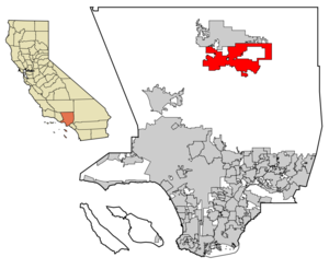
mapsize = 250x200px
map_caption = Location of Palmdale in Los Angeles County,California
mapsize1 =
map_caption1 =
subdivision_type = Country
subdivision_name =United States
subdivision_type1 = State
subdivision_name1 =California
subdivision_type2 = County
subdivision_name2 = Los Angeles
government_type = Incorporated City
leader_title =Mayor
leader_name = James C. Ledford Jr. [cite web | url = http://palmdale.granicus.com/ViewPublisher.php?view_id=2 | title = City Council | accessdate = 2007-01-17 ]
leader_title1 =Mayor Pro Tem
leader_name1 = Steve Knight [Ibid]
leader_title2 =City Manager
leader_name2 = Steve Williams [Ibid]
leader_title3 =
leader_name3 =
established_title =
established_date =
established_title2 =
established_date2 =
established_title3 =
established_date3 =
area_magnitude =
area_total_km2 = 272.2
area_total_sq_mi = 105.1
area_land_km2 = 271.8
area_land_sq_mi = 104.59
area_water_km2 = 0.4
area_water_sq_mi = 0.1
area_water_percent = 0.13
area_urban_km2 =
area_urban_sq_mi =
area_metro_km2 =
area_metro_sq_mi =
population_as_of = 2008
population_note =
settlement_type =City
population_total = 147,897
population_density_km2 = 429.2
population_density_sq_mi = 1111.6
population_metro = 462,272
population_density_metro_km2 =
population_density_metro_sq_mi =
population_urban =
population_density_urban_km2 =
population_density_urban_sq_mi =
timezone = PST
utc_offset = -8
timezone_DST = PDT
utc_offset_DST = -7
latd = 34 |latm = 34 |lats = 52 |latNS = N
longd = 118 |longm = 6 |longs = 2 |longEW = W
elevation_m = 810
elevation_ft = 2657
postal_code_type =ZIP code
postal_code = 93536, 93543, 93550-93553, 93590-93592
area_code = 661
website = [http://www.cityofpalmdale.org/ Official City of Palmdale Web Site]
blank_name = FIPS code
blank_info = 06-55156
blank1_name = GNIS feature ID
blank1_info = 1652769
footnotes =Palmdale, the first community within the
Antelope Valley to incorporate as a city (onAugust 24 ,1962 ), is located in the northeast reaches ofLos Angeles County, California ,United States , separated from Los Angeles by the San Gabriel Mountain range. As of the 2000 US census, the city had a total population of 116,670. As of January 1, 2008, the city proper has a total population estimate of 147,897 according to California state department of finance. [ [http://www.dof.ca.gov/research/demographic/reports/estimates/e-1_2006-07/documents/E-1table.xls California Department of Finance 2008 Population Estimate] ] As of the 2007 population estimate, the "Palmdale / Lancaster, CA Urbanized Area" (a US Census Bureau defined term) has a population of 462,272 according to the Greater Antelope Valley Economic Alliance report. [ [http://www.aveconomy.org/NEW/demographics.html Greater Antelope Valley Economic Alliance] ]Palmdale today
Over the last 25 years this city has consistently been ranked in the top 25 fastest growing cities in the United States (based on percentage change). As of January 1, 2008, the population was estimated at nearly 147,897 according to the state department of finance (which issues the population number on May 1 of each year) making Palmdale the seventh largest city in Los Angeles County. For most of its existence it has had a small population; however it now is arguably the largest "desert city" (from an Angeleno viewpoint) in California. With 104.59 square miles (272 km²) of land in its incorporated boundaries, the city is in the top 100 largest cities in the
United States in geographic area. Palmdale is also one of the largest cities in the United States that is not currently served by either anInterstate Freeway nor aU.S. Highway .The city is known as a family-oriented community with a high quality of life. A first-class medical campus called
Palmdale Regional Medical Center is under construction (expected to open in 2009), which will include the region's largest emergency department, a helipad, medical office towers, and a senior housing complex. A new multimodal transportation center, serving local and commuter bus and train services, opened in 2005. A voter-initiated and approved bond has funded major park and recreation expansions, including an earthen outdoor amphitheater (capacity 10,000), two new pools, other recreation buildings and a water park. Downtown revitalization includes hundreds of new senior housing units, a new senior center, which will break ground soon, and expanded open space. A new convert|48000|sqft|m2|-2|abbr=on. sheriff station opened in July 2006, the largest in Los Angeles County. Two additional fire stations are being built, one on the east side and one on the west side.While Palmdale is still a part of Los Angeles County, the urbanized centers of Palmdale and Los Angeles are separated by the San Gabriel mountain range, which is about 40 miles (60 km) wide. This range forms the southern edge of the Antelope Valley portion of the
Mojave Desert . Palmdale is the largest and principal city of the Antelope Valley, and the fourth largest city overall in the Mojave Desert by population, outstripped only by Las Vegas, Henderson, and North Las Vegas,Nevada .History
"Palmenthal", the first European settlement within the limits of Palmdale, was established as a
village in 1886 by westward travelers from the AmericanMidwest , mostly of German and Swiss descent. According to areafolklore , the travelers had been told they would know they were close to theocean when they saw palm trees. Never actually having seen palm trees before, they mistook the localJoshua tree s for palms and so named their settlement after them. ("Palmenthal" is German for "Palms Valley.") [ [http://get.palmdalelibrary.org/?menu=1§ion=1&page=6 Palmdale City Library] ] Thevillage was officially established upon the arrival of apost office onJune 17 ,1888 .By the 1890s (soon after the last of the indigenous
antelope s, which the valley was named after, had died)farming families continued tomigrate to Palmenthal and nearby "Harold" to growgrain andfruit . However, most of thesesettler s were unfamiliar withfarming in adesert climate, so when thedrought years occurred, most abandoned theirsettlement . By 1899, only one family was left in the original village. The rest of the settlers, including the post office, moved closer to the "Southern Pacific"railroad tracks. This new community was renamed Palmdale and was located where the present daycivic center is. Arailroad station was built along the tracks there. This railroad was operated bySouthern Pacific and traveled between Los Angeles and San Francisco. There was also the "Wells Fargo " stagecoach line that ran between San Francisco and New Orleans that stopped there as well. [ [http://www.colapublib.org/history/antelopevalley/faq.html#q8 Los Angeles County Public Library] ] The only remaining pieces of evidence of the original settlements of Palmenthal and Harold are the oldcemetery located on the northeast corner of Avenue S and 20th Street East, and the oldschoolhouse now relocated to "McAdam Park".As the population of Palmdale began to increase after relocation, water became scarce, until November 5, 1913 when the California – Los Angeles Aqueduct system was completed finally by William Mulholland, bringing water from the Owens Valley into Los Angeles County. During this period, crops of
apples ,pears , andalfalfa became plentiful. [ [http://www.colapublib.org/history/antelopevalley/faq.html#q9 Los Angeles County Public Library] ] [ [http://www.colapublib.org/history/antelopevalley/faq.html#q10 Los Angeles County Public Library] ]In 1915, Palmdale’s first newspaper, the "Palmdale Post", was published. Today it is called the
Antelope Valley Press .In 1921, the first major link between Palmdale and Los Angeles was completed, Mint Canyon/Lancaster Road, later designated U.S. Route 6. Completion of this road caused the local agricultural industry to flourish and was the first major step towards defining the metropolis that exists today. Presently this road is known as
Sierra Highway . [ [Book; Palmdale: How It All Began. © City of Palmdale, 1998] ]In 1924, the Littlerock Dam and the Harold Reservoir, present day
Lake Palmdale , were constructed to assist the agricultural industry and have enough water to serve the growing communities. [ [Book; Palmdale: How It All Began. © City of Palmdale, 1998] ]Agriculture continued to be the foremost industry for Palmdale and its northern neighbor Lancaster until the outbreak of
World War II . In 1933, theUnited States government establishedMuroc Air Base (from an original founder name, Effie Corum, spelled backwards) six miles (10 km) north of Lancaster in Kern County, now known asEdwards Air Force Base . They also bought Palmdale Airport in 1952 and established an aerospace development and testing facility called United States Air Force Plant 42. One year later, in 1953, Lockheed established a facility at the airport. After this point in time, the aerospace industry took over as the primary local source of employment, where it has remained ever since. Today the city is even referred to as the “Aerospace Capital of America” because of its rich heritage in being the home of many of the aircraft used in the United Statesmilitary . [ [http://www.colapublib.org/history/antelopevalley/faq.html#q8 Los Angeles County Public Library] ]In 1957, Palmdale’s first high school,
Palmdale High School , was established, making it easier for youths to not have to travel toAntelope Valley High School in nearby Lancaster. [ [http://www.phsfalcons.org/information/information.htm Palmdale High School] ]In August 1962, the township of Palmdale officially became the "
city " of Palmdale with the incorporation of 2 square miles (5 km²) of land around the present day civic center. [ [http://www.colapublib.org/history/antelopevalley/faq.html#q8 Los Angeles County Public Library] ]In 1964, the
Antelope Valley Freeway , or State Highway 14, was completed as a link between Palmdale and Los Angeles. Thefreeway at this time ran all the way to present day Technology Drive. It was at this time that talk about the future "Palmdale Intercontinental Airport" was seen as the way of the future. By 1965 the new city had annexed an additional 20 square miles (52 km²) of land and industry was thriving. Talk of the future commercialairport had many investors buying up large quantities of land. [ [Book; Palmdale: How It All Began. © City of Palmdale, 1998] ]which now offers twice daily flights to San Francisco on United Airlines. [ [http://www.lawa.org/pmd/pmdHistory.cfm Palmdale Regional Airport - History] ]
By 1974, the Antelope Valley Freeway construction ended at the southern border of Mojave in Kern County. In 1977, Palmdale built its first municipal building, the Palmdale City Library. This was the same year that its northern neighbor Lancaster incorporated itself into a city. Since the 1920s, Lancaster had been the much larger and principal community of the
Antelope Valley , as well as the rest of California'sMojave Desert . [ [http://www.colapublib.org/history/antelopevalley/faq.html#q7 Los Angeles County Public Library] ]. The city became a bedroom community for those employed in Los Angeles. Palmdale's population continued to approach Lancaster's. Throughout the eighties and even the nineties, Palmdale was the fastest growing city in California and second fastest growing city in the nation. In 1980, Palmdale's population was 12,227. [ [Book; Palmdale: How It All Began. © City of Palmdale, 1998] ]
By 1990, it had soared to 68,842. During that same year the
Antelope Valley Mall opened at Avenue P (present day Rancho Vista Blvd.) and 10th Street West, presently the busiest intersection in the entire Mojave Desert. In 1991, the Palmdale Auto Center complex opened. Throughout the 1990s and early 2000s, central Palmdale has become the commercial center of the California High Desert. In 2000, the city's population was 116,670. In 2002, Palmdale's population finally eclipsed its northern neighbor Lancaster. With over 145,000 residents today, the City Planning Commission continues to attempt a form of managed growth in the early part of 21st century. There's a growing perception is that the seemingly endless supply of clean fresh water from the north to residential, commercial and agricultural customers is slowly becoming a pressing problem. The recentsubprime mortgage crisis is also beginning to affect the city with a rising number of foreclosures, much like other cities in California. [ [http://www.pr.com/press-release/79870 pr.com] ] [ [Book; Palmdale: How It All Began. © City of Palmdale, 1998] ]Education
Kindergarten - Grade 12 schools
The City of Palmdale has three separate elementary school districts and one high school district:
*The
Palmdale School District is one of the largest elementary school districts in the nation consisting of 29 schools with about 28,000 students. This school district covers the majority of the city’s Kindergarten through 8th grade students. One of the unique parts of this school district was its practice of naming schools after desert flora and fauna. For instance, there is Tumbleweed, Juniper, and Sage schools.*The
Westside Union School District covers the schools on the far west-side of Palmdale and its western suburbs. This school district has over 8,250 students and 11 schools for K-8 education.*The
Keppel Union School District covers the schools on the far east-side of Palmdale and its eastern suburbs. This school district has 6 schools and nearly 3,000 students for K-8 education.*The
Antelope Valley Union High School District covers nearly all of the 9-12th grade education for the entire metropolitan area, with the exception of private high schools. It has 12 schools with over 25,000 students.Colleges and universities
*The
Antelope Valley Community College District currently has a satellite campus in Palmdale with a student population of about 470. This temporary campus was set up until a permanent community college campus could be established within the city, which is being planned for the southside of the city on 25th Street East, south of Avenue S. [ [http://www.dailynews.com/news/ci_9100777?source=rss Daily News - Antelope Valley] ] The district has one full service campus in nearby Lancaster with about 14,000 students.
*TheCalifornia State University system also has a satellite campus from its Bakersfield facility in nearby Lancaster at the Antelope Valley College main campus.
*DeVry University has a campus in Palmdale at the Palmdale Civic Center that includes it'sKeller Graduate School of Management .
*Chapman University has a satellite campus in Palmdale.
*University of La Verne has a satellite campus in Palmdale.
*University of Phoenix has a satellite campus in nearby Lancaster.
* TheAERO Institute at the Palmdale Institute of Technology is a facility in Palmdale at the Civic Center. It is operated by theNational Aeronautics and Space Administration (NASA), and the City ofPalmdale , and distance learning through a number of universities is available includingPurdue ,USC ,University of San Diego ,Pepperdine University ,Embry-Riddle Aeronautical University ,Cal Tech andCal Poly Pomona . This specialized school offers graduate andundergraduate education in aerospace science, engineering, and technical skills.ites of interest
*
Antelope Valley Mall More than a million square feet of shopping space
* [http://www.cityofpalmdale.org/departments/parks/softball_complex.html Best Of The West Softball Complex]
* [http://www.bigrockcreekcamp.com/ Big Rock Creek Camp]
*Devil's Punchbowl a county protected natural hiking preserve along Big Rock Creek similar to a miniatureGrand Canyon
*Dry Town Water Park on Avenue S, open each summer from May to September
*Hammack Activity Center and Roller Hockey Rink
* [http://www.cityofpalmdale.org/departments/parks/parks/trails.html Joshua Ranch Trail] a natural preservation area, temporarily closed due to a housing development under construction.
* [http://www.littlerockdam.org/index.html Littlerock Dam and Recreation Area]
*Mountain High ski resort in nearby Wrightwood
* [http://www.cityofpalmdale.org/departments/parks/amphitheater.html Palmdale Amphitheater] is a 10,000 seat outdoor amphitheater hosting the [http://www.cityofpalmdale.org/departments/parks/starlight/ Starlight Concert Series] with world famous performers on evenings in the summer
* [http://www.cityofpalmdale.org/departments/publicworks/program_management/civic_center.html Palmdale Civic Center] – (Poncitlan Square and the [http://www.cityofpalmdale.org/departments/parks/cultural_center.html Larry Chimbole Cultural Center] )
* [http://www.palmdalejazz.com/ Palmdale Jazz & Wine Festival] is an annual event held in September at the Palmdale Amphitheater
* [http://www.cityofpalmdale.org/departments/parks/fallfest/ Palmdale Fall Festival] is an annual festival said to be one of the best inCalifornia held every October at Marie Kerr Park
* [http://www.cityofpalmdale.org/airpark/ Joe Davies Heritage Airpark at Palmdale Plant 42] and next-door [http://www.cityofpalmdale.org/airpark/ Blackbird Airpark] show off displays of various aircraft built or tested at Palmdale Air Force Plant 42
* [http://www.cityofpalmdale.org/departments/playhouse/ Palmdale Playhouse and Art Gallery]
* [http://www.cityofpalmdale.org/visitors/attractions_map.html Palmdale Schoolhouse] at McAdam Park, the only remaining building of the original village of Palmenthal in the late 1800s
* [http://www.intheav.com/avbusiness/ranchovista/ranchovista.html Rancho Vista Golf Course] Palmdale's only PGA class golf course
* [http://www.cityofpalmdale.org/departments/parks/tnots/ Thursday Night on the Square] features an outside market, live entertainment, various arts and crafts, refreshments, and children's activities on Thursday Nights in the summer
*Tippi Hedren 'sShambala Preserve Law and government
Local
Palmdale is a general law City governed under the council / manager form of local
government . Themayor is elected every two years for a two-year term. Also every two years, two of the four council members are elected to serve four-year terms. Palmdale has term limits for council and mayor. The current mayor James C. Ledford is serving his ninth and final term in office.The city also has an appointed Planning Commission divided into four separate districts. The Planning Commission was organized to help with the planning, zoning, and development of various city areas in different districts and to give the residents of those particular districts a greater voice in what is built on that land.
The city provides a number of municipal services, including a Parks and Recreation Department, a Film Convention and Visitors Bureau, [http://www.cityofpalmdale.org/library/ Palmdale City Library] , Senior Citizens Center, Larry Chimbole Cultural Center, [http://www.cityofpalmdale.org/departments/playhouse/ Palmdale Playhouse and Art Gallery] , South Antelope Valley Emergency Services,
Dry Town Water Park , [http://www.cityofpalmdale.org/departments/parks/amphitheater.html Palmdale Amphitheater] , Best of the West Softball Complex,Hammack Activity Center , Palmdale Oasis Park Recreation Center, Marie Kerr Park Recreation Center, Joe Davies Heritage Airpark at Palmdale Plant 42, the Palmdale Transportation Center and four swimming pools.The city is policed by the
Los Angeles County Sheriff's Department under a formal contract with the County of Los Angeles and has its municipal judicial system intertwined with the Los Angeles County Superior Court. Palmdale has the largest Sheriff's Station in Los Angeles County.The city is served by the
Los Angeles County Fire Department for its fire and paramedic services through the Fire District. Palmdale downtown Station #37 is one of the busiest fire stations in the United States. Two new fire stations are under construction on the east and west sides of Palmdale.Utility services within the city are provided by several public and private agencies. Water service is primarily provided by
Palmdale Water District (separate public agency) and Los Angeles County Waterworks (part of the County Public Works); sewer service is provided by theCounty Sanitation Districts of Los Angeles County (separate public agency); electrical service is provided bySouthern California Edison ; natural gas service is provided bySouthern California Gas ; cable television service is provided byTime Warner Cable ; telephone service is provided byAT&T andVerizon ; refuse pickup and disposal service is provided byWaste Management, Inc of the Antelope Valley under a franchise agreement with the city.tate and federal
In the state legislature Palmdale is located in the 17th Senate District, represented by Republican
George Runner , and in the 36th Assembly District, represented by RepublicanSharon Runner . Federally, Palmdale is located inCalifornia's 25th congressional district , which has a Cook PVI of R +7 [cite web | title = Will Gerrymandered Districts Stem the Wave of Voter Unrest? | publisher = Campaign Legal Center Blog | url=http://www.clcblog.org/blog_item-85.html | accessdate = 2008-02-10] and is represented by Republican Buck McKeon.Geography
Palmdale is located at coor dms|34|34|52|N|118|06|02|W| (34.581005, -118.100603).GR|1 It has an elevation of convert|2655|ft|m|0 above sea level.
According to the
United States Census Bureau the city has a total area of 104.59 square miles (272.2 km²), of which, 105.0 square miles (271.8 km²) of it is land and 0.1 square miles (0.4 km²) of it is water (the size of man-made Lake Palmdale, the most visible and scenic part of the municipal water supply system) . The total area is 0.13% water.The city lies in close proximity to the
San Andreas Fault , making it, like many other regions of California, prone to strong earthquakes. This faultline cuts across theAntelope Valley Freeway just north of the Avenue S off-ramp; running westward along the old Butterfield Stage Line (now Elizabeth Lake Road) into Leona Valley.ZIP codes
The Palmdale vicinity currently has a total of ten ZIP codes:
*93536 – Most of Quartz Hill (district and adjacent town). Shared with cities and towns of Lancaster (westside), Neenach, Del Sur, and Antelope Acres.
*93543 – Parts of Sun Village. Shared with town of Littlerock.
*93550 – Downtown Palmdale Civic Center, Harold, Vincent-Grade, and Barrel Springs.
*93551 – Palmdale Central City, Anaverde, Rancho Vista, Desert-View Highlands, Portal Ridge, Leona Valley (district and adjacent town), and parts of Quartz Hill (district). Some P.O. boxes.
*93552 – Pearland, parts of Palmdale East, and parts of Sun Village.
*93553 – Parts of Sun Village. Shared with town of Pearblossom. Some P.O. boxes.
*93590 –Palmdale Regional Airport , USAFPlant 42 , and some of Palmdale's P.O. boxes.
*93591 – Lake Los Angeles (district and adjacent town), parts of Palmdale East, and some P.O. boxes.
*93592 – Only P.O. Boxes
*93599 – Only P.O. BoxesNearby Mojave Desert communities
Other cities and towns in the Palmdale vicinity include:
*Acton
*Adelanto
*Agua Dulce
*Antelope Acres
*Apple Valley
*Barstow
*Boron
*California City
*Daggett
*Del Sur
*Elizabeth Lake
*Helendale
*Hesperia
*Hinkley
*Kramer Junction
*Lake Hughes
*Lake Los Angeles
*Lancaster
*Lenwood
*Leona Valley
*Littlerock
*Llano
*Mojave
*Neenach
*North Edwards
*Oro Grande
*Pearblossom
*Pearland
*Phelan
*Pinon Hills
*Quartz Hill
*Randsburg
*Red Mountain
*Ridgecrest
*Rosamond
*Tehachapi
*Valyermo
*Victorville
*YermoNeighborhoods and districts
The area in and around Palmdale is unofficially divided up into 11 separate areas: Downtown or Old Town Palmdale (civic center), Trade & Commerce Center (the main shopping district near where the Antelope Valley Mall is located), Desert-View Highlands (old county area), Anaverde (west end-formerly City Ranch), Rancho Vista (old Bolz Ranch), Ritter Ranch (far west end),Sun Village (far east end-part County), Harold (old settlement near Lake Palmdale-part County),Quartz Hill (northwest end-part County), Lake Los Angeles (farthest east end-part County), and Leona Valley (farthest west end-part County).
Unlike nearby Santa Clarita or Los Angeles, the residents of Palmdale usually do not use the name of their particular areas to have their mail addressed to for the most part. This is mostly due to the very easily navigated local street system, which is almost completely alphabetized and numeric.
treet system
The street system is set out in a grid. Each lettered east-westbound avenue is one mile (1.6 km) from the next letter. (Example: Avenue R is one mile (1.6 km) north from Avenue S.) In between each whole letter avenue, there are 15 sub avenues labeled -1 through -15. Along with the whole letter avenues, the -8 avenues are also major thoroughfares. (Example: Avenue R-8 is a major road just like Avenue R and Avenue S). Sometimes the -8 avenues are renamed to other names (Example: Avenue Q-8 has been renamed Palmdale Boulevard and Avenue P-8 has been renamed Technology Drive or Bulldog Avenue depending on which stretch you're on.) The city is essentially on a perfect grid, and the traffic signals are coordinated by a central processing facility at the Civic Center.
Major streets which run north to south are numbered inside their direction i.e. 10th Street West and 10th Street East. Each 0 and 5 street is a major thoroughfare with each 0 street being convert|1|mi|km|sing=on from the previous 0 street. (Example: 40th Street East is one mile (1.6 km) east of 30th Street East.) The east-west dividing line is Division Street in downtown, which would be the equivalent of 0th Street East/West.
All the addresses on east-west street correspond to this numbering system. For instance, 6066 West Avenue M-2 is at the second street between Avenues M and N just past 60th Street. Avenue M, is the general border of the connected population between Palmdale and Lancaster. Avenue L is actually the longer border between the two cities, east of Challenger Way, but is not as heavily populated. Avenue M has recently been named Columbia Way out of respect for the astronauts onboard the
Space Shuttle Columbia that disintegrated on re-entry in 2003. 10th Street East north of Columbia Way was renamed Challenger Way in 1987, in honor of those lost in theChallenger Disaster . All of the shuttles were built in Palmdale.Climate
Palmdale is located in the high (
altitude ) desert, where the summers are very hot and dry, and winters are cold and windy. Palmdale has over 300 days of sunshine per year. The same weather pattern that brings the marine layer stratus and afternoon sea breeze to the Los Angeles Basin brings gusty winds to Palmdale, especially near the foothills on the south side. Except during Santa Ana (northeast) wind events (usually fall and winter), gusty southwest winds blow over Palmdale almost every afternoon and evening all year round. The wind is so reliable thatwind turbine s are used to generateelectricity .Winter – Relatively cold, wet, and windy. Temperatures have gone into the single-digits at times. The
wind chill factor can be below zero. This is Palmdale's rainy season and is prone to flash flooding during this time. On occasion, it will snow. Average day time highs are in the upper 50s to low 60s while being in the low to mid 30s overnight.Spring – Moderate temperatures. Still occasionally wet. Very windy. Transitional period from winter to summer temperatures is very short. Average daytime highs are in the upper 70s to low 80s while being in the upper 40s to low 50s overnight.
Summer – Very hot, dry heat with little or no precipitation. Temperatures frequently soar into triple-digits. However, the high desert where Palmdale is located allows for the temperatures to cool down somewhat at night, unlike the low desert cities of Palm Springs and Blythe. Average day time highs are in the upper 90s while dropping into the mid to upper 70s after midnight. Local electrical bills spike during this period with air-conditioning units running day and night, until early October. Despite the hot temperature, it is very common to experience "summer storms" in which temperatures are consistent but there is heavy rain and thunderstorms.
Fall – Moderate temperatures with little or no precipitation. Transitional period from summer to winter temperatures is very short. As a result, the
deciduous tree s in Palmdale will lose theirleaves very rapidly, seemingly overnight, with a short color change. Average day time highs are in the upper 70s and low 80s while dropping into the mid 40s to mid 50s overnight.Infobox Weather
single_line= Yes
location = Palmdale, California
Jan_Hi_°F = 59 |Jan_REC_Hi_°F = 81
Feb_Hi_°F = 63 |Feb_REC_Hi_°F = 84
Mar_Hi_°F = 68 |Mar_REC_Hi_°F = 91
Apr_Hi_°F = 75 |Apr_REC_Hi_°F = 98
May_Hi_°F = 83 |May_REC_Hi_°F = 107
Jun_Hi_°F = 92 |Jun_REC_Hi_°F = 112
Jul_Hi_°F = 97 |Jul_REC_Hi_°F = 113
Aug_Hi_°F = 97 |Aug_REC_Hi_°F = 112
Sep_Hi_°F = 91 |Sep_REC_Hi_°F = 111
Oct_Hi_°F = 80 |Oct_REC_Hi_°F = 105
Nov_Hi_°F = 67 |Nov_REC_Hi_°F = 93
Dec_Hi_°F = 59 |Dec_REC_Hi_°F = 84
Year_Hi_°F = 78 |Year_REC_Hi_°F = 113
Jan_Hi_°C = 15 |Jan_REC_Hi_°C = 27
Feb_Hi_°C = 17 |Feb_REC_Hi_°C = 29
Mar_Hi_°C = 20 |Mar_REC_Hi_°C = 33
Apr_Hi_°C = 24 |Apr_REC_Hi_°C = 37
May_Hi_°C = 28 |May_REC_Hi_°C = 42
Jun_Hi_°C = 33 |Jun_REC_Hi_°C = 44
Jul_Hi_°C = 36 |Jul_REC_Hi_°C = 45
Aug_Hi_°C = 36 |Aug_REC_Hi_°C = 44
Sep_Hi_°C = 33 |Sep_REC_Hi_°C = 44
Oct_Hi_°C = 27 |Oct_REC_Hi_°C = 41
Nov_Hi_°C = 19 |Nov_REC_Hi_°C = 34
Dec_Hi_°C = 15 |Dec_REC_Hi_°C = 29
Year_Hi_°C = 26 |Year_REC_Hi_°C = 45
Jan_Lo_°F = 34 |Jan_REC_Lo_°F = 6
Feb_Lo_°F = 37 |Feb_REC_Lo_°F = 15
Mar_Lo_°F = 40 |Mar_REC_Lo_°F = 14
Apr_Lo_°F = 45 |Apr_REC_Lo_°F = 20
May_Lo_°F = 53 |May_REC_Lo_°F = 28
Jun_Lo_°F = 60 |Jun_REC_Lo_°F = 35
Jul_Lo_°F = 66 |Jul_REC_Lo_°F = 43
Aug_Lo_°F = 65 |Aug_REC_Lo_°F = 38
Sep_Lo_°F = 59 |Sep_REC_Lo_°F = 34
Oct_Lo_°F = 50 |Oct_REC_Lo_°F = 23
Nov_Lo_°F = 39 |Nov_REC_Lo_°F = 14
Dec_Lo_°F = 33 |Dec_REC_Lo_°F = 9
Year_Lo_°F = 48 |Year_REC_Lo_°F = 6
Jan_Precip_inch = 1.6
Feb_Precip_inch = 1.7
Mar_Precip_inch = 1.4
Apr_Precip_inch = 0.3
May_Precip_inch = 0.2
Jun_Precip_inch = 0.1
Jul_Precip_inch = 0.1
Aug_Precip_inch = 0.1
Sep_Precip_inch = 0.2
Oct_Precip_inch = 0.2
Nov_Precip_inch = 0.4
Dec_Precip_inch = 1.1
Year_Precip_inch = 7.4
Jan_Lo_°C = 1 |Jan_REC_Lo_°C = -14
Feb_Lo_°C = 3 |Feb_REC_Lo_°C = -9
Mar_Lo_°C = 4 |Mar_REC_Lo_°C = -10
Apr_Lo_°C = 7 |Apr_REC_Lo_°C = -7
May_Lo_°C = 12 |May_REC_Lo_°C = -2
Jun_Lo_°C = 16 |Jun_REC_Lo_°C = 2
Jul_Lo_°C = 19 |Jul_REC_Lo_°C = 6
Aug_Lo_°C = 18 |Aug_REC_Lo_°C = 3
Sep_Lo_°C = 15 |Sep_REC_Lo_°C = 1
Oct_Lo_°C = 10 |Oct_REC_Lo_°C = -5
Nov_Lo_°C = 4 |Nov_REC_Lo_°C = -10
Dec_Lo_°C = 1 |Dec_REC_Lo_°C = -13
Year_Lo_°C = 9 |Year_REC_Lo_°C = -14
Jan_Precip_cm = 4.0
Feb_Precip_cm = 4.3
Mar_Precip_cm = 3.5
Apr_Precip_cm = 0.8
May_Precip_cm = 0.4
Jun_Precip_cm = 0.2
Jul_Precip_cm = 0.2
Aug_Precip_cm = 0.3
Sep_Precip_cm = 0.6
Oct_Precip_cm = 0.6
Nov_Precip_cm = 1.1
Dec_Precip_cm = 2.8
Year_Precip_cm = 18.8
source =weather.comcite web
url =http://www.weather.com/outlook/travel/businesstraveler/wxclimatology/monthly/graph/USCA0829?from=36hr_bottomnav_business | title =Weather.com: Weather Channel Historical Weather for Palmdale, California, United States of America | accessmonthday =Aug 2 | accessyear =2007
publisher = | language = ]
accessdate = Aug 2007
source2 =
accessdate2 =* Annual Average High Temperatures: "98 °F" (summer) "59 °F" (winter)
* Annual Average Low Temperatures "66 °F" (summer) "33 °F" (winter)
* Highest Recorded Temperature: "113 °F" (1972, 2007)
* Lowest Recorded Temperature: "6 °F" (1963)
* Warmest Month: "July"
* Coolest Month: "December"
* Highest Precipitation: "February"
* Annual Precipitation: "7.36 inches"Economy
The most important industry for Palmdale is the
aerospace industry. However in recent times, othermanufacturing companies have relocated to Palmdale seeking more affordable land, close proximity to Palmdale Airport, and special tax breaks.The special tax breaks granted for companies that relocate to Palmdale is due to the city having the Antelope Valley
Enterprise Zone and the Palmdale FederalForeign Trade Zone . These are special zoning areas within the city that are given various state and federal tax breaks and municipal grant incentives to relocate their business there. These zones were put in effect to help Palmdale and nearby Lancaster draw more jobs to the area so that they would be less dependent on the Los Angeles Basin area for employment, thus relieving pollution and traffic congestion, and stabilizing the local economy on several industries instead of just aerospace which is known for its “feast or famine” seasons.Palmdale refers to itself with the nickname the "
aerospace capital of the United States", and has been the site of research, development, final assembly, flight testing and/or servicing/modifications of theSpace Shuttle ,X-15 ,B-2 Spirit &F-117 Nighthawk ,F-35 Joint Strike Fighter ,SR-71 Blackbird , Lockheed L-1011 Tristar, and many other aircraft that have been used in theUnited States Air Force ,NASA and air forces and airlines around the world.USAF Plant 42 , where the aforementioned aerospace projects occurred / occur is home to major operations of the following aerospace companies:Boeing ,Lockheed Martin and its famedSkunk Works , andNorthrop Grumman . The Los Angeles World Airports owns the former Boeing hangar (formerly North American Rockwell) at Plant 42 nearLA/Palmdale Regional Airport which is one of the largest buildings in the world. It was used in theTom Hanks movie "The Terminal " to house the duplicate JFK terminal set since it was the only building in the Southland area large enough to house it. NASA's SOFIA program will relocate its operation to this hangar at Site 9 from Edwards Air Force Base.Employers
Largest employers
*
Lockheed Martin 3,700
*Northrop Grumman 2,100
*Antelope Valley Mall 1,800
*Palmdale School District 1,792
*Wal-Mart 1,242
*Antelope Valley Union High School District 1,116
*Boeing 850
*Westside Union School District 587
*Los Angeles County 500
*Keppel Union School District 364
*City of Palmdale 356
*U.S. Pole 267
*Lowe's 252
*Anderson Barrows 221
*Antelope Valley Press 220
*Kaiser Permanente 200
*Sam's Club 194
*Delta Scientific 175+
*Symvionics 160
*Home Depot 129
*Best Buy 150
*Wells Fargo 75"The following companies also have a large employee base in Palmdale but do not release official figures for their numbers:"
*BAE Systems
*Bank of America
*Beazer Homes
*Burger King
*Burlington Coat Factory
*Carl's Jr.
*Century 21
*Chevron
*Coldwell Banker
*Del Taco
*Dillard's
*Empire Land
*Exxon-Mobil
*Federal Aviation Administration
*Food 4 Less
*Forrest City Development
*Grubb & Ellis
*Harris Gottshalks
*ICS Perely & Sons
*JC Penney
*KB Home
*Keller Williams Realty
*McDonald's
*Mervyn's
*Murphy Switch Company
*ReMax
*Sears
*Senior Systems Technology
*Stater Brothers
*Subway (restaurant)
*Taco Bell
*Teledyne Ryan
*Tie-Tech
*Universal Health Services
*United States Air Force
*Vons
*Washington Mutual [http://www.aveconomy.org/siteselector/employer.html Ref]Headquarters
The following companies are headquartered in Palmdale:
*Delta Scientific
*Murphy Switch Company
*Red Brick Pizza
*Senior Systems Technology
*Symvionics
*U.S. Pole & LightingMedia
Newspapers
*
Antelope Valley Press
*Aerotech News and Review
*Daily News – Antelope ValleyOnline Newszine
Antelope Valley New Press - [http://www.avnewpress.com AVNewPress.com]
Radio stations
AM
*
KAVL 610 AM Sports
*KTPI 1340 AM Adult Standards
*KWJL 1380 AM News/Talk
*KUTY 1470 AM Spanish OldiesFM
*
KCRY 88.1 FM NPR (KCRW Santa Monica)
*KTLW 88.9 FM Religious/Christian
*KGBM 89.7 FM Religious/Christian (simulcast of Hollister KHRI 90.7)
*K211EY 90.1 FM Religious/Christian (simulcast of VictorvilleKHMS 88.5)
*K216FA 91.1 FM Religious/Christian (simulcast of Twin FallsKAWZ 89.9)
*KWTD 91.9 FM Religious/Christian (simulcast of BishopKWTW 88.5)
*KLKX 93.5 FM Classic Rock
*KFXM-LP 96.7 FM Oldies
*KTPI-FM 97.7 FM Country
*KKZQ 100.1 FM Modern Rock
*KRAJ 100.9 FM Hip Hop
*KSRY 103.1 FM Modern Rock (simulcast of Los AngelesKYSR 98.7)
*KGBB 103.9 FM Adult Hits
*KLOA-FM 104.9 FM Country
*KVVS 105.5 FM Top 40 (simulcast ofLos Angeles KIIS 102.7)
*KGMX 106.3 FM Adult Contemporary
*KCEL 106.9 FM Regional SpanishInternet radio
*
Surge Radio Online Radio Local Indie Bands/Underground MusicTelevision stations
* "TW Cable" 3 Local Events / News
*K67AO 12 Simulcast ofKABC-TV Los Angeles
* "Palmdale" 27 City's cable information channel
*KPAL-LP 38 Home Shopping / Local EventsPalmdale in the media
*
Mac and Me (1988) - Palmdale was mentioned in the movie as a nearby city to the location of the alien, Mac's, landed spacecraft. They search this area of open desert for the alien's other family members.
*Star Trek Generations (1994) - Palmdale, although not mentioned by name in the film, was the filming location of the scenes whereCaptain Jean Luc Picard andCaptain James T. Kirk battle with Soran on the surface of Veridian III.
*Volcano (1997) - The movie opens with a sign out in the middle of nowhere that says "Palmdale 5 MILES" which begins to shake due to anearthquake . This sign does not really exist and would be impossible since distance on signs are always measured tocity hall and thus, convert|5|mi|km from Palmdale City Hall would still be well within the city, and not out in the middle of nowhere as depicted in the movie. The next scene in the movie showsseismologist s trying to determine theepicenter of the earthquake shown in the scene with the sign. They determine that Palmdale was the location of the epicenter.
*Palmdale (2000) - A song by rapperAfroman about his life growing up in Palmdale.
*Bubble Boy (2001) - Palmdale was the hometown of the star character, Jimmy Livingston, a boy with a medical condition in which he has no immune system, who is forced by his parents to live in a plastic bubble in his bedroom to prevent him from being infected by various things of the outside world. In the movie, Palmdale is inaccurately depicted as a row of houses and a bus stop, a common view held by many people who have heard of Palmdale, but have never visited it.
*Star Trek Nemesis (2002) - Although not mentioned by name in the movie, Palmdale was the filming location of all scenes on the fictional planet Kolarus III where the "away team" from theStarship Enterprise locates parts of anandroid that resemblesCommander Data .
*The Terminal (2004) - This movie was almost entirely filmed in Palmdale. The terminal set that resemblesJohn F. Kennedy International Airport inNew York City was built in an unused hangar atPalmdale Regional Airport .
* (2007) - The climactic battle was shot in a former air hanger at Site 9 in Palmdale, California.
* (Series 2, episode 4, 2008) - Cameron's human counterpart Alison will be born in Palmdale. In the present, Cameron phones Alison's future mother, who already lives in Palmdale, during a period of memory loss.
*Transformers 2 - Revenge of the Fallen (2009) - The sequel to the 2007's Transformers, scenes shot in quarries in Palmdale, California.Transportation
Area highways
The
Antelope Valley Freeway (SR 14) is the major North-South highway connecting Palmdale toLos Angeles and Mojave.State Route 138 (SR 138) is the major east-west highway connecting Palmdale to the Inland Empire and Frazier Park.
State Route 18 (SR 18) heads eastward out of the Antelope Valley connecting it to Victorville and via I-15 the Barstow area. This road is commonly used as a route to
Las Vegas, Nevada .Cash-strapped
Caltrans , which to date has not yet upgraded SR 138 (nicknamed "Blood Alley") or SR 18 between Palmdale and I-15 into an east / west freeway, has had plans on the table for several years. Due to State funding constraints, this expressway will probably not be completed until near 2020 as the planning, design and construction process can take as many as 10-15 years. There is also a plan to continue the freeway from Palmdale along the southern foothills of the Antelope Valley to I-5 in Gorman.State Route 48 (SR 48) is a planned east / west freeway connecting from the Antelope Valley Freeway (SR 14) at Avenue D, the current segment terminus for the western SR 138 branch, to Interstate 5 in Gorman. This freeway is planned to come after SR 138 has its new southern realignment through Palmdale completed, and will follow the existing SR 138 right of way.
State Route 122 (SR 122) is a planned north / south freeway from eastern Palmdale, passing east of
Edwards Air Force Base to SR 58 near California City.State Route 249 (SR 249) is a planned north / south freeway from southern Palmdale to I-210 in La Canada Flintridge, near Glendale.
Public transportation
.
Airport
The LA/Palmdale Regional Airport is one of the largest in the world (geographically). The airport has two runways, each over 2.25 miles (3.5 km) in length.
LA/Palmdale Regional Airport (PMD) has a commercial air terminal owned and operated byLos Angeles World Airports (LAWA), a City of Los Angeles municipal department, on leased land from the U.S. Air Force.United Airlines offers four flights daily to San Francisco from LA/Palmdale through December 6, 2008.freeway and free parking.
The movie "
The Terminal " was filmed in a hangar at Site 9 owned by Los Angeles World Airports and close to LA/Palmdale Regional Airport.Los Angeles Air Route Traffic Control Center is located on the airport grounds.Demographics
As of the
census GR|2 of 2000, there were 116,670 people, 34,285 households, and 28,113 families residing in the city. Thepopulation density was 1,111.6 people per square mile (429.2/km²). There were 37,096 housing units at an average density of 353.4/sq mi (136.5/km²). The racial makeup of the city was 54.77% White, 14.50% African American, 1.03% Native American, 3.83% Asian, 0.19% Pacific Islander, 20.45% from other races, and 5.23% from two or more races. Hispanic or Latino of any race were 37.71% of the population.There were 34,285 households out of which 54.6% had children under the age of 18 living with them, 59.8% were married couples living together, 16.2% had a female householder with no husband present, and 18.0% were non-families. 13.9% of all households were made up of individuals and 3.8% had someone living alone who was 65 years of age or older. The average household size was 3.40 and the average family size was 3.72.
In the city the population was spread out with 38.0% under the age of 18, 8.5% from 18 to 24, 31.1% from 25 to 44, 16.8% from 45 to 64, and 5.6% who were 65 years of age or older. The median age was 28 years. For every 100 females there were 96.6 males. For every 100 females age 18 and over, there were 92.4 males.
The median
income for a household in the city was $46,941, and the median income for a family was $49,293. Males had a median income of $42,190 versus $29,401 for females. Theper capita income for the city was $16,384. About 12.9% of families and 15.8% of the population were below thepoverty line , including 20.1% of those under age 18 and 8.7% of those age 65 or over.Notable residents
*
Tyrone Culver , NFL player
*Marcus Demps , NFL player
*Will Demps , NFL player
*David Doremus , formerchild actor
*Dana Eveland , MLB player
*R. Lee Ermey , actor andmilitary veteran
*Sean Franklin , MLS player
*Derek Hagan , NFL player
*Lance Hooper , NASCAR driver
*Ron Hornaday ,NASCAR driver
*William J. Knight , former pilot,astronaut , andpolitician and first elected PalmdaleMayor
*Jason Kubel , MLB player
*Randy Kutcher , MLB player
*Pat Mintey Jr. , NASCAR driver
*Kiel McClung ,USL First Division Player
*Erin Moran , actress
*Michelle Perry , track olympiad
*Debbie Rowe , mother ofMichael Jackson 's children
*Eugena Washington , fromAmerica's Next Top Model
*Bubba Harris , Professional BMX Racer
*Jamie Jones , musician in groupAll-4-One
*Marion Jones ,olympics track and field
*Joseph Edgar Foreman , better known asAfroman ,rapper Sister cities
*flagicon|MEX Poncitlán, Jalisco,
Mexico (1998)References
External links
* [http://www.cityofpalmdale.org/ City's official website]
*wikitravelpar|Palmdale
* [http://www.palmdalechamber.org/ Palmdale Chamber of Commerce]
* [http://www.lawa.org/pmd/ LA/Palmdale Regional Airport]
* [http://www.palmdalelibrary.org/history/part2.shtml/ Local History]
* [http://www.avpress.com/ Local Newspaper]
* [http://www.rut.com/mjalbert/AntelopeValley/index.html The Geography of Suburban Sprawl in the Antelope Valley] : an in depth study of the valley's historical development and recent (1995) urban conditions
* [http://www.palmdaleairpark.com/ Joe Davies Heritage Airpark at Palmdale Plant 42 (City's static display airpark/museum)]
Wikimedia Foundation. 2010.