- Corcoran, California
-
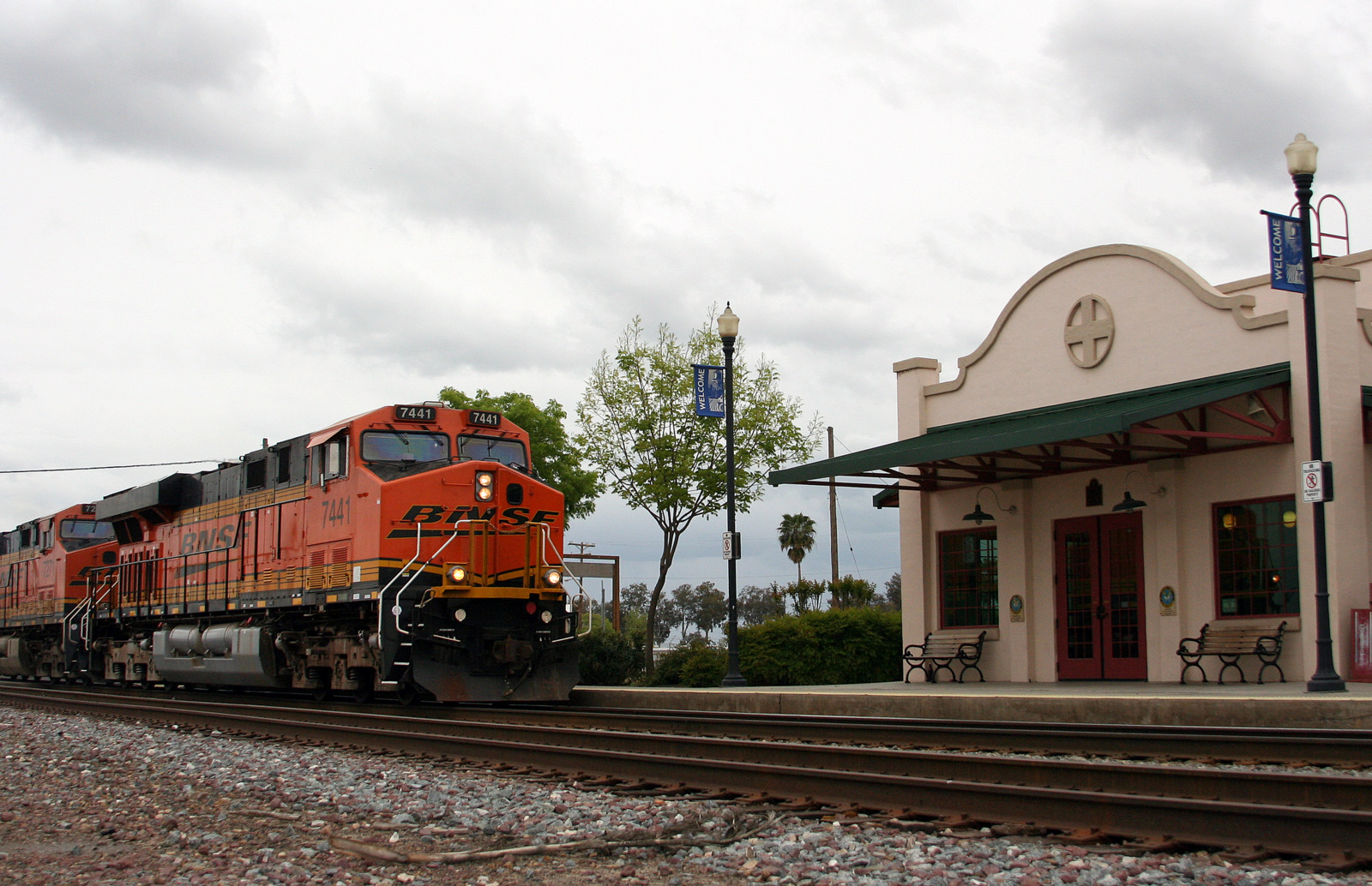
City of Corcoran — City — Amtrak station in Corcoran Location in Kings County and the state of California
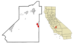
Coordinates: 36°05′53″N 119°33′37″W / 36.09806°N 119.56028°WCoordinates: 36°05′53″N 119°33′37″W / 36.09806°N 119.56028°W Country  United States
State  California
County Kings Area[1] - Total 7.467 sq mi (19.338 km2) - Land 7.467 sq mi (19.338 km2) - Water 0 sq mi (0 km2) 0% Elevation[2] 207 ft (63 m) Population (2010) - Total 24,813 - Density 3,323/sq mi (1,283.1/km2) Time zone Pacific (PST) (UTC-8) - Summer (DST) PDT (UTC-7) ZIP code 93212 Area code(s) 559 FIPS code 06-16224 GNIS feature ID 1652690 Website cityofcorcoran.com Corcoran is a city in Kings County, California, United States. Corcoran is located 17 miles (27 km) south-southeast of Hanford,[3] at an elevation of 207 feet (63 m).[2] It is part of the Hanford–Corcoran, Metropolitan Statistical Area. The population was 24,813 at the 2010 census, up from 14,458 at the 2000 census.
Corcoran is most famous as the site of the California State Prison, Corcoran, home to a number of notable inmates such as Charles Manson, and Juan Corona. The California Substance Abuse Treatment Facility and State Prison, Corcoran is a separate facility that is also located in the city. As of September 2007, the two prisons held a combined total of 13,144 inmates. Inmates are counted as city residents by both the United States Census and the California Department of Finance. Thus, the incarcerated persons in the two prisons comprise just over 50% of the total population of Corcoran.
Contents
Geography
Corcoran is located at 36°05′53″N 119°33′37″W / 36.09806°N 119.56028°W.[2]
According to the United States Census Bureau, the city has a total area of 6.4 square miles (17 km2), all of it land.
Demographics
2010
The 2010 United States Census[4] reported that Corcoran had a population of 24,813. The population density was 3,323.2 people per square mile (1,283.1/km²). The racial makeup of Corcoran was 8,940 (36.0%) White, 3,725 (15.0%) African American, 349 (1.4%) Native American, 193 (0.8%) Asian, 17 (0.1%) Pacific Islander, 10,979 (44.2%) from other races, and 610 (2.5%) from two or more races. Hispanic or Latino of any race were 15,545 persons (62.6%).
The Census reported that 12,573 people (50.7% of the population) lived in households, 116 (0.5%) lived in non-institutionalized group quarters, and 12,124 (48.9%) were institutionalized.
There were 3,594 households, out of which 1,981 (55.1%) had children under the age of 18 living in them, 1,737 (48.3%) were opposite-sex married couples living together, 781 (21.7%) had a female householder with no husband present, 376 (10.5%) had a male householder with no wife present. There were 384 (10.7%) unmarried opposite-sex partnerships, and 19 (0.5%) same-sex married couples or partnerships. 556 households (15.5%) were made up of individuals and 214 (6.0%) had someone living alone who was 65 years of age or older. The average household size was 3.50. There were 2,894 families (80.5% of all households); the average family size was 3.84.
The population was spread out with 4,434 people (17.9%) under the age of 18, 2,695 people (10.9%) aged 18 to 24, 10,203 people (41.1%) aged 25 to 44, 6,163 people (24.8%) aged 45 to 64, and 1,318 people (5.3%) who were 65 years of age or older. The median age was 35.0 years. For every 100 females there were 294.8 males. For every 100 females age 18 and over, there were 398.0 males.
There were 3,958 housing units at an average density of 530.1 per square mile (204.7/km²), of which 1,851 (51.5%) were owner-occupied, and 1,743 (48.5%) were occupied by renters. The homeowner vacancy rate was 1.7%; the rental vacancy rate was 11.8%. 6,607 people (26.6% of the population) lived in owner-occupied housing units and 5,966 people (24.0%) lived in rental housing units.
2000
As of the census[5] of 2000, there were 14,458 people, 2,769 households, and 2,229 families residing in the city. The population density was 2,260.2 people per square mile (872.2/km²). There were 3,016 housing units at an average density of 471.5 per square mile (182.0/km²). The racial makeup of the city was 34.1% White, 14.2% Black or African American, 1.4% Native American, 0.7% Asian, 0.1% Pacific Islander, 46.4% from other races, and 3.1% from two or more races. 59.6% of the population were Hispanic or Latino of any race.
There were 2,769 households out of which 49.7% had children under the age of 18 living with them, 54.5% were married couples living together, 17.9% had a female householder with no husband present, and 19.5% were non-families. 16.0% of all households were made up of individuals and 6.3% had someone living alone who was 65 years of age or older. The average household size was 3.44 and the average family size was 3.83.
In the city the population was spread out with 24.4% under the age of 18, 13.0% from 18 to 24, 42.0% from 25 to 44, 15.3% from 45 to 64, and 5.4% who were 65 years of age or older. The median age was 31 years. For every 100 females there were 207.8 males. For every 100 females age 18 and over, there were 264.9 males. However, the statistics relating to the disparity between the male and female population in Corcoran is due to the prison's male only population.
Economy
At the time of the 2000 census, the median income for a household in the city was $30,783, and the median income for a family was $32,852. Males had a median income of $30,787 versus $21,792 for females. The per capita income for the city was only $13,458. It is noteworthy that about 23.4% of families and 26.9% of the population were below the poverty line, including 36.4% of those under age 18 and 10.6% of those age 65 or over.
The unemployment rate was 14.6% in September 2011.[6]
Politics
In the state legislature Corcoran is located in the 16th Senate District, represented by Democrat Michael Rubio, and in the 30th Assembly District, represented by Republican David Valadao. Federally, Corcoran is located in California's 20th congressional district, which has a Cook PVI of D +5[7] and is represented by Democrat Jim Costa.
Corcoran is represented on the Kings County Board of Supervisors by Richard Valle of Corcoran.
History
Corcoran was founded by Hobart Johnstone Whitley, a prominent land developer from southern California, promoter who platted some 150 towns in the West, who took the lead in building Corcoran (the main street of the community is named in his honor). Liking what he saw during a visit to the area in 1905 (a blacksmith shop, small store, scattered homes and a lush, untapped vista with herds of grazing wild hogs, horses and steers) Whitley purchased 32,000 acres (130 km2) to start development. Much like in the San Fernando Valley (Van Nuys and Canoga Park his "creations"), Whitley "leveraged" his holdings with the support of important Los Angeles businessmen. Whitley first intended the town be named "Otis", after Harrison Gray Otis of the Los Angeles Times, and streets as Otis, Sherman, Letts (the Broadway store) and Ross (after his son, Ross Whitley) show the connections. Whitley, it is claimed, purchased and platted some 150 towns over the American West—and Corcoran is one of his last.
Whitley moved a member of his real estate firm, J. W. Guiberson, to the area. Guiberson became one of the many pioneers of the community, building the first home and business structure in Corcoran. His family also helped establish the first church in the community, an event which helped lead to the town’s incorporation on August 14, 1914.
The basis of Corcoran’s economy then and now is agriculture. Initially, the most successful crops were grains, alfalfa and sugar beets.
The J. G. Boswell Company was established in Corcoran in 1921 and remains a major employer in the city.
The first post office opened in 1901.[3]
Education
Corcoran Unified School District is the public organization responsible for education in the town of Corcoran. The school district has seven schools.
- Bret Harte
- John C. Fremont
- Mark Twain
- John Muir Middle School
- Corcoran High School
- Corcoran Academy
- Kings Lake Educational Center
Railroads
Corcoran is served by the BNSF Railway, which is the successor to the Santa Fe Railway. The mainline track through Corcoran was part of a route connecting the San Francisco Bay Area to Bakersfield, California. The track was constructed by the San Francisco and San Joaquin Valley Railway about 1898.
Today, Amtrak California's San Joaquin stops at Corcoran station.
From 1910-1934, the Kings Lake Shore Railroad operated a line that ran southwest from Corcoran to what is the now-extinct Tulare Lake.
On December 2, 2010, the California High-Speed Rail Authority Board voted to start construction of the first part of the California High-Speed Rail line at Borden near Madera and continue it to Corcoran. Construction is expected to begin in 2012.[8]
References
- ^ U.S. Census
- ^ a b c U.S. Geological Survey Geographic Names Information System: Corcoran, California
- ^ a b Durham, David L. (1998). California's Geographic Names: A Gazetteer of Historic and Modern Names of the State. Quill Driver Books. ISBN 9781884995149.
- ^ All data are derived from the United States Census Bureau reports from the 2010 United States Census, and are accessible on-line here. The data on unmarried partnerships and same-sex married couples are from the Census report DEC_10_SF1_PCT15. All other housing and population data are from Census report DEC_10_DP_DPDP1. Both reports are viewable online or downloadable in a zip file containing a comma-delimited data file. The area data, from which densities are calculated, are available on-line here. Percentage totals may not add to 100% due to rounding. The Census Bureau defines families as a household containing one or more people related to the householder by birth, opposite-sex marriage, or adoption. People living in group quarters are tabulated by the Census Bureau as neither owners nor renters. For further details, see the text files accompanying the data files containing the Census reports mentioned above.
- ^ "American FactFinder". United States Census Bureau. http://factfinder.census.gov. Retrieved 2008-01-31.
- ^ http://www.labormarketinfo.edd.ca.gov/?pageid=133 accessed November 13, 2011
- ^ "Will Gerrymandered Districts Stem the Wave of Voter Unrest?". Campaign Legal Center Blog. http://www.clcblog.org/blog_item-85.html. Retrieved 2007-10-20.
- ^ http://www.cahighspeedrail.ca.gov/pr_approvedstart.aspx accessed 12-4-10
Further reading
- Wartzman, Rick (2003). The King of California,J.G. Boswell and the Making of a Secret American Empire. Public Affairs. ISBN 1-58648-028-6.
External links
Municipalities and communities of Kings County, California County seat: Hanford Cities 
CDPs Armona | Grangeville | Hardwick | Home Garden | Kettleman City | Lemoore Station | Stratford
Unincorporated
communitiesGhost towns Categories:- Incorporated cities and towns in California
- Cities in Kings County, California
- Populated places in California with Hispanic majority populations


Wikimedia Foundation. 2010.