- Nadia district
-
For other uses of the word, see Nadia (disambiguation).
Nadia district
নদিয়া জেলা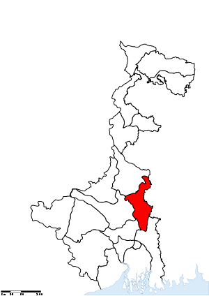
Location of Nadia district in West BengalState West Bengal,  India
IndiaAdministrative division Presidency Headquarters Krishnanagar, Nadia Area 3,927 km2 (1,516 sq mi) Population 5,168,488 (2011) Population density 1,316 /km2 (3,410 /sq mi) Urban population 979,519 Literacy 75.58 per cent[1] Sex ratio 947 Lok Sabha Constituencies Krishnanagar, Ranaghat Assembly Seats Karimpur, Tehatta, Palashipara, Kaliganj, Nakashipara, Chapra, Krishnanagar Uttar, Nabadwip, Krishnanagar Dakshin, Santipur, Ranaghat Uttar Paschim, Krishnaganj, Ranaghat Uttar Purba, Ranaghat Dakshin, Chakdaha, Kalyani, Haringhata Major highways NH 34 Official website Nadia district (Bengali: নদিয়া জেলা) is a district of the state of West Bengal, in the north east of India. It borders with Bangladesh to the east, North 24 Parganas and Hooghly districts to the south, Bardhaman district to the west, and Murshidabad district to the north.
Contents
History
Nabadwip was the capital of Bengal under Ballal Sen and later Lakshman Sen, the famous rulers of the Sena Empire, who ruled from 1159 to 1206.[2] In 1202, Nabadwip was captured by Bakhtiyar Khilji. This victory paved the way for Muslim rule in Bengal.[3] Nabadwip and Nadia were great centres of learning and intellectual prowess. For five centuries, it was referred to as “Oxford of Bengal”.[4] Chaitanyadeb (1486–1533) was born in Nabadwip.
It is the only place where the first school of logic(tarkashastra) in India was setup on the Navya Nyaya system, which produced great logicians in 15th century.The Holy Birth Place of Lord Caitanya Mahaprabhu is known as "Gour Gangar Desh" as well as " Oxford of Bengal". We are proud for Srichaitanyadeb, Krishnanda Agambagish, Basudeb Sarbobhouma etc. The religious atmosphere of Nabadwip is a combination of Baishnaba, Shakta, Buddha, Saiba due to the aforesaid leaders, Pal Monarchy, Sen Monarchy etc. The main festival of Nabadwip is "RASH UTSAV". It is also known as "Pat Purnima" or "Rash Kali Puja" or "Shakta Rash". The varieties of Baishnaba, Shakta, Saiba Pratima (Idols) attracts every one. The Rash Utsav is like national festival of the inhabitants of Nabadwip.
Once the capital of Raja Bikramaditya and Maharaja Pratapaditya was at Dhumghat. Later it was transferred to Ishwaripur (Originated from the name Jeshoreshwaripur). Maharaja Pratapaditya declared independence of South Bengal (Jessore, Khulna in north, Sundarbans, Bay of Bengal in South, Barisal in east and River Ganga in west) against the Mughal Empire of India.
Jashoreshwari Kali Temple (built by Pratapaditya), Chanda Bhairab Mandir at Ishwaripur (a triangular temple, built during the Sena period), Five domed Tenga Mosque at Banshipur (Mughal period), two big and four small domed Hammankhana (constructed by Pratapaditya) at Bangshipur, Govinda Dev Temple at Gopalpur (built by Basanta Roy, uncle of Maharaja Pratapaditya in 1593), Jahajghata Port (Khanpur). Pratapaditya king of Jessore and one of the bara-bhuiyans of Bengal. Pratapaditya fought against the Mughal imperial army during its inroad into Bengal in the early 17th century. His father Shrihari (Shridhar), a Kayastha, was an influential officer in the service of daud khan karrani. On the fall of Daud he fled away with the government treasure in his custody. He then set up a kingdom for himself in the marshy land to the extreme south of Khulna district (1574) and took the title of Maharaja. Pratapaditya succeeded to the kingship in 1574. The baharistan and the travel diary of Abdul Latif and the contemporary European writers, all testify to the personal ability of Pratapaditya, his political pre-eminence, material resources and martial strength, particularly in war-boats. His territories covered the greater part of what is now included in the greater Jessore, Khulna and Barisal districts. He established his capital at Dhumghat, a strategic position at the confluence of the Jamuna and Ichhamati.
Among the Bengal zamindars Pratapaditya was the first to send his envoy to Islam Khan Chisti with a large gift to win the favour of the Mughals, and then tendered personal submission to the Subahdar (1609). He promised military assistance and personal service in the Mughal campaign against musa khan, a pledge that he did not keep. To punish Pratapaditya for his disloyalty as a vassal and to subjugate his territory, a large expedition was launched under the command of Ghiyas Khan, which soon reached a place named Salka, near the confluence of the Jamuna and Ichhamati (1611). Pratapaditya equipped a strong army and a fleet and placed them under expert officers including Feringis, Afghans and Pathans. His eldest son Udayaditya made a big fort at Salka with natural barriers on three sides rendering it almost impregnable. In battle the Jessore fleet gained an initial advantage. But the imperial army cut off the Jessore fleet, made a breach in its ranks and broke its unity and discipline. In the melee that followed, the admiral Khwaja Kamal was killed. Udayaditya lost heart and hastily fled to his father, narrowly escaping capture. Jamal Khan evacuated the fort and followed Udayaditya.
Pratapaditya prepared himself to fight a second time from a new base near the confluence of Kagarghat canal and the Jamuna. He made a big fort at a strategic point and gathered all his available forces there. The imperialists began the battle by an attack on the Jessore fleet (Jan 1612) and compelled it to seek shelter beneath the fort. But their further advance was checked by the heavy cannonade of the Jessore artillery. A sudden attack of the imperialists completely defeated the Jessore fleet and they fell upon the fort with the elephants in front, thereby compelling Pratapaditya to evacuate the fort and retreat.
The second defeat sealed the fate of Pratapaditya. At Kagarghat he tendered submission to Ghiyas Khan, who personally escorted Pratapaditya to Islam Khan at Dhaka. The Jessore king was put in chains and his kingdom was annexed. Pratapaditya was kept confined at Dhaka. No authentic information is available regarding his last days. Probably he died at Benares on his way to Delhi, as a prisoner.[5]
Geography
Important towns
Nabadwip was the capital of Bengal under Ballal Sen and later Lakshman Sen, the famous rulers of the Sena Empire, who ruled from 1159 to 1206.[6]
Krishnanagar is the most important town of this district, as this is district headquarters of Nadia. Krishnanagar is on the bank of river Jalangi. Krishnanagar is named after Raja Krishna Chandra Rai (1728–1782). The Rajbari (palace) built here during the reign of Raja Krishna Chandra Rai is a prominent place of tourist attraction though the remnants of the past glory have been eroded and only a dilapidated structure of the exquisite places with carving on its inner walls exists today. This place is shared by people from Hindu, Muslim & Christian religion. Apart from Hindu temples there are also Christian & Muslim shrines. The Christian Missionaries attached much importance to Krishnanagar. The Protestant Church was built here during 1840s. The Roman Catholic Cathedral was built in 1898. This is town is situated almost 100 km away from Kolkata and older than Kolkata. Famous for clay modelling, potteries, sweets. The origin of famous clay models of Krishnanagar is Ghurni. The clay model artists of Ghurni have won international repute and fame for their excellence in clay modelling. Krishnanagar was the birth place of the noted Poet, Composer and Playwright Shri. Dwijendra Lal Roy (1863–1913) whose contribution to Bengali Literature needs no mention. The town is also known for famous poets/ authors like Bharatchandra, Dr. Sudhir Chakraborty, Dr. Khsudiram Das and actors like Saumitra Chattopadhyay. Shri Somesh Kumar Bhattacharya, IAS is the present executive head called District Magistrate and Collector of Nadia, located at Krishnanagar. Office of the local body for rural areas headed by Mr. Meghlal Sheikh Sabhadhipati is also located at this town.
Kalyani is another important town of this district. It was identified (and named) by Dr. B. C. Roy to act as an alternative to the city of Kolkata, from which it is about 50 km away.
Ranaghat is one of the most important of the towns is Ranaghat, situated 74 kilometers north of Kolkata
Tehatta is another important subdivisional town. It is the newest subdivision in the district of Nadia.
Dhubulia has biggest TB hospital in Asia & Also has a Airport, which used to be in use before 1947 in British Period.
Important Villages
It has been reported that the following list of Villages are in Nadia District [7]
- Bahirgachhi Halt
- Cheuria
- Devagram
- Dhubulia
- Eralbahadurpur
- Ghoshpara (presently, a neighbourhood of Kalyani city)
- Kutabpur
- Nabadwip Ghat
- Suvarnapur
Divisions
Administrative subdivisions
The district comprises four subdivisions: Krishnanagar Sadar, Kalyani, Ranaghat and Tehatta. Krishnanagar Sadar subdivision consists of Krishnanagar municipality, Nabadwip municipality and seven community development blocks: Kaliganj, Nakashipara, Chapra, Krishnanagar–I, Krishnanagar–II, Nabadwip and Krishnaganj. Kalyani subdivision consists of Chakdaha municipality, Gayespur municipality, Kalyani municipality and two community development blocks: Chakdaha and Haringhata. Ranaghat subdivision consists of Shantipur municipality, Ranaghat municipality, Birnagar municipality and four community development blocks: Hanskhali, Shantipur, Ranaghat–I and Ranaghat–II. Tehatta subdivision consists of four community development blocks: Karimpur–I, Karimpur–II, Tehatta–I and Tehatta–II.[8] Krishnanagar is the district headquarters. There are 19 police stations, 17 development blocks, 8 municipalities, 187 gram panchayats and 2639 villages in this district.[8][9]
Other than municipality area, each subdivision contains community development blocks which in turn are divided into rural areas and census towns. In total there are 29 urban units: 8 municipalities and 15 census towns and two notified areas.[10] Ranaghat, Aistala, Satigachha, Nasra and Cooper's Camp together forms Ranaghat urban agglomeration. Nabadwip, Char Maijdia and Char Brahmanagar forms Nabadwip UA. Chakdaha, Gopalpur and Parbbatipur forms Chakdaha UA. Krishnanagar and Baruihuda together forms Krishnanagar UA. Birnagar, Phulia and Taherpur together forms Birnagar UA.
Krishnanagar Sadar subdivision
- Krishnanagar: municipality
- Nabadwip: municipality
- Kaliganj (Community development block) consists of rural areas only with 15 gram panchayats.
- Nakashipara (Community development block) consists of rural areas with 15 gram panchayats and two census town: Jagadanandapur and Kshidirpur.
- Chapra, Nadia (Community development block) consists of rural areas with only 13 gram panchayats.
- Krishnanagar I (Community development block) consists of rural areas with 12 gram panchayats and one census town: Baruihuda.
- Krishnanagar II (Community development block) consists of rural areas only with 7 gram panchayats.
- Nabadwip (Community development block) consists of rural areas with 8 gram panchayats and three census towns: Bablari Dewanganj, Char Maijdia and Char Brahmanagar.
- Krishnaganj (Community development block) consists of rural areas only with 7 gram panchayats.
Kalyani subdivision
- Chakdaha: municipality
- Kalyani: municipality
- Gayespur: municipality
- Chakdaha (Community development block) consists of rural areas with 17 gram panchayats and two census towns: Darappur and Madanpur.
- Haringhata (Community development block) consists of rural areas only with 10 gram panchayats.
Ranaghat subdivision
- Shantipur: municipality
- Ranaghat: municipality
- Birnagar: municipality
- Hanskhali (Community development block) consists of rural areas only with 13 gram panchayats.
- Santipur (Community development block) consists of rural areas with 10 gram panchayats and one census town, Phulia.
- Ranaghat I (Community development block) consists of rural areas with 10 gram panchayats and four census towns: Aistala, Satigachha, Gopalpur and Parbbatipur and one notified area: Taherpur.
- Ranaghat II (Community development block) consists of rural areas with 14 gram panchayats and one census town: Nasra and one notified area: Cooper's Camp.
Tehatta subdivision
- Karimpur I (Community development block) consists of rural areas with 8 gram panchayats and one census town: Karimpur.
- Karimpur II (Community development block) consists of rural areas only with 10 gram panchayats.
- Tehatta I (Community development block) consists of rural areas only with 11 gram panchayats.
- Tehatta II (Community development block) consists of rural areas only with 7 gram panchayats.
Fulia is located about 26 km from Krishnanagar, the headquarters of Nadia District, in West Bengal. The place has a prominent place in the history of Bengali literature. It is famous as the birth place of Krittibas, who first translated the epic Ramayana from Sanskrit to Bengali in verses.
The residence of Krittibas is now converted in to Krittibas Memorial Community Hall Cum Museum Library. Adjacent to this is a Gofa, the place of worship of Thakur Haridas. The old banyan tree situated nearby; it is said that the poet had translated the Ramayana into Bengali sitting under the tree.
Ganges River flows close to the town. Fulia is also famous for producing Tangail Saree.
National Highway 34 passes through the town. By train, Fulia is about 92 km from Kolkata.
The town of Plassey has a memorial of The Battle of Plassey (Bengali: পলাশীর যুদ্ধ, Pôlashir Juddho), which took place on 23 June 1757, on the riverbanks of the Bhagirathi River, about 150 km north of Calcutta, near Murshidabad, then the capital of the Nawab of Bengal. The battle was a decisive victory for the British East India Company over Siraj Ud Daulah, the last independent Nawab of Bengal and his French allies. This established the Company's rule in India which expanded over much of South Asia for the next 190 years.
Assembly constituencies
The district is divided into 15 assembly constituencies:[11]
- Karimpur (assembly constituency no. 69),
- Palashipara (assembly constituency no. 70),
- Nakshipara (assembly constituency no. 71),
- Kaliganj (assembly constituency no. 72),
- Chapra (assembly constituency no. 73),
- Krishnaganj (SC) (assembly constituency no. 74),
- Krishnanagar East (assembly constituency no. 75),
- Krishnanagar West (assembly constituency no. 76),
- Nabadwip (assembly constituency no. 77),
- Shantipur (assembly constituency no. 78),
- Hanskhali (SC) (assembly constituency no. 79),
- Ranaghat East (SC) (assembly constituency no. 80),
- Ranaghat West (assembly constituency no. 81),
- Chakdaha (assembly constituency no. 82) and
- Haringhata (assembly constituency no. 83).
Krishnaganj, Hanskhali and Ranaghat East constituencies are reserved for Scheduled Castes (SC) candidates. Along with six assembly constituencies from Murshidabad district, Karimpur assembly constituency forms the Murshidabad (Lok Sabha constituency). Palashipara, Nakashipara, Kaliganj, Chapra, Krishnaganj, Krishnanagar East and Krishnanagar West constituencies form the Krishnagar (Lok Sabha constituency). Nabadwip, Shantipur, Hanskhali, Ranaghat East, Ranaghat West, Chakdaha and Haringhata assembly constituencies form the Nabadwip (Lok Sabha constituency), which is reserved for Scheduled Castes (SC) candidates.
Impact of delimitation of constituencies
As per order of the Delimitation Commission in respect of the delimitation of constituencies in the West Bengal, the district will be divided into 17 assembly constituencies:[12]
- Karimpur (assembly constituency no. 77),
- Tehatta (assembly constituency no. 78),
- Palashipara (assembly constituency no. 79),
- Kaliganj (assembly constituency no. 80),
- Nakshipara (assembly constituency no. 81),
- Chapra (assembly constituency no. 82),
- Krishnanagar Uttar (assembly constituency no. 83),
- Nabadwip (assembly constituency no. 84),
- Krishnanagar Dakshin (assembly constituency no. 85),
- Santipur (assembly constituency no. 86),
- Ranaghat Uttar Paschim (assembly constituency no. 87),
- Krishnaganj (SC) (assembly constituency no. 88),
- Ranaghat Uttar Purba (SC) (assembly constituency no. 89),
- Ranaghat Dakshin (SC) (assembly constituency no. 90),
- Chakdaha (assembly constituency no. 91),
- Kalyani (SC) (assembly constituency no. 92) and
- Haringhata (SC) (assembly constituency no. 93).
Krishnaganj, Ranaghat North East, Ranaghat South, Kalyani and Haringhata constituencies will be reserved for Scheduled Castes (SC) candidates. Along with six assembly constituencies from Murshidabad district, Karimpur assembly constituency will form the Murshidabad (Lok Sabha constituency). Tehatta, Palashipara, Kaliganj, Nakashipara, Chapra, Krishnanagar North and Nabadwip constituencies form the Krishnanagar (Lok Sabha constituency). Krishnanagar South, Shantipur, Ranaghat North West, Krishnaganj, Ranaghat North East, Ranaghat South and Chakdaha assembly constituencies will form the Ranaghat (Lok Sabha constituency), which will be reserved for Scheduled Castes (SC) candidates. Kalyani and Haringhata, along with five assembly segments from North 24 Parganas district, will form the Bangaon (Lok Sabha constituency), which will be reserved for Scheduled Castes (SC) candidates.
Transport
See also: List of bus routes in KolkataRail
Nabadwip Dham is 65 km from Bandel, 105 km from Howrah and 112 km from Sealdah on the Bandel-Katwa-Azimganj (B.A.K Loop Line) section of Eastern Railway.[13] It has three Railway Stations as Nabadwip Dham (NDAE), Bishnupriya (VSPR) of Howrah Division and Nabadwip Ghat (NDF) of Sealdah Division. It has very good railway communication with North Bengal, Assam, Bihar, Orissa and Kolkata. Important express trains which has stoppage at Nabadwip Dham are
15643 UP/15644 DN Puri-Kamakhya Express
15959 UP/15960 DN Howrah-Tinsukia-Dibrugarh Kamrup Express
13141 UP/13142 DN Sealdah-New Alipurduar/Haldibari Teesta Torsha Express
13164 UP/13165 DN Sealdah-Barauni-Katihar-Saharsha Hatey Bazare Express
13145 UP/13146 DN Sealdah-Radhikapur Radhikapur Express
13011 UP/13012 DN Howrah Maldah Intercity Express
13421 UP/13422 DN Nabadwip Dham- New Frakka Express
15721 UP/15722 DN New Jalpaiguri-Digha Paharia Express
12517 UP/12518 DN Kolkata Guwahati Garib Rath Express.Krishnanagar City Junction is 100 km from Sealdah on the Sealdah-Lalgola Section of Eastern Railway. It has very good railway communication with Murshidabad, Nadia, North 24 Parganas and Kolkata. Important express trains which has stoppage at Krishnanagar City Junction are
Bhagirathi Express
Hazar Duari Express.Ranaghat Junction is 74 km from Sealdah on the Sealdah-Lalgola Section of Eastern Railway. It has very good railway communication with Murshidabad, Nadia, North 24 Parganas and Kolkata. Important express trains which has stoppage at Ranaghat Junction are
Bhagirathi Express
Hazar Duari Express.Demographics
According to the 2011 census Nadia district has a population of 5,168,488 ,[14] roughly equal to the United Arab Emirates[15] or the US state of Colorado.[16] This gives it a ranking of 18th in India (out of a total of 640).[14] The district has a population density of 1,316 inhabitants per square kilometre (3,410 /sq mi) .[14] Its population growth rate over the decade 2001-2011 was 12.24 %.[14] Nadia has a sex ratio of 947 females for every 1000 males,[14] and a literacy rate of 75.58 %.[14]
Culture
Notable personalities
Some of the notable figures from Nadia district are Sri Chaitanya, Swami Nigamananda, Sri Advaita Acharya, Dwijendralal Roy, Sir Azizul Haque, Ramtanu Lahiri, Kabi Krittibas Ojha, Kabi Mohammed Mozammel Haque, Kabi Jatindranath Sengupta, kabi Modon Mohan Tarkalankar.
Flora and fauna
In 1980 Nadia district became home to the Bethuadahari Wildlife Sanctuary, which has an area of 0.7 km2 (0.3 sq mi).[17]
References
- ^ "District-specific Literates and Literacy Rates, 2001". Registrar General, India, Ministry of Home Affairs. http://www.educationforallinindia.com/page157.html. Retrieved 2010-10-10.
- ^ Official district website
- ^ Tourist Department
- ^ Cotton, H.E.A., Calcutta Old and New, 1909/1980, p1, General Printers and Publishers Pvt. Ltd.
- ^ Muazzam Hussain Khan (Banglapedia)
- ^ Official district website
- ^ Cities and villages in Nadia District.
- ^ a b "Directory of District, Sub division, Panchayat Samiti/ Block and Gram Panchayats in West Bengal, March 2008". West Bengal. National Informatics Centre, India. 2008-03-19. http://wbdemo5.nic.in/writereaddata/Directoryof_District_Block_GPs(RevisedMarch-2008).doc. Retrieved 2008-11-30.
- ^ "District Profile". Official website of the Nadia district. http://www.nadia.nic.in/District_Profile/District_Profile-Details-page1/district_profile-details-page1.html. Retrieved 2008-11-30.
- ^ "Population, Decadal Growth Rate, Density and General Sex Ratio by Residence and Sex, West Bengal/ District/ Sub District, 1991 and 2001". West Bengal. Directorate of census operations. http://www.wbcensus.gov.in/DataTables/02/Table5_10.htm. Retrieved 2008-11-12.[dead link]
- ^ "General election to the Legislative Assembly, 2001 – List of Parliamentary and Assembly Constituencies". West Bengal. Election Commission of India. http://archive.eci.gov.in/se2001/background/S25/WB_ACPC.pdf. Retrieved 2008-11-22.
- ^ "Press Note, Delimitation Commission". Assembly Constituencies in West Bengal. Delimitation Commission. http://www.wbgov.com/e-gov/English/DELIMITATION.pdf. Retrieved 2008-11-22.
- ^ Eastern Railway time table.
- ^ a b c d e f "District Census 2011". Census2011.co.in. 2011. http://www.census2011.co.in/district.php. Retrieved 2011-09-30.
- ^ US Directorate of Intelligence. "Country Comparison:Population". https://www.cia.gov/library/publications/the-world-factbook/rankorder/2119rank.html. Retrieved 2011-10-01. "United Arab Emirates 5,148,664"
- ^ "2010 Resident Population Data". U. S. Census Bureau. http://2010.census.gov/2010census/data/apportionment-pop-text.php. Retrieved 2011-09-30. "Colorado 5,029,196"
- ^ Indian Ministry of Forests and Environment. "Protected areas: West Bengal". http://oldwww.wii.gov.in/envis/envis_pa_network/index.htm. Retrieved September 25, 2011.
External links
- Official website
- An article on Shivniwas by Rangan Datta
- Travel article on Ballal Dhipi by Rangan Datta
- Travel Article on Palpara by Rangan Datta

Murshidabad district Bardhaman district 
Bangladesh  Nadia district

Hooghly district North 24 Parganas district Cities and towns in Nadia District Krishnanagar Sadar subdivision Kalyani subdivision Ranaghat subdivision Aistala · Birnagar · Cooper's Camp · Gopalpur · Nasra · Parbbatipur · Phulia · Ranaghat · Shantipur · Satigachha · TaherpurTehatta subdivision Related topics Nadia topics · People from Nadia district · Villages in Nadia districtCities and towns
in other districtsBankura · Bardhaman · Birbhum · Cooch Behar · Dakshin Dinajpur · Darjeeling · Hooghly · Howrah · Jalpaiguri · Malda · Murshidabad · North 24 Parganas · Paschim Medinipur · Purba Medinipur · Purulia · South 24 Parganas · Uttar DinajpurMinority Concentrated Districts in India Andaman & Nicobar Islands Arunachal Pradesh Assam Barpeta · Bongaigaon · Cachar · Darrang · Dima Hasao · Dhubri · Goalpara · Hailakandi · Kamrup · Karimganj · Kokrajhar · Marigaon · Nagaon
Bihar Delhi Haryana Jammu & Kashmir Jharkhand Karnataka Kerala Madhya Pradesh Maharashtra Manipur Meghalaya Mizoram Orissa Uttar Pradesh Baghpat · Bahraich · Balrampur · Barabanki · Bareilly · Bijnor · Budaun · Bulandshahar · Ghaziabad · Jyotiba Phule Nagar · Kheri · Lucknow · Meerut · Moradabad · Muzaffarnagar · Pilibhit · Rampur · Saharanpur · Shahjahanpur · Shravasti · Siddharth NagarUttarakhand West Bengal Bardhaman · Birbhum · Cooch Behar · Dakshin Dinajpur · Howrah · Kolkata · Malda · Murshidabad · Nadia · North 24 Parganas · South 24 Parganas · Uttar DinajpurNadia district topics General Bethuadahari Wildlife Sanctuary • Gopal Bhar • Indian Institute of Science Education and Research, Kolkata • University of KalyaniHistory Religion Subdivisions Kalyani • Krishnanagar • Ranaghat • TehattaLocations
other than cities and townsMunicipalities Community development blocks Krishnanagar Sadar Kaliganj • Nakashipara • Chapra • Krishnanagar I • Krishnanagar II • Nabadwip • Krishnaganj Ranaghat Hanskhali • Santipur • Ranaghat I • Ranaghat II Tehatta Karimpur I • Karimpur II • Tehatta I • Tehatta II Kalyani Chakdaha • HaringhataRivers Transport Lok Sabha constituencies Krishnanagar • Ranaghat • Nabadwip – now defunctVidhan Sabha constituencies Karimpur • Tehatta • Palashipara • Kaliganj • Nakashipara • Chapra • Krishnanagar Uttar • Nabadwip • Krishnanagar Dakshin • Santipur • Ranaghat Uttar Paschim • Krishnaganj • Ranaghat Uttar Purba • Ranaghat Dakshin • Chakdaha • Kalyani • HaringhataFormer Vidhan Sabha constituencies HanskhaliSee also Other districts in West Bengal Bankura • Bardhaman • Birbhum • Cooch Behar • Dakshin Dinajpur • Darjeeling • Hooghly • Howrah • Jalpaiguri • Kolkata • Malda • Murshidabad • North 24 Parganas • Paschim Medinipur • Purba Medinipur • Purulia • South 24 Parganas • Uttar DinajpurSurrounding areas outside West Bengal Categories:- Districts of West Bengal
- Nadia district
- Minority Concentrated Districts in India

Wikimedia Foundation. 2010.