- Portia, Arkansas
Infobox Settlement
official_name = Portia, Arkansas
settlement_type =Town
imagesize =
image_caption =
image_
imagesize =
image_caption =
image_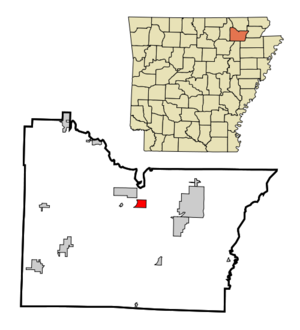
mapsize = 250px
map_caption = Location in Lawrence County and the state ofArkansas
mapsize1 =
map_caption1 =
subdivision_type = Country
subdivision_type1 = State
subdivision_type2 = County
subdivision_name =United States
subdivision_name1 =Arkansas
subdivision_name2 = Lawrence
government_type =
leader_title =
leader_name =
established_date =
area_magnitude =
area_total_km2 = 3.3
area_total_sq_mi = 1.3
area_land_km2 = 3.3
area_land_sq_mi = 1.3
area_water_km2 = 0
area_water_sq_mi = 0
elevation_ft = 259
elevation_m = 79
population_as_of = 2000
population_footnotes =
population_total = 483
population_metro =
population_density_km2 = 146.4
population_density_sq_mi = 371.5
timezone = Central (CST)
utc_offset = -6
latd = 36 |latm = 5 |lats = 7 |latNS = N
longd = 91 |longm = 4 |longs = 6 |longEW = W
timezone_DST = CDT
utc_offset_DST = -5
postal_code_type =ZIP code
postal_code = 72457
area_code = 870
blank_name = FIPS code
blank_info = 05-56720
blank1_name = GNIS feature ID
blank1_info = 0053704
footnotes =
website =Portia is a town in Lawrence County,
Arkansas ,United States . The population was 483 at the 2000 census.Geography
Portia is located at coor dms|36|5|7|N|91|4|6|W|city (36.085273, -91.068430)GR|1.
According to the
United States Census Bureau , the town has a total area of 3.3km² (1.3 mi²), all land.Demographics
As of the
census GR|2 of 2000, there were 483 people, 206 households, and 138 families residing in the town. Thepopulation density was 144.6/km² (373.8/mi²). There were 225 housing units at an average density of 67.3/km² (174.1/mi²). The racial makeup of the town was 97.10% White, 1.24% Black or African American, 1.45% Native American, and 0.21% from two or more races. 1.66% of the population were Hispanic or Latino of any race.There were 206 households out of which 25.7% had children under the age of 18 living with them, 55.3% were married couples living together, 11.2% had a female householder with no husband present, and 33.0% were non-families. 31.6% of all households were made up of individuals and 21.4% had someone living alone who was 65 years of age or older. The average household size was 2.30 and the average family size was 2.88.
In the town the population was spread out with 22.2% under the age of 18, 8.1% from 18 to 24, 24.4% from 25 to 44, 19.5% from 45 to 64, and 25.9% who were 65 years of age or older. The median age was 40 years. For every 100 females there were 83.0 males. For every 100 females age 18 and over, there were 76.5 males.
The median income for a household in the town was $21,250, and the median income for a family was $31,250. Males had a median income of $24,750 versus $18,182 for females. The
per capita income for the town was $13,118. About 20.0% of families and 32.7% of the population were below thepoverty line , including 55.6% of those under age 18 and 29.7% of those age 65 or over.References
External links
Wikimedia Foundation. 2010.