- Crofton, West Yorkshire
-
Coordinates: 53°39′32″N 1°26′07″W / 53.658985°N 1.435302°W
Crofton 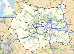
 Crofton
Crofton shown within West YorkshirePopulation 5,978 OS grid reference SE374182 Parish Crofton Metropolitan borough City of Wakefield Metropolitan county West Yorkshire Region Yorkshire and the Humber Country England Sovereign state United Kingdom Post town WAKEFIELD Postcode district WF4 Dialling code 01924 Police West Yorkshire Fire West Yorkshire Ambulance Yorkshire EU Parliament Yorkshire and the Humber UK Parliament Hemsworth List of places: UK • England • Yorkshire Crofton is a village near Wakefield in West Yorkshire, England. It is located roughly 4 miles (6 km) to the south east of the city and is roughly 6 miles (10 km) to the west of the town of Pontefract and 4 miles (6 km) from the town of Featherstone.
Contents
History
Crofton is listed in the Domesday Book as Scroftune. The village has one church: the Anglican church was built around 1430. A Roman Catholic church built in the 1920s closed in 2008. Crofton New Hall was built in the 1750s for the Wilsons who lived in the village until 1935 when the Colonel sold the manor house and the estate and moved away from the village. During World War 2, the hall was used by the army, later the Coal Board, then became Brown's Tutorial School, closed in 1980 to be demolished. Shortly afterwards, a new housing estate built there. Some of the Wilson family are buried in a large mausoleum in the cemetery.
Crofton was predominantly a farming community, but the mining of coal became important in the 19th century and continued until the 1980s. There were three coal mines within a two-mile radius of the village, these mines being Nostell, Walton and Sharlston. By the early 1900s, Lord St Oswald had built houses at New Crofton, known locally as both Cribbens and Scribbens Lump, for the workers of Nostell Mine. This area was populated until the 1980s when they were demolished along with the mines. 'The Lump' also had a mission hall, a local shop and a fish and chip shop, the fish and chip shop in question was known locally as "The Leaning Chippy" due to the subsidence from the local mines at Nostell. In the 1970s, there were twp shops near the lump, "Alf's" which was a corner shop located where the Slipper public house is today and the other shop, also the local car garage "Mrs Moony's". There is also an old, disused well from which villagers used to get their water supplies many years ago: the well is still there but has since been filled in due to it being a hazard for local children.
The houses from 'The Lump' as it was known were demolished due to severe subsidence from the mine at nostell, it was simply cheaper to demolish the houses and rebuild rather than to repair the damage the subsidence had caused. Once it was demolished, the area was a wasteland for many years, but the old cobble streets and roads were still visible and eventually the land was sold and a new housing estate was built on it. Most of the old subsidence would have stopped by now with many of the old mines being collapsed and filled in years ago but some still remain and will affect the surrounding areas for years to come.
When the miners at Nostell pit were clearing new coal seams, one day they came across what was described as an underground church which the monks from Nostell Priory had built years ago, this church was complete with tunnels which the monks used to use for transporting coal to the monastery. The church had wooden doors and seating inside, exactly why they built it there underground and for what reason may never be known. The entrance and tunnel was eventually sealed but the church should still be there today unless it has caved in, Local miner and Nostell safety man Leslie Simpson Snr and a fellow miner carved their names into the wood of the church door just before the tunnel was sealed. One theory is that the monks built the underground church to pray and worship in private, the monastery which was built on Nostell Priory got dissolved by Henry VIII in 1540 and could possibly explain the existence of the underground church.
Crofton Castle
Crofton Castle was built on Towers Lane in 1853 by John Blackburn in the style of a gothic manor house, complete with a parapet. The house acted as a prisoner of war camp during World War II housing captured Italian soldiers. The house then passed was then bought by the Abbott family who allowed the house to fall into disrepair. Rumours of hauntings and paranormal activity surfaced regarding the mansion. In 2004 the house suffered a horrific blaze, which led to the mansion being demolished.
Many schoolchildren and also adults have reported seeing a white figure stood at the back window and locally known as the "Grey Lady" over the years there were rumours around suicides and hangings surround the castle and the immediate area but most were simply not true or has become blown out of all proportion. Since the castle has been demolished, a new housing estate has been built on its land, but the developers were mindful of the stories behind the castle and as such they planned the new housing estate so no houses stood directly in the same space/area as the castle. If you visit the area today, there is a road now where the castle once stood. This has not stopped the legend of the grey lady and numerous reports of strange phenomenon or events are still reported in the new housing estate today.
Location grid

Wakefield Crigglestone 
Pontefract  Crofton, West Yorkshire

Hemsworth, Barnsley Crofton today
Today, Crofton is seen as a commuting village, with many of the inhabitants leaving to nearby cities such as Leeds and Wakefield to work. The village has two post offices, one in New Crofton and one on the main high street, 2 fish and chip shops - one in New Crofton, mini supermarkets and a carpet store . The village also boasts 9 pubs: the Crofton Arms & the Cock and Crown both on the A638 road, the Weavers Green, The Royal Oak, The Lord of the Manor, The Slipper, Ralphie's Bar, The Working Men's Club, and the Crofton Community Centre formerly known as the Nostell Miners Welfare. The Crofton Arms has been closed down for a short period of time.
Crofton made national tabloid headlines when the famous motel in the village 'The Redbeck,' stayed open for 21 years without ever closing, working its way through renovations, leaks and power cuts. The redbeck is a diner and a popular long haul truck stop on the outskirts of Crofton located on the A638.
The main supermarket in Crofton is now the Sainsbury's mini store located on the High Street, and other shops on High Street include Lloyd's Pharmacy, The Post Office, a deli, fish and chip, and carpet shop.
Crofton has had quite a makeover in the last few years, mainly the old Nostell pit and surrounding area has been transformed into a nature park with a small pond and very good walking areas which many locals use. The walk comprises around 3–4 miles of ash path from start to finish with some being concreted (remnants of the old opencast mining area). If you feel adventurous you can follow on the path right to the pennine trail and through Walton forest, this is a very good bike track and is used every day. Local residents need to take care on this path this year, the tick population has exploded and farmers are finding it hard to control the pests on their cattle. Dog walkers are especially vulnerable.
Sport
Crofton is in the centre of what is locally known as rugby land, with the local team Crofton Cougars contributing to the maintenance of the rugby tradition. The team was formed in 1996 by Pete Storey and Andy Reid. They play rugby in the CMS Unison Division 1. They won the CMS Division 2 title in 2006. The home ground of the Cougars is Cougar Park which is part of the Community Centre Facilities. It provides up to 3000 capacity, with both seating and standing capacity.
Crofton Cricket team play at The Sidings Playing Fields as well as Crofton Juniors AFC and Crofton Sports FC who have 2 teams playing in the Wakefield Saturday League and are based at the Weavers Green pub.
Nostell Miners Welfare F.C. also play at the community centre facilities and are currently in the Northern Counties Premier division.
Notable residents
- Sir Titus Salt, who built the mills of Saltaire, lived on the Manor Farm (now the Lord of the Manor Pub) in Crofton
- Richmal Mangnall, Headmistress of Crofton School for Young Girls and a famous author
- John Harrison - The man who solved the longitudinal problem was born in Foulby. Harrison Road in Crofton is named for him.
- Richard Fleming - later Bishop of Lincoln, founder of Lincoln College, Oxford who also built Crofton Church
- Charlotte Brontë - lived at Crofton Hall and educated in the Crofton Hall School under Richmal Mangnall
- Emily Brontë - lived at Crofton Hall and educated in the Crofton Hall School under Richmal Mangnall
Schools
Crofton Infants School was opened in 1877 and was then known as Crofton Board School. In 1920, at a dance, Crofton school was the scene of a horrific murder, in which 19 year old Jane Darwell was murdered in the hall during the dance by her ex-boyfriend Edwin Sowerby in front of several witnesses. Sowerby, who had taken the breakup of their relationship hard, was given the death penalty and was hung at Armley Prison in Leeds on 31 December 1920. Local legend depicts that the ghost of Jane Darwell still haunts the infants school, and is known as The Blue Lady. In 1955, Crofton Secondary School opened in Crofton Old Hall. Crofton Slack Lane Junior School and Crofton High School were both constructed in the 1960s. A new Junior and Infant school was opened in Shay lane in 1972. In the summer of 1995, a fire destroyed most of the High School and a new school opened in 1998 which is still open today. In 2007 Crofton High School achieved record GCSE pass rates, putting it in the top 100 state schools in the country.
In 1808 Miss Richmal Mangnall bought Crofton Hall School for Young Ladies, which at least one of the Brontë sisters is thought to have attended.
Transport
Bus
Crofton is located on the A638 road that runs between Wakefield and Doncaster and serves as the village's lifeline. There are several bus routes that run from Crofton:
- The 145/148/149, Arriva Yorkshire - Wakefield to Knottingley and Pontefract via Crofton and Featherstone.
- The 150, Arriva Yorkshire - Wakefield to Knottingley and Selby via Crofton, Featherstone and Pontefract.
- The 194, Arriva Yorkshire - Wakefield to Barnsley via Crofton, Walton and Royston.
- The 195/196, Arriva Yorkshire - Wakefield to Hemsworth via Crofton and Walton.
- The 485, Arriva Yorkshire - Wakefield to South Elmsall via Ackworth Crofton and Agbrigg.
- The 496, Arriva Yorkshire - Wakefield to Doncaster via Belle Vue (Wakefield), Crofton, South Elmsall and Upton.
- The 223, B.L TRAVEL - Minsthorpe to Wakefield via Hemsworth, South Elmsall, South Kirkby and Crofton.
- The P2/6, Poppletons Coaches - Pontefract to Wakefield via NEW College, North Featherstone, Ackton, Sharlston, Crofton and Walton
Train
Up until the 1960s the village was served by the Hare Park & Crofton railway station before it was demolished. The station was located on the Great North Eastern Railway and on the Wakefield Line. The sidings were also used as part of the Dearne Valley Line. There has been much speculation as to whether a new train station should be built on this site, which would serve trains to Leeds, Wakefield, Sheffield and Doncaster, but the council has stated that a train station cannot be built for fear of it not being used enough, although many citizens of the village would like to see a train station on Hare Park Lane.
A smaller station at Crofton was located next to Doncaster road, on the current Pontefract Line, behind the Crofton Arms Public House. The station was demolished too, in the 1960s, yet the remains of the old station house in its current derelict form can be seen from the A638, or on passing trains from Wakefield Kirkgate railway station towards Pontefract.
Air
Crofton is located 26 miles from Leeds Bradford International Airport, and offers services to European and Asian destinations such as Paris, Milan, Rome, Alicante, Tenerife, Larnaca and Islamabad. Crofton is also the same distance from Doncaster Airport, at Finningley in Doncaster. That airport has destinations to smaller European Destinations. The nearest International Airport with major destinations is Manchester Airport, which is 69 miles from the village. Manchester has flights as far as Dubai, New York, Orlando, Singapore and Vancouver to name a few.
External links
Categories:- Villages in West Yorkshire
- Geography of Wakefield
- Civil parishes in West Yorkshire

Wikimedia Foundation. 2010.