Magna Carta Island

Magna Carta Island
Magna Carta Island is located in Berkshire
{{{alt}}}
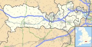
Map showing the location of Magna Carta Island within Berkshire.

Magna Carta Island is an island in the River Thames in England, on the reach above Bell Weir Lock. It is in Berkshire across the river from the water-meadows at Runnymede. The island was transferred from Buckinghamshire to Berkshire in 1974.

The island is one of several contenders for being the place where, in 1215, King John sealed the Magna Carta.[1] Whilst the charter itself indicates Runnymede by name, it is possible the island may have been considered part of Runnymede at the time.

It is known that in 1217 the island was the meeting-place of Henry III and Louis (afterwards Louis VIII) of France.[1]

See also

References

  1. ^ a b History of the Parish of Wraysbury, Ankerwycke Priory, and Magna Charta Island; with the History of Horton, and the town of Colnbrook, Bucks., G.W.J. Gyll, 1862, London: H. G. Bohn. OCLC: 5001532 Online Version at Google Books
Next island upstream River Thames Next island downstream
Pats Croft Eyot Magna Carta Island The Island, Hythe End

Coordinates: 51°26′46″N 0°33′46″W / 51.4462°N 0.5629°W / 51.4462; -0.5629


Wikimedia Foundation. 2010.

Игры ⚽ Нужно решить контрольную?

Look at other dictionaries:

  • Magna Carta (band) — Magna Carta (from left to right) Chris Simpson, Linda Simpson, Matt Barnhoorn. May 2008. Background information Origin England …   Wikipedia

  • Magna — may refer to: Contents 1 Companies, products and institutions 2 Place names 2.1 Place names in England …   Wikipedia

  • Carta de Derechos de los Estados Unidos — Saltar a navegación, búsqueda Para otros usos de este término, véase Bill of Rights. Imagen de la Carta de Derechos de los Estados Unidos, en la Administración de Archivos Nacionales de EE. UU. La Carta de Derechos …   Wikipedia Español

  • The Island, Hythe End — is an island in the River Thames in England on the reach above Bell Weir Lock, near Hythe End and Wraysbury, Berkshire. It is connected to the Berkshire side of the river (Buckinghamshire before 1974) and has a number of riverside houses on it.… …   Wikipedia

  • Runnymede — Location map Surrey label = lat = 51.44451 long = 0.56537 background = white caption = Location of Runnymede, in Surrey, at grid reference SU998727 in the United Kingdom float = right width = 175Runnymede is a water meadow alongside the River… …   Wikipedia

  • Wraysbury — infobox UK place country = England latitude= 51.458 longitude= 0.552 official name= Wraysbury population= unitary england= Windsor and Maidenhead lieutenancy england=Berkshire region= South East England constituency westminster=Windsor post town …   Wikipedia

  • River Thames — Thames redirects here. For other uses, see Thames (disambiguation). Coordinates: 51°29′56″N 0°36′31″E / 51.4989°N 0.6087°E / 5 …   Wikipedia

  • Bell Weir Lock — Infobox Waterlock lock name = Bell Weir Lock [ [http://www.visitthames.co.uk/uploads/a users guide to the River thames.pdf Statistics from Environment Agency A User s Guide to the River Thames:Part II ] ] caption= Bell Weir Lock with the M25… …   Wikipedia

  • Islands in the River Thames — This article lists the islands in the River Thames, in England. It excludes many of the smaller lock islands that were created when weirs and locks were built, and also some very small islands that immediately adjoin the larger ones. The Isle of… …   Wikipedia

  • Pats Croft Eyot — is a small island in the River Thames in England on the reach above Bell Weir Lock, near Wraysbury, Berkshire and Runnymede, Surrey. The island is uninhabited and heavily wooded.ee also*Islands in the River ThamesRiver item line|upstream=Friary… …   Wikipedia

Share the article and excerpts

Direct link
Do a right-click on the link above
and select “Copy Link”