- Mezen
-
Mezen (English)
Мезень (Russian)- Town[1] - 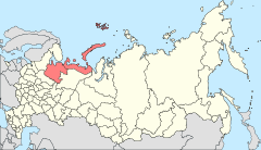
Location of Arkhangelsk Oblast in Russia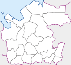
 Mezen
MezenCoordinates: 65°51′N 44°14′E / 65.85°N 44.233°ECoordinates: 65°51′N 44°14′E / 65.85°N 44.233°E 
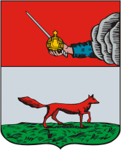
Coat of arms Administrative status (as of June 2011) Country Russia Federal subject Arkhangelsk Oblast Administrative district Mezensky District[1] Administrative center of Mezensky District[1] Municipal status (as of July 2010) Municipal district Mezensky Municipal District[2] Urban settlement Mezenskoye Urban Settlement[2] Administrative center of Mezensky Municipal District, Mezenskoye Urban Settlement[2] Statistics Population (2010 Census,
preliminary)3,599 inhabitants[3] Population (2002 Census) 3,863 inhabitants[4] Time zone MSD (UTC+04:00)[5] Founded 1780[6] Mezen (Russian: Мезень) is a town and the administrative center of Mezensky District of Arkhangelsk Oblast, Russia,[1] located on the right bank of the Mezen River close to the point where it flows into the White Sea. Municipally, it is incorporated as Mezenskoe Urban Settlement in Mezensky Municipal District.[2] Population: 3,599 (2010 Census preliminary results);[3] 3,863 (2002 Census);[4] 4,968 (1989 Census).[7]
Contents
History
The settlement at the location of the present-day Mezen was founded in the 16th century and was known as Okladnikova Sloboda (Окладникова Слобода). It was subsequently developed into the trading center of the Mezen River valley; in particular, yearly trade fairs were held in Mezen. Besides the trade, the main occupations of the Mezen inhabitants were fishery and seal hunting. In 1780, Okladnikova Sloboda was merged with the nearby settlement of Kuznetsovskaya Sloboda into the town of Mezen.[6] In 1784, Mezen became the administrative center of Mezensky Uyezd of Vologda Viceroyalty. In 1796, the area was transferred to Arkhangelsk Governorate. In 1929, several governorates were merged into Northern Krai. On July 15, 1929 the uyezds were abolished, and Mezen became the administrative center of Mezensky District.
Restricted access
The northern part of Mezensky District, including Mezen itself, is included into the border security zone, intended to protect the borders of Russian Federation from unwanted activity. In order to visit Mezen, a permit issued by the local FSB department is required.[8]
Economy
Industry
Mezen currently only has food industry and mechanical works. The Mezen sawmill and the Mezen sea harbor are both located in Kamenka across the Mezen River.[9]
Transport
The Mezen River is navigable; however, there is no passenger navigation in Mezen except for the ferry boat to the settlement of Kamenka. There is an all-seasonal road to Arkhangelsk (which crosses the Mezen near the selo of Kimzha), completed in 2008. During winter, temporary roads (zimniks) are built in snow; in summer, the air transport is the only means for passenger connections to Arkhangelsk and the rest of the world.
Mezen is served by the Mezen Airport, with several weekly flights to Arkhangelsk.
Culture and recreation
Mezen is one of the few former uyezd towns which generally preserved the historical center. There are many former merchant houses, mostly made of wood, in the town center.
Mezen hosts the Mezen Regional Museum.[10]
A carved epitaph was found in 1957 on a nameless island in the White Sea, done by brothers Ivan and Ondriyan, fishermen from Mezen, who apparently got to the island after the shipwreck and did not any hope to be saved from the island. The epitaph was featured in Laughter and Grief by the White Sea, a 1987 Soviet traditionally-animated feature film directed by Leonid Nosyrev made at the Soyuzmultfilm studio.
Climate
Climate data for Mezen Month Jan Feb Mar Apr May Jun Jul Aug Sep Oct Nov Dec Year Average high °C (°F) −12
(10)−9
(16)−3
(27)1
(34)8
(46)15
(59)18
(64)15
(59)10
(50)2
(36)−3
(27)−8
(18)2 Daily mean °C (°F) −15
(5)−12
(10)−6
(21)−2
(28)4
(39)11
(52)14
(57)11
(52)7
(45)−6
(21)−11
(12)−0.4
(31.3)Average low °C (°F) −18
(0)−15
(5)−10
(14)−6
(21)6
(43)10
(50)8
(46)3
(37)−1
(30)−8
(18)−14
(7)−3 Avg. precipitation days 25 22 22 18 18 15 17 19 19 23 26 27 251 Source: Weatherbase[11] References
Notes
- ^ a b c d Государственный комитет Российской Федерации по статистике. Комитет Российской Федерации по стандартизации, метрологии и сертификации. №ОК 019-95 1 января 1997 г «Общероссийский классификатор объектов административно-территориального деления. Код 11 242 501 007», в ред. изменения №168/2011 от 1 октября 2011 г. (State Statistics Committee of the Russian Federation. Committee of the Russian Federation on Standardization, Metrology, and Certification. #OK 019-95 January 1, 1997 Russian Classification of Objects of Administrative Division . Code 11 242 501 007, as amended by the Amendment #168/2010 of October 1, 2011. ).
- ^ a b c d Архангельское областное Собрание депутатов. Областной закон №258-внеоч.-ОЗ от 23 сентября 2004 г. «О статусе и границах территорий муниципальных образований в Архангельской области (текст в ред. от 15 февраля 2010 г.)», в ред. Областного закона №309-23-ОЗ от 7 июля 2011 г «О внесении изменений и дополнений в отдельные Областные законы в сфере организации и осуществления местного самоуправления». Вступил в силу со дня официального опубликования. Опубликован: "Волна", №38, 8 октября 2004 г. (Arkhangelsk Oblast Council of Deputies. Oblast Law #258-vneoch.-OZ of September 23, 2004 On the Status and Borders of the Territories of the Municipal Formations in Arkhangelsk Oblast (text of rev. of February 15, 2010), as amended by the Oblast Law #309-23-OZ of July 7, 2011 On Amending and Supplementing Several Oblast Laws on the Subject of Organization and Implementation of the Local Self-Government. Effective as of the day of the official publication).
- ^ a b Федеральная служба государственной статистики (Federal State Statistics Service) (2011). "Предварительные итоги Всероссийской переписи населения 2010 года (Preliminary results of the 2010 All-Russian Population Census)" (in Russian). Всероссийская перепись населения 2010 года (All-Russia Population Census of 2010). Federal State Statistics Service. http://www.perepis-2010.ru/results_of_the_census/results-inform.php. Retrieved 2011-04-25.
- ^ a b Федеральная служба государственной статистики (Federal State Statistics Service) (2004-05-21). "Численность населения России, субъектов Российской Федерации в составе федеральных округов, районов, городских поселений, сельских населённых пунктов – районных центров и сельских населённых пунктов с населением 3 тысячи и более человек (Population of Russia, its federal districts, federal subjects, districts, urban localities, rural localities—administrative centers, and rural localities with population of over 3,000)" (in Russian). Всероссийская перепись населения 2002 года (All-Russia Population Census of 2002). Federal State Statistics Service. http://www.perepis2002.ru/ct/doc/1_TOM_01_04.xls. Retrieved 2010-03-23.
- ^ Правительство Российской Федерации. Постановление №725 от 31 августа 2011 г. «О составе территорий, образующих каждую часовую зону, и порядке исчисления времени в часовых зонах, а также о признании утратившими силу отдельных Постановлений Правительства Российской Федерации». Вступил в силу по истечении 7 дней после дня официального опубликования. Опубликован: "Российская Газета", №197, 6 сентября 2011 г. (Government of the Russian Federation. Resolution #725 of August 31, 2011 On the Composition of the Territories Included into Each Time Zone and on the Procedures of Timekeeping in the Time Zones, as Well as on Abrogation of Several Resolutions of the Government of the Russian Federation. Effective as of after 7 days following the day of the official publication).
- ^ a b Энциклопедия Города России. Moscow: Большая Российская Энциклопедия. 2003. p. 256. ISBN 5-7107-7399-9.
- ^ "Всесоюзная перепись населения 1989 г. Численность наличного населения союзных и автономных республик, автономных областей и округов, краёв, областей, районов, городских поселений и сёл-райцентров. (All Union Population Census of 1989. Present population of union and autonomous republics, autonomous oblasts and okrugs, krais, oblasts, districts, urban settlements, and villages serving as district administrative centers.)" (in Russian). Всесоюзная перепись населения 1989 года (All-Union Population Census of 1989). Demoscope Weekly (website of the Institute of Demographics of the State University—Higher School of Economics. 1989. http://demoscope.ru/weekly/ssp/rus89_reg.php. Retrieved 2010-03-23.
- ^ "Приказ ФСБ РФ от 2 июня 2006 года N 237 "О пределах пограничной зоны на территории Архангельской области"" (in Russian). Rossiyskaya Gazeta 2006. http://www.mccme.ru/putevod/Border/border.html.
- ^ "Экономика:Основные действующие предприятия" (in Russian). Администрация Мезенского района. http://www.mezen.ru/index.php?option=com_content&view=article&id=6&Itemid=11. Retrieved 13 August 2011.
- ^ "Мезенский историко-краеведческий музей" (in Russian). Российская сеть культурного наследия. http://www.museum.ru/M938. Retrieved 15 August 2011.
- ^ "Weatherbase: Historical Weather for Mezen'". http://www.weatherbase.com/weather/weather.php3?s=17422&refer=&units=metric&cityname=Mezen%27-Severo-Zapadniy-Fed.-Okrug-Russia. Retrieved 21 August 2011.
Sources
- Архангельское областное Собрание депутатов. Областной закон №65-5-ОЗ от 23 сентября 2009 г. «Об административно-территориальном устройстве Архангельской области», в ред. Областного закона №150-12-ОЗ от 4 мая 2010 г «О внесении изменений и дополнений в отдельные областные законы». Вступил в силу через десять дней со дня официального опубликования. Опубликован: "Волна", №43, 6 октября 2009 г. (Arkhangelsk Oblast Council of Deputies. Oblast Law #65-5-OZ of September 23, 2009 On the Administrative and Territorial Structure of Arkhangelsk Oblast, as amended by the Oblast Law #150-12-OZ of May 4, 2010 On Amending and Supplementing Certain Oblast Laws. Effective as of the day ten days after the official publication).
Administrative divisions of Arkhangelsk Oblast Administrative center: ArkhangelskCities and towns Arkhangelsk · Kargopol · Koryazhma · Kotlas · Mezen · Mirny · Naryan-Mar · Novodvinsk · Nyandoma · Onega · Severodvinsk · Shenkursk · Solvychegodsk · Velsk

Districts (raions) Kargopolsky · Kholmogorsky · Konoshsky · Kotlassky · Krasnoborsky · Lensky · Leshukonsky · Mezensky · Novaya Zemlya · Nyandomsky · Onezhsky · Pinezhsky · Plesetsky · Primorsky · Shenkursky · Solovetsky · Ustyansky · Velsky · Verkhnetoyemsky · Vilegodsky · VinogradovskyCategories:- Cities and towns in Arkhangelsk Oblast
- Populated places of Arctic Russia


Wikimedia Foundation. 2010.