- Ditchling Common
-
Ditchling Common Site of Special Scientific Interest 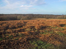
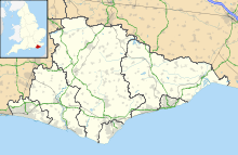
 Shown within East Sussex
Area of Search East Sussex Grid reference TQ335183 Coordinates 50°56′56″N 0°05′56″W / 50.949°N 0.099°WCoordinates: 50°56′56″N 0°05′56″W / 50.949°N 0.099°W Interest Biological Area 63.6 ha (157 acres) Notification 1966 Natural England website  A view of the lake in January.
Ditchling Common once the King's land as part of the Saxon Manor, is now a Country Park (designated as such in 1974) north of Ditchling and lies between Haywards Heath and Lewes to the east of Burgess Hill in West Sussex. It covers an area of 188 acres (0.76 km2) and can be found at map reference TQ337181. The common is very popular with walkers and particularly dog walkers, partially due to its proximity to the southeastern outskirts of Burgess Hill. There is a sizeable car park, although this becomes difficult to use in poor weather. The country park trail is a mile long (1.6 km) and passes through oak trees, grassland and an area of scrub. There are some willow trees in the scrubland, a lake and a stream. Birdlife in the park includes stonechats, linnets, woodpeckers, chiffchaffs, blackcaps and tits.
Visible at the northern end of the common is "Jacob's Post". The post marks the spot where the body of an itinerent peddlar, Jacob Harris, was displayed after he was hanged in 1734 for the murder of Richard Miles.[1]
The trail is marked by purple arrows on posts and takes about 40 minutes to complete. In wet weather stout footwear is recommended as the Weald clay in the area gets very waterlogged. The lake is well used by local fishermen who fish for carp, perch and roach. To fish here, an Environment Agency rod licence and a permit is needed.
References
(PDF) SSSI Citation — Ditchling Common. Natural England. http://www.english-nature.org.uk/citation/citation_photo/1002188.pdf. Retrieved 2008-10-26.
Categories:- Sites of Special Scientific Interest in East Sussex
- Sites of Special Scientific Interest notified in 1966


Wikimedia Foundation. 2010.