Magyarhertelend

Magyarhertelend
Magyarhertelend
Magyarhertelend is located in Hungary
Magyarhertelend
Location of Magyarhertelend
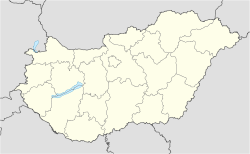
Coordinates: 46°11′09″N 18°09′03″E / 46.18575°N 18.15078°E / 46.18575; 18.15078Coordinates: 46°11′09″N 18°09′03″E / 46.18575°N 18.15078°E / 46.18575; 18.15078
Country  Hungary
County Baranya
Area
 - Total 16.16 km2 (6.2 sq mi)
Population (2004)
 - Total 670
 - Density 41.46/km2 (107.4/sq mi)
Time zone CET (UTC+1)
 - Summer (DST) CEST (UTC+2)
Postal code 7394
Area code(s) 72

Magyarhertelend is a village in Baranya county, Hungary.


External links


Wikimedia Foundation. 2010.

Игры ⚽ Нужен реферат?

Look at other dictionaries:

  • Magyarhertelend — Administration …   Wikipédia en Français

  • Holiday home Tábor Utca-Magyarhertelend — (Magyarhertelend,Венгрия) Категория отеля: Адрес: 7394 Magy …   Каталог отелей

  • Horcholond Vendèghàz — (Magyarhertelend,Венгрия) Категория отеля: Адрес: 7394 Magyarhertelend, Kossut …   Каталог отелей

  • Baranya County — Infobox Hungarian county name =Baranya region =Southern Transdanubia seat = Pécs area = 4430 population = 396,600 density = 89 cities = 301Baranya (Croatian: Baranja , Serbian: Барања, Baranja , German: Branau ) is the name of an administrative… …   Wikipedia

  • Mohács — Mohač/Mohatsch Aerial view …   Wikipedia

  • Mecsek — Some mountains viewed from Máré Castle, near Magyaregregy. Location Baranya and Tolna counties, Hungary Territory 500 km² …   Wikipedia

  • Komlo — Komló Hilfe zu Wappen …   Deutsch Wikipedia

  • Komló — Komló …   Deutsch Wikipedia

  • Baranya — Blason du Comitat Carte du comitat …   Wikipédia en Français

  • Pécs — Pour les articles homonymes, voir PEC. Pécs Héraldique …   Wikipédia en Français

Share the article and excerpts

Direct link
Do a right-click on the link above
and select “Copy Link”