Russell River National Park
- Russell River National Park
Infobox_protected_area_of_Australia | name = Russell River National Park
iucn_category = II
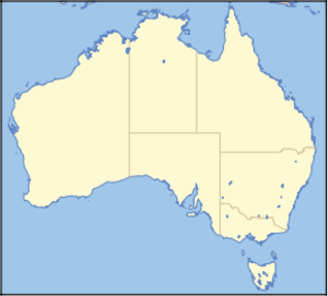
caption =
locator_x = 220
locator_y = 48
nearest_town_or_city = Innisfail
coordinates = coord|17|13|29|S|145|56|20|E|type:landmark_region:AU
area = 41 km²
established = 1969
visitation_num =
visitation_year =
managing_authorities = Queensland Parks and Wildlife Service
official_site = [http://www.epa.qld.gov.au/projects/park/index.cgi?parkid=210 Russell River National Park]
Russell River is a national park in North Queensland (Australia), 1352 km northwest of Brisbane. Camping is allowed with a camping permit, but the park itself has no visitor facilities.
See also
* Protected areas of Queensland (Australia)
External links
* [http://www.epa.qld.gov.au/projects/park/index.cgi?parkid=210 Russell River National Park at Queensland's EPA]
Wikimedia Foundation.
2010.
Look at other dictionaries:
Russell Cave National Monument — Catégorie UICN V (paysage terrestre/marin protégé) Identifiant 21060 Pays … Wikipédia en Français
National Park Service — Arrowhead Agency overview Formed August 25, 1916 Jurisdiction … Wikipedia
National Park Service — Logo du National Park Service Création 25 août 1916 … Wikipédia en Français
Russell Cave National Monument — Infobox Protected area name = Russell Cave National Monument iucn category = V caption = locator x = 198 locator y = 113 location = Jackson County, Alabama, USA nearest city = Bridgeport, AL lat degrees = 34 lat minutes = 58 lat seconds = 27 lat… … Wikipedia
Mount Field National Park — IUCN Category II (National Park) … Wikipedia
Mesa Verde National Park — Mesa Verde redirects here. For other uses, see Mesa Verde (disambiguation). Mesa Verde National Park IUCN Category II (National Park) … Wikipedia
Crooked River State Park — is a 500 acre (2.02 km²) Georgia state park located near St. Mary s on the south bank of the Crooked River, providing an excellent coastal setting. In addition to a boat ramp, the park is near the ruins of the McIntosh Sugar Works , built around… … Wikipedia
Mount Walsh National Park — IUCN Category II (National Park) Mount Walsh Nearest town/city Biggenden, Queensland Coordinates … Wikipedia
Curtis Island National Park — IUCN Category II (National Park) Coordinates 23°31′49″S 151°13′16″E … Wikipedia
Mungkan Kandju National Park — IUCN Category II (National Park) … Wikipedia
