- Maryland Route 452
-
Maryland Route 452
Friendship Road Route information Maintained by MDSHA Length: 1.64 mi[1] (2.64 km) Major junctions South end:  US 50 near Berlin
North end:  MD 575 in Friendship
Location Counties: Worcester Highway system Maryland highway system
Interstate • US • State • Minor • Former • Turnpikes←  MD 451
MD 453  →
→Maryland Route 452 (MD 452) is a state highway in the U.S. state of Maryland. Known as Friendship Road, the state highway runs 1.64 miles (2.64 km) from U.S. Route 50 (US 50) near Berlin north to MD 575 in Friendship, Worcester County. MD 452 was built as a cut-off between US 213 (now US 50) and US 113 (now MD 575) in the early 1930s.
Contents
Route description
MD 452 begins at an intersection with US 50 (Ocean Gateway) to the northeast of Berlin. Seahawk Road continues south from the intersection, providing access to Stephen Decatur High School and Stephen Decatur Middle School. MD 452 immediately encounters the west end of MD 707 (Grays Corner Road), which was formerly US 213. The state highway heads north as a two-lane road through a mix of farms and residences, crossing Taylorville Creek. MD 452 reaches its northern terminus at MD 575 (Worcester Highway), the old alignment of US 113, in the hamlet of Friendship.[1][2]
History
MD 452 was constructed between 1930 and 1933 from US 213 (now MD 707) to US 113 (now MD 575).[3][4] The state highway was extended south a short distance to its present terminus when the US 50 divided highway was completed in 1950.[5]
Junction list
The entire route is in Worcester County.
Location Mile
[1]Destinations Notes Berlin 0.00 Seahawk Road south Southern terminus US 50 (Ocean Gateway) – Salisbury, Ocean City0.02  MD 707 east (Grays Corner Road)
Officially MD 707B; old alignment of US 50 Friendship 1.64 MD 575 (Worcester Highway) – Showell, Ocean PinesNorthern terminus 1.000 mi = 1.609 km; 1.000 km = 0.621 mi References
- ^ a b c "Highway Location Reference: Worcester County" (PDF). Maryland State Highway Administration. 2009. http://www.marylandroads.com/Location/2009_WORCESTER.pdf. Retrieved 2010-10-24.
- ^ Google, Inc. Google Maps – Maryland Route 452 (Map). Cartography by Google, Inc. http://maps.google.com/maps?f=d&source=s_d&saddr=Friendship+Rd%2FMD-452+N%2FSeahawk+Rd&daddr=Friendship+Rd%2FMD-452+N%2FSeahawk+Rd&geocode=FcoSSQId1LCE-w%3BFTRnSQIdwoOE-w&hl=en&mra=ls&sll=38.365029,-75.200751&sspn=0.007722,0.01929&ie=UTF8&t=h&z=14. Retrieved 2010-04-06.
- ^ Report of the State Roads Commission of Maryland. 1927-1930. Baltimore: Maryland State Roads Commission. 1930-10-01. p. 235. http://www.archive.org/details/annualreportsofs1927mary. Retrieved 2010-04-06.
- ^ Maryland Geological Survey. Map of Maryland Showing State Road System: State Aid Roads and Improved County Road Connections (Map) (1933 ed.).
- ^ Report of the State Roads Commission of Maryland. 1949-1950. Baltimore: Maryland State Roads Commission. 1950-12-20. pp. 98–99. http://www.archive.org/details/annualreportsofs1949mary. Retrieved 2010-04-01.
External links
Roads in Worcester County, Maryland State highways 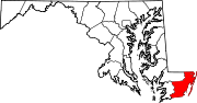
U.S. Highways Categories:- State highways in Maryland
- Roads in Worcester County, Maryland


Wikimedia Foundation. 2010.