- Iron Range National Park
Infobox_protected_area_of_Australia | name = Iron Range National Park
iucn_category = II
caption =
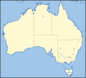
locator_x = 204
locator_y = 17
nearest_town_or_city = Weipa
coordinates = coord|12|34|00|S|143|18|55|E|type:landmark_region:AU
area = 346 km²
established = 1977
visitation_num =
visitation_year =
managing_authorities = Queensland Parks and Wildlife Service
official_site = [http://www.epa.qld.gov.au/projects/park/index.cgi?parkid=195 Iron Range National Park]Iron Range is a National Park located in
Queensland ,Australia , 1940 km northwest ofBrisbane and 100 km east ofWeipa in theCape York Peninsula , Queensland.Within the National Park is the Iron Range (Lockhart River Resources Reserve), Scrubby Creek mining area and Lockhart River Aboriginal Reserve.
During WW2 there were a number of
Australian Army units located at this base.History of airbases
In March 1940,
Val Augenson of the Department of Civil Aviation inspected a possible site for an Emergency Landing Ground for theRoyal Australian Air Force (RAAF). He reported to the RAAF that a suitable all-weather Emergency Landing Ground could be built in the area.On about
18 April 1942 ,Walter Maiersperger , the Commanding Officer of33 Bomb Squadron of theUnited States Army Air Force 's22nd Bomb Group , carried out an aerial reconnaissance flight over the Iron Range area. He had been tasked with surveying coastal airfields in Queensland that would be suitable for operation of theB-26 Marauder s used by the 22nd Bomb Group.Air Commodore Lukis, Air Officer Commanding, North East Area, reported on28 May 1942 , that Pilot Officer Trench, RAAF had inspected the countryside nearPortland Roads (also known as Weymouth Bay), with Colonel Mills and Captain Herman G. Cox of the USAAF. Their first attempt to fly to the Iron Range area fromCoen was not successful. An engine failed in their Rapide and they returned to Coen. After being repaired they took off the next morning and landed on a beach at low tide a few miles south of Portland Roads. As the plane slowed down upon landing on the soft sand the Rapide swung towards the sea. The tips of the propeller started to thrash in the water but the skilful pilot was able to turn the aircraft back onto the beach.The inspection party reported to Lukis that there were good jetty facilities at Portland Roads but that there was no suitable site for an aerodrome near the jetty. They reported that a fairly extensive site just to the west of Iron Range and east of the Claudie River was suitable for the construction of several airfields. [ Iron Range Airfield Nth Qld during WW2, accessed May 2006 http://home.st.net.au/~dunn/airfields/ironrange.htm] On
7 June 1942 , an advance party of the US46 Engineer General Service Regiment and 26 Operational Base Unit RAAF boarded the SS Wandana inTownsville headed for Portland Roads. 26 OBU arrived at Portland Roads and established radio communications with Townsville on the evening of10 June 1942 .A few weeks after his initial visit, Jim Trench returned to the Iron Range area with Colonel Mills and observed two American Battalions of Pioneer Engineers busily buildings the Iron Range runways. They managed to build two 7,000-feet runways and thirteen miles of sealed taxiways within three months.
On
14 June 1942 , Companies A, B and C of the 46th Engineers boarded theMS Dona Nati at Townsville and arrived at Portland Roads on16 June 1942 .Headquarters and Service Company (H & S Company) of the 46th Engineers left Townsville on
10 July 1942 and arrived at Portland Roads on12 July 1942 .On27 October 1942 , Headquarters Detachment of the 46th Engineers left Townsville and arrived at Iron Range on 29 October 1942.The
90th Bomb Group arrived in Queensland in early November 1942 with their forty-eight (48) B-24D Liberators ( [http://www.wpafb.af.mil/museum/research/bombers/b2-38.htm variant D] ). They were initially based as follows at Iron Range, 16 km inland from the port facility of Portland Roads:List of the sections/units during World War II
According to Peter Dunn, [ Iron Range bases during WW2), accessed May 2006 http://home.st.net.au/~dunn/locations/muironrange.htm] the following sections were situated at Iron Range:
* 2 Section, 2 Australian Survey Company
* 3rd Portable Surgical Hospital (US Army)
* 5th AACS
* 13 Garrison Battalion 1 Aust Army, CMF
* 13 Australian Gun (less A, B & C Company)
* 15th Weather Squadron
* 18th Station Hospital (US)
* 18th Station Hospital (US)
* 22nd Bomb Group
* 26th AA Battery
* 26 OBU (RAAF)
* 28 Service Squadron (US)
* 36 Australian AA Battery Workshops Section, Cape Direction
* 36 Australian Supply Depot Pl
* 43rd Bomb Group
* 46 Engineer Regiment (US)
* 61 Service Group & 46 (EGS)
* 90th Bomb Group
* 197th Coastal Artillery (AA) Regiment
* 387th Port Battalion (US)
* 404 Signal
* 1909 Ordnance
* AASC 4 Australian DID, Cape Direction
* Attached Detachment 200 Supply Depot (AIF)
* Australian 446 - 447 Heavy AA Gun Static
* Australian 136 Coastal Artillery Searchlight Company
* Australian Army Airway Radio Range and Communication Station
* Allied Works Council
* Carrier Pl, 51 Australian Infantry Battalion
* Civil Construction Corps (CCC)
* D Section, 2/4th Australian Dental Unit
* Detachment 1 Australian Army AA Pool Under Command CA Artillery Portland Roads
* Detachment 2/1 Australian Field Butchery Company
* Detachment 2/109 Australian General Transport Company
* Detachment 3 Company Queensland AA & CA Signals
* Detachment 8 Australian Field Baker
* Detachment 19 Australian Field Bakery
* Detachment 21 Australian Field Bakery (AIF)
* Detachment 56 Australian Comp. AA Regiment Workshop (LE)
* Directorate of Air Transport
* HQ 36 Australian AA Battery
* Main Roads Commission (MRC)
* Portland Road Battery
* Port Detachment "A"
* RAAF AASC Station Base and Weather Station
* RAAF Key Communication Centre
* US 5 Air Force CommandAerial photos & maps - World War II bomber base
ee also
*
Protected areas of Queensland (Australia) References

Wikimedia Foundation. 2010.