Copeland, North Carolina

Copeland, North Carolina

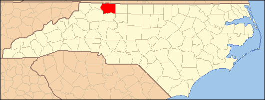
Copeland is a small unincorporated community in the Rockford Township of Surry County, North Carolina.

Geography

The community is centered around the intersection of Stony Knoll Road and Copeland School Road/Double Creek Road and generally lies near the head of East Double Creek (Powell 1968, pp. 477–478). Copeland has an elevation of 1,172 feet above sea level. Area landmarks near the center of the community include Copeland Elementary School, the local masonic lodge, Ruritan club, and area churches.

References

Powell, William S. (1968), The North Carolina Gazetteer: A Dictionary of Tar Heel Places, Chapel Hill: University of North Carolina Press, ISBN 0-8078-1247-1 

External links

Coordinates: 36°20′17″N 80°39′00″W / 36.338°N 80.650°W / 36.338; -80.650


Wikimedia Foundation. 2010.

Игры ⚽ Нужна курсовая?

Look at other dictionaries:

  • North Carolina General Assembly election, 2004 — Elections in North Carolina Federal government Presidential elections 1964  …   Wikipedia

  • Asheville, North Carolina — Not to be confused with Ashville (disambiguation). Asheville, North Carolina   City   Downtown Asheville …   Wikipedia

  • Dobson, North Carolina —   Town   Location of Dobson, North Carolina …   Wikipedia

  • Crutchfield, North Carolina — Crutchfield is a small community along the Yadkin River in the Marsh Township of Surry County, North Carolina (Powell 1968, p. 129). The community, situated across the Yadkin River just north of Boonville was a stop on the former Southern… …   Wikipedia

  • Devotion, North Carolina — Devotion is a small unincorporated community in the Bryan Township of western Surry County, North Carolina. Fairly isolated, Devotion is on the Mitchell River and is the site of a large (100 square miles) family estate owned by members of the R.… …   Wikipedia

  • Combstown, North Carolina — Combstown is a small unincorporated community in Surry County, North Carolina on the outskirts of the city of Mount Airy between Bannertown and Flat Rock. Coordinates: 36°30′04″N 80°34′44″W /  …   Wikipedia

  • Stokes, North Carolina — Stokes or Carolina is an unincorporated community in Pitt County, North Carolina, United States. The community is a part of the Greenville Metropolitan Area in North Carolina s Inner Banks region.EducationStokes local school is Stokes Elementary… …   Wikipedia

  • Surry County, North Carolina — Seal …   Wikipedia

  • Masonic Lodges of North Carolina — Part of a series of articles on Freemasonry Core Articles Freemasonry · Grand Lodge · Masonic Lodge · Masonic Lodge Officers · Grand Master · Prince Hall Freemasonry · Regular Masonic jurisdictions · Continental F …   Wikipedia

  • Mount Airy, North Carolina —   City   Downtown Mount Airy …   Wikipedia

Share the article and excerpts

Direct link
Do a right-click on the link above
and select “Copy Link”