- Onkaparinga River National Park
-
Onkaparinga River National Park IUCN Category II (National Park)
Nearest town/city Adelaide Coordinates 35°09′38″S 138°33′14″E / 35.16056°S 138.55389°E Area 13.8 km² Established 1993 Managing authorities Department for Environment and Heritage Official site Onkaparinga River National Park Onkaparinga River National Park is in South Australia (Australia), 32 km south of Adelaide and incorporates the Onkaparinga River Recreation Park.
Contents
History
The lower reaches of the Onkaparinga River were inhabited by the Kaurna Aboriginal people, and the name of the river is taken from the Kaurna name meaning "women's river". European settlement and farming in the district began about 1840 leading to the rapid displacement of the Aboriginal inhabitants. Kaurna people still have strong ties to the area through cultural practices and religious beliefs. Many local place names such as ‘Onkaparinga’, ‘Noarlunga’ and ‘Willunga’ have their origins in the Kaurna language. The town of Noarlunga (renamed Old Noarlunga) was the service centre with farm produce being transported 10 km down river to Port Noarlunga.
The remains of Pingle Farm, built in 1862, can be seen in the section of the park west of Main South Road. In 1878, several additional structures were built, including an underground water tank, a stone barn and a shed. The farm was occupied by the Jared family until the early 1970s when it was sold to the South Australian Government.
Flora and fauna
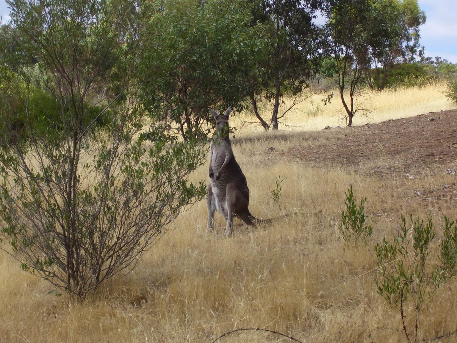
 A Kangaroo of Onkaparinga River National Park
The vegetation of the park has been greatly perturbed by human activity, but remnant patches remain. The most intact area is the Hardy's Scrub section of the reserve. 160 years of livestock grazing, timber harvesting and cropping has cleared most of the reserve of native understorey species and in many areas invasive grasses are the main vegetation type. Remnant Eucalypts are the most noticeable native species in the reserve. Eucalyptus microcarpa (Grey Box), Eucalyptus fasciculosa (Pink Gum), Eucalyptus porosa (Mallee box), Eucalyptus Cameldulensis (Red Gum), and Eucalyptus leucoxylyn (Blue Gum) all occur in the reserve. The European Olive (Olea europaea) is a noxious weed in South Australia and has invaded the park, although generally individuals are not as large as in older parks in the Mount Lofty Ranges like Belair NP but will continue to be a problem unless managed. Over the last twenty years accessible areas of the gorge have been revegetated by contractors working for National Parks SA. The oldest area of revegetation in the park was conducted with tubestock, predominantly of Eucalypts. Recent efforts have focused on the direct seeding method where seed of native species is ploughed into a scraped trench. Insect activity includes butterflies (Lepidoptera) and dragonflies (Anisoptera). Kangaroos are common among the open hillsides with abundant grasses.
Trails
Wetlands Walk
 Onkaparinga Estuary
2.5 hr loop, 4.5 km loop (Gate 31, 34).
The Wetlands Walk is located on the estuary within the recreation park and provides an insight into the complex life of a wetland. The trail offers the opportunity for walking, birdwatching and photography. Along the trail are interpretive signs that provide information about the flora and fauna of the area.
Pingle Farm Walk
2.5 hr loop, 4.5 km loop (Gate 29).
Built in 1862, all that remains of Pingle Farm is a group of limestone buildings on the fertile flood plains on the southern side of the Onkaparinga River.
Hardys Scrub Hike
 Old Quarry Track
2 hr loop, 4 km loop (Gate 11).
This patch of native vegetation is a very important conservation area, despite a history of timber cutting, quarrying and grazing.
Nature Hike
2 hr loop, 3.5 km loop (Gate 6).
The Nature Hike includes good views of the gorge, while trails provide an opportunity to view many species of birds and the occasional lizard.
Echidna Hike
 An echidna under an olive tree
2.5 hr loop, 3.5 km loop (Gate 7).
The Echidna Trail winds its way amongst some of the best remnant vegetation and visits six heritage sites, including huts and houses built in the 1880s. The dominant overstorey species is Peppermint Box, with River Red Gum in the gullies and Pink Gum on the higher slopes. Other plant species include sheoak, Golden Wattle, a small stand of native pine and various herbaceous ground covers. Twenty-seven native orchid species have been recorded in the area.
Sundews Ridge Hike
 Sundews Lookout
2 hr loop, 4 km loop (Gate 6).
A relatively short hike to view the rocky outcrops and meandering Onkaparinga River from the Sundews Lookout.
Gorge Track
4 hr return, 3.5 km return (Gate 18).
This hard trail takes you to gorge vantage points before descending steeply to the river.
Sundews River Hike
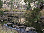 Onkaparinga River at the end of Sundews River Hike
4 hr loop, 4.5 km loop (Gate 6).
This rocky trail descends steeply from the Sundews Lookout to the bottom of the gorge, and then follows the river downstream for a short distance before returning up the steep slopes of the gorge to the ridge and then the car park.
Rock climbing
Climbing is permitted on the designated cliff area near Gate 10. Specific skills and equipment are required. Climbers are required to contact the Belair District Office first.
See also
External links
- Postcards Feature with Keith Conlon
- A blog of a bush walk in the Onkaparinga River National Park by SA-hiker
Protected areas of South Australia National Parks Belair · Canunda · Coffin Bay · Coongie Lakes · Coorong · Flinders Chase · Flinders Ranges · Gawler Ranges · Innes · Lake Eyre · Lake Gairdner · Lake Torrens · Lincoln · Mount Remarkable · Murray River · Naracoorte Caves · Nullarbor · Onkaparinga River · Vulkathunha-Gammon Ranges · Witjira
Conservation Parks Acraman Creek · Billiatt · Black Hill · Cape Gantheaume · Cleland · Cox Scrub · Danggali · Deep Creek · Fairview · Finniss · Fort Glanville · Gum Laqoon · Kelly Hill · Hacks Lagoon · Hallett Cove · Horsnell Gully · Kaiserstuhl · Lake Gilles · Mamungari · Marino · Monarto · Morialta · Mount Magnificent · Naracoorte Caves · Ngarkat · Peebinga · Piccaninnie Ponds · Scott Creek · Seal Bay · Simpson Desert · Spring Gully · Talisker
Recreation Parks Regional Reserves Innamincka · Lake Frome · Nullarbor · Simpson Desert · Strzelecki
Conservation Reserves Wilderness Protection Areas Game Reserves Categories:- IUCN Category II
- National parks of South Australia
- Parks in Adelaide
- Protected areas established in 1993
- 1993 establishments in Australia
- Adelaide Plains


Wikimedia Foundation. 2010.