- Corpus Christi metropolitan area
-
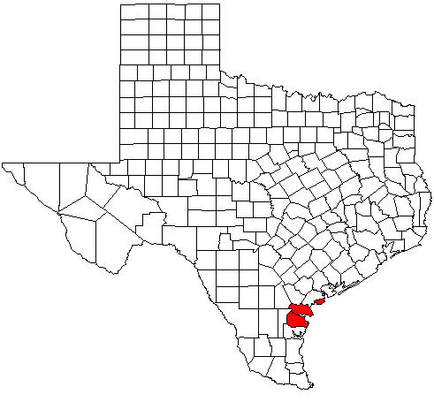
 Map of Texas highlighting the Corpus Christi metropolitan area.
The Corpus Christi Metropolitan Statistical Area is a metropolitan area in South Texas that covers three counties - Aransas, Nueces, and San Patricio. As of the 2000 census, the MSA had a population of 403,280 (though a July 1, 2009 estimate placed the population at 416,095).[1]
Contents
Counties
Communities
Places with more than 275,000 people
- Corpus Christi (Principal City)
Places with 10,000 to 30,000 people
Places with 1,000 to 10,000 people
Places with 500 to 1,000 people
- Del Sol-Loma Linda
- Driscoll
- Ingleside on the Bay
- Lake City
- Lakeshore Gardens-Hidden Acres
- North San Pedro
- St. Paul
- Spring Garden-Terra Verde
Places with less than 500 people
- Agua Dulce
- Doyle
- Edgewater-Paisano
- Edroy
- Falman-County Acres
- La Paloma-Lost Creek
- Lakeside
- Morgan Farm Area
- Petronila
- Rancho Banquete
- Rancho Chico
- San Patricio
- Sandy Hollow-Escondidas
- Tierra Grande
- Tradewinds
- Violet
Demographics
As of the census[2] of 2000, there were 403,280 people ,2007 estimates a population of 427,568, 141,590 households, and 103,316 families residing within the MSA. The racial makeup of the MSA was 73.68% White, 3.85% African American, 0.64% Native American, 1.16% Asian, 0.08% Pacific Islander, 17.52% from other races, and 3.07% from two or more races. Hispanic or Latino of any race were 52.74% of the population.
The median income for a household in the MSA was $33,682 and the median income for a family was $38,661. Males had a median income of $31,433 versus $21,134 for females. The per capita income for the MSA was $17,007.
See also
References
- ^ "Table 1. Annual Estimates of the Population of Metropolitan and Micropolitan Statistical Areas: April 1, 2000 to July 1, 2009 (CBSA-EST2009-01)" (CSV). 2009 Population Estimates. United States Census Bureau, Population Division. 2010-03-23. http://www.census.gov/popest/metro/tables/2009/CBSA-EST2009-01.csv. Retrieved 2010-03-24.
- ^ "American FactFinder". United States Census Bureau. http://factfinder.census.gov. Retrieved 2008-01-31.
Categories:- Corpus Christi metropolitan area
- Geography of Aransas County, Texas
- Geography of Nueces County, Texas
- Geography of San Patricio County, Texas
Wikimedia Foundation. 2010.