- 2002–03 Australian region cyclone season
-
2002–03 Australian region cyclone season 
Season summary mapFirst storm formed: 5 January 2003 Last storm dissipated: 7 June 2003 Strongest storm: Inigo – 900 hPa (mbar), 220 km/h (140 mph) (10-minute sustained) Total storms: 9 Tropical cyclones: 3 Total fatalities: Unknown Total damage: Unknown Australian region cyclone seasons
2000–01, 2001–02, 2002–03, 2003–04, 2004–05Related articles: The 2002–03 Australian region cyclone season was an event in the ongoing cycle of tropical cyclone formation. It began on 1 November 2002 and ended on 30 April 2003. The regional tropical cyclone operational plan also defines a tropical cyclone year separately from a tropical cyclone season, which runs from 1 July 2002 to 30 June 2003.
Tropical cyclones in this area are monitored by four Tropical Cyclone Warning Centres (TCWCs): the Australian Bureau of Meteorology in Perth, Darwin, and Brisbane; and TCWC Port Moresby in Papua New Guinea.[1]
Contents
Storms
Tropical Cyclone 07S
Tropical depression (SSHS) 

Duration 27 December – 3 January Intensity 55 km/h (35 mph) (1-min), 1000 mbar (hPa) This system was classified by the Joint Typhoon Warning Center.
Unnamed Tropical Cyclone
Category 1 tropical cyclone (Australian scale) 
Duration 22 January – 25 January Intensity 65 km/h (40 mph) (10-min), 994 mbar (hPa) A strong low pressure system crossed near Elcho Island on 5 January 2003. It was operationally recognised as a tropical low, but post-analysis indicated that the system reached tropical cyclone intensity, with winds reaching 50 knots. It remained in the Northern Territory mainland for many days, until 21 January when it moved into the Timor Sea. It crossed the Western Australian coast near Port Hedland on 24 January. It again was treated as a tropical low at first, but it again was upgraded to tropical cyclone strength after post-analysis.[2]
Tropical Low Beni
Tropical low (Australian scale) Tropical depression (SSHS) 
Duration 1 February – 5 February Intensity 85 km/h (50 mph) (10-min), 995 mbar (hPa) Beni originated from the South Pacific region and its remnants moved into the Coral Sea where it briefly strengthened to a tropical cyclone off Mackay on 4 February. It finally crossed the Queensland coast over Seaforth just north of Mackay as a very weak tropical low.[3] Little rain was recorded around the region as Beni had very little storm structure when approaching the coastline, as wind shear was quite high.
Severe Tropical Cyclone Fiona
Category 4 severe tropical cyclone (Australian scale) Category 3 tropical cyclone (SSHS) 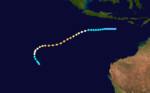
Duration 3 February – 12 February Intensity 180 km/h (110 mph) (10-min), 935 mbar (hPa) Formed on 4 February and dissipated on 13 February. It reached a peak intensity of 105 knots (1-min), but it did not affect any land areas.[3]
Tropical Cyclone Graham
Category 2 tropical cyclone (Australian scale) Tropical storm (SSHS) 

Duration 27 February – 1 March Intensity 90 km/h (55 mph) (10-min), 985 mbar (hPa) Main article: Cyclone GrahamGraham formed on 27 February 2003 near Broome, Australia. The storm then made landfall the next day before dissipating inland on 1 March. The storm killed one person.
Tropical Cyclone Harriet
Category 2 tropical cyclone (Australian scale) Tropical storm (SSHS) 
Duration 1 March – 11 March Intensity 90 km/h (55 mph) (10-min), 985 mbar (hPa) Formed on 2 March and became extratropical on 9 March. Perth still tracked its remnants until 11 March.[4]
Severe Tropical Cyclone Erica
Category 3 severe tropical cyclone (Australian scale) Category 1 tropical cyclone (SSHS) 

Duration 1 March – 12 March Intensity 150 km/h (90 mph) (10-min), 960 mbar (hPa) Formed on 4 March and became extratropical on 15 March and dissipated on 16 March. It formed near Australia, but later moved out of Brisbane's area of responsibility, hitting New Caledonia.[4] July 2002 to June 2003 Tropical Cyclones in the South Pacific Ocean
Tropical Cyclone Craig
Main article: Cyclone Craig (2003)Category 2 tropical cyclone (Australian scale) Tropical storm (SSHS) 
Duration 8 March – 12 March Intensity 100 km/h (65 mph) (10-min), 976 mbar (hPa) Formed on 7 March and dissipated on 12 March. Caused minor damage to northern parts of the Northern Territory and Queensland.[4]
Severe Tropical Cyclone Inigo
Category 5 severe tropical cyclone (Australian scale) Category 5 tropical cyclone (SSHS) 

Duration 1 April – 8 April Intensity 240 km/h (150 mph) (10-min), 900 mbar (hPa) Main article: Cyclone InigoA disturbance that had crossed the islands of Indonesia organized and was named Inigo on 2 April. In a favourable environment, Inigo rapidly intensified and became a Category-5 equivalent with a central pressure of 900 mb. It moved slowly southwest and started recurving. Shear increased and dry air became entrapped into the cyclone. It weakened quickly, and by the time of its landfall is was of only depression strength. Inigo dissipated on 8 April.
No one was killed by Inigo when it was a named cyclone. However, the precursor disturbance caused heavy rains over parts of Indonesia. There were at least 50 deaths, with 100 people missing. In the Sikka District of Besar Island, the total damage was 3.3 million dollars (USD). Over 1300 homes were destroyed, and 4800 were damaged. In East Flores, there was major damage to infrastructure. In many locations, crops and cattle were swept away.
Tropical Cyclone Epi
Category 1 tropical cyclone (Australian scale) 

Duration 5 June – 6 June Intensity 65 km/h (40 mph) (10-min), 985 mbar (hPa) Formed on 5 June and dissipated before 7 June. Epi formed within Port Moresby's area of responsibility just one year after Cyclone Upia was named in May 2002.[5] Tropical cyclones forming in this region are rare. Since 1993, only two other cyclones were named by Papua New Guinea.[6]
Storm names
Tropical cyclones are assigned names by the Australian Bureau of Meteorology or Papua New Guinea.
Tropical cyclones are named if they are non-frontal low pressure systems of synoptic scale developing over warm waters, or Dvorak intensity analysis indicate the presence of gale force or stronger winds near the centre. Therefore, a tropical system with gales in one or more quadrants, but not near the centre, are not named.[7]
All names assigned in the Australian region are used sequentially, unlike lists used annually by the National Hurricane Centre in the Atlantic Ocean and east Pacific Ocean. Only the names used during this cyclone season are listed below. The complete list of names for each basin are found in the World Meteorological Organization's official list.
Southeast Indian Ocean
Tropical cyclones that develop east of 90°E, south of the Equator, and west of 125°E are assigned names by the Tropical Cyclone Warning Centre in Perth, Western Australia.[1]
- Fiona
- Graham
- Harriet
- Inigo
Arafura Sea and Western Gulf of Carpentaria
Tropical cyclones that develop south of the Equator between 125°E and 141°E are assigned names by the Tropical Cyclone Warning Centre in Darwin, Northern Territory.[1]
- Craig
Coral Sea and Eastern Gulf of Carpentaria
Tropical cyclones that develop south of 10°S between 141°E and 160°E are assigned names by the Tropical Cyclone Warning Centre in Brisbane, Queensland.[1]
- Erica
Solomon Sea and Gulf of Papua
Tropical cyclones that develop north of 10°S between 141°E and 160°E are assigned names by the Tropical Cyclone Warning Centre in Port Moresby, Papua New Guinea.[1]
- Epi
See also
- List of Southern Hemisphere tropical cyclone seasons
- Atlantic hurricane seasons: 2002, 2003
- Pacific hurricane seasons: 2002, 2003
- Pacific typhoon seasons: 2002, 2003
- North Indian Ocean cyclone seasons: 2002, 2003
References
- ^ a b c d e http://www.wmo.ch/web/www/TCP/TCP24-English2004.pdf[dead link]
- ^ Monthly Global Tropical Cyclone Summary January 2003 Archived 23 January 2011 at WebCite
- ^ a b .Monthly Global Tropical Cyclone Summary February 2003 Archived 23 January 2011 at WebCite
- ^ a b c Monthly Global Tropical Cyclone Summary March 2003 Archived 23 January 2011 at WebCite
- ^ Monthly Global Tropical Cyclone Summary June 2003 Archived 23 January 2011 at WebCite
- ^ Monthly Global Tropical Cyclone Summary May 2002 Archived 23 January 2011 at WebCite
- ^ http://www.wmo.ch/web/www/TCP/OperationPlans/TCP24-English2004.pdf Archived August 24, 2006 at the Wayback Machine
External links
- Joint Typhoon Warning Center (JTWC).
- Australian Bureau of Meteorology (TCWC Perth).
- Australian Bureau of Meteorology (TCWC Darwin).
- Australian Bureau of Meteorology (TCWC Brisbane).
- World Meteorological Organization
2000–09 Australian region cyclone seasons


Wikimedia Foundation. 2010.