- Monroe County, Arkansas
-
Monroe County, Arkansas 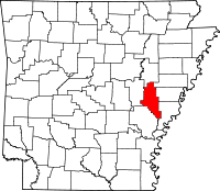
Location in the state of Arkansas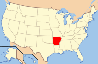
Arkansas's location in the U.S.Founded November 2, 1829 Seat Clarendon Area
- Total
- Land
- Water
621.41 sq mi (1,609 km²)
606.65 sq mi (1,571 km²)
14.76 sq mi (38 km²), 2.38%Population
- (2010)
- Density
8,149
13/sq mi (5.18/km²)Congressional district 1st Monroe County is a county located in the U.S. state of Arkansas. As of 2010, the population is 8,149. The county seat is Clarendon, while its largest city is Brinkley. Monroe County is Arkansas's 20th county, formed on November 2, 1829, from portions of Arkansas and Phillips counties, and named for James Monroe, the fifth President of the United States.
Sheffield Nelson, the Arkansas Republican National Committeeman and his party's gubernatorial nominee in 1990 and 1994, was born in 1940 in Monroe County.
Contents
Geography
According to the 2000 census, the county has a total area of 621.41 square miles (1,609.4 km2), of which 606.65 square miles (1,571.2 km2) (or 97.62%) is land and 14.76 square miles (38.2 km2) (or 2.38%) is water.[1]
Major Highways
 Interstate 40
 U.S. Highway 49
 U.S. Highway 70
 U.S. Highway 79
 Highway 1
 Highway 17
 Highway 39
 Highway 86
Adjacent counties
- Woodruff County (north)
- St. Francis County (northeast)
- Lee County (east)
- Phillips County (southeast)
- Arkansas County (southwest)
- Prairie County (west)
National protected areas
Demographics
Historical populations Census Pop. %± 1830 461 — 1840 936 103.0% 1850 2,049 118.9% 1860 5,657 176.1% 1870 8,336 47.4% 1880 9,574 14.9% 1890 15,336 60.2% 1900 16,816 9.7% 1910 19,907 18.4% 1920 21,601 8.5% 1930 20,651 −4.4% 1940 21,133 2.3% 1950 19,540 −7.5% 1960 17,327 −11.3% 1970 15,657 −9.6% 1980 14,052 −10.3% 1990 11,333 −19.3% 2000 10,254 −9.5% 2010 8,149 −20.5% [2][3][4]  Age pyramid Monroe County[5]
As of the census[6] of 2000, there were 10,254 people, 4,105 households, and 2,733 families residing in the county. The population density was 17 people per square mile (7/km²). There were 5,067 housing units at an average density of 8 per square mile (3/km²). The racial makeup of the county was 59.37% White, 38.79% Black or African American, 0.26% Native American, 0.13% Asian, 0.04% Pacific Islander, 0.26% from other races, and 1.14% from two or more races. 1.29% of the population were Hispanic or Latino of any race.
There were 4,105 households out of which 29.30% had children under the age of 18 living with them, 46.10% were married couples living together, 16.70% had a female householder with no husband present, and 33.40% were non-families. 30.10% of all households were made up of individuals and 15.10% had someone living alone who was 65 years of age or older. The average household size was 2.47 and the average family size was 3.07.
In the county the population was spread out with 27.90% under the age of 18, 7.60% from 18 to 24, 23.70% from 25 to 44, 23.40% from 45 to 64, and 17.30% who were 65 years of age or older. The median age was 38 years. For every 100 females there were 88.50 males. For every 100 females age 18 and over, there were 83.30 males.
The median income for a household in the county was $22,632, and the median income for a family was $28,915. Males had a median income of $25,299 versus $17,117 for females. The per capita income for the county was $13,096. About 21.00% of families and 27.50% of the population were below the poverty line, including 37.40% of those under age 18 and 22.40% of those age 65 or over.
History
It was at a site near the intersection of Monroe, Phillips, and Lee counties that surveys began shortly after the United States had completed the Louisiana Purchase. From wetlands in what would become southern Monroe County, approximately 900,000 square miles (2,300,000 km2) of land would be explored after President James Madison commissioned a survey of the purchase area. The point was commemorated in 1961 by the Arkansas General Assembly as part of Louisiana Purchase State Park.
Cities and towns
Townships
Townships in Arkansas are the divisions of a county. Each township includes unincorporated areas and some may have incorporated towns or cities within part of their space. Townships have limited purposes in modern times. However, the US Census does list Arkansas population based on townships (often referred to as "minor civil divisions"). Townships are also of value for historical purposes in terms of genealogical research. Each town or city is within one or more townships in an Arkansas county based on census maps. The townships of Monroe County are listed below with the town(s) and/or city that are fully or partially inside them listed in parentheses. [7][8]
- Brinkley (most of Brinkley)
- Brown
- Cache (Clarendon)
- Cleburne
- Cypress Ridge
- Dixon (part of Brinkley)
- Duncan (Holly Grove)
- Greenfield (Fargo)
- Hindman
- Jackson
- Keevil
- Montgomery-Smalley
- Pine Ridge
- Raymond
- Richland (part of Brinkley)
- Roc Roe (Roe)
See also
References
- ^ "Census 2000 U.S. Gazetteer Files: Counties". United States Census. http://www.census.gov/tiger/tms/gazetteer/county2k.txt. Retrieved 2011-02-13.
- ^ http://www.census.gov/population/www/censusdata/cencounts/files/ar190090.txt
- ^ http://factfinder2.census.gov
- ^ http://mapserver.lib.virginia.edu/
- ^ Based on 2000 census data
- ^ "American FactFinder". United States Census Bureau. http://factfinder.census.gov. Retrieved 2008-01-31.
- ^ US Census Bureau. 2011 Boundary and Annexation Survey (BAS): Monroe County, AR (Map). http://www2.census.gov/geo/pvs/bas/bas11/st05_ar/cou/c05117_prairie/BAS11C20511700000_000.pdf. Retrieved 20110824.
- ^ http://www.census.gov/geo/www/maps/DC10_GUBlkMap/cousub/dc10blk_st05_cousub.html#M
Municipalities and communities of Monroe County, Arkansas Cities 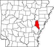
Towns Unincorporated
communitiesBlackton | Cross Roads | Monroe‡
Footnotes ‡This populated place also has portions in an adjacent county or counties
 State of Arkansas
Topics - Index
- Arkansans
- Constitution
- Delegations
- Geography
- Government
- Governor (List)
- History
- Images
- Places
- Transportation
- Visitor Attractions
Society - Culture
- Crime
- Demographics
- Economy
- Education
- Politics
Regions Metros Largest cities Other cities Counties - Arkansas
- Ashley
- Baxter
- Benton
- Boone
- Bradley
- Calhoun
- Carroll
- Chicot
- Clark
- Clay
- Cleburne
- Cleveland
- Columbia
- Conway
- Craighead
- Crawford
- Crittenden
- Cross
- Dallas
- Desha
- Drew
- Faulkner
- Franklin
- Fulton
- Garland
- Grant
- Greene
- Hempstead
- Hot Spring
- Howard
- Independence
- Izard
- Jackson
- Jefferson
- Johnson
- Lafayette
- Lawrence
- Lee
- Lincoln
- Little River
- Logan
- Lonoke
- Madison
- Marion
- Miller
- Mississippi
- Monroe
- Montgomery
- Nevada
- Newton
- Ouachita
- Perry
- Phillips
- Pike
- Poinsett
- Polk
- Pope
- Prairie
- Pulaski
- Randolph
- Saline
- Scott
- Searcy
- Sebastian
- Sevier
- Sharp
- St. Francis
- Stone
- Union
- Van Buren
- Washington
- White
- Woodruff
- Yell
Coordinates: 34°42′48″N 91°13′20″W / 34.71333°N 91.22222°W
Categories:- Arkansas counties
- Monroe County, Arkansas
- 1829 establishments in the United States
- Populated places established in 1829


Wikimedia Foundation. 2010.