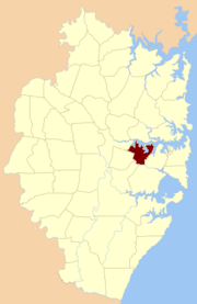
Concord Parish, Cumberland
Look at other dictionaries:
Willoughby Parish, Cumberland — Infobox Australian cadastral name = Willoughby state = New South Wales imagesize = 180 caption = Location of the parish within Cumberland lga = Municipality of Mosman county = Cumberland former hundred = Packenham est = 1835 near nw = Gordon near … Wikipedia
Petersham Parish, Cumberland — Infobox Australian cadastral name = Petersham state = New South Wales imagesize = 180 caption = Location of the parish within Cumberland lga = Municipality of Leichhardt county = Cumberland former hundred = Sydney est = 1835 near nw = Hunters… … Wikipedia
Liberty Plains Parish, Cumberland — Infobox Australian cadastral name = Liberty Plains state = New South Wales imagesize = 180 caption = Location of the parish within Cumberland lga = City of Parramatta county = Cumberland former hundred = Parramatta est = 1835 near nw = St. John… … Wikipedia
St. John Parish, Cumberland — Infobox Australian cadastral name = St. John state = New South Wales imagesize = 180 caption = Location of the parish within Cumberland lga = City of Parramatta county = Cumberland former hundred = Parramatta est = 1835 near nw = Castle Hill near … Wikipedia
St. George Parish, Cumberland — Infobox Australian cadastral name = St. George state = New South Wales imagesize = 180 caption = Location of the parish within Cumberland lga = Canterbury county = Cumberland former hundred = Sydney est = 1835 near nw = Concord near n = Petersham … Wikipedia
Hunters Hill Parish, Cumberland — Infobox Australian cadastral name = Hunters Hill state = New South Wales imagesize = 180 caption = Location of the parish within Cumberland lga = City of Ryde county = Cumberland former hundred = Parramatta est = 1835 near nw = South Colah near n … Wikipedia
Concord — For the airplane, see Concorde. Contents 1 Agreement 2 Places 2.1 Antarctica … Wikipedia
Cumberland County, New South Wales — Map of all coordinates from Google Map of all coordinates from Bing Export all coordinates as KML … Wikipedia
History of Massachusetts — Flag of Massachusetts Massachusetts was first colonized by principally English Europeans in the early 17th century, and became the Commonwealth of Massachusetts in the 18th century. Prior to English colonization of the area, it was inhabited by a … Wikipedia
James Monroe — For other people named James Monroe, see James Monroe (disambiguation). James Monroe 5th President of the United States In office March 4, 1817 – March 4, 1825 … Wikipedia