- Cerro Gordo County, Iowa
-
Cerro Gordo County, Iowa 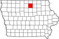
Location in the state of Iowa
Iowa's location in the U.S.Founded 1851 Seat Mason City Area
- Total
- Land
- Water
575.12 sq mi (1,490 km²)
568.33 sq mi (1,472 km²)
6.80 sq mi (18 km²), 1.18%Population
- (2010)
- Density
44,151
77.7/sq mi (30/km²)Time zone Central: UTC-6/-5 Website www.co.cerro-gordo.ia.us Footnotes: Population [1] Cerro Gordo County is a county located in the U.S. state of Iowa. The population was 44,151 in the 2010 census, a decline from 46,447 in 2000.[1][2] Its county seat is Mason City.[3] The county is named for the Battle of Cerro Gordo, which took place during the Mexican-American War.
Cerro Gordo County is part of the Mason City Micropolitan Statistical Area.
Contents
Geography
According to the 2000 census, the county has a total area of 575.12 square miles (1,489.6 km2), of which 568.33 square miles (1,472.0 km2) (or 98.82%) is land and 6.80 square miles (17.6 km2) (or 1.18%) is water.[4]
Major highways
 Interstate 35
 U.S. Highway 18
 U.S. Highway 65
 Iowa Highway 27
 Iowa Highway 122
Adjacent counties
- Worth County (north)
- Mitchell County (northeast)
- Floyd County (east)
- Franklin County (south)
- Hancock County (west)
History
Cerro Gordo County was formed in 1851 and named after a battlefield in the Mexican War, where General Winfield Scott defeated the Mexican General Santa Anna on April 18, 1847.
In 1851 the first white settlers came into the area of the present county and settled on Clear Lake. Four years later, on August 7, 1855, the first elections were held and the first legal proceedings occurred in 1857. In the summer of the same year, Livonia was chosen as the new county seat. In 1858, the seat was returned to Mason City. In 1866, the first courthouse was erected from stone at the cost of $600, which was used until 1900. The courthouse still used today was opened on November 17, 1960.
Cerro Gordo County was the site of the airplane crash north of the city of Clear Lake, in which rock and roll stars Buddy Holly, Ritchie Valens, and J.P. "The Big Bopper" Richardson, along with their pilot Roger A. Peterson, were killed on February 3, 1959. The site is located in Grant Township, in the northwestern part of the county.
Demographics
Historical populations Census Pop. %± 1860 940 — 1870 4,722 402.3% 1880 11,461 142.7% 1890 14,864 29.7% 1900 20,672 39.1% 1910 25,011 21.0% 1920 34,675 38.6% 1930 38,476 11.0% 1940 43,845 14.0% 1950 46,053 5.0% 1960 49,894 8.3% 1970 49,223 −1.3% 1980 48,458 −1.6% 1990 46,733 −3.6% 2000 46,447 −0.6% 2010 44,151 −4.9% Iowa Data Center [2] 2010 census
The 2010 census recorded a population of 44,151 in the county, with a population density of 77.73/sq mi (30.012/km2). There were 22,163 housing units, of which 19,350 were occupied.[1]
2000 census
 2000 Census Age Pyramid for Cerro Gordo County.
As of the census[5] of 2000, there were 46,447 people, 19,374 households, and 12,399 families residing in the county. The population density was 82 people per square mile (32/km²). There were 21,488 housing units at an average density of 38 per square mile (15/km²). The racial makeup of the county was 96.26% White, 0.80% Black or African American, 0.17% Native American, 0.70% Asian, 0.02% Pacific Islander, 0.88% from other races, and 1.16% from two or more races. 2.78% of the population were Hispanic or Latino of any race.
There were 19,374 households out of which 29.10% had children under the age of 18 living with them, 51.90% were married couples living together, 9.10% had a female householder with no husband present, and 36.00% were non-families. 30.90% of all households were made up of individuals and 13.50% had someone living alone who was 65 years of age or older. The average household size was 2.32 and the average family size was 2.91.
In the county the population was spread out with 23.80% under the age of 18, 9.00% from 18 to 24, 26.40% from 25 to 44, 23.20% from 45 to 64, and 17.70% who were 65 years of age or older. The median age was 39 years. For every 100 females there were 92.80 males. For every 100 females age 18 and over, there were 89.10 males.
The median income for a household in the county was $35,867, and the median income for a family was $46,099. Males had a median income of $31,790 versus $21,781 for females. The per capita income for the county was $19,184. About 5.90% of families and 8.50% of the population were below the poverty line, including 9.10% of those under age 18 and 8.60% of those age 65 or over.
Communities
Cities
Townships
Cerro Gordo County is divided into sixteen townships:
Unincorporated communities
- Burchinal
- Cameron
- Cartersville
- Emery
- Freeman
- Hurley
- Portland
See also
References
- ^ a b c "Population and Housing Occupancy Status: 2010 - State -- County". United States Census Bureau American FactFinder. http://factfinder2.census.gov/faces/tableservices/jsf/pages/productview.xhtml?pid=DEC_10_PL_GCTPL2.ST05&prodType=table. Retrieved March 8, 2011.
- ^ a b "Data from the 2010 Census". State Data Center of Iowa. http://www.iowadatacenter.org/archive/2011/02/feb10. Retrieved March 8, 2011.
- ^ "Find a County". National Association of Counties. http://www.naco.org/Counties/Pages/FindACounty.aspx. Retrieved 2011-06-07.
- ^ "Census 2000 U.S. Gazetteer Files: Counties". United States Census. http://www.census.gov/tiger/tms/gazetteer/county2k.txt. Retrieved 2011-02-13.
- ^ "American FactFinder". United States Census Bureau. http://factfinder.census.gov. Retrieved 2008-01-31.
External links

Worth County Mitchell County Hancock County 
Floyd County  Cerro Gordo County, Iowa

Franklin County Municipalities and communities of Cerro Gordo County, Iowa County seat: Mason City Cities Clear Lake | Dougherty | Mason City | Meservey | Nora Springs‡ | Plymouth | Rock Falls | Rockwell | Swaledale | Thornton | Ventura

Townships Bath | Clear Lake | Dougherty | Falls | Geneseo | Grant | Grimes | Lake | Lime Creek | Lincoln | Mason | Mount Vernon | Owen | Pleasant Valley | Portland | Union
Footnotes ‡This populated place also has portions in an adjacent county or counties
Coordinates: 43°04′46″N 93°16′01″W / 43.07944°N 93.26694°W
Categories:- Iowa counties
- Cerro Gordo County, Iowa
- 1851 establishments in the United States
- Mason City micropolitan area


Wikimedia Foundation. 2010.