- Osborne County, Kansas
-
Osborne County, Kansas 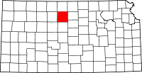
Location in the state of Kansas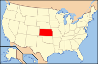
Kansas's location in the U.S.Founded February 26, 1867 Seat Osborne Area
- Total
- Land
- Water
894.28 sq mi (2,316 km²)
892.39 sq mi (2,311 km²)
1.89 sq mi (5 km²), 0.21%Population
- (2010)
- Density
3,858
4.5/sq mi (1.8/km²)Time zone Central: UTC-6/-5 Website OsborneCounty.org Osborne County (standard abbreviation: OB) is a county located in the U.S. state of Kansas. As of the 2010 census, the county population was 3,858.[1] The largest city and county seat is Osborne.
Contents
History
19th century
Osborne County was named after Sergeant Vincent B. Osborne, Second Kansas Cavalry, who was wounded at the Battle of Wilson's Creek during the Civil War.[2]
Frontiersman Charles "Buffalo" Jones lived in a sod house for a time in Osborne County prior to his co-founding Garden City, Kansas, in 1879.[3]
Law and government
Although the Kansas Constitution was amended in 1986 to allow the sale of alcoholic liquor by the individual drink with the approval of voters, Osborne County has remained a prohibition, or "dry", county.[4]
Geography
According to the 2000 census, the county has a total area of 894.28 square miles (2,316.2 km2), of which 892.39 square miles (2,311.3 km2) (or 99.79%) is land and 1.89 square miles (4.9 km2) (or 0.21%) is water.[5]
The geodetic center of North America is located within the county.[1] The geographic center of the 48 contiguous states is located in neighboring Smith County.
Adjacent counties
- Smith County (north)
- Jewell County (northeast)
- Mitchell County (east)
- Lincoln County (southeast)
- Russell County (south)
- Ellis County (southwest)
- Rooks County (west)
Demographics
Historical populations Census Pop. %± 1900 11,844 — 1910 12,827 8.3% 1920 12,441 −3.0% 1930 11,568 −7.0% 1940 9,835 −15.0% 1950 8,558 −13.0% 1960 7,506 −12.3% 1970 6,416 −14.5% 1980 5,959 −7.1% 1990 4,867 −18.3% 2000 4,452 −8.5% 2010 3,858 −13.3% U.S. Decennial Census  Age pyramid
 2005 KDOT Map of Osborne County (map legend)
As of the census[6] of 2000, there were 4,452 people, 1,940 households, and 1,208 families residing in the county. The population density was 5 people per square mile (2/km²). There were 2,419 housing units at an average density of 3 per square mile (1/km²). The racial makeup of the county was 98.61% White, 0.07% Black or African American, 0.22% Native American, 0.20% Asian, 0.02% Pacific Islander, 0.07% from other races, and 0.81% from two or more races. 0.38% of the population were Hispanic or Latino of any race.
There were 1,940 households out of which 25.90% had children under the age of 18 living with them, 54.50% were married couples living together, 5.20% had a female householder with no husband present, and 37.70% were non-families. 35.20% of all households were made up of individuals and 18.30% had someone living alone who was 65 years of age or older. The average household size was 2.23 and the average family size was 2.90.
In the county the population was spread out with 23.80% under the age of 18, 5.50% from 18 to 24, 22.30% from 25 to 44, 22.60% from 45 to 64, and 25.70% who were 65 years of age or older. The median age was 44 years. For every 100 females there were 96.80 males. For every 100 females age 18 and over, there were 92.60 males.
The median income for a household in the county was $29,145, and the median income for a family was $35,438. Males had a median income of $24,736 versus $16,516 for females. The per capita income for the county was $16,236. About 7.20% of families and 10.40% of the population were below the poverty line, including 12.20% of those under age 18 and 8.50% of those age 65 or over.
Cities and towns
Incorporated cities
Name and population (2004 estimate):
Unincorporated places
- Academy
- Bloomington
- Bristow
- Cheyenne
- Covert
- Delhi
- Grand Center
- Kill Creek
- Twin Creek
- Vincent
Townships
Osborne County is divided into twenty-three townships. The city of Osborne is considered governmentally independent and is excluded from the census figures for the townships. In the following table, the population center is the largest city (or cities) included in that township's population total, if it is of a significant size.
Sources: 2000 U.S. Gazetteer from the U.S. Census Bureau. Township FIPS Population
centerPopulation Population
density
/km² (/sq mi)Land area
km² (sq mi)Water area
km² (sq mi)Water % Geographic coordinates Bethany 06425 Portis 199 2 (6) 93 (36) 0 (0) 0 % 39°31′58″N 98°39′54″W / 39.53278°N 98.665°W Bloom 07400 81 1 (1) 140 (54) 0 (0) 0.02% 39°20′9″N 98°33′7″W / 39.33583°N 98.55194°W Corinth 15625 51 1 (1) 92 (35) 0 (0) 0.24% 39°25′38″N 98°32′32″W / 39.42722°N 98.54222°W Covert 16100 19 0 (1) 93 (36) 0 (0) 0.18% 39°15′25″N 98°46′49″W / 39.25694°N 98.78028°W Delhi 17500 37 0 (1) 139 (54) 0 (0) 0.31% 39°11′46″N 98°32′11″W / 39.19611°N 98.53639°W Grant 27875 28 0 (1) 91 (35) 1 (0) 0.55% 39°31′0″N 98°59′6″W / 39.516667°N 98.985°W Hancock 29825 21 0 (1) 93 (36) 0 (0) 0.24% 39°21′36″N 98°38′36″W / 39.36°N 98.64333°W Hawkeye 30850 36 0 (1) 92 (36) 0 (0) 0.46% 39°32′24″N 98°51′34″W / 39.54°N 98.85944°W Independence 33925 32 0 (1) 92 (35) 0 (0) 0.24% 39°21′31″N 98°45′36″W / 39.35861°N 98.76°W Jackson 34875 42 0 (1) 93 (36) 0 (0) 0.09% 39°11′2″N 98°38′54″W / 39.18389°N 98.64833°W Kill Creek 36750 35 0 (1) 93 (36) 0 (0) 0.20% 39°21′9″N 98°52′52″W / 39.3525°N 98.88111°W Lawrence 38925 37 0 (1) 90 (35) 0 (0) 0.37% 39°31′56″N 98°45′56″W / 39.53222°N 98.76556°W Liberty 40300 31 0 (1) 93 (36) 0 (0) 0.27% 39°11′33″N 98°54′29″W / 39.1925°N 98.90806°W Mount Ayr 48875 41 0 (1) 92 (36) 0 (0) 0.03% 39°21′0″N 98°59′11″W / 39.35°N 98.98639°W Natoma 49450 Natoma 402 4 (11) 93 (36) 0 (0) 0.34% 39°11′8″N 99°0′49″W / 39.18556°N 99.01361°W Penn 55350 129 1 (3) 119 (46) 0 (0) 0.05% 39°26′29″N 98°39′59″W / 39.44139°N 98.66639°W Ross 61375 Downs 1,166 13 (33) 92 (35) 1 (0) 0.81% 39°30′30″N 98°32′46″W / 39.50833°N 98.54611°W Round Mound 61475 59 1 (2) 92 (36) 0 (0) 0.11% 39°16′23″N 99°0′7″W / 39.27306°N 99.00194°W Sumner 69150 Alton 206 1 (4) 139 (54) 0 (0) 0.01% 39°27′19″N 98°58′14″W / 39.45528°N 98.97056°W Tilden 70575 116 1 (3) 107 (41) 0 (0) 0.21% 39°26′15″N 98°48′58″W / 39.4375°N 98.81611°W Valley 73000 37 0 (1) 93 (36) 0 (0) 0.07% 39°9′52″N 98°45′44″W / 39.16444°N 98.76222°W Victor 73750 24 0 (1) 93 (36) 0 (0) 0.08% 39°16′16″N 98°53′13″W / 39.27111°N 98.88694°W Winfield 79975 16 0 (0) 93 (36) 0 (0) 0.20% 39°15′35″N 98°40′7″W / 39.25972°N 98.66861°W Education
Unified school districts
See also
- Dry counties
- National Register of Historic Places listings in Osborne County, Kansas
- Meades Ranch, Kansas, the geodetic base point for the North American Datum of 1927 (NAD 27), which was used as a reference point until 1983.
Information on this and other counties in Kansas
- List of counties in Kansas
- National Register of Historic Places listings in Kansas
- Kansas locations by per capita income
Other information for Kansas
- List of cities in Kansas
- List of unified school districts in Kansas
- List of colleges and universities in Kansas
References
- ^ "2010 County Population and Housing Occupancy Status". U.S. Census Bureau. http://factfinder2.census.gov/faces/tableservices/jsf/pages/productview.xhtml?pid=DEC_10_PL_GCTPL2.ST05&prodType=table. Retrieved April 5, 2011.
- ^ Kansas Place-Names,John Rydjord, University of Oklahoma Press, 1972, ISBN 0-8061-0994-7
- ^ "Buffalo Jones". h-net.msu.edu. http://h-net.msu.edu/cgi-bin/logbrowse.pl?trx=vx&list=h-shgape&month=0008&week=c&msg=4ZaC2nPza053qdx7jtInAg&user=&pw=. Retrieved September 4, 2010.
- ^ "Map of Wet and Dry Counties". Alcoholic Beverage Control, Kansas Department of Revenue. November 2004. http://www.ksrevenue.org/abcwetdrymap.htm. Retrieved 2007-01-21.
- ^ "Census 2000 U.S. Gazetteer Files: Counties". United States Census. http://www.census.gov/tiger/tms/gazetteer/county2k.txt. Retrieved 2011-02-13.
- ^ "American FactFinder". United States Census Bureau. http://factfinder.census.gov. Retrieved 2008-01-31.
Further reading
- History of the State of Kansas; William G. Cutler; A.T. Andreas Publisher; 1883. (Online HTML eBook)
- Kansas : A Cyclopedia of State History, Embracing Events, Institutions, Industries, Counties, Cities, Towns, Prominent Persons, Etc; 3 Volumes; Frank W. Blackmar; Standard Publishing Co; 944 / 955 / 824 pages; 1912. (Volume1 - Download 54MB PDF eBook),(Volume2 - Download 53MB PDF eBook), (Volume3 - Download 33MB PDF eBook)
External links
- Official
- General county information
- County Level Data
- Maps
- Osborne County Map, KDOT
- Kansas Highway Map, KDOT
- Kansas Railroad Map, KDOT
- Kansas School District Boundary Map, KSDE

Smith County Jewell County Rooks County 
Mitchell County  Osborne County, Kansas

Ellis County Russell County Lincoln County Municipalities and communities of Osborne County, Kansas Cities 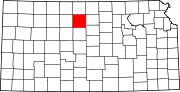
Townships Bethany | Bloom | Corinth | Delhi | Grant | Hancock | Hawkeye | Independence | Jackson | Kill Creek | Lawrence | Liberty | Mount Ayr | Natoma | Penn | Ross | Round Mound | Sumner | Tilden | Valley | Victor | Winfield
Unincorporated
communitiesBloomington | Corinth | Covert | Forney
Categories:- Kansas counties
- Osborne County, Kansas
- 1867 establishments


Wikimedia Foundation. 2010.