- Calloway County, Kentucky
-
Calloway County, Kentucky  Calloway County courthouse in Murray, Kentucky
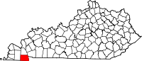
Location in the state of Kentucky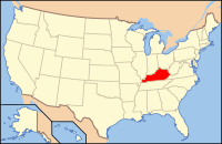
Kentucky's location in the U.S.Founded 1823 Named for Colonel Richard Callaway (1724–1780), pioneer. Seat Murray Area
- Total
- Land
- Water
410.79 sq mi (1,064 km²)
386.25 sq mi (1,000 km²)
24.53 sq mi (64 km²), 5.97Population
- (2010)
- Density
37,191
88/sq mi (34/km²)Time zone Central: UTC-6/-5 Website www.callowaycounty-ky.gov Calloway County is a county located in the U.S. state of Kentucky. It was formed in 1823. As of 2010, the population was 37,191. Its county seat is Murray, Kentucky.[1] The county is named for Colonel Richard Callaway, one of the founders of Boonesborough. It was created on November 3, 1822, from Hickman County.
Calloway County is a limited dry county, meaning that sale of alcohol in the county is prohibited except by the drink in restaurants seating at least 100 diners in Murray and at the Murray Golf Course.
Calloway County is home to two school systems, the Murray Independent School District and the Calloway County School District.
Contents
Geography
According to the 2000 census, the county has a total area of 410.79 square miles (1,063.9 km2), of which 386.25 square miles (1,000.4 km2) (or 94.03%) is land and 24.53 square miles (63.5 km2) (or 5.97%) is water.[2]
Adjacent counties
- Marshall County (north)
- Trigg County (northeast)
- Stewart County, Tennessee (southeast)
- Henry County, Tennessee (south)
- Graves County (west)
National protected area
- Fort Donelson National Battlefield (Fort Heiman part)
Demographics
Historical populations Census Pop. %± 1830 5,164 — 1840 9,794 89.7% 1850 8,096 −17.3% 1860 9,915 22.5% 1870 9,410 −5.1% 1880 13,295 41.3% 1890 14,675 10.4% 1900 17,633 20.2% 1910 19,867 12.7% 1920 20,802 4.7% 1930 17,662 −15.1% 1940 19,041 7.8% 1950 20,147 5.8% 1960 20,972 4.1% 1970 27,692 32.0% 1980 30,031 8.4% 1990 30,735 2.3% 2000 34,177 11.2% 2010 37,191 8.8% http://ukcc.uky.edu/~census/21035.txt As of the census[3] of 2000, there were 34,177 people, 13,862 households, and 8,594 families residing in the county. The population density was 88 per square mile (34 /km2). There were 16,069 housing units at an average density of 42 per square mile (16 /km2). The racial makeup of the county was 93.48% White, 3.56% Black or African American, 0.20% Native American, 1.33% Asian, 0.03% Pacific Islander, 0.46% from other races, and 0.93% from two or more races. 1.38% of the population were Hispanic or Latino of any race.
There were 13,862 households out of which 25.80% had children under the age of 18 living with them, 51.00% were married couples living together, 8.10% had a female householder with no husband present, and 38.00% were non-families. 29.70% of all households were made up of individuals and 11.40% had someone living alone who was 65 years of age or older. The average household size was 2.25 and the average family size was 2.79.
The age distribution was 18.70% under the age of 18, 19.80% from 18 to 24, 24.60% from 25 to 44, 21.90% from 45 to 64, and 15.00% who were 65 years of age or older. The median age was 34 years. The relatively large 18-to-24 population is mostly due to the presence of Murray State University. For every 100 females there were 93.20 males. For every 100 females age 18 and over, there were 91.00 males.
The median income for a household in the county was $30,134, and the median income for a family was $39,914. Males had a median income of $31,184 versus $22,046 for females. The per capita income for the county was $16,566. About 9.80% of families and 16.60% of the population were below the poverty line, including 17.70% of those under age 18 and 10.00% of those age 65 or over.
Micropolitan Area
According to the 2000 census, the Murray Micropolitan Statistical Area is composed of Calloway County. A micropolitan area is one that is too small to be a metropolitan area, but has a central city of at least 10,000 people.
Cities and towns
- Almo
- Coldwater
- Crossland
- Dexter
- Elm Grove
- Faxon
- Harris Grove
- Hazel
- Kirksey
- Lynn Grove
- Midway
- Murray
- New Concord
- Stella
- Wiswell
- Shiloh
Places of interest
- Fort Heiman, part of Fort Donelson National Battlefield
Notable Calloway Countians
- John R. Alford Founder of Hico, Texas, which he named for Hico, Calloway County, Kentucky
- W. Earl Brown Actor/Musician
- T.R.M. Howard Surgeon, civil rights leader, and entrepreneur
- Joe Staton Cartoonist
- Frank Stubblefield Politician
- Nathan Stubblefield Inventor
- Harry Lee Waterfield Politician
- Molly Sims Actress/Model
- Cleanth Brooks Professor, literary critic
- Stan Key University of Kentucky basketball player and current alumni director
- David Kennedy Retired Special Forces, Green Beret, War Hero
- Mel Purcell Professional Tennis Player
- Martha R. Ellison, founder of The Brown School and teacher of Pulitzer-winning playwright Marsha Norman.
- Jackie De Shannon 1960s singer-songerwriter
See also
References
- ^ "Find a County". National Association of Counties. http://www.naco.org/Counties/Pages/FindACounty.aspx. Retrieved 2011-06-07.
- ^ "Census 2000 U.S. Gazetteer Files: Counties". United States Census. http://www.census.gov/tiger/tms/gazetteer/county2k.txt. Retrieved 2011-02-13.
- ^ "American FactFinder". United States Census Bureau. http://factfinder.census.gov. Retrieved 2008-01-31.
External links
Municipalities and communities of Calloway County, Kentucky Cities Categories:- Kentucky counties
- 1823 establishments in the United States
- Populated places established in 1823
- Calloway County, Kentucky


Wikimedia Foundation. 2010.