- Martin County, Kentucky
-
This article is about Martin County, Kentucky. See Martin County for uses in other states.
Martin County, Kentucky  Martin County courthouse in Inez, Kentucky
Location in the state of Kentucky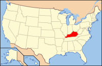
Kentucky's location in the U.S.Founded 1870 Named for John P. Martin, Representative in Kentucky's 6th Congressional District, 29th United States Congress (1845–1847) Seat Inez Area
- Total
- Land
- Water
230.81 sq mi (598 km²)
230.70 sq mi (598 km²)
0.11 sq mi (0 km²), 0.05%Population
- (2010)
- Density
12,929
56/sq mi (22/km²)Time zone Eastern: UTC-5/-4 Website www.martincountykentucky.com Martin County is a county located in the U.S. state of Kentucky. As of 2010, the population was 12,929. Its county seat is Inez[1]. The county is named for Congressman John Preston Martin. It is a prohibition or dry county.
Contents
Geography
According to the 2000 census, the county has a total area of 230.81 square miles (597.8 km2), of which 230.70 square miles (597.5 km2) (or 99.95%) is land and 0.11 square miles (0.28 km2) (or 0.05%) is water.[2]
Adjacent counties
- Lawrence County (northwest)
- Wayne County, West Virginia (northeast, across the Tug Fork of the Big Sandy River)
- Mingo County, West Virginia (southeast, across the Tug Fork)
- Pike County (south)
- Floyd County (southwest)
- Johnson County (west)
Demographics
As of the census[3] of 2000, there were 12,578 people, 4,776 households, and 3,620 families residing in the county. The population density was 54 per square mile (21 /km2). There were 5,551 housing units at an average density of 24 per square mile (9.3 /km2). The racial makeup of the county was 99.25% White, 0.03% Black or African American, 0.06% Native American, 0.07% Asian, 0.06% Pacific Islander, 0.01% from other races, and 0.52% from two or more races. 0.62% of the population were Hispanic or Latino of any race.
There were 4,776 households out of which 39.20% had children under the age of 18 living with them, 59.50% were married couples living together, 12.50% had a female householder with no husband present, and 24.20% were non-families. 21.80% of all households were made up of individuals and 8.30% had someone living alone who was 65 years of age or older. The average household size was 2.62 and the average family size was 3.05.
Historical populations Census Pop. %± 1880 3,057 — 1890 4,209 37.7% 1900 5,780 37.3% 1910 7,291 26.1% 1920 7,654 5.0% 1930 8,584 12.2% 1940 10,970 27.8% 1950 11,677 6.4% 1960 10,201 −12.6% 1970 9,377 −8.1% 1980 13,925 48.5% 1990 12,526 −10.0% 2000 12,578 0.4% Est. 2008 11,602 −7.8% http://ukcc.uky.edu/~census/21159.txt In the county the population was spread out with 28.10% under the age of 18, 9.50% from 18 to 24, 29.30% from 25 to 44, 23.30% from 45 to 64, and 9.70% who were 65 years of age or older. The median age was 34 years. For every 100 females there were 98.00 males. For every 100 females age 18 and over, there were 92.10 males.
The median income for a household in the county was $18,279, and the median income for a family was $21,574. Males had a median income of $31,994 versus $18,011 for females. The per capita income for the county was $10,650. About 33.30% of families and 37.00% of the population were below the poverty line, including 45.10% of those under age 18 and 26.90% of those age 65 or over.
Cities and towns
Government and infrastructure
The Federal Bureau of Prisons U.S. Penitentiary, Big Sandy is located in unincorporated Martin County, near Inez.[4]
Schools
The Martin County School System operates public schools.
- Sheldon Clark High School
- Inez Middle School
- Eden Elementary School
- Inez Elementary School
- Warfield Elementary School
See also
- Big Sandy Regional Airport
- Big Sandy Area Development District
- Dry counties
- Martin County Sludge Spill
- National Register of Historic Places listings in Martin County, Kentucky
- United States Penitentiary, Big Sandy
References
- ^ "Find a County". National Association of Counties. http://www.naco.org/Counties/Pages/FindACounty.aspx. Retrieved 2011-06-07.
- ^ "Census 2000 U.S. Gazetteer Files: Counties". United States Census. http://www.census.gov/tiger/tms/gazetteer/county2k.txt. Retrieved 2011-02-13.
- ^ "American FactFinder". United States Census Bureau. http://factfinder.census.gov. Retrieved 2008-01-31.
- ^ "Institution Supplement." United States Penitentiary, Big Sandy. 2 (2/18). Retrieved on February 21, 2011. "USP Big Sandy is located at 1197 Airport Rd, Inez, Kentucky." and "Directions from Interstate 64: From the following areas: Ashland, KY, Huntington, WV, and the Ohio area, travel Interstate 64 to Kentucky Exit 191 to Route 23 South. Follow 23 South for approximately 38 miles until you reach Route 645. Turn left onto Route 645 South and travel approximately 11 miles until you reach Route 3. Turn right onto Route 3 and travel for approximately 10 miles until you reach Airport Road. Turn left onto Airport Road and follow signs to the institution."
External links
- The Kentucky Highlands Project
- Martin County Slurry Spill
- Sandy Valley Transportation Services, Inc.
Municipalities and communities of Martin County, Kentucky County seat: Inez Cities Unincorporated
communitiesBeauty | Laura | Tomahawk
Eastern Mountain Coal Fields Counties Cities and towns
10k-25kCities and towns
5k-10kCities and towns
1k-5kBarbourville • Beattyville • Catlettsburg • Clay City • Cumberland • Elkhorn City • Evarts • Grayson • Greenup • Harlan • Hazard • Jackson • Jeffersonville • Jenkins • Louisa • Manchester • Olive Hill • Paintsville • Pineville • Prestonsburg • Raceland • Russell • Salyersville • South Shore • Stanton • West Liberty • Wheelwright • Whitesburg • Worthington • WurtlandCities and towns
under 1kAllen • Bellefonte • Benham • Blackey • Blaine • Booneville • Buckhorn • Camargo • Campton • Cedarville • Coal Run Village • Fleming-Neon • Frenchburg • Hindman • Hyden • Inez • Lakeview Heights • Loyall • Lynch • Martin • McKee • Pippa Passes • Sandy Hook • Vicco • Wallins Creek • Warfield • WaylandStatistical areas Categories:- Kentucky counties
- Martin County, Kentucky
- Dry counties of Kentucky


Wikimedia Foundation. 2010.