- Chipita Park, Colorado
-
Chipita Park is an unincorporated town located in El Paso County, Colorado, named for the wife of Chief Ouray.
Coordinates: 38°55′28″N 105°00′24″W / 38.92444°N 105.00667°W
See also
- Cascade, Colorado
- Cascade-Chipita Park, Colorado
- Colorado Springs Metropolitan Statistical Area
- El Paso County, Colorado
- Front Range Urban Corridor
- List of cities and towns in Colorado
- Pikes Peak
- State of Colorado
References
External links
Municipalities and communities of El Paso County, Colorado Cities 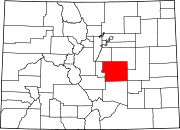
Towns Calhan | Green Mountain Falls‡ | Monument | Palmer Lake | Ramah
CDPs Air Force Academy | Black Forest | Cascade-Chipita Park | Cimarron Hills | Ellicott | Fort Carson | Gleneagle | Peyton | Rock Creek Park | Security-Widefield | Stratmoor | Woodmoor
Unincorporated
communitiesFootnotes ‡This populated place also has portions in an adjacent county or counties
Categories:- Colorado geography stubs
- Populated places in El Paso County, Colorado
- Unincorporated communities in Colorado

Wikimedia Foundation. 2010.