- Hottentots-Holland
Geobox|Range
name = Hottentots Holland
native_name =
other_name =
category =
etymology =
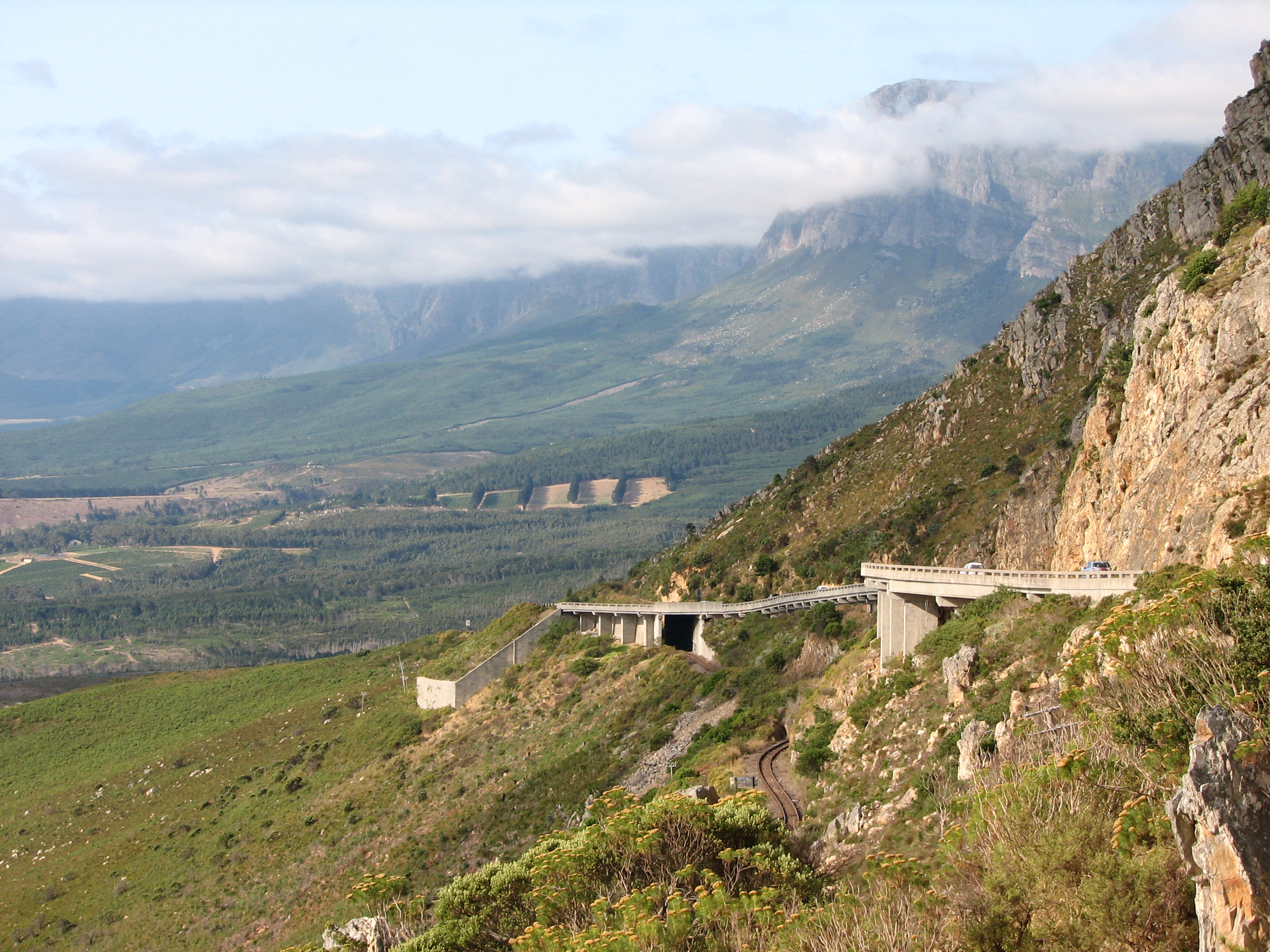
image_caption = Hottentots-Holland Mountains and Sir Lowry's Pass
country = South Africa
state = Western Cape
region = Overberg
district =
municipality =
range =
border =
part =
city =
landmark =
river =
highest = Somerset Sneeukop
highest_location = | highest_region = | highest_country =
highest_elevation = 1590
highest_lat_d = 34| highest_lat_m = 2| highest_lat_s = 5.56| highest_lat_NS = S
highest_long_d = 18| highest_long_m = 59| highest_long_s = 6.53| highest_long_EW = E
lowest =
lowest_location = | lowest_region = | lowest_country =
lowest_elevation =
lowest_lat_d = | lowest_lat_m = | lowest_lat_s = | lowest_lat_NS =
lowest_long_d = | lowest_long_m = | lowest_long_s = | lowest_long_EW =
length = | length_orientation =
width = | width_orientation =
area =
geology =
orogeny =
period =
biome =
plant =
animal =
free = | free_type =
map_caption =
map_background =
map_location =
map_locator =
website =
footnotes =The Hottentots Holland mountain range is part of the
Cape Fold Belt in theWestern Cape ,South Africa . The range forms a barrier between theCape Town metropolitan area and the southernOverberg coast. The range is comprised primarily ofTable Mountain sandstone and forms an inpressive range to the east ofSomerset West andGordon's Bay .Sir Lowry's Pass is the only crossing in the form of the N2 motorway. TheSteenbras Dam , one ofCape Town 's main supply dams, is located in the southern section of the range. This is due to the abundant rainfall experienced in the uplands located in theGrabouw Valley on the eastern slopes.At the start of the Great Trek in 1835 when migrants decided to leave the Cape Town area, or Cape Colony as it was then known, the first mountain range they crossed was this range. Cuts and wheel markings from their ox wagons can still be seen in rock formations in the vicinity of Sir Lowry's Pass on this mountain range. This route still serves as the primary route out of the Cape Town area for travellers heading up the east coast of South Africa.
The climate is typically Mediterranean, however it is generally much cooler and more verdant than other areas in the
Western Cape , with annual precipitation exceeding 1500 mm and summertime maximums rarely exceeding 25 °C. Snow is not unusual on the higher peaks, like Verkykerkop, Somerset Sneeukop (Afrikaans :Snow Peak) at 1590 m high and The Triplets in the northern section of the range. This area and the other ranges to the south are considered the hub of theCape floristic region with the most biodiversity in the entirefynbos biome. The surrounding lowlands have rich alluvial soils supportingviticulture and otherdeciduous fruit farms.
Wikimedia Foundation. 2010.