Dalur

Dalur
Dalur
—  Village  —
Dalur
Dalur is located in Denmark Faroe Islands
Dalur
Location of the village in the Faroe Islands
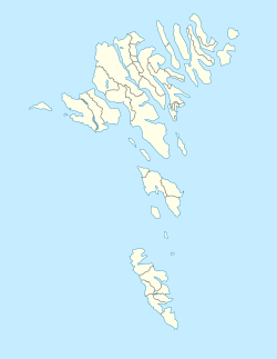
Coordinates: 61°46′56″N 6°40′32″W / 61.78222°N 6.67556°W / 61.78222; -6.67556Coordinates: 61°46′56″N 6°40′32″W / 61.78222°N 6.67556°W / 61.78222; -6.67556
State  Kingdom of Denmark
Constituent country  Faroe Islands
Island Sandoy
Municipality Húsavík
Population
 - Total 142
Time zone GMT (UTC+0)
 - Summer (DST) EST (UTC+1)
Dalur on a Faroese stamp of 2006

Dalur is a village in the Faroe Islands. Dalur is located on the east-side of Sandoy. The village lies in the bottom of a relatively large valley. Dalur means valley in Faroese. A little road leads from Dalur to the south-tip of the island. From there it is possible to walk to the bird cliffs Skorin. The church in Dalur was built in 1957 and this is the only church that has ever been here.[1]

See also

References

  1. ^ "Dalur". The Tourist Information Center in Sandoy. http://www.visitsandoy.fo/UK/index.asp?pID={F762E19E-F660-4B9F-8FCB-0DDFB9435131}. Retrieved June 8, 2010. 

External links


Wikimedia Foundation. 2010.

Игры ⚽ Поможем написать реферат

Look at other dictionaries:

  • Dalur — est un village de Sandoy aux Îles Féroé. Population: 48 coordonnées: 61° 46 56 N ; 6° 40 32 O code postal FO 235 municipalité: Húsavík Le village tire son nom de sa situation géographique. Dalur se trouve en effet dans une vallée et le mot… …   Wikipédia en Français

  • Dalur — Lage von Dalur. Dalur auf einer färöischen Briefmarke von 2 …   Deutsch Wikipedia

  • Breiðdalur — Landgemeinde Breiðdalur (Breiðdalshreppur) Basisdaten Staat: Island Region: Austurland Wahlkreis: Norðausturkjördæmi Sýsla …   Deutsch Wikipedia

  • Ytri Dalur — is the southernmost of the valleys of Fuglafjørð on the island of Eysturoy in the Faroes. It is also referred to as Kambsdalur. The valleys of Fuglafjørð can be divided into three categories: The eastern valleys, the western valleys and the… …   Wikipedia

  • Heimari Dalur — is a valley in the Faroe Islands, which lies between the town of Fuglafjørður and the village of Kambsdalur. It is surrounded by the firth in the east, Mount Kambur in the south, Breiðáskarð in the west and Gjógvaráfjall in the north.The valleys… …   Wikipedia

  • Innari Dalur — is the valley in the west of the town of Fuglafjørður in the Faroe Islands. It is surrounded by Fuglafjørður in the east, mount Gjógvaráfjall in the south, Jøklaskarð in the west and mount Blábjørg and mount Slætnatindur in the north.The valleys… …   Wikipedia

  • Breiddalsvik — Landgemeinde Breiðdalur (Breiðdalshreppur) Basisdaten Staat: Island Region: Austurland Wahlkreis: Norðausturkjördæmi Sýsla …   Deutsch Wikipedia

  • Breiddalur — Landgemeinde Breiðdalur (Breiðdalshreppur) Basisdaten Staat: Island Region: Austurland Wahlkreis: Norðausturkjördæmi Sýsla …   Deutsch Wikipedia

  • Breiðdalshreppur — Landgemeinde Breiðdalur (Breiðdalshreppur) Basisdaten Staat: Island Region: Austurland Wahlkreis: Norðausturkjördæmi Sýsla …   Deutsch Wikipedia

  • Breiðdalsvík — Landgemeinde Breiðdalur (Breiðdalshreppur) Basisdaten Staat: Island Region: Austurland Wahlkreis: Norðausturkjördæmi Sýsla …   Deutsch Wikipedia

Share the article and excerpts

Direct link
Do a right-click on the link above
and select “Copy Link”