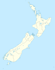
Clifford Bay, New Zealand

Clifford Bay, New Zealand
Clifford Bay is located in New Zealand
{{{alt}}}
Clifford Bay

Clifford Bay is a bay in the northeast of the South Island of New Zealand, in the Marlborough Region. It lies between Cloudy Bay to the northwest, and Cape Campbell, the easternmost point of the South Island. The bay's most notable feature is the solar salt extraction works at Lake Grassmere, close to the southern end of the bay.

Since the 1920s, there have been various proposals for an inter-island port and ferry terminal to replace Picton. However, such plans never proceeded beyond an investigation stage, often due to the capital costs. In May 2011, plans were announced to revisit the development of a port at Clifford Bay, using a mix of private and public funding.[1] Such a port would reduce both sailing time across the Cook Strait from Wellington and the surface distance to Christchurch. It would also allow fast ferries to operate at higher speeds than they can in the ecologically sensitive Marlborough Sounds and remove the steep grades on the railway line that lead out of Picton.

While a new port at Clifford Bay would have an impact on the economy of Picton, there are positive options to focus Picton as a tourist centre, and the gateway to the Marlborough Sounds.[2]

References

Coordinates: 41°44′S 174°15′E / 41.733°S 174.25°E / -41.733; 174.25


Wikimedia Foundation. 2010.

Игры ⚽ Нужно сделать НИР?

Look at other dictionaries:

  • New Zealand — • Consists of three main islands (North Island, South Island, sometimes also called Middle island, and Stewart island) and several groups of smaller islands . . . Catholic Encyclopedia. Kevin Knight. 2006. New Zealand     New Zealand …   Catholic encyclopedia

  • New Zealand general election, 1853 — 1853 general election 14 July – 1 October 1853 → 1855 members …   Wikipedia

  • New Zealand general election, 1855 — 1855 general election 1853 ← members 26 October – 28 December 1855 → 1860–61 member …   Wikipedia

  • New Zealand general election, 1899 — 1899 general election 1896 ← 6 (general) 19 December (Māori) 1899 → 1902 …   Wikipedia

  • Clifford Bay — 41.680091902222174.18411254889 Koordinaten: 41° 41′ S, 174° 11′ O …   Deutsch Wikipedia

  • Transport in New Zealand — Transport in New Zealand, with its mountainous topography and relatively small population mostly located on a long coastline, has always faced many challenges. Before Europeans arrived, Māori either walked or used watercraft on rivers or along… …   Wikipedia

  • 1980 in New Zealand — Population* Estimated Population as of 31 December: 3,176,400 http://www.stats.govt.nz/NR/rdonlyres/24107FC8 E7B5 4CF2 B17C 15E31CCA7D05/0/HistoricalPop.xls] * Increase since 31/12/1979: 12,500 (0.40%) * Males per 100 Females: 99.2IncumbentsRegal …   Wikipedia

  • 1857 in New Zealand — PopulationThe estimated population of New Zealand at the end of 1857 is 57,150 Māori and 49,802 non Māori. [Statistics New Zealand has collated estimates from a number of sources (interpolating where necessary) at cite web… …   Wikipedia

  • Blind River (New Zealand) — Blind (Otuwhero) River Basin countries New Zealand The Blind (Otuwhero) River is a small river in the Marlborough district of New Zealand. It flows into Clifford Bay 4km north of Lake Grassmere. A small settlement named Blind River is located on… …   Wikipedia

  • Blind River, New Zealand — The Blind River is in the northeast of the South Island of New Zealand. It is also known as the Otuwhero River.The river flows into Clifford Bay on the east coast of the South Island …   Wikipedia

Share the article and excerpts

Direct link
Do a right-click on the link above
and select “Copy Link”