- Newton County, Missouri
-
Newton County, Missouri 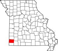
Location in the state of Missouri
Missouri's location in the U.S.Founded December 15, 1838 Seat Neosho Area
- Total
- Land
- Water
624.77 sq mi (1,618 km²)
626.42 sq mi (1,622 km²)
0.24.4 sq mi (1 km²), 0.04%Population
- (2010)
- Density
58,114
84/sq mi (32.41/km²)Newton County is a county located in the U.S. state of Missouri. It is included in the Joplin, Missouri Metropolitan Statistical Area. The population was 58,114 at the 2010 census.[1] It is the eighteen most populous county in Missouri. The county was organized in 1838 and named for John Newton, hero of the Revolutionary War. Its county seat is Neosho.[2]
Contents
Geography
According to the 2010 census, the county has a total area of 624.77 square miles (1,618.1 km2), of which 626.42 square miles (1,622.4 km2) (or 99.96%) is land and 0.24 square miles (0.62 km2) (or 0.04%) is water.[3]
Adjacent counties
- Jasper County (north)
- Lawrence County (northeast)
- Barry County (southeast)
- McDonald County (south)
- Ottawa County, Oklahoma (west)
- Cherokee County, Kansas (northwest)
 Entrance of Newton Co. Courthouse
 View of the Newton Co. Courthouse
Water
Lakes
Total lake area: 2,573 acres (10.4 km2)
- Newtonia Lake
- Thurman Lake
Rivers and creeks
Total river area: 361 acres (1.5 km2); length: 70 miles (110 km)
- Baynham Branch
- Buffalo Creek
- Center Creek
- Clear Creek
- Dry Valley Branch
- Elm Spring Creek
- Five Mile Creek
- Harrison Creek
- Hickory Creek
- Clear Creek
- Indian Creek
- Shoal Creek
- Jacobs Creek
- Lost Creek
- Mason Spring Creek
- Middle Creek
- Rock Creek
- Silver Creek
- Warren Creek
- Willow Creek
Major highways
 Interstate 44
 U.S. Route 60
 U.S. Route 71, Future
  Interstate 49
 Route 43
 Route 59
 Route 86
 Route 175
National protected area
Demographics
Historical populations Census Pop. %± 1840 8,790 — 1850 4,268 −51.4% 1860 9,319 118.3% 1870 12,821 37.6% 1880 18,947 47.8% 1890 22,108 16.7% 1900 27,001 22.1% 1910 27,136 0.5% 1920 24,886 −8.3% 1930 26,959 8.3% 1940 29,039 7.7% 1950 28,240 −2.8% 1960 30,093 6.6% 1970 32,901 9.3% 1980 40,555 23.3% 1990 44,445 9.6% 2000 52,636 18.4% 2010 58,114 10.4% U.S. Decennial Census As of the census[4] of 2000, there were 52,636 people, 20,140 households, and 14,742 families residing in the county. The population density was 84 people per square mile (33.75/km²). There were 21,897 housing units at an average density of 35 per square mile (14/km²). The racial makeup of the county was 93.26% White, 0.59% Black or African American, 2.23% Native American, 0.32% Asian, 0.28% Pacific Islander, 1.12% from other races, and 2.20% from two or more races. 2.18% of the population were Hispanic or Latino of any race.
There were 20,140 households out of which 33.10% had children under the age of 18 living with them, 60.50% were married couples living together, 8.80% had a female householder with no husband present, and 26.80% were non-families. 22.70% of all households were made up of individuals and 9.70% had someone living alone who was 65 years of age or older. The average household size was 2.57 and the average family size was 3.00.
In the county the population was spread out with 26.30% under the age of 18, 8.70% from 18 to 24, 27.10% from 25 to 44, 23.80% from 45 to 64, and 14.00% who were 65 years of age or older. The median age was 37 years. For every 100 females there were 95.60 males. For every 100 females age 18 and over, there were 92.30 males.
The median income for a household in the county was $35,041, and the median income for a family was $40,616. Males had a median income of $30,057 versus $21,380 for females. The per capita income for the county was $17,502. About 8.10% of families and 11.60% of the population were below the poverty line, including 14.20% of those under age 18 and 9.50% of those age 65 or over.
Communities
Cities
Villages
Other localities
Townships
- Neosho Township Pop: 18,039
- Shoal Creek Township Pop: 12,829
- Granby Township Pop: 4,595
- Five mile Township Pop: 4,073
- Marion Township Pop: 3,787
- Seneca Township Pop: 3,474
- West Benton Township Pop: 2,547
- Buffalo Township Pop: 2,149
- Franklin Township Pop: 1,795
- Dayton Township Pop: 1,605
- Van Buren Township Pop: 1,374
- Newtonia Township Pop: 788
- Benton Township Pop: 681
- Berwick Township Pop: 378
See also
- National Register of Historic Places listings in Newton County, Missouri
References
- ^ United States Census Bureau. "2010 Census Data". United States Census Bureau. http://2010.census.gov/2010census/data/. Retrieved 28 August 2011.
- ^ "Find a County". National Association of Counties. http://www.naco.org/Counties/Pages/FindACounty.aspx. Retrieved 2011-06-07.
- ^ "Census 2000 U.S. Gazetteer Files: Counties". United States Census. http://www.census.gov/tiger/tms/gazetteer/county2k.txt. Retrieved 2011-02-13.
- ^ "American FactFinder". United States Census Bureau. http://factfinder.census.gov. Retrieved 2008-01-31.
External links
- Newton County Genealogy
- Newton County Historical Society - Official website
- Newton County Tourism Council - Official website
- Rootsweb, Newton County, Missouri
- Digitized 1930 Plat Book of Newton County from University of Missouri Division of Special Collections, Archives, and Rare Books

Cherokee County, Kansas Jasper County Lawrence County Ottawa County, Oklahoma 
 Newton County, Missouri

McDonald County Barry County Municipalities and communities of Newton County, Missouri Cities 
Villages Cliff Village | Dennis Acres | Grand Falls Plaza | Leawood | Loma Linda | Newtonia | Redings Mill | Ritchey | Shoal Creek Drive | Shoal Creek Estates | Silver Creek | Saginaw | Stark City | Stella | Wentworth
Unincorporated
communitiesHornet | Monark Springs | Racine | Spring City | Tipton Ford | Wanda
Footnotes ‡This populated place also has portions in an adjacent county or counties
Categories:- Missouri counties
- Newton County, Missouri
- Joplin metropolitan area
- 1838 establishments in the United States
- Populated places established in 1838


Wikimedia Foundation. 2010.