- Degnepoll
-
Degnepoll
Deknepollen— Village — Nickname(s): Polljen Location in Sogn og Fjordane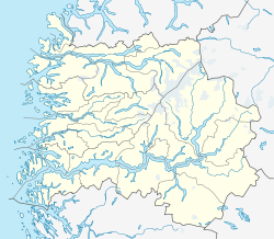
 Degnepoll
Coordinates: 61°55′49″N 05°08′28″E / 61.93028°N 5.14111°ECoordinates: 61°55′49″N 05°08′28″E / 61.93028°N 5.14111°E Country Norway Region Western Norway County Sogn og Fjordane District Nordfjord Municipality Vågsøy Population (2001) - Total 245 Time zone CET (UTC+01) - Summer (DST) CEST (UTC+02) Post Code 6718 Degnepoll or Deknepollen is a village in the municipality of Vågsøy in Sogn og Fjordane county, Norway. Degnepoll is an eastern suburb of the town of Måløy, which it is connected to by a 1,224-metre (4,016 ft) long Måløy Bridge. It is also located about 15 kilometres (9.3 mi) west of the village of Bryggja. The village of Tennebø is located about 1 kilometre (0.62 mi) southeast of Degnepoll, with the lake Degnepollvatnet located between the two villages.
The name Degnepoll could be roughly translated as a "small fjord arm by the parish clerk". Degnepoll is also a surname used by some families originating from the community or still living there. The estimated population (2001) of Degnepoll is 245.[1]
The main industry is fish processing and the main production facility produces fish oil and animal fodder. This factory was under construction during World War II and was totally destroyed during Operation Archery days before it could have been put into operation. Degnepoll has a combined post office, gas station, and fast food vendor in addition to an electronics shop, two car dealerships and two supermarkets.[2]
References
- ^ Statistisk sentralbyrå (2001) (in Norwegian) (PDF). Folke- og boligtellingen 2001, kommune- og bydelshefter 1439 Vågsøy. http://www.ssb.no/fob/kommunehefte/1439/fob_1439_tabeller.pdf.
- ^ Store norske leksikon. "Deknepollen" (in Norwegian). http://www.snl.no/Deknepollen. Retrieved 2010-07-20.
Categories:- Sogn og Fjordane geography stubs
- Villages in Sogn og Fjordane
- Vågsøy

Wikimedia Foundation. 2010.