- Manupeu Tanah Daru National Park
-
Manupeu Tanah Daru National Park IUCN Category II (National Park)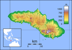
 Manupeu Tanah Daru NP
Location Sumba, Indonesia Coordinates 9°44′0″S 119°41′0″E / 9.733333°S 119.683333°ECoordinates: 9°44′0″S 119°41′0″E / 9.733333°S 119.683333°E Area 87,984.09 ha Established 1998 Governing body Ministry of Forestry Manupeu Tanah Daru National Park is located on the island of Sumba in Indonesia. This national park consists plenty of steepy slopes. There are about 118 plant species protected in this national park including Toona sureni, Sterculia foetida, Schleichera oleosa, Alstonia scholaris (Ditabark), Tamarind, Candlenut, Syzygium species, Casuarina species, and Lantana camara (Spanish Flag).
There are also 87 species of birds protected in this region, with 7 bird taxa are endemic to the island of Sumba. These are Sumba Yellow-crested Cockatoo, Sumba Green Pigeon, Sumba Flycatcher, Sumba Cicadabird, Apricot-breasted Sunbird and Sumba Hornbill.
57 species of butterflies are also protected here, 7 of them are endemic to this island. These are Papilio neumoegenii, Ideopsis oberthurii, Delias fasciata, Junonia adulatrix, Athyma karita, Sumalia chilo, and Elimnia amoena.
See also
National parks of Indonesia Bali and Nusa Tenggara Java Alas Purwo · Baluran · Bromo Tengger Semeru · Gunung Ciremai · Gunung Gede Pangrango · Gunung Halimun · Gunung Merapi · Gunung Merbabu · Karimunjawa · Kepulauan Seribu · Meru Betiri · Ujung KulonKalimantan Betung Kerihun · Bukit Baka Bukit Raya · Danau Sentarum · Gunung Palung · Kayan Mentarang · Kutai · Sabangau · Tanjung PutingMaluku and Papua Sulawesi Bantimurung-Bulusaraung · Bogani Nani Wartabone · Bunaken · Kepulauan Togean · Lore Lindu · Rawa Aopa Watumohai · Taka Bone Rate · WakatobiSumatra Batang Gadis · Berbak · Bukit Barisan Selatan · Bukit Duabelas · Bukit Tigapuluh · Gunung Leuser · Kerinci Seblat · Sembilang · Siberut · Tesso Nilo · Way KambasCategories:- IUCN Category II
- National parks of Indonesia
- Lesser Sunda Islands
- Sumba

Wikimedia Foundation. 2010.