Chernyshevskoye

Chernyshevskoye
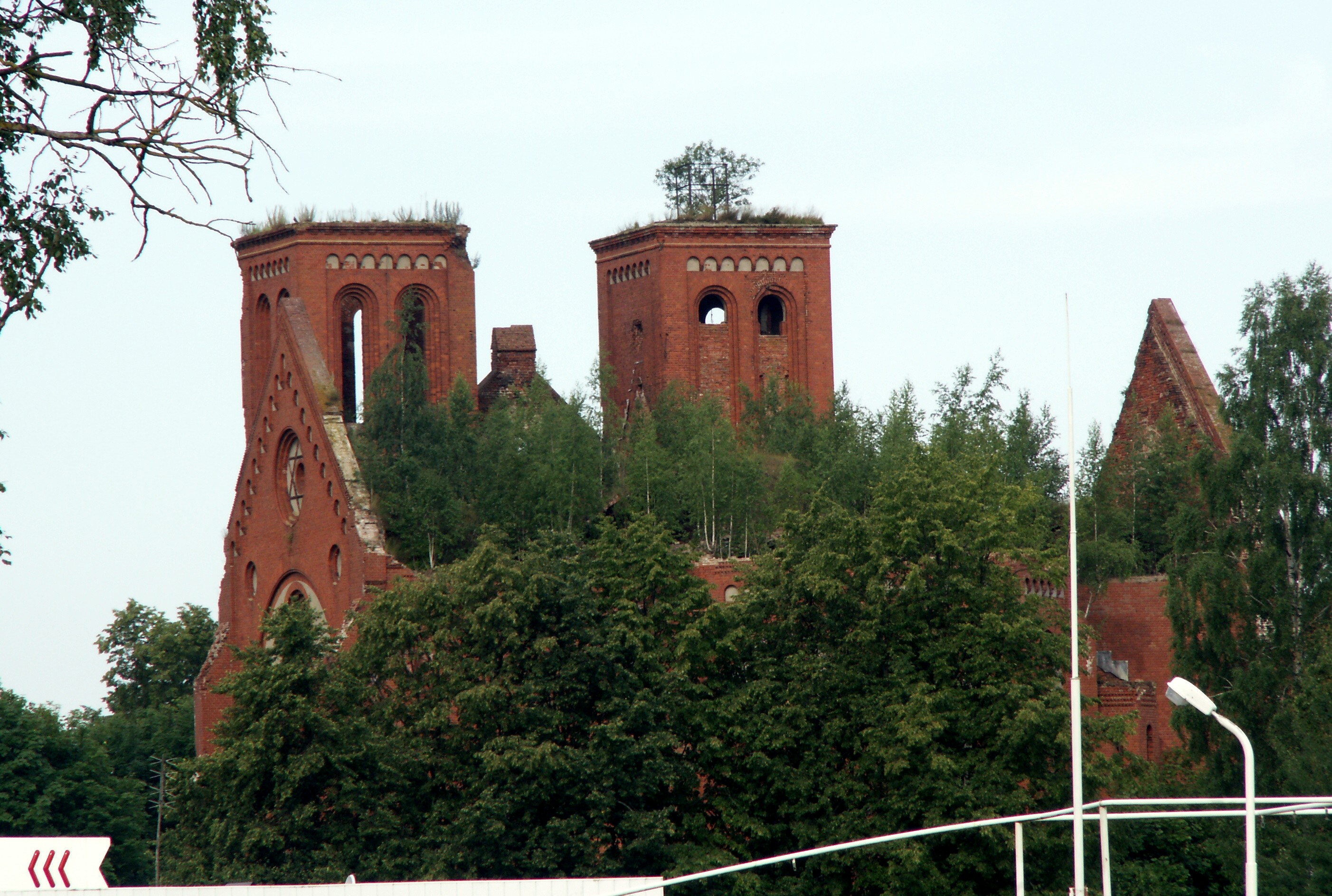
Ruins of the Lutheran church

Chernyshevskoye (Russian: Черныше́вское; German: Eydtkuhnen, from 1938 Eydtkau; Lithuanian: Eitkūnai; Polish: Ejtkuny) is a settlement in Nesterovsky District in the eastern part of Kaliningrad Oblast, Russia, on the border with Lithuania.

Between Chernyshevskoye and Lithuanian Kybartai is an important 24-hour border crossing point on the A229 principal road and the railway route connecting Kaliningrad with Moscow through the European Union member Lithuania and Belarus. Until 1945 a part of the German province of East Prussia, Eydtkuhnen was the easternmost terminus of the Prussian Eastern Railway finished in 1860 connecting Berlin with the Saint Petersburg – Warsaw Railway in the Russian Empire. To continue their voyage, passengers e.g. of the Nord Express had to change over to a Russian gauge train.

The railway connection decisively promoted Eydtkuhnen's development: The Lutheran church built by Friedrich Adler was consecrated in 1889, the settlement received town privileges in 1922. Nevertheless Eydtkuhnen was devastated during the Russian invasion of East Prussia in 1914 and again in 1945 during the East Prussian Offensive of the Red Army. With the implementation of the Oder-Neisse line after World War II, the area became part of the Soviet Union.

Persons

  • Dieter Biallas (* 1936), German Politician
  • Felix Bressart (1892—1949), German-American actor
  • Marie Madeleine (1881–1944), writer

Coordinates: 54°38′28″N 22°44′15″E / 54.64111°N 22.7375°E / 54.64111; 22.7375


Wikimedia Foundation. 2010.

Игры ⚽ Нужен реферат?

Look at other dictionaries:

  • Chernyshevsky (disambiguation) — Nikolay Chernyshevsky (1828–1889) was a Russian revolutionary democrat, philosopher, critic, and socialist. Chernyshevsky (masculine), Chernyshevskaya (feminine), or Chernyshevskoye (neuter) may also refer to: Chernyshevsky District, a district… …   Wikipedia

  • Prussian Eastern Railway — Berlin–Tschernyschewskoje Braniewo (formerly Braunsberg) station on Russian Polish border …   Wikipedia

  • Chernyshevsky (inhabited locality) — For other uses, see Chernyshevsky (disambiguation). Chernyshevsky (Russian: Чернышевский; masculine), Chernyshevskaya (Чернышевская; feminine), or Chernyshevskoye (Чернышевское; neuter) is the name of several inhabited localities in Russia: Urban …   Wikipedia

  • Frombork — Infobox Settlement name = Frombork imagesize = 250px image caption = Frombork Cathedral, with Vistula Lagoon in background. image shield = POL Frombork COA.svg pushpin pushpin label position = bottom subdivision type = Country subdivision name =… …   Wikipedia

  • Polish State Railroads Summer 1939 — In the summer of 1939, the map of both Europe and Poland looked very different from today. Obviously, the railway network of interwar Poland was also different from the present one, and also slightly different from the German, Austrian and… …   Wikipedia

  • Nesterovsky District — Coordinates: 54°38′N 22°34′E / 54.633°N 22.567°E / 54.633; 22.567 Nesterovsky District …   Wikipedia

  • Polish exonyms — Below is list of Polish language exonyms for places in non Polish speaking areas of Europe : List of Polish exonyms for places in other areasAlbania*Korçë Korcza *Shkodër SzkodraAustria*Bregenz Bregencja *Wien WiedeńBelarus (Białoruś)*Ashmyany… …   Wikipedia

  • German exonyms (Kaliningrad Oblast) — This is a list of German names for inhabited localities in Kaliningrad Oblast, Russia.*Alexeyevka: Klein Kackschen (Kleinbirkenhain) *Aprelevka: Wargienen *Arkhangelskoye: Ebenhausen *Artemovka: Argenhof *Babushkino: Groß Degesen *Bagrationovsk:… …   Wikipedia

  • Lithuanian exonyms — Below is list of Lithuanian language exonyms for places in non Lithuanian speaking areas of Europe : Note that this list does not include place names whose only alteration is that the ending as has been appended to the local name (e.g. Dublinas… …   Wikipedia

  • Virbalis — Infobox Settlement name = Virbalis nickname = settlement type = City pushpin pushpin label position = pushpin map caption =Location of Virbalis image shield = Virbalis COA.gif latd=54|latm=38|lats=0|latNS=N|longd=22|longm=49|longs=0|longEW=E… …   Wikipedia

Share the article and excerpts

Direct link
Do a right-click on the link above
and select “Copy Link”