- Craig County, Oklahoma
-
Craig County, Oklahoma 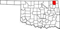
Location in the state of Oklahoma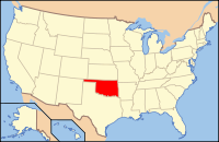
Oklahoma's location in the U.S.Founded 1907 Seat Vinita Area
- Total
- Land
- Water
763 sq mi (1,975 km²)
761 sq mi (1,971 km²)
2 sq mi (4 km²), 0.22%Population
- (2010)
- Density
15,029
20/sq mi (8/km²)Time zone Central: UTC-6/-5 Craig County is a county located in the U.S. state of Oklahoma. As of 2010, the population was 15,029, a gain of 0.5 percent from 14,950 in 2000.[1] Its county seat is Vinita[2].
Craig County was organized in 1907.
Contents
History
This county was created in 1907 and named for Granville Craig, a prominent mixed-blood-Cherokee farmer who lived in the Bluejacket area. This area was part of the hunting grounds of the Osage nations and other Plains tribes. The Cherokee began moving into the area during the 1830s, particularly after the "Trail of Tears." Then the area became part of the Delaware and Cooweescoowee districts of the Cherokee Nation, Indian Territory. [3]
In 1871, the Missouri, Kansas and Texas Railroad constructed a north-south railroad through this area, while the Atlantic and Pacific Railroad built an east-west line that ran through Vinita. This line was extended through Tulsa, Oklahoma in 1881.[3]
Geography
According to the U.S. Census Bureau, the county has a total area of 763 square miles (1,976.2 km2), of which 761 square miles (1,971.0 km2) is land and 2 square miles (5.2 km2) (0.22%) is water. The county lies in the Osage Plains, on the western edge of the Ozark Plateau, and drains into several tributaries of the Neosho River.[3]
Major highways
 Interstate 44
 U.S. Highway 59
 U.S. Highway 60
 U.S. Highway 69
 State Highway 2
 State Highway 10
 State Highway 25
 State Highway 66
 State Highway 82
Adjacent counties
- Labette County, Kansas (north)
- Cherokee County, Kansas (northeast)
- Ottawa County (east)
- Delaware County (southeast)
- Mayes County (south)
- Rogers County (southwest)
- Nowata County (west)
Demographics
 Age pyramid for Craig County, Oklahoma, based on census 2000 data.
As of the census[4] of 2006, there were 14,880 people, 5,620 households, and 3,945 families residing in the county. The population density was 20 people per square mile (8/km²). There were 6,459 housing units at an average density of 8 per square mile (3/km²). The racial makeup of the county was 68.54% White, 3.09% Black or African American, 16.31% Native American, 0.18% Asian, 0.03% Pacific Islander, 0.48% from other races, and 11.37% from two or more races. 1.20% of the population were Hispanic or Latino of any race.
There were 5,620 households out of which 30.90% had children under the age of 18 living with them, 57.30% were married couples living together, 9.70% had a female householder with no husband present, and 29.80% were non-families. 27.00% of all households were made up of individuals and 13.90% had someone living alone who was 65 years of age or older. The average household size was 2.46 and the average family size was 2.97.
In the county, the population was spread out with 23.90% under the age of 18, 7.80% from 18 to 24, 27.90% from 25 to 44, 24.30% from 45 to 64, and 16.20% who were 65 years of age or older. The median age was 39 years. For every 100 females there were 101.10 males. For every 100 females age 18 and over, there were 98.60 males.
The median income for a household in the county was $30,997, and the median income for a family was $36,499. Males had a median income of $26,704 versus $20,082 for females. The per capita income for the county was $16,539. About 10.90% of families and 13.70% of the population were below the poverty line, including 17.30% of those under age 18 and 11.90% of those age 65 or over.
Cities and towns
NRHP sites
The following sites in Craig County are listed on the National Register of Historic Places:
- Craig County Courthouse, Vinita
- First Methodist Episcopal Church, South, Vinita
- Hotel Vinita, Vinita
- McDougal Filling Station, Vinita
- Randall Tire Company, Vinita
- Spraker Service Station, Vinita
References
- ^ U. S. Census Quick Facts for Craig County, Oklahoma.[1]
- ^ "Find a County". National Association of Counties. http://www.naco.org/Counties/Pages/FindACounty.aspx. Retrieved 2011-06-07.
- ^ a b c Craig County Genealogical Society. Encyclopedia of Oklahoma History and Culture. "Craig County." Retrieved October 28, 2011.[2]
- ^ "American FactFinder". United States Census Bureau. http://factfinder.census.gov. Retrieved 2008-01-31.
External links
Municipalities and communities of Craig County, Oklahoma City 
Towns Big Cabin | Bluejacket | Ketchum | Welch
Unincorporated
communitiesCategories:- Oklahoma counties
- Craig County, Oklahoma
- 1907 establishments in the United States
- Populated places established in 1907


Wikimedia Foundation. 2010.