- Clackamas County, Oregon
-
Clackamas County, Oregon 
Seal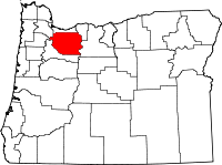
Location in the state of Oregon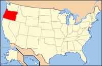
Oregon's location in the U.S.Founded July 5, 1843 Seat Oregon City Area
- Total
- Land
- Water
1,879 sq mi (4,867 km²)
1,868 sq mi (4,838 km²)
11 sq mi (28 km²), 0.58%Population
- (2010)
- Density
375,992
201/sq mi (77.7/km²)Website www.clackamas.us Clackamas County (
 /ˈklækəmɨs/) is a county located in the U.S. state of Oregon. The county was named after the Native Americans living in the area, the Clackamas Indians, who were part of the Chinookan people. As of 2010, the population was 375,992. Its county seat is Oregon City.[1]
Contents
Economy
Since the county's creation, agriculture, timber, manufacturing, and commerce have been the principal economic activities. Mount Hood, the only year-round ski resort in the United States and the site of Timberline Lodge, is a major attraction for recreation and tourism. The mountain and its rivers and forests offer outdoor recreation activities, from skiing and rafting to fishing and camping.
Geography
 Forest west of Clackamas River Valley.
According to the U.S. Census Bureau, the county has a total area of 1,879 square miles (4,866.6 km2). 1,868 square miles (4,838.1 km2) is land and 11 square miles (28.5 km2), (0.58%) is water.
The county includes parts of two national forests: Mount Hood National Forest and Willamette National Forest.
Major highways
 Interstate 5
 Interstate 205
 U.S. Route 26
 Oregon Route 35
 Oregon Route 99E
 Oregon Route 212
 Oregon Route 213
 Oregon Route 224
Adjacent counties
- Multnomah County - north
- Hood River County - northeast
- Wasco County - east
- Marion County - south
- Yamhill County - west
- Washington County - northwest

Washington County Multnomah County Hood River County Yamhill County 
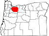
Wasco County  Clackamas County, Oregon

Marion County Demographics
Historical populations Census Pop. %± 1850 1,859 — 1860 3,466 86.4% 1870 5,993 72.9% 1880 9,260 54.5% 1890 15,233 64.5% 1900 19,658 29.0% 1910 29,931 52.3% 1920 37,698 25.9% 1930 46,205 22.6% 1940 57,130 23.6% 1950 86,716 51.8% 1960 113,038 30.4% 1970 166,088 46.9% 1980 241,919 45.7% 1990 278,850 15.3% 2000 338,391 21.4% 2010 375,992 11.1% sources:[2] [3] As of the census[4] of 2000, there were 338,391 people, 128,201 households, and 91,663 families residing in the county. The population density was 181 people per square mile (70/km²). There were 136,954 housing units at an average density of 73 per square mile (28/km²). The racial makeup of the county was 91.27% White, 2.45% Asian, 0.71% Native American, 0.66% Black or African American, 0.17% Pacific Islander, 2.28% from other races, and 2.46% from two or more races. 4.95% of the population were Hispanic or Latino of any race. 20.7% were of German, 11.6% English, 9.1% Irish and 7.5% American ancestry.
There were 128,201 households out of which 34.20% had children under the age of 18 living with them, 58.60% were married couples living together, 9.00% had a female householder with no husband present, and 28.50% were non-families. 22.00% of all households were made up of individuals and 7.80% had someone living alone who was 65 years of age or older. The average household size was 2.62 and the average family size was 3.07.
In the county, the population was spread out with 26.20% under the age of 18, 8.00% from 18 to 24, 28.70% from 25 to 44, 26.00% from 45 to 64, and 11.10% who were 65 years of age or older. The median age was 38 years. For every 100 females there were 97.50 males. For every 100 females age 18 and over, there were 94.90 males.
The median income for a household in the county was $52,080, and the median income for a family was $60,791. Males had a median income of $43,462 versus $30,891 for females. The per capita income for the county was $25,973. About 4.60% of families and 6.60% of the population were below the poverty line, including 7.60% of those under age 18 and 5.10% of those age 65 or over.
History
 Abandoned barn in eastern Clackamas County; Bittner family estate
Originally named Clackamas District, it was one of the four original Oregon districts created by Oregon's Provisional Legislature on July 5, 1843 along with Twality (later Washington), Champooick (later Marion), and Yamhill. The four districts were redesignated as counties in 1845. At the time of its creation, Clackamas County covered portions of four present-day states and a Canadian province. The Columbia River became the northern boundary of the county in 1844. Soon after John McLoughlin staked a land claim in Oregon City and built a house that in 2003 became a unit of the Fort Vancouver National Historic Site.
Oregon City was also the site of the only federal court west of the Rockies in 1849, when San Francisco, California was platted. The plat was filed in 1850 in the first plat book of the first office of records in the West Coast and is still in Oregon City.
In 1902, the Willamette Meteorite was recovered from a field just outside present-day West Linn.
In contrast with the more liberal and cosmopolitan Multnomah County to the north, and the more corporate Washington County to the west, some citizens of Clackamas county have espoused a blue-collar, yet conservative political outlook of the backlash mold described by Thomas Frank. It is the headquarters of Lon Mabon, whose Oregon Citizens Alliance has worked to pass a number of anti-homosexual initiatives, and where Bill Sizemore, who has championed various anti-government initiatives for most of the 1990s, had his base before he moved to Klamath Falls. However, it is a very mixed area overall, narrowly voting for Republican George W. Bush over Democrat John Kerry in 2004, but moderately voting for Democrat Barack Obama over Republican John McCain in 2008.
As of August 2005[update], Clackamas is the first county in Oregon to have four models of governance for its communities. Like the rest of Oregon, it has cities (which are formally incorporated) and rural communities (some of which for federal purposes are considered census-designated places).
After completion of a process that began late in 1999, the county adopted an ordinance on August 11, 2005 which defined hamlets and villages. As of the November 30, 2005, deadline, three communities have submitted petitions to start the process of becoming a hamlet or a village. Boring petitioned to become a village. The communities along US 26 near Mount Hood from Brightwood to Rhododendron have petitioned to become "The Villages at Mount Hood". Beavercreek has become a hamlet.
Law and government
Presidential elections results[5][6] Year Republican Democratic 2008 43.6% 83,595 54.0% 103,476 2004 50.1% 97,691 48.8% 95,129 2000 47.8% 77,539 47.1% 76,421 1996 41.0% 59,443 46.6% 67,709 1992 34.8% 53,724 39.0% 60,310 - Elected Officials
- Board of County Commissioners (one chair, four commissioners; nonpartisan)
- Chair: Lynn Peterson
- Commissioner: Paul Savas
- Commissioner: Jim Bernard
- Commissioner: Charlotte Lehan
- Commissioner: Ann Lininger
- Treasurer: Shari Anderson
- Assessor: Bob Vroman
- District Attorney: John Foote
- County Clerk: Sherry Hall
- Sheriff: Craig Roberts
- Justice Court Judge: Karen Brisbin
Cities and communities
 Mount Hood reflected in Trillium Lake
Several of the county's communities extend into other counties. Lake Oswego and Milwaukie include areas in Multnomah County. Lake Oswego, Tualatin, Rivergrove and Wilsonville include areas in Washington County.
Cities and CDPs in the Portland metropolitan area
- Portland (a small portion in the city's southeast quadrant)
- Clackamas (a census-designated place)
- Damascus/Carver
- Gladstone
- Happy Valley
- Jennings Lodge (a CDP)
- Johnson City
- Lake Oswego
- Milwaukie
- Oak Grove (a CDP)
- Oatfield (a CDP)
- Oregon City
- Rivergrove
- Sunnyside (a CDP)
- Tualatin (a small portion)
- West Linn
- Wilsonville
 Clackamas River flowing through Milo McIver State Park.
Other incorporated cities and CDPs
- Molalla
- Mount Hood Village (a CDP)
- Sandy
Other unincorporated communities
- Aims
- Alder Creek
- Barton
- Boring
- Bull Run
- Canemah
- Carus
- Charbonneau (private community within
the city limits of Wilsonville) - Cherryville
- Clarkes
- Colton
- Cottrell
- Currinsville
- Dodge
- Eagle Creek
- Faubion
- Firwood
- Government Camp
- Highland
- Hillsview
- Kelso
- Macksburg
- Marquam
- Marylhurst
- Mountain Air Park
- Needy
- New Era
- Redland
- Ripplebrook
- Salmon
- Shadowood
- Springwater
- Three Lynx
- Union Mills
- Viola
- Wankers Corner
- Wildwood
- Yoder
Hamlets
In Clackamas County, a hamlet is a model of local governance for unincorporated areas.[7]
Villages
- Villages at Mount Hood (consists of Brightwood, Marmot, Rhododendron, Welches, Wemme, and Zigzag)
County-wide services
The county supports the Library Information Network of Clackamas County. The urban areas of the county are also served by Metro.
See also
References
- ^ "Find a County". National Association of Counties. http://www.naco.org/Counties/Pages/FindACounty.aspx. Retrieved 2011-06-07.
- ^ census.gov Oregon population by county, 1900-90 - accessed 2010-06-19
- ^ http://factfinder2.census.gov
- ^ "American FactFinder". United States Census Bureau. http://factfinder.census.gov. Retrieved 2008-01-31.
- ^ Staff (2010). "Presidential General Election Results - Clackamas County, OR". uselectionatlas.org. http://www.uselectionatlas.org/RESULTS/statesub.php?year=2008&fips=41005&f=0&off=0&elect=0. Retrieved 2010-07-05.
- ^ Staff (2008-12-09). "President Map - Election Results". The New York Times. http://elections.nytimes.com/2008/results/president/map.html. Retrieved 2010-07-05.
- ^ "Complete Communities". Clackamas County. http://www.clackamas.us/community/. Retrieved May 26, 2010.
External links
- Clackamas County, Oregon
- Clackamas County hamlets and villages
- Clackamas County Considering Hamlets and Villages, a September 2005 article from Oregon Public Broadcasting
Municipalities and communities of Clackamas County, Oregon County seat: Oregon City Cities Barlow | Canby | Damascus | Estacada | Gladstone | Happy Valley | Johnson City | Lake Oswego‡ | Milwaukie‡ | Molalla | Oregon City | Portland‡ | Rivergrove‡ | Sandy | Tualatin‡ | West Linn | Wilsonville‡
CDPs Hamlets Village Unincorporated
communitiesBarton | Boring | Brightwood | Bull Run | Carus | Carver | Cazadero | Cherryville | Clackamas | Colton | Cottrell | Eagle Creek | Government Camp | Jean | Kelso | Ladd Hill | Lakewood | Liberal | Logan | Lone Elder | Macksburg | Marmot | Marquam | Marylhurst | Milwaukie Heights | Mountain Air Park | Needy | New Era | Redland | Rhododendron | Ripplebrook | Riverside | Shadowood | Springwater | Wankers Corner | Welches | Wemme | Yoder | Zigzag
Footnotes ‡This populated place also has portions in an adjacent county or counties
Categories:- Oregon counties
- Clackamas County, Oregon
- 1843 establishments in the United States
- Portland metropolitan area


Wikimedia Foundation. 2010.