- Clatsop County, Oregon
-
Clatsop County, Oregon 
Seal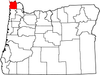
Location in the state of Oregon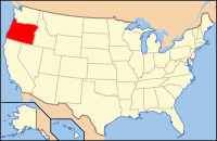
Oregon's location in the U.S.Founded 1844 Seat Astoria Area
- Total
- Land
- Water
1,085 sq mi (2,810 km²)
905 sq mi (2,344 km²)
180 sq mi (466 km²), 23.74%Population
- (2010)
- Density
37,039
41/sq mi (15.8/km²)Website www.co.clatsop.or.us Clatsop County (
 /ˈklætsəp/) is a county located in the U.S. state of Oregon. The county is named for the Clatsop tribe of Native Americans, who lived along the coast of the Pacific Ocean prior to European settlement. As of 2010, the population was 37,039. The county seat is Astoria.
Contents
Economy
The principal industries of Clatsop County are manufacturing, travel (primarily tourism), and trade.[1][2] Fishing and timber are still important but contribute proportionally less to the county's employment and income than they used to.[citation needed] The county's average nonfarm employment was 17,480 in 2007.[citation needed] About 30% of the lands within the county boundaries belong to the state of Oregon, as part of the state forests. The Port of Astoria was created in 1914 to support trade and commerce.
Tourism
Astoria, Oregon, the county seat, has multiple tourist attractions including the Astoria Riverfront Trolley, Fort Clatsop, the Uppertown Fire Fighters Museum, and Columbia River Maritime Museum.[3] Seaside, Oregon, noted as Oregon’s oldest ocean resort community,[4] also has multiple tourist attractions including, the Seaside Aquarium, and the Seaside Historical Society Museum. Tourism is noted as one of the major forces in Clatsop County's economy.[4]
Geography
According to the U.S. Census Bureau, the county has a total area of 1,085 square miles (2,810.1 km2), of which 827 square miles (2,141.9 km2) is land and 258 square miles (668.2 km2) (23.74%) is water. The highest point is Saddle Mountain at 3,283 feet (1,001 m), part of the Northern Oregon Coast Range.[5]
Major highways
National protected areas
- Julia Butler Hansen National Wildlife Refuge (part)
- Lewis and Clark National and State Historical Parks (part)
- Lewis and Clark National Wildlife Refuge
- Oregon Islands National Wildlife Refuge (part)
Demographics
Historical populations Census Pop. %± 1850 462 — 1860 498 7.8% 1870 1,255 152.0% 1880 7,222 475.5% 1890 10,016 38.7% 1900 12,765 27.4% 1910 16,106 26.2% 1920 23,030 43.0% 1930 21,124 −8.3% 1940 24,697 16.9% 1950 30,776 24.6% 1960 27,380 −11.0% 1970 28,473 4.0% 1980 32,489 14.1% 1990 33,301 2.5% 2000 35,630 7.0% 2010 37,039 4.0% sources:[6][7] As of the census[8] of 2000, there were 35,630 people, 14,703 households, and 9,454 families residing in the county. The population density was 43 people per square mile (17/km²). There were 19,685 housing units at an average density of 24 per square mile (9/km²). The racial makeup of the county was 93.14% White, 0.52% Black or African American, 1.03% Native American, 1.21% Asian, 0.17% Pacific Islander, 1.64% from other races, and 2.30% from two or more races. 4.48% of the population were Hispanic or Latino of any race. 15.3% were of German, 10.8% English, 10.4% Irish, 9.3% American and 6.5% Norwegian ancestry.
There were 14,703 households out of which 28.50% had children under the age of 18 living with them, 50.60% were married couples living together, 9.70% had a female householder with no husband present, and 35.70% were non-families. 29.50% of all households were made up of individuals and 11.70% had someone living alone who was 65 years of age or older. The average household size was 2.35 and the average family size was 2.88.
In the county, the population was spread out with 23.70% under the age of 18, 8.90% from 18 to 24, 25.30% from 25 to 44, 26.60% from 45 to 64, and 15.60% who were 65 years of age or older. The median age was 40 years. For every 100 females there were 97.80 males. For every 100 females age 18 and over, there were 95.10 males.
The median income for a household in the county was $36,301, and the median income for a family was $44,575. Males had a median income of $32,153 versus $22,479 for females. The per capita income for the county was $19,515. About 9.10% of families and 13.20% of the population were below the poverty line, including 16.80% of those under age 18 and 8.00% of those age 65 or over.
History
The Lewis and Clark Expedition stayed for the winter of 1805-6 in the area of the future county at Fort Clatsop. Astoria, Oregon's oldest city, was established as a fur trading post in 1811 and named after John Jacob Astor.
Clatsop County was created from the northern and western portions of the original Twality District on June 22, 1844. Until the creation of Vancouver District five days later, Clatsop County extended north across the Columbia into present-day Washington. The Provisional and Territorial Legislatures further altered Clatsop County's boundaries in 1845 and 1853.
Before 1850 most of Clatsop County's government activity occurred in Lexington, a community located where Warrenton is now. However, commercial and social activities came to center on Astoria as that city grew, and an election in 1854 chose Astoria to be the new county seat.
Fort Stevens, located near the peninsula formed by the south shore of the Columbia river and the Pacific Ocean, became the only continental US military installation attacked in World War II, when submarine I-25 of the Imperial Japanese Navy fired 17 rounds at the base June 21, 1942. The submarine escaped when the order was given not to return fire with the 10-inch (250 mm) shore guns. This was done to so that the base position was not given away. While the damage caused was slight (reportedly only a baseball backstop was damaged and a powerline severed), the presence of the enemy ship sowed panic along the Pacific coast of the United States.
In 1975, Clatsop County commissioners considered seceding from Oregon, and become a part of Washington.[9] The movement was based on disagreements residents of the county had with then-Oregon Governor Bob Straub.[10] The movement was created after Alumax Corporation changed their plans of building a plant in the county.[11] Some residents, including two county commissioners, blamed the Oregon Governor for the movement of the plant.[11] Then-Washington Governor Daniel J. Evans said the county was not welcome in the state of Washington.[10] Clatsop County commissioners later abandoned the idea.[9]
Politics
Although once Republican, in the last seven decades the county has generally been carried by the Democratic candidate in Presidential elections. The exception to this is Dwight D. Eisenhower who won the county twice.[12] In gubernatorial elections the county has been won by the Democratic Party candidate since, at least, 1990.[13]
Clatsop County is located in Oregon's 1st congressional district, which has a Cook Partisan Voting Index of D+8 and is represented by David Wu. In the Oregon State Senate it is represented by Democrat Betsy Johnson. In the Oregon House of Representatives it is represented by Democrats Brad Witt and Deborah Boone.
Communities
Incorporated cities
Unincorporated communities
- Arch Cape
- Bradwood
- Brownsmead
- Carnahan
- Clifton
- Elsie
- Fern Hill
- Fort Stevens (within the northern section of the city of Warrenton)
- Grand Rapids
- Hamlet
- Hammond (within the northern section of the city of Warrenton)
- Jeffers Garden
- Jewell
- Knappa
- Lukarilla
- Melville
- Miles Crossing
- Mishawaka
- Navy Heights
- Necanicum (historical)
- Oklahoma Hill
- Olney
- Sunset Beach
- Surf Pines
- Svensen
- Svensen Junction
- Taylorville
- Tolovana Park (within the city of Cannon Beach)
- Tongue Point Village (within the western section of the city of Astoria)
- Uniontown
- Vinemaple
- Wauna
- Westport
Adjacent counties
- Columbia County, Oregon - (east)
- Pacific County, Washington - (north)
- Wahkiakum County, Washington - (north)
- Tillamook County, Oregon - (south)
- Washington County, Oregon - (southeast)

Pacific County, Washington and Wahkiakum County, Washington Pacific Ocean 
Columbia County  Clatsop County, Oregon

Tillamook County Washington County See also
References
- ^ Oregon Labor Market Information System
- ^ Bureau of Economic Analysis
- ^ "Astoria Travel Guide". WorldWeb. astoria-or.worldweb.com. http://www.astoria-or.worldweb.com/. Retrieved March 21, 2010.
- ^ a b "About Clatsop County". co.clatsop.or.us. http://www.co.clatsop.or.us/default.asp?pageid=443&deptid=6. Retrieved March 21, 2010.
- ^ "Saddle Mountain, Oregon". Peakbagger.com. http://www.peakbagger.com/peak.aspx?pid=1070.
- ^ census.gov Oregon population by county, 1900-90 - accessed 2009-05-02
- ^ quickfacts.census.gov - Clatsop County - accessed 2009-05-02
- ^ "American FactFinder". United States Census Bureau. http://factfinder.census.gov. Retrieved 2008-01-31.
- ^ a b "Clatsop County changes plans". Associated Press. Ellensburg Daily Record. March 23, 1975. http://news.google.com/newspapers?id=tN0PAAAAIBAJ&sjid=1o4DAAAAIBAJ&pg=3926,4897605&dq=clatsop+county&hl=en. Retrieved March 21, 2010.
- ^ a b "Clatson 'not welcome'". Associated Press. Tri City Herald. March 23, 1975. http://news.google.com/newspapers?id=AXghAAAAIBAJ&sjid=ZogFAAAAIBAJ&pg=3191,6974479&dq=clatsop+county+secede&hl=en. Retrieved March 21, 2010.
- ^ a b "They want out". Ellensburg Daily Record. March 18, 1975. http://news.google.com/newspapers?id=rN0PAAAAIBAJ&sjid=1o4DAAAAIBAJ&pg=5864,4105324&dq=clatsop+county+secede&hl=en. Retrieved March 21, 2010.
- ^ Geographie Electorale
- ^ David Leip's US Election Atlas (Gubernatorial election maps for Oregon)
Municipalities and communities of Clatsop County, Oregon Cities Astoria | Cannon Beach | Gearhart | Seaside | Warrenton

Unincorporated
communitiesArch Cape | Brownsmead | Elsie | Hamlet | Jeffers Garden | Jewell | Jewell Junction | Knappa | Lukarilla | Melville | Miles Crossing | Navy Heights | Necanicum | Olney | Sunset Beach | Surf Pines | Svensen | Tolovana Park | Wauna | Westport
Categories:- Oregon counties
- Clatsop County, Oregon
- 1844 establishments in the United States


Wikimedia Foundation. 2010.