- Carbon County, Pennsylvania
-
Carbon County, Pennsylvania 
Location in the state of Pennsylvania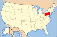
Pennsylvania's location in the U.S.Founded March 13, 1843 Seat Jim Thorpe Largest city Lehighton Area
- Total
- Land
- Water
387 sq mi (1,002 km²)
381 sq mi (987 km²)
6 sq mi (16 km²), 1.06%Population
- (2010)
- Density
65,249
171/sq mi (66.1/km²)Website carboncounty.com Carbon County is a county located in the U.S. state of Pennsylvania. As of 2010, the population was 65,249.
Carbon County marks the northern border of the Lehigh Valley region of the state and is considered part of the state's Coal Region, though the eastern and northeastern section is considered part of the Pocono Mountains region. Most consider lower Carbon County, including Palmerton and Lehighton areas, as part of the Lehigh Valley in spite of being north of Blue Mountain.
Its county seat is Jim Thorpe.[1]
Contents
Law and government
As of November 2008, there are 39,591 registered voters in Carbon County [1].
- Democratic: 20,075 (50.71%)
- Republican: 14,737 (37.22%)
- Other Parties: 4,779 (12.07%)
Carbon County is one of the most competitive counties in Pennsylvania statewide elections, although Democrats hold the commissioner majority and all county row offices. Al Gore carried it in 2000 and, in 2004, Republican George W. Bush defeated Democrat John Kerry 49.99% to 48.81% or a margin of 296 votes.[2]
In 2008 it voted for Democrat Barack Obama over Republican John McCain by a close margin of 49.77% to 47.90% (507 votes.)[3] The other three statewide winners (Rob McCord for Treasurer, Jack Wagner for Auditor General, and Tom Corbett for Attorney General) also carried Carbon. [2]
County commissioners
- Wayne Nothstein, Chairman, Republican
- Thomas Gerhard, Republican
- Charles Getz, Democratic
Pennsylvania State Senate
- John Yudichak, Democrat, Pennsylvania's 14th Senatorial District
- Dave Argall, Republican, Pennsylvania's 29th Senatorial District
Pennsylvania House of Representatives
- Doyle Heffley, Republican, Pennsylvania's 122nd Representative District
United States House of Representatives
United States Senate
History
Carbon County was created on March 13, 1843 from parts of Northampton and Monroe Counties and was named for the extensive deposits of coal in the region.
The first settlement in Carbon County was the Moravian mission Gnadenhutten, established in 1745. Deeply moved by the deplorable state of the Leni Lenape Indians in America, twelve Moravian missionaries left their home in Herrnhut Germany and traveled by sea to the wilderness of Pennsylvania, a place known for religious tolerance under the auspieces of Count Zinzendorf. Located where Lehighton now stands, Gnadenhutten exemplified communal simplicity. Home to hundreds of Lenni Lenape (Delaware) and Mahican Indians. The mission was a scene of quiet, humble and unobtrusive heroism and the Indians' shelter. Although the wilderness of Carbon County was quite treacherous, the Moravians traveled in the wilds of Carbon County undaunted. By 1752, increased hostility put Gnadenhutten at risk for attack, but the missionaries' pious good works did not go unnoticed. The frankness and earnestness of the simple Moravians had won respect with the many tribes of Pennsylvania Indians, and they lived without incident until 1755. [4]
Carbon County is the location of the trials and executions of the controversial Molly Maguires, an Irish secret society that had been accused of terrorizing the region.
Carbon County has a rich history, some interesting people have passed through her mountains, including County Zinzendorf, Moravian mystic; John James Audubon, Benjamin Franklin and many more.
Blessed with a unique geography, Carbon County dazzled the adventurous travelers of the Victorian era, just as it attracts adventurers today. Aesthetically not much has changed of this unique landscape, written about in 1877, the following passage is still valid today, 'Such rough and tumble experience, climbing mountains, falling over rocks, exploring wild ravines, diving into coal mines, and riding on every description of conveyance which it has entered into the mind of man to run on.' Home of the Lehigh Gorge State Park, Carbon County is an ideal place for hikers, cyclists, history buffs and adventurers. [4]
Geography
According to the U.S. Census Bureau, the county has a total area of 387 square miles (1,002.3 km2), of which 381 square miles (986.8 km2) is land and 6 square miles (15.5 km2) (1.60%) is water. Blue Mountain forms the southern boundary of Carbon. The northeast area of the county is located in the Pocono Mountains and the northwest area includes portions of Broad Mountain and Spring Mountain. It is drained by the Lehigh River except for a small area in western Packer Township and the borough of Lansford that are drained by the Still Creek and Panther Creek, respectively, into the Little Schuylkill River and the Schuylkill River, and the Audenried area in the northwest corner that drains into the Susquehanna River via the Catawissa Creek. The Lehigh cuts a gorge between Jim Thorpe and White Haven which hosts the Lehigh Gorge State Park.
Adjacent counties
- Luzerne County (north)
- Monroe County (east)
- Northampton County (southeast)
- Lehigh County (south)
- Schuylkill County (southwest)
Demographics
Historical populations Census Pop. %± 1850 15,686 — 1860 21,033 34.1% 1870 28,144 33.8% 1880 31,923 13.4% 1890 38,624 21.0% 1900 44,510 15.2% 1910 52,846 18.7% 1920 62,565 18.4% 1930 63,380 1.3% 1940 61,735 −2.6% 1950 57,558 −6.8% 1960 52,889 −8.1% 1970 50,573 −4.4% 1980 53,285 5.4% 1990 56,846 6.7% 2000 58,802 3.4% 2010 65,249 11.0% [5][6] As of the census[7] of 2000, there were 58,802 people, 23,701 households, and 16,424 families residing in the county. The population density was 154 people per square mile (60/km²). There were 30,492 housing units at an average density of 80 per square mile (31/km²). The racial makeup of the county was 97.82% White, 0.60% Black or African American, 0.16% Native American, 0.31% Asian, 0.03% Pacific Islander, 0.32% from other races, and 0.76% from two or more races. 1.46% of the population were Hispanic or Latino of any race. 29.4% were of German, 10.1% Irish, 9.2% Italian, 7.9% American, 6.6% Slovak, 6.0% Polish and 5.8% Pennsylvania German ancestry according to Census 2000.
There were 23,701 households out of which 28.70% had children under the age of 18 living with them, 54.80% were married couples living together, 9.90% had a female householder with no husband present, and 30.70% were non-families. 26.00% of all households were made up of individuals and 13.50% had someone living alone who was 65 years of age or older. The average household size was 2.44 and the average family size was 2.93.
In the county, the population was spread out with 22.20% under the age of 18, 6.90% from 18 to 24, 28.30% from 25 to 44, 24.20% from 45 to 64, and 18.50% who were 65 years of age or older. The median age was 41 years. For every 100 females there were 94.90 males. For every 100 females age 18 and over, there were 92.30 males.
Municipalities
 Map of Carbon County, Pennsylvania with Municipal Labels showing Boroughs (red), Townships (white), and Census-designated places (blue).
Under Pennsylvania law, there are four types of incorporated municipalities: cities, boroughs, townships, and, in the case of Bloomsburg, a town. The following boroughs and townships are located in Carbon County:
Boroughs
Townships
- Banks Township
- East Penn Township
- Franklin Township
- Kidder Township
- Lausanne Township
- Lehigh Township
- Lower Towamensing Township
- Mahoning Township
- Packer Township
- Penn Forest Township
- Towamensing Township
Census-designated places
Census-designated places are geographical areas designated by the U.S. Census Bureau for the purposes of compiling demographic data. They are not actual jurisdictions under Pennsylvania law. Other unincorporated communities, such as villages, may be listed here as well.
 Map of Carbon County, Pennsylvania Public School Districts
Education
Community, Junior and Technical Colleges
- Lehigh Carbon Community College – Carbon Campus, Nesquehoning
Public School Districts
- Hazleton Area School District (also in Luzerne and Schuylkill Counties)
- Jim Thorpe Area School District
- Lehighton Area School District
- Palmerton Area School District
- Panther Valley School District (also in Schuylkill County)
- Weatherly Area School District
- There are 11 public cyber charter schools in Pennsylvania that are available for free statewide, to children K-12. See: Education in Pennsylvania.
Recreation
Mauch Chuck Lake is a county-run park that offers swimming, camping, hiking and cross country skiing in the winter. There are three Pennsylvania state parks in Carbon County.
- Beltzville State Park
- Lehigh Gorge State Park stretches along the Lehigh River in Luzerne County and into Carbon County.
- Hickory Run State Park
See also
- List of municipal authorities in Carbon County, Pennsylvania
- Media in the Lehigh Valley
- National Register of Historic Places listings in Carbon County, Pennsylvania
References
- ^ "Find a County". National Association of Counties. http://www.naco.org/Counties/Pages/FindACounty.aspx. Retrieved 2011-06-07.
- ^ http://uselectionatlas.org/RESULTS/statesub.php?year=2004&fips=42025&off=0&elect=0&f=0
- ^ http://uselectionatlas.org/RESULTS/statesub.php?year=2008&fips=42025&off=0&elect=0&f=0
- ^ a b Rebecca M. Rabenold-Finsel, Carbon County: Postcard History (South Carolina: Arcadia Publishing 2004), 9.
- ^ http://factfinder2.census.gov
- ^ http://mapserver.lib.virginia.edu/
- ^ "American FactFinder". United States Census Bureau. http://factfinder.census.gov. Retrieved 2008-01-31.
External links
Lehigh Valley States Counties Three Cities Cities and towns
100k-250kCities and towns
50k-99kCities and towns
10-50kBethlehem Township • Easton • Emmaus • Forks Township • Hanover Township • Lehigh Township • Lower Macungie Township • Lower Saucon Township • North Whitehall Township • Palmer Township • Phillipsburg • Salisbury Township • South Whitehall Township • Upper Macungie Township • Upper Saucon Township • Whitehall TownshipPeople List of people from the Lehigh ValleyMunicipalities and communities of Carbon County, Pennsylvania Boroughs Beaver Meadows | Bowmanstown | East Side | Jim Thorpe | Lansford | Lehighton | Nesquehoning | Palmerton | Parryville | Summit Hill | Weatherly | Weissport

Townships CDPs Unincorporated
communitiesAlbrightsville | Audenried | Forest Inn | Harrity | Lake Harmony | Little Gap | Normal Square | Packerton
Categories:- Pennsylvania counties
- Carbon County, Pennsylvania
- Anthracite Coal Region of Pennsylvania
- The Poconos
- 1843 establishments in the United States
- Populated places established in 1843


Wikimedia Foundation. 2010.