- Harrison County, Texas
-
Harrison County, Texas 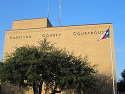 Harrison County Courthouse in Marshall, Texas
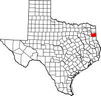
Location in the state of Texas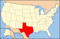
Texas's location in the U.S.Founded 1839 Named for Jonas Harrison[1] Seat Marshall Area
- Total
- Land
- Water
915 sq mi (2,370 km²)
899 sq mi (2,328 km²)
16 sq mi (41 km²), 1.79%Population
- (2000)
- Density
62,110
70/sq mi (27/km²)Website www.co.harrison.tx.us Harrison County is a county of the U.S. state of Texas. In 2000, its population was 62,110. It is named for Jonas Harrison, a lawyer and Texas revolutionary. It is located in the Ark-La-Tex region. The seat of the county is Marshall[2].
Harrison County is part of the Marshall Micropolitan Statistical Area as well as the Longview–Marshall Combined Statistical Area.
Harrison County, formerly heavily Democratic, is represented in the Texas House of Representatives by the Republican Bryan Hughes, a lawyer in Mineola.
Contents
History

Early History
American settlement began in present-day Harrison County during the 1830s. In 1835, the Mexican authorities granted a dozen land grants to Americans. After the Texas Revolution, the Congress of the Texas Republic established Harrison County, formed from Shelby County, in 1839. Harrison County was named for Texas Revolutionary Jonas Harrison. The county was organized in 1842. The county's area was reduced in 1846, following the establishment of Panola and Upshur Counties. Marshall was established in 1841, and became the county seat in 1842.[1]
The area was settled by predominately by natives from the Southern United States, who brought the slave-holding cotton-plantation society with them. By 1850, the county had more slaves than any other county in Texas until the end of the Civil War. The census of 1860 counted 8,746 slaves, 59% of the county's population.[1]
In 1861, the county's voters overwhelmingly supported secession. Defeat at the end of the war brought Reconstruction. The white minority bitterly resented federal authority and the Republican party county government that continued even after the Democratic party gained control of the state government in 1874. In 1878, the Citizen's Party of Harrison County, amid charges of fraud and coercion, gained firm control of the county government after winning on a technicality involving the placement of a key ballot box. In 1951, Harrison County's Jim Crow laws were struck down with the Perry v. Cyphers decision.[1]
From 1880 to 1930, Harrison County remained primarily agricultural and rural. The county maintained its black majority through these years. In the 1870s the county's non-agricultural sector increased when the Texas and Pacific Railway located its headquarters and shops in Marshall. In 1928, oil was discovered in the county, and made a significant contribution to the economy.[1]
The Great Depression of the 1930s hit the county hard, decimating the agricultural sector. World War II brought an end to the depression, but brought a significant emigration of blacks from the county. The population of the county declined until 1980, when the trend reversed, and the white population increases put whites in the majority.[1]
Geography
According to the U.S. Census Bureau, the county has a total area of 915 square miles (2,369.8 km2), of which 899 square miles (2,328.4 km2) is land and 16 square miles (41.4 km2) is water. The total area is 1.79% water.
Major Highways
 Interstate 20
 U.S. Highway 59
 U.S. Highway 80
 State Highway 43
 State Highway 49
 State Highway 154
Adjacent counties
- Marion County (north)
- Caddo Parish, Louisiana (east)
- Panola County (south)
- Rusk County (southwest)
- Gregg County (west)
- Upshur County (northwest)
National protected area
- Caddo Lake National Wildlife Refuge
Demographics
Historical populations Census Pop. %± 1850 11,822 — 1860 15,001 26.9% 1870 13,241 −11.7% 1880 25,177 90.1% 1890 26,721 6.1% 1900 31,878 19.3% 1910 37,243 16.8% 1920 43,565 17.0% 1930 48,937 12.3% 1940 50,900 4.0% 1950 47,745 −6.2% 1960 45,594 −4.5% 1970 44,841 −1.7% 1980 52,265 16.6% 1990 57,483 10.0% 2000 62,110 8.0% Est. 2009 64,795 4.3% U.S. Census Bureau[3] Texas Almanac[4] As of the census[5] of 2000, there were 62,110 people, 23,087 households, and 16,945 families residing in the county. The population density was 69 people per square mile (27/km²). There were 26,271 housing units at an average density of 29 per square mile (11/km²). The racial makeup of the county was 71.35% White, 24.03% Black or African American, 0.35% Native American, 0.31% Asian, 0.04% Pacific Islander, 2.86% from other races, and 1.06% from two or more races. 5.34% of the population were Hispanic or Latino of any race.
There were 23,087 households out of which 34.40% had children under the age of 18 living with them, 56.00% were married couples living together, 13.60% had a female householder with no husband present, and 26.60% were non-families. 23.70% of all households were made up of individuals and 10.70% had someone living alone who was 65 years of age or older. The average household size was 2.62 and the average family size was 3.09.
In the county, the population was spread out with 26.80% under the age of 18, 10.00% from 18 to 24, 27.10% from 25 to 44, 23.00% from 45 to 64, and 13.10% who were 65 years of age or older. The median age was 36 years. For every 100 females there were 94.10 males. For every 100 females age 18 and over, there were 89.90 males.
The median income for a household in the county was $33,520, and the median income for a family was $41,112. Males had a median income of $32,451 versus $20,913 for females. The per capita income for the county was $16,702. 16.70% of the population and 12.90% of families were below the poverty line. Out of the total population, 21.80% of those under the age of 18 and 14.60% of those 65 and older were living below the poverty line.
Cities and towns
- Elysian Fields (unincorporated)
- Gill (unincorporated)
- Hallsville
- Harleton (unincorporated)
- Jonesville (unincorporated)
- Karnack (unincorporated)
- Latex (unincorporated)
- Longview (partially in county)
- Marshall
- Nesbitt
- Scottsville
- Uncertain
- Waskom
- Woodlawn (unincorporated)
Education
The following school districts serve Harrison County:
- Elysian Fields ISD (partly in Panola County)
- Hallsville ISD
- Harleton ISD
- Marshall ISD
- Longview ISD (mostly in Gregg County)
- New Diana ISD (mostly in Upshur County)
- Ore City ISD (mostly in Upshur County, small portion in Marion County)
- Waskom ISD
Transportation
The TTC-69 component (recommended preferred) of the planned Trans-Texas Corridor goes through Harrison County.[6][7]
See also
References
- ^ a b c d e f Campbell, Randolph B.. "Harrison County - The Handbook of Texas Online". Texas State Historical Association. http://www.tshaonline.org/handbook/online/articles/hch08. Retrieved 24 May 2011.
- ^ "Find a County". National Association of Counties. http://www.naco.org/Counties/Pages/FindACounty.aspx. Retrieved 2011-06-07.
- ^ http://www.factfinder.census.gov
- ^ http://www.texasalmanac.com/population/population-counties-history.pdf
- ^ "American FactFinder". United States Census Bureau. http://factfinder.census.gov. Retrieved 2008-01-31.
- ^ TxDoT, TTC Section E, Detailed Map 1, 2007-12-21
- ^ TxDoT, TTC Section F, Detailed Map 2, 2007-12-28
External links
- Harrison County government's website
- Harrison County from the Handbook of Texas Online
- Historic materials about Harrison County, hosted by the Portal to Texas History

Upshur County Marion County Gregg County 
Caddo Parish, Louisiana  Harrison County, Texas

Rusk County Panola County Municipalities and communities of Harrison County, Texas Cities Hallsville | Longview‡ | Marshall | Scottsville | Waskom
Towns Unincorporated
communitiesElysian Fields | Gill | Harleton | Jonesville | Karnack | Latex | Nesbitt | Woodlawn
Footnotes ‡This populated place also has portions in an adjacent county or counties
City of Shreveport & Shreveport/Bossier City Metro Freeways Topics Shreveport
NeighborhoodsDowntown | Riverfront District | Highlands | Shreve City | Anderson Island | Broadmoor | Shreve Island | Southern Hills | Jewella-South Park | Cross Lake | LSUS-University Area | Greenwood | Blanchard | Texas Border
The Ark-La-Tex Shreveport | Bossier City | Texarkana | Atlanta | Stonewall | Mansfield | Minden | Homer | Haynesville | Magnolia | Hope | Waskom | Marshall | Longview | Jefferson | Carthage | Nacogdoches | Coushatta | Natchitoches |
Categories:- Texas counties
- Harrison County, Texas
- 1839 establishments in the United States
- Populated places established in 1839


Wikimedia Foundation. 2010.