- Maverick County, Texas
-
Maverick County, Texas 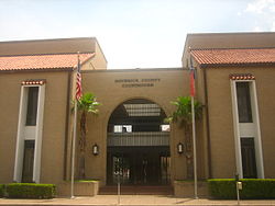 The Maverick County Courthouse in Eagle Pass.
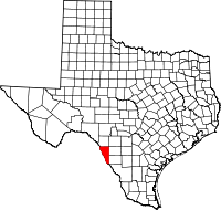
Location in the state of Texas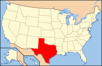
Texas's location in the U.S.Founded 1856 Seat Eagle Pass Area
- Total
- Land
- Water
1,292 sq mi (3,346 km²)
1,280 sq mi (3,315 km²)
12 sq mi (31 km²), 0.90%Population
- (2000)
- Density
47,297
36/sq mi (14/km²)Website http://www.co.maverick.tx.us Maverick County is a county located in the U.S. state of Texas. In 2000, its population was 47,297. Its county seat is Eagle Pass[1]. Maverick County is named for Samuel Maverick, cattleman and state legislator.
The Eagle Pass Micropolitan Statistical Area includes all of Maverick County.
Contents
Geography
According to the U.S. Census Bureau, the county has a total area of 1,292 square miles (3,346 km²), of which 1,280 square miles (3,315 km²) is land and 12 square miles (31 km²) (0.90%) is water.
Major highways
 U.S. Highway 57
 U.S. Highway 277
 State Highway 131
Adjacent counties and municipios
- Kinney County (north)
- Zavala County (east)
- Dimmit County (east)
- Uvalde County (northeast)
- Webb County (southeast)
- Guerrero, Coahuila, Mexico (southwest)
- Jiménez, Coahuila, Mexico (west)
- Piedras Negras, Coahuila, Mexico (southwest)
Demographics
As of the census[2] of 2000, there are 47,297 people, 13,089 households, and 11,230 families residing in the county. The population density is 37 people per square mile (14/km²). There are 14,889 housing units at an average density of 12 per square mile (4/km²). The racial makeup of the county is 70.89% White, 0.31% Black or African American, 1.34% Native American, 0.39% Asian, 0.04% Pacific Islander, 24.08% from other races, and 2.95% from two or more races. 95.01% of the population are Hispanic or Latino of any race.
There are 13,089 households out of which 51.60% have children under the age of 18 living with them, 66.50% are married couples living together, 16.00% have a female householder with no husband present, and 14.20% are non-families. 12.90% of all households are made up of individuals and 6.60% have someone living alone who is 65 years of age or older. The average household size is 3.60 and the average family size is 3.98.
In the county, the population is spread out with 36.90% under the age of 18, 9.20% from 18 to 24, 26.70% from 25 to 44, 17.70% from 45 to 64, and 9.50% who are 65 years of age or older. The median age is 28 years. For every 100 females there are 91.90 males. For every 100 females age 18 and over, there are 86.40 males.
The median income for a household in the county is $21,232, and the median income for a family is $23,614. Males have a median income of $20,956 versus $15,662 for females. The per capita income for the county is $8,758. 34.80% of the population and 32.00% of families are below the poverty line. Out of the total population, 40.60% of those under the age of 18 and 40.90% of those 65 and older are living below the poverty line. Based on per-capita income, Maverick is one of the poorest counties in the United States.
According to the 2000 census, Maverick county has the nation's highest percentage of people who speak Spanish at home, at 91%.
History

Native Americans
Prehistoric hunter-gatherer were the first inhabitants, and their artifacts have been found in various areas of the county. Lipan Apache, Shawnee and Coahuiltecan culture followed.[3] The abandonment of Fort Duncan on March 20, 1861 during the Civil War enabled the Indian population to gain control of the region; both American and Mexican inhabitants suffered tremendous loss of life and property. The fort was reoccupied in 1868.[4] In the early 1871 a number of Black Seminole Indians living along the border were organized into a company of scouts and brought to Fort Duncan.[5] The last Indian raid in the county occurred in 1877. Three traders were murdered and mutilated by Lipan Apaches. The site of the incident, eight miles (13 km) northeast of Eagle Pass, became known as Deadman's Hill.[3]
Spanish Explorations
The El Camino Real, later known as the Old San Antonio Road, that crosses the Rio Grande begins in east Texas and crosses southern Maverick County.[6] The trail was originally blazed by Alonso De León in 1690, and is said to have been traversed by more early Spanish explorers and settlers than any other section of the state.[7] In 1989, the legislature authorized the Old San Antonio Road Preservation Commission to coordinate the 1991 300th anniversary of the trail’s founding.[8][9]
Saltillo alcade Fernando de Azcué in 1665 pursued Indians into the county.[10] In 1675 Fernando del Bosque traversed the area near Quemado, and Franciscans with the expedition are said to have celebrated the first Mass on Texas soil.[11][12] In 1688 Alonso De León followed the Camino Real across the county en route to Fort St. Louis.[13] Domingo Terán de los Ríos, the first Governor of Spanish Texas, led an expedition through the county in 1691.[14] Spanish Texas Governor Martín de Alarcón crossed the county in 1718 on the expedition that resulted in the founding of San Antonio.[15] Governor of the Mexican provinces of Coahuila and Texas, Marqués de San Miguel de Aguayo, in 1720 passed through on an expedition that brought goats, 2800 horses and 6400 sheep that was the onset of Spanish ranching in Texas.[16] Pedro de Rivera y Villalón crossed the county in 1727 as part of an expedition to inspect the frontier defenses of New Spain.[17]
Early Settlers
Antonio Rivas was the first known rancher on the land in 1765.[3]
On March 27, 1849, Capt. Sidney Burbank established Fort Duncan, previously known as Camp Eagle Pass, on a site two miles (3 km) north of the ford at Adjuntos Pass.[4]
General William Leslie Cazneau, credited several years earlier with burying the Alamo casualties with full military honors, began ranching in the area circa 1850. He partnered with Irish-born San Antonio banker and county settler John Twohig to lay out a plan of Eagle Pass in 1850. That same year, a Mexican garrison established Piedras Negras across the border.[18]
Freight operator Friedrich Wilhelm Carl Groos secured a contract to haul supplies for the army at Fort Duncan. At his urging, several early settlers of Eagle Pass were emigres of the Mexican river villages and missions of San Juan Bautista, San José, Santo Domingo, San Nicolás, La Navaja, and San Isidro.[19]
Emigres Refugio and Rita Alderete de San Miguel used the profits of their freighting business to establish a large-scale cattle, sheep and horse ranch on Elm Creek in 1853. They were joined in ranching operations by stranded pilgrims on the California Gold Rush trail and discharged Fort Duncan soldiers. Among these was Infantry veteran Jesse Sumpter who also worked at many odd jobs before becoming Sheriff in the newly formed Maverick County.[3]
Landscape pioneer Frederick Law Olmsted visited Eagle Pass in 1854 and noted the many slave hunters and runaway slaves residing in Piedras Negras, as well as the many saloons and gambling houses, which catered to Fort Duncan's soldiers and other unsavory characters.[20]
In 1855 Texas Governor Elisha M. Pease authorized a raid into Mexico. An international incident was brought about by James H. Callahan and William R. Henry whose pursuit of Lipan, Apache raiders and runaway slaves into Mexico ended in the looting and torching of Piedras Negras, Mexico, after an encounter with Mexican forces at La Marama on the Río Escondido.[3][21]
County Established and Growth
Maverick County was established from Kinney County and named for Samuel A. Maverick in 1856. The county was organized some years later on September 4, 1871. The estimated population of the county in 1860 was 726. Eagle Pass voted 83-3 against secession from the Union.[3]
Fort Duncan was occupied by Confederate troops during the Civil War. Eagle Pass was chosen as a trade depot for the Military Board of Texas. Eagle Pass was a major terminus of the Cotton Road, custom house and Confederate port of entry into Mexico 1863-65. A cotton press was installed at Piedras Negras to handle the enormous quantities coming across the Rio Grande. At the close of the Civil War General Joseph Orville Shelby’s brigade never surrendered, but hoped to continue their fight across the border. On July 4, 1865, Shelby stopped in the middle of the Rio Grande to bury the last Confederate flag to fly over his troops. To the sound of drum and bugle, he wrapped the flag around the plume of his hat, weighted it with a stone from the river bank, and lowered it into the river.[3] Shelby’s unit became known as “The Undefeated” and were used as a basis for the 1969 John Wayne-Rock Hudson film by the same name.[3]
Saloons, gambling houses, and smuggling operations proliferated in and around Eagle Pass during Reconstruction. The infamous J. King Fisher and his followers dominated the era in the region.[3]
Telegraph lines reached Eagle Pass in 1875. In 1880, the main line of the Galveston, Harrisburg and San Antonio Railway was extended west from San Antonio, connecting to the Mexican Railway in Piedras Negras.[3]
Irrigation has been vital to area farmers. In 1885, rancher Patrick W. Thomson formed the Eagle Pass Irrigation Company to construct a huge gravity-flow irrigation system to draw water from the Rio Grande. Thompson died in 1910, but his efforts came to fruition as The Maverick County Irrigation Canal system, operational by April 1932.[22]
March 3, 1911, when Lt. Benjamin D. Foulois and Philip O. Parmalee made the first official military reconnaissance flight, looking for Army troops between Laredo and Eagle Pass, Texas, with a ground exercise in progress. In 1942 the Army Air Force built a single-engine advanced flying school twelve miles (19 km) north of Eagle Pass.[23]
Oil and gas exploration in the county began in the 1950s, with the three biggest fields being the 1969 Fitzpatrick and Wipff, and the 1970 Burr.[24]
 The Maverick County Jail, established 1949, adjacent to county courthouse.
The coal industry of Maverick County is located along a section of the Olmos Coal Formation immediately north of Eagle Pass. Mining operations developed by Dolch at Dolchburg and by the Olmos Coal, Coke, and Oil Company at Olmos were the largest coal producers in Texas around the turn of the century.[25]
Industries located in the county in 1977 included a cotton gin and two cattle feedlots with capacities of 25,000 cattle at El Indio, one at Normandy, and another between Eagle Pass and El Indio. A spinach-packing shed was at the southern edge of Eagle Pass. A number of industries have located in the Eagle Pass–Maverick County area since 1977. These include the Eagle Pass Manufacturing Company (a division of Hicks-Ponder, Incorporated) and the Williamson-Dickie Manufacturing Company, both makers of work clothing; the Reynolds Mining Corporation fluorspar plant and the Tejas Barite plant; Alta-Verde Industries and Maverick Beef Producers, and the Big River Catfish Farm.[3]
In 1982, 88 percent of all land in the county was considered farmland and ranches, but only 2 percent of the farmland was under cultivation, and most of that was irrigated. Primary crops were hay, oats, and wheat.[3]
Communities
Cities
Eagle Pass is the only incorporated city in Maverick County.
Census-designated places
Politics
Maverick Russell runs this county Traditionally Democratic, Maverick County was one of the only counties in Texas where George McGovern received a majority of the vote.[26] The last Republican to carry the county was Herbert Hoover in 1928.[27] In recent times it cast a majority of its votes for U.S. Senator John Kerry in the 2004 U.S. presidential election. President George W. Bush received 4,025 votes to Kerry's 5,948. In the 2008 U.S. presidential election it cast a higher majority of 8,554 votes for Barack Obama[28]
The county is located in Texas Senate, District 19 so is represented by Democrat Carlos Uresti in the Texas Senate. As part of the 80th district of the Texas House of Representatives it is represented by Democrat Tracy O. King. In the United States House of Representatives it is part of Texas's 23rd congressional district, which has a Cook Partisan Voting Index of R+4 and is represented by Democrat Ciro Rodriguez.
Education
All of Maverick County is served by the Eagle Pass Independent School District.
See also
References
- ^ "Find a County". National Association of Counties. http://www.naco.org/Counties/Pages/FindACounty.aspx. Retrieved 2011-06-07.
- ^ "American FactFinder". United States Census Bureau. http://factfinder.census.gov. Retrieved 2008-01-31.
- ^ a b c d e f g h i j k l Ochoa, Ruben E. "Maverick County". Handbook of Texas Online. Texas State Historical Association. http://www.tshaonline.org/handbook/online/articles/hcm06. Retrieved 13 December 2010.
- ^ a b "Fort Duncan". Handbook of Texas Online. Texas State Historical Association. http://www.tshaonline.org/handbook/online/articles/qbf17. Retrieved 13 December 2010.
- ^ Aleshire, William (2004). A Buffalo Soldier's Story. Heritage Books, Inc. p. 178. ISBN 978-0788431401.
- ^ "Old San Antonio Road". Handbook of Texas Online. Texas State Historical Association. http://www.tshaonline.org/handbook/online/articles/exo04. Retrieved 13 December 2010.
- ^ Chipman, Donald E. "Alonso De León". Handbook of Texas Online. Texas State Historical Association. http://www.tshaonline.org/handbook/online/articles/fde06. Retrieved 13 December 2010.
- ^ Williams, Jeffrey M. GIS Aided Archaeological Research of El Camino Real de Los Tejas with Focus. p. 12.
- ^ "Texas Old San Antonio Road Preservation Commission". An Inventory of Records at the Texas State Archives, 1979, 1988-1993. Texas Archival Resources Online. http://www.lib.utexas.edu/taro/tslac/10198/tsl-10198.html. Retrieved 13 December 2010.
- ^ Chipman, Donald E. "Fernando de Azcué". Handbook of Texas Online. Texas State Historical Association. http://www.tshaonline.org/handbook/online/articles/faz01. Retrieved 13 December 2010.
- ^ "Quemado, Texas". Texas Escapes. Texas Escapes - Blueprints For Travel, LLC. http://www.texasescapes.com/SouthTexasTowns/QuemadoTexas.htm. Retrieved 13 December 2010.
- ^ Chipman, Donald E. "Fernando del Bosque". Handbook of Texas Online. Texas State Historical Association. http://www.tshaonline.org/handbook/online/articles/fboaj. Retrieved 13 December 2010.
- ^ Foster, William C (1995). "In Search of LaSalle". Spanish Expeditions into Texas, 1689-1768. University of Texas Press. pp. 17–33. ISBN 978-0292724891.
- ^ Weddle, Robert S (1991). San Juan Bautista: Gateway to Spanish Texas. University of Texas Press. pp. 15–18. ISBN 978-0292776517.
- ^ Arias, Bishop David (2006). "Martin de Alarcon". Spanish-Americans: Lives and Faces. Trafford Publishing. pp. 87–89. ISBN 978-1412047173.
- ^ Newton, Lewis W. "Marqués de San Miguel de Aguayo". Handbook of Texas Online. Texas State Historical Association. http://www.tshaonline.org/handbook/online/articles/fag02. Retrieved 13 December 2010.
- ^ Blake, Robert Bruce. "Pedro de Rivera y Villalón". Handbook of Texas Online. Texas State Historical Association. http://www.tshaonline.org/handbook/online/articles/fri27. Retrieved 13 December 2010.
- ^ Wagner, Frank. "William Leslie Cazneau". Handbook of Texas Online. Texas State Historical Association. http://www.tshaonline.org/handbook/online/articles/fcaae. Retrieved 13 December 2010.
- ^ York, Miriam. "Friedrich (Frederick) Wilhelm Carl Groos". Handbook of Texas Online. Texas State Historical Association. http://www.tshaonline.org/handbook/online/articles/fgr76. Retrieved 13 December 2010.
- ^ Greene, A C (1998). "A Journey Through Texas". The 50+ Best Books on Texas. University of North Texas Press. pp. 61–62. ISBN 978-1574410433.
- ^ Hardin, Stephen; Hook, Richard (1991). The Texas Rangers (Elite). Osprey Publishing. pp. 21–22. ISBN 978-1855321557.
- ^ Pingenot, Ben E. "Maverick County Irrigation Canal". Handbook of Texas Online. Texas State Historical Association. http://www.tshaonline.org/handbook/online/articles/rum03. Retrieved 13 December 2010.
- ^ Hundnall, Ken and Sharon (2005). Spirits of the Border V: The History and Mystery of the Lone Star State. Omega Press. pp. 232–233. ISBN 978-0962608797.
- ^ Warner, C A; Thompson, Ernest O (2007). Texas Oil & Gas Since 1543. Copano Bay Press. p. 268. ISBN 978-0976779957.
- ^ Calderon, Dr. Robert R (2000). Mexican Coal Mining Labor in Texas and Coahuila, 1880-1930 (Rio Grande/Rio Bravo: Borderlands Culture and Traditions). TAMU Press. p. 43. ISBN 978-0890968840.
- ^ David Leip Atlas
- ^ Geographie Electorale
- ^ The New York Times Electoral Map
External links
- Maverick County government's website
- Maverick County from the Handbook of Texas Online
- Historic Maverick County materials, hosted by the Portal to Texas History.
- "Eagle Pass Rising," a grouping of articles on the growth of Eagle Pass, Texas

Kinney County Jiménez, Coahuila, Mexico 
Zavala County and Dimmit County  Maverick County, Texas

Guerrero, Coahuila, Mexico and Piedras Negras, Coahuila, Mexico Webb County Municipalities and communities of Maverick County, Texas City 
CDPs Categories:- Texas counties
- 1871 establishments
- Maverick County, Texas
- Counties of the United States with Hispanic majority populations


Wikimedia Foundation. 2010.