- Val Verde County, Texas
-
Val Verde County, Texas 
Location in the state of Texas
Texas's location in the U.S.Founded 1885 Seat Del Rio Area
- Total
- Land
- Water
3,232 sq mi (8,371 km²)
3,170 sq mi (8,210 km²)
62 sq mi (161 km²), 1.92%Population
- (2000)
- Density
44,856
13/sq mi (5/km²)Website www.valverdecounty.org Val Verde County is a county located on the Edwards Plateau in the U.S. state of Texas. In 2008, estimated population was 55,000. Its county seat is Del Rio.[1] In 1936, Val Verde County received Recorded Texas Historic Landmark number 5625 to commemorate its founding.[2]
Val Verde, which means "green valley", was named for a Civil War battle. In 1862, soldiers of Sibley's Brigade took part in the Texas invasion of New Mexico Territory, where they captured several artillery pieces at the Battle of Val Verde. The battle is memorialized both in the name of the county and a small settlement in Milam County.
The Del Rio Micropolitan Statistical Area includes all of Val Verde County.
Judge Roy Bean (1825–1903) operated a general store and saloon west of the Pecos River in Langtry, where the original Bean building is displayed at a Texas Tourist Bureau station. Bean and his son are interred on the grounds of the Whitehead Memorial Museum in Del Rio. Bean is the subject of the 1956 syndicated television series Judge Roy Bean, starring Edgar Buchanan, and the 1972 film, The Life and Times of Judge Roy Bean, with Paul Newman in the featured role.
Contents
History Timeline
- First inhabitants were 6,000–10,000 years ago and later came to include Lipan Apache, Coahuiltecan, Jumanos, Tamaulipans and Comanches.[3][4]
- 1590 Spanish explorer Gaspar Castaño de Sosa leads a mining expedition of 170 who pass through Devils Draw. He refers to a stream by the name of Laxas, which is believed Devils River.[5][6][7]
- 1673 Juan Larios opens a mission school at between Del Rio and Eagle Pass.[4][8]
- 1675 Traveling Franciscan priests celebrate Mass at San Felipe Springs.[4][8]
- 1736 Lt. Miguel de la Garza Falcón[9] leads 100 soldiers along the Devils River[10] in pursuit of Apaches.
- 1834 James Grant[11] and John Charles Beales[12] establish settlement on San Felipe Creek,[13] which becomes undesirable due to Indian attacks.
- 1850’s Military bases to protect against Indian attacks include Camp Blake,[14] Camp Hudson[15] and Camp San Felipe.[16]
- 1860 Population of 2,874, includes 108 blacks and 1,103 foreign-born.[4]
- 1868 San Felipe Del Rio community is established on San Felipe Creek next to Camp San Felipe.[4]
- 1869 through 1882 Seminole Negro Indian Scouts (mixed heritage Seminoles with African blood) under John Lapham Bullis, namesake of Camp Bullis, defend the Texas border against Indian attack.[17][18]
- 1883 Galveston Harrisburg and San Antonio Railway is completed.[19] Frank Qualia establishes Val Verde winery.[20][21][22]
- 1884 Langtry community established, named by Judge Roy Bean after Lillie Langtry.[4][23]
- 1885 Val Verde County is organized from Crockett, Kinney, and Pecos counties. Roy Bean elected justice of the peace in Langtry, operating out of the Jersey Lily Saloon and becoming renowned as “the Law West of the Pecos”.[4]
- 1886 Juno and Devils River communities established.[4]
- 1888 Comstock community established.[4][24]
- 1889 Norris community established.[4]
- 1928 Lake Hamilton Dam complete.[4]
- 1904 Lillie Langtry visits the community of Langtry.[25]
- 1929 Lake Walk Dam complete.[4][26]
- 1942 Laughlin Field/Laughin Army Air Field opens to train World War II pilots.[4][27]
- 1945 Laughlin Field closes.[4]
- 1952 Laughlin Field reopens as Laughlin Air Force Base, and serves as a secret U2 unit. Major Rudolf Anderson, a U-2 pilot from Laughlin, is the only casualty of the Cuban Missile Crisis.[28][29]
- 1969 Armistad Dam and Reservoir complete. The project cost $78 million.[4][30]
Geography
According to the U.S. Census Bureau, the county has a total area of 3,232 square miles (8,370 km2), of which 3,170 square miles (8,200 km2) is land and 62 square miles (160 km2) (1.92%) is water.
Major highways
 U.S. Highway 90
 U.S. Highway 277
 U.S. Highway 377
 State Highway 163
- State Loop 79 is currently under construction in Val Verde County & Del Rio. It will connect with U.S. Highway 90, U.S. Highway 277 and U.S. Highway 377. The Loop is expected to create an economic boom that will bring in well known National name brand Hotels, retail stores and restaurant establishments to the area.
Adjacent counties and municipios
- Crockett County (north)
- Sutton County (northeast)
- Edwards County (east)
- Kinney County (east)
- Terrell County (west)
- Acuña, Coahuila, Mexico (south)
- Jiménez, Coahuila, Mexico (south)
National protected areas
Demographics
As of the census[31] of 2000, there were 44,856 people, 14,151 households, and 11,320 families residing in the county. The population density was 14 people per square mile (5/km²). There were 16,288 housing units at an average density of 5 per square mile (2/km²). The racial makeup of the county was 76.36% White, 1.54% Black or African American, 0.68% Native American, 0.55% Asian, 0.05% Pacific Islander, 18.22% from other races, and 2.60% from two or more races. 75.46% of the population were Hispanic or Latino of any race.
There were 14,151 households out of which 42.90% had children under the age of 18 living with them, 62.50% were married couples living together, 13.90% had a female householder with no husband present, and 20.00% were non-families. 17.50% of all households were made up of individuals and 7.50% had someone living alone who was 65 years of age or older. The average household size was 3.11 and the average family size was 3.55.
In the county, the population was spread out with 32.10% under the age of 18, 9.40% from 18 to 24, 27.90% from 25 to 44, 19.60% from 45 to 64, and 11.00% who were 65 years of age or older. The median age was 31 years. For every 100 females there were 97.00 males. For every 100 females age 18 and over, there were 93.20 males.
Economy
The median income for a household in the county was $28,376, and the median income for a family was $31,434. Males had a median income of $26,485 versus $18,039 for females. The per capita income for the county was $12,096. About 22.10% of families and 26.10% of the population were below the poverty line, including 33.80% of those under age 18 and 26.40% of them age 65 or over.
Cities and towns
Education
The Val Verde County Library in Del Rio serves the county.[32]
See also
References
- ^ "Find a County". National Association of Counties. http://www.naco.org/Counties/Pages/FindACounty.aspx. Retrieved 2011-06-07.
- ^ "THC Val Verde County". Recorded Texas Historic Landmark. Texas State Historical Association. http://atlas.thc.state.tx.us/viewform.asp?atlas_num=5465005625&site_name=Val+Verde+County&class=5000. Retrieved 19 February 2011.
- ^ Foster, William C; Thoms, Alston V (2008). "The Texas Trans-Pecos, Study Area V". Historic Native Peoples of Texas. University of Texas Press. pp. 137–168. ISBN 978-0292717930.
- ^ a b c d e f g h i j k l m n o Smith, Julia Cauble. "Val Verde County". Handbook of Texas Online. Texas State Historical Association. http://www.tshaonline.org/handbook/online/articles/hcv01. Retrieved 29 November 2010.
- ^ Tarpley, Fred (1980). 1001 Texas Place Names. University of Texas Press. p. 61. ISBN 978-0292760165.
- ^ "Devil's Draw". Handbook of Texas Online. Texas State Historical Association. http://www.tshaonline.org/handbook/online/articles/rbdbv. Retrieved 29 November 2010.
- ^ Chipman, Donald E. "Gaspar Castaño de Sosa". Handbook of Texas Online. Texas State Historical Association. http://www.tshaonline.org/handbook/online/articles/fca87. Retrieved 29 November 2010.
- ^ a b Wade, Maria F; Wade, Don E; Hester, Thomas R (2002). "The Bosque-Larios Expedition". The Native Americans of the Texas Edwards Plateau, 1582-1799. University of Texas Press. pp. 24–54. ISBN 978-0292791565.
- ^ Garcia, Clotilde P. "Miguel de la Garza Falcón". Handbook of Texas Online. Texas State Historical Association. http://www.tshaonline.org/handbook/online/articles/fga95. Retrieved 29 November 2010.
- ^ Smith, Julia Cauble. "Devils River". Handbook of Texas Online. Texas State Historical Association. http://www.tshaonline.org/handbook/online/articles/htd12. Retrieved 29 November 2010.
- ^ Blake, Robert Bruce. "James Grant". Handbook of Texas Online. Texas State Historical Association. http://www.tshaonline.org/handbook/online/articles/fgr12. Retrieved 29 November 2010.
- ^ Estep, Raymond. "John Charles Beales". Handbook of Texas Online. Texas State Historical Association. http://www.tshaonline.org/handbook/online/articles/fbe03. Retrieved 29 November 2010.
- ^ "San Felipe Creek". Handbook of Texas Online. Texas State Historical Association. http://www.tshaonline.org/handbook/online/articles/rbs44. Retrieved 29 November 2010.
- ^ Smith, Julia Cauble. "Camp Blake". Handbook of Texas Online. Texas State Historical Association. http://www.tshaonline.org/handbook/online/articles/qcc02. Retrieved 29 November 2010.
- ^ Smith, Julia Cauble. "Camp Hudson". Handbook of Texas Online. Texas State Historical Association. http://www.tshaonline.org/handbook/online/articles/qbc16. Retrieved 29 November 2010.
- ^ Seale, Axcie. "Camp San Felipe". Handbook of Texas Online. Texas State Historical Association. http://www.tshaonline.org/handbook/online/articles/qbc25. Retrieved 29 November 2010.
- ^ Glasrud, Bruce A; Searles, Michael N (2007). "The Black Seminole Indian Scouts in the Big Bend". Buffalo Soldiers in the West: A Black Soldiers Anthology. TAMU Press. pp. 143–152. ISBN 978-1585446209.
- ^ Eckhardt, C F. "THE WHIRLWIND Lt. John Lapham Bullis and the Seminole Negro Scouts". Texas Escapes. Texas Escapes - Blueprints For Travel, LLC. http://www.texasescapes.com/CFEckhardt/Whirlwind-Lt-John-Lapham-Bullis-and-the-Seminole-Negro-Scouts.htm. Retrieved 29 November 2010.
- ^ "Galveston Harrisburg and San Antonio Railway". Texas Transportation Museum. http://www.txtransportationmuseum.org/Sunset.htm. Retrieved 29 November 2010.
- ^ Braudaway, Douglas Lee; Valverde County Historical Commission (1999). Val Verde County (Images of America: Texas). Arcadia Publishing. p. 93. ISBN 978-0738501284.
- ^ Overfelt, Robert C. "Val Verde Winery". Handbook of Texas Online. Texas State Historical Association. http://www.tshaonline.org/handbook/online/articles/div01. Retrieved 29 November 2010.
- ^ "Val Verde Winery". Val Verde Winery. http://www.valverdewinery.com/. Retrieved 29 November 2010.
- ^ "Langtry, Texas". Texas Escapes. Texas Escapes - Blueprints For Travel, LLC. http://www.texasescapes.com/TOWNS/Texas_ghost_towns/Langtry_Texas/Langtry_Texas.htm. Retrieved 29 November 2010.
- ^ "Comstock, Texas". Texas Escapes. Texas Escapes - Blueprints For Travel, LLC. http://www.texasescapes.com/TOWNS/Comstock_Texas/Comstock.htm. Retrieved 29 November 2010.
- ^ Crutchfield, James A (2007). It Happened in Texas. TwoDot. pp. 104–107. ISBN 978-0762745692.
- ^ "Lake Walk Dam". Handbook of Texas Online. Texas State Historical Association. http://www.tshaonline.org/handbook/online/articles/rol83. Retrieved 29 November 2010.
- ^ Benton, Jeffrey C (2005). Air Force Officer's Guide. Stackpole Books. p. 330. ISBN 978-0811731942.
- ^ "Laughlin AFB". Laughlin AFB. http://www.laughlin.af.mil/. Retrieved 29 November 2010.
- ^ Leatherwood, Art. "Laughlin Air Force Base". Handbook of Texas Online. Texas State Historical Association. http://www.tshaonline.org/handbook/online/articles/qbl04. Retrieved 29 November 2010.
- ^ Braudaway, Douglas (2002). Del Rio: Queen City of the Rio Grande. Arcadia Publishing. p. 125. ISBN 978-0738523873.
- ^ "American FactFinder". United States Census Bureau. http://factfinder.census.gov. Retrieved 2008-01-31.
- ^ Home page. Val Verde County Library. Retrieved on March 26, 2010.
External links
- Val Verde County from the Handbook of Texas Online
- Texas Beyond History, Hinds Cave
- Texas Beyond History, Lower Pecos Canyonlands

Crockett County Sutton County Terrell County 
Edwards County and Kinney County  Val Verde County, Texas

Jiménez, Coahuila, Mexico and Acuña, Coahuila, Mexico Kinney County Municipalities and communities of Val Verde County, Texas City 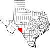
CDPs Unincorporated
communitiesCategories:- Texas counties
- Val Verde County, Texas
- 1885 establishments
- Counties of the United States with Hispanic majority populations
- Recorded Texas Historic Landmarks


Wikimedia Foundation. 2010.