- Fauquier County, Virginia
-
Fauquier County, Virginia 
Seal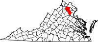
Location in the state of Virginia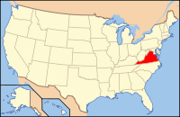
Virginia's location in the U.S.Founded 1759 Seat Warrenton Area
- Total
- Land
- Water
651 sq mi (1,686 km²)
650 sq mi (1,683 km²)
2 sq mi (5 km²), 0.26%Population
- (2010)
- Density
68,010
105/sq mi (40.4/km²)Website www.fauquiercounty.gov Fauquier (
 /fɔːˈkɪər/) is a county located in the United States Commonwealth of Virginia. As of 2010, the county's population was 68,010.[1] Fauquier County's county seat is Warrenton[2], and the county is a part of the Washington Metropolitan Area.
Contents
History
The original inhabitants, the Siouan Manahoac tribe, were subdued and driven off around 1670 by the Iroquois (Seneca), who did not resettle the area. The Conoy camped briefly near The Plains, from 1697 to 1699. The Six Nations ceded the entire region including modern Fauquier to Virginia Colony at the Treaty of Albany, in 1722.
Fauquier County was established on May 1, 1759, from Prince William County. It is named for Francis Fauquier, Lieutenant Governor of Virginia at the time, who won the land in a poker game, according to legend.
Fauquier County celebrated its 250th anniversary in 2009. The county celebrated by having year-long events. The festivities were kicked off with the African-American Historical Association celebrating Black History Month in February. The grand events took place on May 1 when Main Street was filled with guests and residents who enjoyed entertainment by historians, demonstrations, performances, contests, activities, lectures, Kid’s Corner, and live music. Birthday cakes were assembled and shared with the Fauquier Food Distribution Coalition. There were historical site visits including some of the confederate battlefields. Many of the local churches participated in this event with homecoming celebrations. Festivities were concluded with the First Night Warrenton on December 31. This family oriented event included musical performances, puppet shows and a magician.
Education
Elementary schools
- C. M. Bradley Elementary School
- James G. Brumfield Elementary School
- W. G. Coleman Elementary School
- Grace Miller Elementary School
- H. M. Pearson Elementary School
- C. Hunter Ritchie Elementary School
- P. B. Smith Elementary School
- Claude Thompson Elementary School
- Mary Walter Elementary School
- Greenville Elementary School
- M. M. Pierce Elementary School
Middle schools
- Auburn Middle School
- Cedar Lee Middle School
- W. C. Taylor Middle School
- Marshall Middle School
- Warrenton Middle School
High schools
- Fauquier High School
- Liberty High School
- Southeastern Alternative School
- Kettle Run High School
Higher education
- Lord Fairfax Community College
- Thorpe House Adult Learning Center
- Mountain Vista Governor's School
Geography
According to the U.S. Census Bureau, the county has a total area of 651 square miles (1,686.1 km2), of which 650 square miles (1,683.5 km2) is land and 2 square miles (5.2 km2) (0.26%) is water.
Adjacent counties
- Clarke County (north)
- Loudoun County (north)
- Prince William County (east)
- Stafford County (southeast)
- Culpeper County (southwest)
- Rappahannock County (west)
- Warren County (northwest)
Major highways
 Interstate 66
 U.S. Route 15
 U.S. Route 17
 U.S. Route 29
 U.S. Route 50
 U.S. Route 211
 State Route 28
 State Route 55
Demographics
Historical populations Census Pop. %± 1790 17,892 — 1800 21,329 19.2% 1810 22,689 6.4% 1820 23,103 1.8% 1830 26,086 12.9% 1840 21,897 −16.1% 1850 20,868 −4.7% 1860 21,706 4.0% 1870 19,690 −9.3% 1880 22,993 16.8% 1890 22,590 −1.8% 1900 23,374 3.5% 1910 22,526 −3.6% 1920 21,869 −2.9% 1930 21,071 −3.6% 1940 21,039 −0.2% 1950 21,248 1.0% 1960 24,066 13.3% 1970 26,375 9.6% 1980 35,889 36.1% 1990 48,741 35.8% 2000 55,139 13.1% 2010 68,010 23.3% As of the census[3] of 2000, there were 55,139 people, 19,842 households, and 15,139 families residing in the county. The population density was 85 people per square mile (33/km2). There were 21,046 housing units at an average density of 32 per square mile (13/km2). The racial makeup of the county was 88.39% White, 8.79% Black or African American, 0.26% Native American, 0.59% Asian, 0.03% Pacific Islander, 0.60% from other races, and 1.33% from two or more races. 2.02% of the population were Hispanic or Latino of any race.
 Typical Fauquier County landscape
By 2005 non-Hispanic whites were 84.5% of the population of the county. African-Americans were still 8.8% of the population. Native Americans were 0.3% while the Asians population was 1.1% of the county total. The Latino population had more than doubled as a percentage of the total population of the county to 4.4%.
In 2000 there were 19,842 households out of which 36.10% had children under the age of 18 living with them, 63.80% were married couples living together, 8.60% had a female householder with no husband present, and 23.70% were non-families. 18.70% of all households were made up of individuals and 6.20% had someone living alone who was 65 years of age or older. The average household size was 2.75 and the average family size was 3.14.
In the county, the population was spread out with 26.80% under the age of 18, 6.40% from 18 to 24, 30.30% from 25 to 44, 26.00% from 45 to 64, and 10.50% who were 65 years of age or older. The median age was 38 years. For every 100 females there were 97.70 males. For every 100 females age 18 and over, there were 95.40 males.
The median income for a household in the county was $61,999, and the median income for a family was $69,507 (these figures had risen to $80,549 and $93,597 respectively as of a 2007 estimate[4]). Males had a median income of $45,484 versus $31,738 for females. The per capita income for the county was $28,757. About 3.70% of families and 5.40% of the population were below the poverty line, including 4.70% of those under age 18 and 8.70% of those age 65 or over.
The county is primarily rural and agricultural. There is some industry in Fauquier County, however the largest employer in the County is the county government and the hospital. As of the 2000 census, 47% of county residents that work have jobs that are outside the county.[5]
Communities
Incorporated towns
Unincorporated communities
- New Baltimore
- Old Tavern
- Opal
- Orlean
- Paris
- Rectortown
- Somerville
- Sumerduck
- Upperville
Notable residents
- Turner Ashby, born in Fauquier County, Confederate Army general in the American Civil War.[6]
- Martin Berkofsky, classical pianist and philanthropist.
- Matt Carson, author and businessman.
- Walter Chrysler, automobile pioneer, owned North Wales Farm in Warrenton .
- Susan Cummings, an heiress infamous for killing Argentine polo player Roberto Villegas.
- Robert Duvall, American-born actor who maintains a farm in The Plains.
- George B. Fitch, American businessman, Mayor of Warrenton, founder of Jamaican Bobsled Team.
- Bertram and Diana Firestone, owners of Newstead Farm.
- Rear Admiral Cary Travers Grayson, owner of historic Blue Ridge Farm.
- Eppa Hunton, U.S. Representative and Senator from Virginia, born and lived in Warrenton.
- Charles Marshall, born in Warrenton, assistant adjutant general, aide de camp and military secretary to Gen. Robert E. Lee. Great nephew of Chief Justice John Marshall.
- James K. Marshall, Colonel in the Confederate States Army, killed in action during Pickett's Charge at the Battle of Gettysburg while leading the brigade of J. Johnston Pettigrew, grandson of Chief Justice John Marshall.
- John Marshall, born in Fauquier County, Chief Justice of the United States.
- Paul Mellon, philanthropist, an Exemplar of Racing and owner of Rokeby Farm.
- John S. Mosby, lived in Warrenton, was a Confederate partisan ranger and cavalryman during the American Civil War. Buried in Warrenton cemetery.
- Willard Scott, an American media personality best known for his work on NBC's The Today Show who lives in Paris, Virginia.
- Scott Shipp, born in Warrenton, Superintendent of Virginia Military Institute from 1890-1907.
- Isabel Dodge Sloane, owner of Brookmeade Stud.
- William "Extra Billy" Smith, died in Warrenton, was a lawyer, congressman, two time Governor of Virginia and one of the oldest Confederate generals in the American Civil War.
- Liz Whitney Tippett, owner of the Llangollen estate.
- Michaele Salahi and Tareq Salahi, the White House Gate Crashers.
- Irv Cross, American footballer and sportscaster.
See also
- Fauquier County Sheriff's Office
- National Register of Historic Places listings in Fauquier County, Virginia
References
- ^ [1]. Weldon Cooper Center 2010 Census Count Retrieved January 26, 2011
- ^ "Find a County". National Association of Counties. http://www.naco.org/Counties/Pages/FindACounty.aspx. Retrieved 2011-06-07.
- ^ "American FactFinder". United States Census Bureau. http://factfinder.census.gov. Retrieved 2008-01-31.
- ^ http://factfinder.census.gov/servlet/ACSSAFFFacts?_event=Search&geo_id=05000US24017&_geoContext=01000US%7C04000US24%7C05000US24017&_street=&_county=fauquier&_cityTown=fauquier&_state=04000US51&_zip=&_lang=en&_sse=on&ActiveGeoDiv=geoSelect&_useEV=&pctxt=fph&pgsl=050&_submenuId=factsheet_1&ds_name=ACS_2007_3YR_SAFF&_ci_nbr=null&qr_name=null®=null%3Anull&_keyword=&_industry=
- ^ "Fauquier Times-Democrat: Get A Life, Lose The Commute, August 30, 2007". http://www.fauquier.com/news/2007/aug/30/get-a-life-lose-the-commute/.[dead link]
- ^ Who Was Who in America, Historical Volume, 1607-1896. Chicago: Marquis Who's Who. 1963.
7. The Civil War in Fauquier by Eugene M Scheel
External links
- Visit Fauquier County
- Fauquier County Government Site
- Fauquier County Public Library
- Fauquier County Public Schools
- Fauquier County Chamber of Commerce
- Fauquier Times-Democrat
- Fauquier County Fair
- Fauquier County Historical Society
- Fauquier County Businesses
- Fauquier County / Opal Weather Station
- Town of Remington Police Department

Warren County Clarke County and Loudoun County Rappahannock County 
Prince William County  Fauquier County, Virginia

Culpeper County Stafford County Municipalities and communities of Fauquier County, Virginia Towns 
CDPs Unincorporated
communitiesAirlie | Belle Meade | Belvoir | Bristersburg | Broad Run | Casanova | Delaplane | Elk Run | Germantown | Goldvein | Halfway | Hopewell | Hume | Linden‡ | Markham | Morrisville | Old Tavern | Orlean | Paris | Rectortown | Somerville | Sumerduck | Upperville
Footnotes ‡This populated place also has portions in an adjacent county or counties
Categories:- Virginia counties
- Fauquier County, Virginia
- 1759 establishments
- Washington metropolitan area


Wikimedia Foundation. 2010.