- CH postcode area
-
Coordinates: 53°18′N 2°56′W / 53.30°N 2.94°W
Chester postcode area 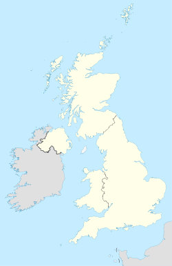
 CH
CHPostcode area CH Postcode area name Chester Post towns 13 Postcode districts 36 Postcode sectors 212 Postcodes (live) 18,857 Postcodes (total) 22,269 Statistics as at October 2006 [1] The CH postcode area, also known as the Chester postcode area,[2] is a group of postcode districts near the England/Wales border. Having previously roughly covered the former Chester district and present-day Flintshire county, postcodes for the Wirral Peninsula (CH41-CH66) were transferred to it in 1999 from the L postcode area.[3] It includes Birkenhead, Chester, Ellesmere Port, Neston, Prenton and Wallasey in England and Bagillt, Buckley, Connah's Quay, Flint, Holywell and Mold in Wales.
Contents
Coverage
The approximate coverage of the postcode districts:
Postcode district Post town Coverage Local authority area CH1 CHESTER Blacon, Chester, Higher Ferry, Capenhurst, Backford Cheshire West and Chester, Flintshire County Council CH2 CHESTER Backford, Chester, Elton, Hoole, Ince, Mickle Trafford, Moston Cheshire West and Chester CH3 CHESTER Boughton, Chester, Huntington, Mouldsworth, Tarvin, Tattenhall, Farndon Cheshire West and Chester CH4 CHESTER Chester, Handbridge, Lache, Pulford, Penyffordd, Broughton, Saltney Cheshire West and Chester, Flintshire County Council CH5 DEESIDE Connah's Quay, Shotton, Queensferry, Sealand, Sandycroft, Dobshill, Ewloe Flintshire CH6 BAGILLT, FLINT Flint, Oakenholt, Flint Mountain, The Nant, Bagillt Flintshire CH7 BUCKLEY, MOLD Buckley, Leeswood, Treuddyn, Llanarmon-yn-Ial, Caerwys, Mold, Northop Hall, Drury Flintshire, Denbighshire council CH8 HOLYWELL Holywell, Milwr, Holway, Carmel, Lloc, Bryn Celyn, Greenfield, Halkyn, Lixwm, Talacre Flintshire CH25 BIRKENHEAD PO Boxes Metropolitan Borough of Wirral CH26 PRENTON PO Boxes Wirral CH27 WALLASEY Wallasey[nb 1] Wirral CH28 WIRRAL PO Boxes in Moreton Wirral CH29 WIRRAL PO Boxes in Hoylake Wirral CH30 WIRRAL PO Boxes in Upton Wirral CH31 WIRRAL PO Boxes in Heswall Wirral CH32 WIRRAL PO Boxes in New Ferry Wirral CH33 NESTON PO Boxes Cheshire West and Chester CH34 ELLESMERE PORT PO Boxes Cheshire West and Chester CH41 BIRKENHEAD Birkenhead, Claughton, Seacombe, Tranmere, Woodside Wirral CH42 BIRKENHEAD Birkenhead, Oxton, Prenton, Rock Ferry, Wirral CH43 PRENTON Bidston, Noctorum, Oxton, Prenton Wirral CH44 WALLASEY Egremont, Liscard, Poulton, Seacombe, Wallasey, Wirral CH45 WALLASEY New Brighton, Wallasey, Wallasey Village Wirral CH46 WIRRAL Leasowe, Moreton Wirral CH47 WIRRAL Hoylake, Meols, Saughall Massie, West Kirby Wirral CH48 WIRRAL Caldy, Frankby, Grange, Greasby, Hoylake, Meols, Newton, Saughall Massie, West Kirby Wirral CH49 WIRRAL Greasby, Landican, Upton, Woodchurch Wirral CH60 WIRRAL Gayton, Heswall Wirral CH61 WIRRAL Barnston, Heswall, Irby, Pensby, Thingwall, Thurstaston Wirral CH62 WIRRAL Bromborough, Eastham, New Ferry, Port Sunlight, Spital, Wirral CH63 WIRRAL Bebington, Brimstage, Bromborough, Clatterbridge, Higher Bebington, Raby, Raby Mere, Spital, Storeton, Thornton Hough, Wirral CH64 NESTON Little Neston, Ness, Neston, Parkgate, Puddington, Willaston, Cheshire West and Chester CH65 ELLESMERE PORT Ellesmere Port, Great Sutton, Whitby, Wolverham Cheshire West and Chester CH66 ELLESMERE PORT Childer Thornton, Ellesmere Port, Great Sutton, Hooton, Ledsham, Little Sutton, Overpool, Whitby, Cheshire West and Chester CH70 CHESTER Department for Work and Pensions[4] CH88 CHESTER North West Securities Bank[4] CH99 CHESTER Benefits Agency[4], St. Michaels Financial Services & Chargecard[4] Adjacent areas
Adjacent postcode areas L WA 
LL  CH
CH 
CW 
SY Clockwise from the east, the adjacent postcode areas are: CW (Crewe), SY (Shrewsbury), LL (Llandudno), L (Liverpool), WA (Warrington).
See also
Notes
- ^ This may only be used for PO Boxes now. There are live geographical postcodes, but (for example) Wallasey Town Hall is usually given the postcode CH44 8ED rather than CH27 9ZZ.
References
- ^ "National Statistics Postcode Directory" (PDF). Office for National Statistics Postcode Directory (November 2006). Office for National Statistics. November 2006. http://www.statistics.gov.uk/geography/downloads/NSPDVersionNotes.pdf. Retrieved 2009-05-29.
- ^ Royal Mail, Address Management Guide, (2004)
- ^ "Why we are changing postcodes \u2013 Royal Mail". Wirral Globe website. Newsquest Media Group. 1999-03-18. http://archive.wirralglobe.co.uk/1999/3/18/15609.html. Retrieved 2009-05-29.
- ^ a b c d "RM non-geographical postcode list". ftp://ftp.royalmail.com/Downloads/public/cmwalk/doc/active/doc41700003/09sep%20current%20non%20geographical%20postcodes.pdf.
Postcode areas in the United Kingdom, Channel Islands and Isle of Man AB AL B BA BB BD BH BL BN BR BS BT BX CA CB CF CH CM CO CR CT CV CW DA DD DE DG DH DL DN DT DY E EC EH EN EX FK FY G GIR GL GU GY HA HD HG HP HR HS HU HX IG IM IP IV JE KA KT KW KY L LA LD LE LL LN LS LU M ME MK ML N NE NG NN NP NR NW OL OX PA PE PH PL PO PR RG RH RM S SA SE SG SK SL SM SN SO SP SR SS ST SW SY TA TD TF TN TQ TR TS TW UB W WA WC WD WF WN WR WS WV YO ZE
Categories:- Chester
- Postcode areas covering Wales
- Postcode areas covering North West England

Wikimedia Foundation. 2010.