Clarendon County, New South Wales

Clarendon County, New South Wales
Clarendon
New South Wales
Clarendon NSW.PNG
Location in New South Wales
Lands administrative divisions around Clarendon
Bourke Bland Bland
Bourke Clarendon Harden
Mitchell Wynyard Buccleuch

Clarendon County is one of the 141 Cadastral divisions of New South Wales. It contains the towns of Gundagai, Junee and Bethungra. The Murrumbidgee River is the boundary to the south.

Clarendon County was named in honour of George William Frederick Villiers, 4th Earl Clarendon (1800-1870).[1]

The Murrumbidgee River at Gundagai; the boundary between Clarendon and Wynyard

Parishes within this county

A full list of parishes found within this county; their current LGA and mapping coordinates to the approximate centre of each location is as follows:

Parish LGA Coordinates
Bethungra Junee Shire Council 34°43′54″S 147°50′04″E / 34.73167°S 147.83444°E / -34.73167; 147.83444 (Bethungra)
Bilda Junee Shire Council 35°04′54″S 147°39′04″E / 35.08167°S 147.65111°E / -35.08167; 147.65111 (Bilda)
Billabung Junee Shire Council 34°47′54″S 147°48′04″E / 34.79833°S 147.80111°E / -34.79833; 147.80111 (Billabung)
Boree Junee Shire Council 34°50′54″S 147°39′04″E / 34.84833°S 147.65111°E / -34.84833; 147.65111 (Boree)
Bulgan City of Wagga Wagga 34°57′54″S 147°20′04″E / 34.965°S 147.33444°E / -34.965; 147.33444 (Bulgan)
Bute Junee Shire Council 34°35′54″S 147°46′04″E / 34.59833°S 147.76778°E / -34.59833; 147.76778 (Bute)
Claris Junee Shire Council 34°59′54″S 147°40′04″E / 34.99833°S 147.66778°E / -34.99833; 147.66778 (Claris)
Cooba Junee Shire Council 34°55′54″S 147°52′04″E / 34.93167°S 147.86778°E / -34.93167; 147.86778 (Cooba)
Eunanoreenya City of Wagga Wagga 35°03′54″S 147°29′04″E / 35.065°S 147.48444°E / -35.065; 147.48444 (Eunanoreenya)
Eurongilly Junee Shire Council 34°55′54″S 147°45′04″E / 34.93167°S 147.75111°E / -34.93167; 147.75111 (Eurongilly)
Gobbagombalin City of Wagga Wagga 35°02′54″S 147°18′04″E / 35.04833°S 147.30111°E / -35.04833; 147.30111 (Gobbagombalin)
Gwynne Junee Shire Council 34°47′54″S 147°30′04″E / 34.79833°S 147.50111°E / -34.79833; 147.50111 (Gwynne)
Houlaghan Junee Shire Council 34°43′40″S 147°32′43″E / 34.72778°S 147.54528°E / -34.72778; 147.54528 (Houlaghan)
Hurley Junee Shire Council 34°36′54″S 147°41′04″E / 34.615°S 147.68444°E / -34.615; 147.68444 (Hurley)
Ironbong Junee Shire Council 34°44′54″S 147°45′04″E / 34.74833°S 147.75111°E / -34.74833; 147.75111 (Ironbong)
Ivor Junee Shire Council 34°44′54″S 147°40′04″E / 34.74833°S 147.66778°E / -34.74833; 147.66778 (Ivor)
Jeralgambeth Junee Shire Council 34°59′54″S 147°35′04″E / 34.99833°S 147.58444°E / -34.99833; 147.58444 (Jeralgambeth)
Junee Junee Shire Council 34°47′54″S 147°33′04″E / 34.79833°S 147.55111°E / -34.79833; 147.55111 (Junee)
Kimo Gundagai Shire Council 35°02′54″S 148°00′04″E / 35.04833°S 148.00111°E / -35.04833; 148.00111 (Kimo)
Malebo Junee Shire Council 34°55′54″S 147°23′04″E / 34.93167°S 147.38444°E / -34.93167; 147.38444 (Malebo)
Maror Junee Shire Council 34°50′54″S 147°28′04″E / 34.84833°S 147.46778°E / -34.84833; 147.46778 (Maror)
Merrybundinah Junee Shire Council 34°51′54″S 147°48′04″E / 34.865°S 147.80111°E / -34.865; 147.80111 (Merrybundinah)
Mitta Mitta Junee Shire Council 34°51′54″S 147°54′04″E / 34.865°S 147.90111°E / -34.865; 147.90111 (Mitta Mitta)
Nangus Gundagai Shire Council 35°00′54″S 147°57′04″E / 35.015°S 147.95111°E / -35.015; 147.95111 (Nangus)
North Gundagai Gundagai Shire Council 35°00′54″S 148°04′04″E / 35.015°S 148.06778°E / -35.015; 148.06778 (North Gundagai)
North Wagga Wagga City of Wagga Wagga 35°03′54″S 147°23′04″E / 35.065°S 147.38444°E / -35.065; 147.38444 (North Wagga Wagga)
Oura City of Wagga Wagga 35°03′54″S 147°33′04″E / 35.065°S 147.55111°E / -35.065; 147.55111 (Oura)
Sebastopol Temora Shire Council 34°35′54″S 147°34′04″E / 34.59833°S 147.56778°E / -34.59833; 147.56778 (Sebastopol)
South Junee Junee Shire Council 34°53′54″S 147°31′04″E / 34.89833°S 147.51778°E / -34.89833; 147.51778 (South Junee)
Tenandra Junee Shire Council 34°59′54″S 147°50′04″E / 34.99833°S 147.83444°E / -34.99833; 147.83444 (Tenandra)
Trevethin Junee Shire Council 34°40′54″S 147°40′04″E / 34.68167°S 147.66778°E / -34.68167; 147.66778 (Trevethin)
Ulandra Junee Shire Council 34°45′54″S 147°54′04″E / 34.765°S 147.90111°E / -34.765; 147.90111 (Ulandra)
Wallace City of Wagga Wagga 34°57′54″S 147°28′04″E / 34.965°S 147.46778°E / -34.965; 147.46778 (Wallace)
Wantabadgery Junee Shire Council 34°59′54″S 147°45′04″E / 34.99833°S 147.75111°E / -34.99833; 147.75111 (Wantabadgery)
Wantiool Junee Shire Council 34°54′54″S 147°39′04″E / 34.915°S 147.65111°E / -34.915; 147.65111 (Wantiool)
Warre Warral Junee Shire Council 34°38′54″S 147°32′04″E / 34.64833°S 147.53444°E / -34.64833; 147.53444 (Warre Warral)

References


Wikimedia Foundation. 2010.

Игры ⚽ Поможем решить контрольную работу

Look at other dictionaries:

  • Wynyard County, New South Wales — Infobox Australian cadastral name = Wynyard state = New South Wales caption = Location in New South Wales near nw = Bourke near n = Clarendon near ne = Harden near e = Buccleuch near se = Selwyn near s = Selwyn near sw = Goulburn near w =… …   Wikipedia

  • Buccleuch County, New South Wales — Infobox Australian cadastral name = Buccleuch state = New South Wales caption = Location in New South Wales near nw = Clarendon near n = Harden near ne = Harden near e = Cowley near se = Wallace near s = Wallace near sw = Selwyn near w =… …   Wikipedia

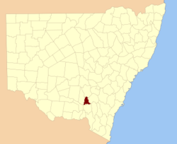
  • Bourke County, New South Wales — Infobox Australian cadastral name = Bourke state = New South Wales caption = Location in New South Wales near nw = Dowling near n = Gipps near ne = Bland near e = Clarendon near se = Wynyard near s = Mitchell near sw = Mitchell near w =… …   Wikipedia

  • Harden County, New South Wales — Infobox Australian cadastral name = Harden state = New South Wales caption = Location in New South Wales near nw = Bland near n = Monteagle near ne = King near e = King near se = Murray near s = Buccleuch near sw = Wynyard near w =… …   Wikipedia

  • Bland County, New South Wales — Infobox Australian cadastral name = Bland state = New South Wales caption = Location in New South Wales near nw = Gipps near n = Gipps near ne = Forbes near w = Bourke near e = Monteagle near sw = Bourke near s = Clarendon near se = HardenBland… …   Wikipedia

  • Mitchell County, New South Wales — Map of all coordinates from Google Map of all coordinates from Bing Export all coordinates as KML …   Wikipedia

  • Clarendon County, South Carolina — Location in the state of South Carolina …   Wikipedia

  • Clarendon County — may refer to: Clarendon County, New South Wales, Australia Clarendon County, South Carolina, USA This disambiguation page lists articles about distinct geographical locations with the same name. If an …   Wikipedia

  • Wagga Wagga, New South Wales — Infobox Australian Place type=city name=Wagga Wagga state=New South Wales caption=Looking down Baylis Street lga=City of Wagga Wagga county=Wynyard Clarendon stategov=Wagga Wagga fedgov=Riverina elevation=147 maxtemp = 22.0 mintemp = 9.0 rainfall …   Wikipedia

  • Mitta Mitta, New South Wales — This article is about the locality in New South Wales, Australia. For the town in Victoria, Australia, see Mitta Mitta, Victoria. Mitta Mitta New South Wales …   Wikipedia

Share the article and excerpts

Direct link
Do a right-click on the link above
and select “Copy Link”