- Allegheny County, Pennsylvania
-
Allegheny County, Pennsylvania 
Flag
Seal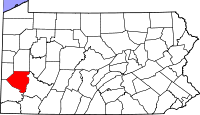
Location in the state of Pennsylvania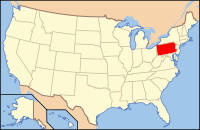
Pennsylvania's location in the U.S.Founded September 24, 1788 Seat Pittsburgh Largest city Pittsburgh Area
- Total
- Land
- Water
745 sq mi (1,929 km²)
730 sq mi (1,891 km²)
15 sq mi (39 km²), 1.95%Population
- (2010)
- Density
1,223,348
1,675.8/sq mi (646.9/km²)Website www.county.allegheny.pa.us Allegheny County is a county in the southwestern part of the U.S. state of Pennsylvania. As of the 2010 census, the population was 1,223,348; making it the second most populous county in Pennsylvania, following Philadelphia County. The county seat is Pittsburgh. The county forms the nucleus of the Pittsburgh metropolitan area, Pittsburgh DMA, and Pittsburgh Tri-state area.
Contents
History
Allegheny County was the first in Pennsylvania to be given a Native American name, being named after the Allegheny River. The word "Allegheny" is of Lenape origin, with uncertain meaning. It is usually said to mean "fine river", but sometimes said to refer to an ancient mythical tribe called "Allegewi" who lived along the river long ago before being destroyed by the Lenape.[1]
Not a great deal is known about the native inhabitants of the region prior to European contact. During the colonial era various native groups claimed or settled in the area, resulting in a multi-ethnic mix that included Iroquois, Lenape, Shawnee, and Mingo.
The first Europeans to enter the area were the French in 1749. Captain Pierre Joseph de Celeron, sieur de Blainville claimed the Ohio Valley and all of western Pennsylvania for Louis XV of France. The captain traveled along the Ohio and Allegheny rivers inserting lead plates in the ground to mark the land for France.
Since most of the towns during that era were developed along waterways, both the French and the British desired control over the local rivers. Therefore, the British sent Major George Washington to try to compel the French to leave their posts, with no success. Having failed in his mission, he returned and nearly drowned crossing the ice-filled Allegheny River. In 1754, the English tried again to enter the area. This time, they sent 41 Virginians to build Fort Prince George. The French got news of the plan and sent an army to take over the fort, which they then resumed building with increased fortification, renaming it Fort Duquesne.
The loss of the fort cost the English dearly because Fort Duquesne became one of the focal points of the French and Indian War. The first attempt to retake the fort, the Braddock Expedition, failed miserably.[2] It was not until General John Forbes attacked in 1758, four years after they had lost the original fort, that they recaptured and destroyed it. They subsequently built a new fort on the site, including a moat, and named it Fort Pitt. The site is now Pittsburgh's Point State Park.
Both Pennsylvania and Virginia claimed the region that is now Allegheny County. Pennsylvania administered most of the region as part Westmoreland County. Virginia considered everything south of the Ohio River and east of the Allegheny River to be part of its Yohogania County and governed it from Fort Dunmore. In addition, parts of the county were located in the proposed British colony of Vandalia and the proposed U.S. state of Westsylvania. The overlapping boundaries, multiple governments, and confused deed claims soon proved unworkable. In 1780 Pennsylvania and Virginia agreed to extend the Mason–Dixon line westward, and the region became part of Pennsylvania. From 1781 until 1788, much of what had been claimed as part of Yohogania County, Virginia, was administered as a part of the newly created Washington County, Pennsylvania.
Allegheny County was officially created on September 24, 1788, from parts of Washington and Westmoreland counties. It was formed due to pressure from settlers living in the area around Pittsburgh, which became the county seat in 1791. The county originally extended all the way north to the shores of Lake Erie and became the "mother county" for most of what is now northwestern Pennsylvania. By 1800, the county's current borders were set.
In the 1790s, a whiskey excise tax was imposed by the United States federal government. This started the so-called Whiskey Rebellion when the farmers who depended on whiskey income refused to pay and drove off a local town's marshal. After a series of demonstrations by farmers, President George Washington sent troops to stop the rebellion.
The area developed rapidly throughout the 19th century to become the center of steel production in the nation. Pittsburgh would later be labeled the "Steel Capital of the World".
Law and government
For most of the 20th century, until 1999, Allegheny County was governed exclusively under the state's Second Class County Code. Under this code, the county handled everything: elections, prisons, airports, public health and city planning. Unlike the rest of the state, where certain public offices are combined and held by one person, in Allegheny County all public offices are held by elected individuals.
Before the implementation of the home-rule charter on January 1, 2000, there were three county commissioners. These were replaced with an elected chief officer (the county executive), a county council with 15 members (13 elected by district, two elected county-wide), and an appointed county manager. The changes were intended to maintain a separation of powers between the executive and legislative branches while providing the citizens with greater control over the government.
 County Medical Examiner office
The county has 130 municipalities, each governing itself; no other county in Pennsylvania has nearly as many, with Luzerne County's 76 being second.[3] The county has one Second Class City (Pittsburgh) and three Third Class Cities (Clairton, Duquesne, and McKeesport).
A 2004 study by the University of Pittsburgh stated that Allegheny County would be better served by consolidating the southeastern portion of the county (which includes many small, poor communities) into one large municipality, called "Rivers City," which would have a combined population of approximately 250,000. [1]
State relations
Under the Dan Onorato administration, Allegheny County has paid $10,000 per month to Robert Ewanco, of Greenlee Partners, to lobby the Pennsylvania General Assembly.[4][5] County officials credit him with a "20-fold" return in the form of appropriations for a widening project on Pennsylvania Route 28, as well as a footbridge and security cameras at Duquesne University.[5]
County Executive
- Rich Fitzgerald, Democrat
County Council
- Matt Drozd, District 1, Republican
- Jan Rea, District 2, Republican
- James Burn Jr., District 3, Democrat
- Michael J. Finnerty, District 4, Democrat
- Vince Gastgeb, District 5, Republican
- Joan Cleary, District 6, Democrat
- Nicholas Futules, District 7, Democrat
- Charles Martoni, District 8, Vice-President, Democrat
- Robert J. Macey, District 9, Democrat
- William Russell Roberston, District 10, Democrat
- Rich Fitzgerald, District 11, President, Democrat
- James Ellenbogen, District 12, Democrat
- Amanda Green, District 13, Democrat
- John DeFazio, At-large, Democrat
- Chuck McCullogh, At-large, Republican
Other elected county offices
- Controller, Mark Patrick Flaherty, Democrat
- District Attorney, Stephen A. Zappala Jr., Democrat
- Sheriff, William P. Mullen, Democrat
- Treasurer, John K. Weinstein, Democrat
Politics
Presidential Election Results 1960–2008 Year Democrat Republican 2008 57.20% 368,453 41.89% 269,819 2004 57.15% 368,912 42.13% 271,925 2000 56.65% 329,963 40.41% 235,361 1996 52.82% 284,480 37.89% 204,067 1992 52.75% 324,004 29.80% 183,035 1988 59.51% 348,814 39.43% 231,137 1984 55.96% 372,576 42.76% 284,692 1980 47.87% 297,464 43.75% 271,850 1976 50.68% 328,343 46.79% 303,127 1972 42.26% 282,496 55.60% 371,737 1968 51.12% 364,906 37.09% 264,790 1964 66.03% 475,207 33.58% 241,707 1960 57.07% 428,455 42.76% 320,970 As of November 2008, there are 955,982 registered voters in Allegheny County [2].
- Democratic: 595,149 (62.26%)
- Republican: 256,291 (26.81%)
- Other Parties: 104,542 (10.94%)
The Republican Party had been historically dominant in county-level politics; prior to the Great Depression Pittsburgh and Allegheny County had been Republican. Since the Great Depression on the state and national levels, the Democratic Party has been dominant in county-level politics and is the Democratic stronghold of western Pennsylvania. In 2000, Democrat Al Gore won 56% of the vote and Republican George W. Bush won 41%. In 2004, Democrat John Kerry received 57% of the vote and Bush received 42%. In 2006, Democrats Governor Ed Rendell and Senator Bob Casey, Jr. won 59% and 65% of the vote in Allegheny County, respectively. In 2008, Democrat Barack Obama received 57% of the vote, John McCain received 41%, and each of the three state row office winners (Rob McCord for Treasurer, Jack Wagner for Auditor General, and Tom Corbett for Attorney General) also carried Allegheny.
State senators
- John Pippy, Republican, 37th district
- Jim Ferlo, Democrat, 38th district
- Jane Clare Orie, Republican, 40th district
- Wayne D. Fontana, Democrat, 42nd district
- Jay Costa, Democrat, 43rd district
- Sean Logan, Democrat, 45th district
- Barry Stout, Democrat, 46th district
- Elder Vogel, Republican, 47th district
US representatives
- Jason Altmire, Democrat, 4th district
- Michael F. Doyle, Democrat, 14th district
- Tim Murphy, Republican, 18th district
Geography
Allegheny County is known for the three major rivers that flow through it: the Allegheny River and the Monongahela River converge at Downtown Pittsburgh to form the Ohio River. The Youghiogheny River flows into the Monongahela River at McKeesport, 10 miles (16 km) southeast. Several islands are located within the riverine systems. Water from these rivers eventually flows into the Gulf of Mexico via the Mississippi River. Although the county's industrial growth caused the clearcutting of forests, a significant woodland remains.
According to the U.S. Census Bureau, the county has a total area of 745 square miles (1,930 km2); 730 square miles (1,900 km2) is land and 15 square miles (39 km2) (1.95%) is water.
Adjacent counties
- Butler County (north)
- Armstrong County (tangent to the northeast)
- Westmoreland County (east)
- Washington County (southwest)
- Beaver County (northwest)
Demographics
Historical populations Census Pop. %± 1790 10,203 — 1800 15,087 47.9% 1810 25,317 67.8% 1820 34,921 37.9% 1830 50,552 44.8% 1840 81,235 60.7% 1850 138,290 70.2% 1860 178,831 29.3% 1870 262,204 46.6% 1880 355,869 35.7% 1890 551,959 55.1% 1900 775,058 40.4% 1910 1,018,463 31.4% 1920 1,185,808 16.4% 1930 1,374,410 15.9% 1940 1,411,539 2.7% 1950 1,515,237 7.3% 1960 1,628,587 7.5% 1970 1,605,016 −1.4% 1980 1,450,085 −9.7% 1990 1,336,449 −7.8% 2000 1,281,666 −4.1% 2010 1,223,348 −4.6% [6] As of the census of 2010, there were 1,223,348 people residing in the county. The population density was 1676 people per square mile (647/km²). The racial makeup of the county was 80.87% White, 14.39% Black or African American, 2.94% Asian, 0.03% Pacific Islander, 0.37% from other races, and 1.40% from two or more races. About 1.31% of the population were Hispanic or Latino of any race.
At the census[7] of 2000, there were 1,281,666 people, 537,150 households, and 332,495 families residing in the county. The population density was 1,755 people per square mile (678/km²). There were 583,646 housing units at an average density of 799 per square mile (309/km²). The racial makeup of the county was 84.33% White, 12.41% Black or African American, 0.12% Native American, 1.69% Asian, 0.03% Pacific Islander, 0.34% from other races, and 1.07% from two or more races. About 0.87% of the population were Hispanic or Latino of any race. 20.0% were of German, 15.0% Italian, 12.7% Irish, 7.5% Polish and 5.1% English ancestry according to Census 2000. 93.5% spoke English and 1.3% Spanish as their first language.
There were 537,150 households out of which 26.40% had children under the age of 18 living with them, 46.10% were married couples living together, 12.40% had a female householder with no husband present, and 38.10% were non-families. Some 32.70% of all households were made up of individuals and 13.20% had someone living alone who was 65 years of age or older. The average household size was 2.31 and the average family size was 2.96.
The population was spread out with 21.90% under the age of 18, 8.50% from 18 to 24, 28.30% from 25 to 44, 23.40% from 45 to 64, and 17.80% who were 65 years of age or older. The median age was 40. For every 100 females, there were 90.00 males; for every 100 females age 18 and over, there were 86.20 males.
Economy
See also: Economy of PittsburghIn the late 18th century farming played a critical role in the growth of the area. There was a surplus of grain due to transportation difficulties in linking with the eastern portion of the state. As a result, the farmers distilled the grain into whiskey, which significantly helped the farmers financially.
The area quickly became one of the key manufacturing areas in the young nation. Coupled with deposits of iron and coal, and the easy access to waterways for barge traffic, the city quickly became one of the most important steel producing areas in the world. Based on 2007 data from the US Army Corps of Engineers, Pittsburgh is the second busiest inland port in the nation.
With the decline of the steel industry in the US, the area shifted to other industries. Today, it is known for its hospitals, universities, and industrial centers. Despite the decline of heavy industry, Pittsburgh is home to a number of major companies and is ranked in the top ten among US cities hosting headquarters of Fortune 500 corporations. These include U.S. Steel Corporation, PNC Financial Services Group, PPG Industries, and H. J. Heinz Company.
Regions
Municipalities
 Map of Allegheny County, Pennsylvania, with municipal labels showing cities and boroughs (red), townships (white), and census-designated places (blue)
Under Pennsylvania law, there are four types of incorporated municipalities: cities, boroughs, townships, and, in at most two cases, towns. Allegheny County also labels four of its municipalities as being simply "Municipalities" without using any of the specific qualifying labels.[8] The following cities, municipalities, boroughs and townships are in Allegheny County:
Cities
Municipalities
- Bethel Park
- Monroeville
- Mt. Lebanon
- Penn Hills
Boroughs
Townships
- Aleppo Township
- Baldwin Township
- Collier Township
- Crescent Township
- East Deer Township
- Elizabeth Township
- Fawn Township
- Findlay Township
- Forward Township
- Frazer Township
- Hampton Township
- Harmar Township
- Harrison Township
- Indiana Township
- Kennedy Township
- Kilbuck Township
- Leet Township
- Marshall Township
- McCandless
- Moon Township
- Neville Township
- North Fayette Township
- North Versailles Township
- O'Hara Township
- Ohio Township
- Pine Township
- Reserve Township
- Richland Township
- Robinson Township
- Ross Township
- Scott Township
- Shaler Township
- South Fayette Township
- South Park Township
- South Versailles Township
- Springdale Township
- Stowe Township
- Upper St. Clair
- West Deer Township
- Wilkins Township
Census-designated places
Census-designated places are geographical areas designated by the US Census Bureau for the purposes of compiling demographic data. They are not actual jurisdictions under Pennsylvania law. Other unincorporated communities, such as villages, may be listed here as well.
- Acmetonia
- Allison Park
- Bairdford
- Blackridge
- Blanchard
- Boston
- Broughton
- Bruceton
- Carnot-Moon
- Clinton
- Creighton
- Curtisville
- Dorseyville
- Gibsonia
- Greenock
- Harmarville
- Hickory Heights
- Imperial-Enlow
- Ingomar
- Karns
- Keown Station
- Kirwan Heights
- Library
- Mount Vernon
- Natrona
- Natrona Heights
- Regent Square
- Rennerdale
- Russellton
- Sturgeon-Noblestown
- Wexford
- Wildwood
Former municipalities and political subdivisions
Many political subdivisions of Allegheny County have come and gone through subdivision or annexation through the years. These include:
- Allegheny City – the area that is now the North Shore (or North Side) of the City of Pittsburgh, north of the Allegheny River.
- Allentown Borough – now the neighborhood of Allentown in Pittsburgh.
- Birmingham Borough – what is now Pittsburgh's South Side.
- Carrick Borough – now the neighborhood of Carrick. Formed out of Baldwin Township in 1904, this borough existed until it was annexed by Pittsburgh in 1927. It was named for Carrick-on-Suir, Ireland. To this day, some of the manhole covers bear the Carrick Borough name.
- Collins Township – in what is now the Strip District and Lawrenceville of the City of Pittsburgh.
- McClure Township – McClure was formed in 1858 from the section of Ross Township adjacent to Allegheny City. In 1867 McClure, along with sections of Reserve Township, was incorporated into Allegheny City. The McClure section of this annexation became Wards 9 (Woods Run Area) and 11 (present day Brighton Heights) in the City of Pittsburgh.
- Patton Township – was in east central part of the county, north of North Versailles Township, east of Wilkins and Penn Townships, and south of Plum Township. In U.S. census for 1860–1880.
- Peebles Township – included most of what is now the eastern part of the city of Pittsburgh from the Monongahela River in the south (today's Hazelwood) to the Allegheny River in the north. It was subdivided into Collins and Liberty townships, all of which were incorporated into Pittsburgh in 1868.
- St. Clair Township – stretched from the Monongahela River south to the Washington County line. It divided into Lower St. Clair, which eventually became part of the City of Pittsburgh, and Upper St. Clair.
- Snowden – now known as South Park Township.
- Temperanceville – what is now Pittsburgh's West End.
- Union Borough – the area surrounding Temperanceville.
Education
Colleges and universities
- The Art Institute of Pittsburgh
- Byzantine Catholic Seminary of SS. Cyril and Methodius
- Carlow University
- Carnegie Mellon University
- Chatham University
- DeVry University
- Duquesne University
- La Roche College
- Penn State Greater Allegheny
- Pittsburgh Theological Seminary
- Point Park University
- Reformed Presbyterian Theological Seminary
- Robert Morris University
- University of Pittsburgh
Community, junior and technical colleges
- Bidwell Training Center
- Bradford School
- Career Training Academy
- Community College of Allegheny County
- Dean Institute of Technology
- Duff's Business Institute
- ICM School of Business and Medical Careers
- International Academy of Design and Technology
- ITT Technical Institute
- Le Cordon Bleu Institute of Culinary Arts in Pittsburgh
- Median School of Allied Health Careers
- Pittsburgh Beauty Academy
- Pittsburgh Institute of Aeronautics
- Pittsburgh Institute of Mortuary Science
- Pittsburgh Technical Institute
- Rosedale Technical Institute
- Triangle Tech
- Western School of Health and Business Careers
Public school districts
 Map of Allegheny County, Pennsylvania Public School Districts
Public charter schools
Pennsylvania charter schools participate in PSSA testing just like all public schools.
- Environmental Charter School at Frick Park – 3rd grade
- Manchester Academic Charter School – Liverpool Street, Pittsburgh
- MT Lebanon Montessori School and Academy PreK age 3 through 6th grade
- Northside Urban Pathways Charter School 6th–12th grades
- PA Learners Online Charter School – public cyber school
- Propel East – Turtle Creek
- Propel Homestead – Homestead
- Propel Montour – Kennedy Township
- Propel Andrew Street High School – Munhall
- Spectrum Charter School – 7th–12th grades Monroeville
- Urban League of Greater Pittsburgh Charter School – Kindergarten-5th grades Wood Street, Pittsburgh
Approved private schools and charter schools for the blind and deaf
The Commonwealth of Pennsylvania has 36 Approved Private Schools including the Charter Schools for the Blind and Deaf. Students attending these schools come from across the commonwealth. The private schools are licensed by the State Board of Private Academic Schools. They provide a free appropriate special education for students with severe disabilities. The cost of tuition for these schools is paid 60% by the state and 40% by the local school district where the student is a resident. Pennsylvania currently has four PA chartered and 30 non-charter APSs for which the Department approves funding. These schools provide a program of special education for over 4,000 day and residential students. Parents are not charged for the services at the school.[9] In 2009, the Pennsylvania Department of Education budgeted $98 million for tuition of children in approved private schools and $36.8 million for students attending the charter schools for the deaf and blind.[10] The majority of these schools are located in the southeastern region and southwestern region of Pennsylvania.
- ACLD Tillotson School, Pittsburgh – Tuition rate $38,804
- The Day School at The Children's Institute, Pittsburgh – Tuition rate $55,217
- DePaul School for Hearing and Speech, Pittsburgh – Tuition rate $36,892
- Easter Seal Society of Western Pennsylvania – Tuition rate $60,891.97
- The Education Center at the Watson Institute, Sewickley – Tuition rate $42,242
- Pace School, Pittsburgh – Tuition rate – $37,635
- Pressley Ridge Day School, Pittsburgh – Tuition rate – $51,177
- Pressley Ridge School for the Deaf, Pittsburgh – Tuition rate – $66,022, residential $128,376
- The Watson Institute Friendship Academy, Pittsburgh – Tuition rate – $38,211
- Wesley Spectrum Highland Services, Pittsburgh – Tuition rate – $39,031
- Western Pennsylvania School for Blind Children, Pittsburgh – Tuition rate – $82,500, residential $120,100
- Western Pennsylvania School for the Deaf, Pittsburgh – Tuition rate – $61,051, residential – $99,919
Private high schools
- Bishop Canevin High School
- Central Catholic High School
- Mount Alvernia High School
- North Catholic High School
- Oakland Catholic High School
- Our Lady of the Sacred Heart High School
- Serra Catholic High School
- Seton-La Salle Catholic High School
- Sewickley Academy
- Shady Side Academy
- St. Joseph High School
21st Century Community Learning Centers
These are state designated before and after school program providers. They receive state funding through grants. CCLCs provide academic, artistic and cultural enhancement activities to students and their families when school is not in session.[11]
- Boys & Girls Clubs of Western PA – 2010 Grant – $261,748
- Cornell School District – 2010 Grant – $526,800
- Human Services Center Corporation – 2010 Grant- $550,000
- McKeesport Area School District – 2010 Grant – $468,000
- Penn Hills School District – 2010 Grant – $360,000
- The Hill House/One Small Step −2010 Grant – $675,000
- Wireless Neighborhoods – 2010 Grant – $612,000
Transportation
Allegheny County's public transportation provider is the Port Authority of Allegheny County. The Allegheny County Department of Public Works oversees infrastructure, maintenance and engineering services in the county.
Major roadways
 Interstate 79 runs north to south from Wexford to Bridgeville
 Interstate 279 runs north to south from the North Hills to Downtown
 Interstate 579 (Crosstown Boulevard)
 Interstate 76 /
  PA Turnpike runs east to west from I-376 in Monroeville to the Warrendale interchange (near I-79)
 Interstate 376 runs east to west from the eastern suburbs (Monroeville, Plum, Penn Hills) across the county to Pittsburgh International Airport and beyond
 Pennsylvania Turnpike 576 (future I-576) (Findlay Connector)
 US Route 19 runs north to south from [[Wexford, Pennsylvania|Wexford|] to Mt. Lebanon
 US Route 22 runs west to east and makes up US Route 30 and I-376
 US Route 30 runs west to east and joins US 22 and I-376 near Pittsburgh International Airport
For information about major state roads, see list of State Routes in Allegheny County, Pennsylvania and Allegheny County Belt System.
Parks and recreation
There are two Pennsylvania state parks in Allegheny County. Point State Park is at the confluence of the Allegheny and Monongahela rivers in Downtown Pittsburgh, and Allegheny Islands State Park is in the Allegheny River in Harmar Township and is undeveloped as of August 2010.
The Regional Parks of Allegheny County, Pennsylvania Notable people
Further information: List of people from the Pittsburgh metropolitan areaMajor League Sports teams
- Pittsburgh Pirates, baseball team
- Pittsburgh Steelers, football team
- Pittsburgh Penguins, ice hockey team
See also
- List of municipal authorities in Allegheny County, Pennsylvania
- List of Pennsylvania state historical markers in Allegheny County
- National Register of Historic Places listings in Allegheny County, Pennsylvania
References
- ^ Stewart, George R. (1967) [1945]. Names on the Land: A Historical Account of Place-Naming in the United States (Sentry edition (3rd) ed.). Houghton Mifflin. pp. 8, 193. ISBN 1590172736.
- ^ Fiske, John (1902). New France and New England, pp. 290–92. Houghton Mifflin Company.
- ^ Pennsylvania Municipalities Information
- ^ "Lobbyist Profile – Ewanco, Robert J." (database). Pennsylvania Lobbyist Database. Pennsylvania General Assembly. Archived from the original on 2009-12-01. http://www.webcitation.org/5lhLyCa27.
- ^ a b Bumsted, Brad; Mike Wereschagin (November 29, 2009). "Lobbyist expenses wasteful, critics say". Pittsburgh Tribune Review. http://www.pittsburghlive.com/x/pittsburghtrib/news/pittsburgh/s_655376.html.
- ^ http://mapserver.lib.virginia.edu/
- ^ "American FactFinder". United States Census Bureau. http://factfinder.census.gov. Retrieved 2008-01-31.
- ^ "Allegheny County Municipality Map". Allegheny County Government. http://www.alleghenycounty.us/munimap/index.asp. Retrieved 12 December 2010.
- ^ Approved Private Schools and Chartered Schools for the Deaf and the Blind, Pennsylvania Department of Education website, accessed April 2010.
- ^ Tommasini, John, Assistant Secretary of Education, Testimony before the Pennsylvania Senate Education Committee Hearing on SB982 of 2010. given April 14, 2010.
- ^ Pennsylvania Awards $29.9 Million to Support 21st Century Community Learning Centers, Pennsylvania Department of Education Press Release, April 7, 2010
External links
- Allegheny County official website
- Allegheny County Quest
- County Map by Municipality
- Historic Pittsburgh Map Collection
- Southwest Pennsylvania Commission

Beaver County Butler County Armstrong County 
Westmoreland County  Allegheny County, Pennsylvania

Washington County Pittsburgh Metropolitan Area Principal city Counties Municipalities 30,000-50,000 population
(in 2010)Municipalities 15,000-30,000 population
(in 2010)Baldwin • Butler Township • Cranberry Township • Hampton Township • McCandless Township • McKeesport • Monroeville • Moon Township • Murrysville • New Castle • Penn Township • Peters Township • Plum • Scott Township • Shaler Township • Upper St. Clair Township • Unity Township • West Mifflin • WilkinsburgMunicipalities 10,000-15,000 population
(in 2010)Adams Township • Butler • Cecil Township • Center Township • Derry Township • Elizabeth Township • Franklin Park • Greensburg • Harrison Township • Hopewell Township • Jefferson Hills Lower Burrell • Mount Pleasant Township • Munhall • New Kensington • North Fayette Township • North Strabane Township • North Union Township • North Versailles Township • Pine Township • Richland Township • Robinson Township • Rostraver Township • South Fayette Township • South Park Township • South Union Township • Uniontown • Washington • West Deer Township • Whitehall50 largest metropolitan statistical areas in the United States by population - New York
- Los Angeles
- Chicago
- Dallas–Fort Worth
- Philadelphia
- Houston
- Washington
- Miami
- Atlanta
- Boston
- San Francisco–Oakland
- Detroit
- Riverside–San Bernardino
- Phoenix
- Seattle
- Minneapolis–St. Paul
- San Diego
- St. Louis
- Tampa–St. Petersburg
- Baltimore
- Memphis
- Louisville
- Richmond
- Oklahoma City
- Hartford
- New Orleans
- Buffalo
- Raleigh
- Birmingham
- Salt Lake City
 Commonwealth of Pennsylvania
Topics - Cities
- Politics
- Government
- Delegations
- History
- Geography
- Geology
- Pennsylvanians
- State parks
- Symbols
- Visitor attractions
Metro areas Cities Largest
municipalities- Baldwin
- Berwick
- Bethel Park
- Brentwood
- Carlisle
- Chambersburg
- Columbia
- Darby
- Dunmore
- Elizabethtown
- Emmaus
- Ephrata
- Franklin Park
- Hanover
- Indiana
- Kingston
- Lansdale
- Lansdowne
- Monroeville
- Munhall
- Murrysville
- Norristown
- Penn Hills
- Phoenixville
- Plum
- Pottstown
- State College
- West Chester
- West Mifflin
- Whitehall
- Wilkinsburg
- Wyomissing
- Yeadon
Regions - Allegheny Mountains
- Allegheny National Forest
- Allegheny Plateau
- Atlantic Coastal Plain
- Blue Ridge
- Coal Region
- Cumberland Valley
- Delaware Valley
- Dutch Country
- Endless Mountains
- Happy Valley
- Laurel Highlands
- Lehigh Valley
- Main Line
- Northeast
- Northern Tier
- Northwestern
- Oil Region
- Pennsylvania Highlands
- Piedmont
- The Poconos
- Ridge and Valley
- South Central
- Susquehanna Valley
- Western
- Wyoming Valley
Counties - Adams
- Allegheny
- Armstrong
- Beaver
- Bedford
- Berks
- Blair
- Bradford
- Bucks
- Butler
- Cambria
- Cameron
- Carbon
- Centre
- Chester
- Clarion
- Clearfield
- Clinton
- Columbia
- Crawford
- Cumberland
- Dauphin
- Delaware
- Elk
- Erie
- Fayette
- Forest
- Franklin
- Fulton
- Greene
- Huntingdon
- Indiana
- Jefferson
- Juniata
- Lackawanna
- Lancaster
- Lawrence
- Lebanon
- Lehigh
- Luzerne
- Lycoming
- McKean
- Mercer
- Mifflin
- Monroe
- Montgomery
- Montour
- Northampton
- Northumberland
- Perry
- Philadelphia
- Pike
- Potter
- Schuylkill
- Snyder
- Somerset
- Sullivan
- Susquehanna
- Tioga
- Union
- Venango
- Warren
- Washington
- Wayne
- Westmoreland
- Wyoming
- York
Categories:- Pennsylvania counties
- Allegheny County, Pennsylvania
- Ohio River counties
- Pittsburgh metropolitan area
- 1788 establishments


Wikimedia Foundation. 2010.