- Majadahonda
-
Majadahonda Gran Via, the pedestrianized center of Majadahonda

Flag
Coat of armsLocation of Majadahonda within Spain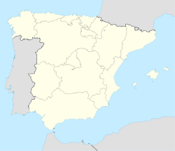
 Majadahonda
Coordinates: 40°23′N 3°43′W / 40.383°N 3.717°W Country  Spain
SpainRegion Madrid Province Madrid Province Metropolitan area of Madrid Government - Mayor Narciso de Foxá Alfaro (PP) Area - Total 38.48 km2 (14.9 sq mi) Elevation 743 m (2,438 ft) Population (2010) - Total 69,439 - Density 1,804.5/km2 (4,673.8/sq mi) Demonym Majariegos Time zone CET (UTC+1) - Summer (DST) CEST (UTC+2) Postal_codes_in_Spain 28220, 28221, 28222 Area code(s) 34 (Spain) + 91 (Madrid) Patron Saint St. Catherine of Alexandria Website Official website Majadahonda is a municipality in Spain, situated 16 km northwest of Madrid, in the Community of Madrid. In 2009 the population was 66,585 inhabitants .
It lies alongside the motorway A6 Madrid-A Coruña.
The Puerta de Hierro university (public) hospital was relocated to Majadahonda from the western part of the city of Madrid into a newly built medical complex in 2009.
Contents
History
Facts surrounding the original founding of Majadahonda are not readily verifiable, although some current residents of Majadahonda believe that the founders were Segovian shepherds who, by the 13th century, were based in the area, which, being poor agricultural land, was mostly used for grazing.
According to tradition, a small village emerged as a droving station called Majadahonda. Some archaeological findings include the remains of a Roman-Visigoth town tend to support the idea that a settlement was established in the 1st century AD, before being abandoned and then recolonized.
By the 16th century Majadahonda began to become proper village with a population of about 400 inhabitants. At the end of the 16th century there were almost two hundred houses and some 800 inhabitants. Majadahonda is mentioned in Miguel de Cervantes' Don Quixote and The Petty Thief by Francisco de Quevedo. The center of the village at the time was the Church of Santa Catherine, a small hospital and a modest inn. The town extended through the streets named San Roque, Calle Real and Calle Christ.
In the 17th century a dramatic reduction of population occurred. Tradition says that Majadahonda was on the verge of being sold to a private owner, as occurred at Boadilla del Monte and Pozuelo de Aravaca (which was renamed Pozuelo de Alarcón, after the sale). However, the protest of the inhabitants to Philip IV of Spain was effective and the sale was frustrated. In the 18th century a considerable population increase occurred, with some 800 inhabitants according to the census of Floridablanca. The majority of the men were day laborers, serving a minority of rich farmers and landed gentry.
In the early 19th century bad harvests, the plague, and the effects of the wars, left the town almost desolate. In 1812, during the War of Spanish Independence, it was the seat of a battle between the French and British troops, which left the town in ruins. Ecclesiastical and civil confiscation enforced the sale of land, which acquired by the rich and powerful nobility. One of them, the marqués de Remisa, used his position with the railroad company to have a train station built on his property, which is the origin of the present station, relocated from its original site at El Plantio, but still some distance from the town.
The Spanish Civil War greatly damaged the area, which, like Madrid, was mostly Republican. From 1936 to 1939 the town was mostly deserted. The town was entirely reconstructed with a more modern grid format.
Throughout the 1960s a process of urban transformation and population increase took place. Majadahonda abandoned agricultural activities, becoming a dormitory town for Madrid, and thus highly dependent upon the service sector. The population increase prompted the paving of the streets, the construction of sewage systems, and the establishment of schools and hospitals. In 1970, alongside the motorway A6, a series of private “garden cities” appeared, many containing single-family homes. These were followed by a great number of closed apartment blocks, that predominate nowadays.
The political changes across Spain have been broadly supported Majadahonda, which voted in favor of the Spanish Constitution of 1978. In the first municipal elections, the old oligarchy lost the power, and a new City council was democratically elected.
Transmitter
Near Majadahonda, at Las Rozas ( Geographical coordinates: 40°29'6"N 3°52'27"W), is the most powerful broadcasting station in Spain, which transmits the programs of RNE-1 (Radio Nacional de España) on 585 kHz at 600 kW. The antenna is on a 264 meters tall mast built in 1962, which was then the tallest structure in Madrid area.
The facility also has a second mast, 130 metres tall used for broadcasting RNE-5 on 657 kHz and COPE Madrid on 999 kHz at 50 kW power. COPE stands for Cadena de Ondas Populares Españolas.
Twin towns
 Clamart, France
There is a park named after that French town. It is located near the Majadahonda train station.
External links
Municipalities of the Madrid Metropolitan Area Ajalvir · Alcalá de Henares · Alcobendas · Alcorcón · Algete · Aranjuez · Arganda del Rey · Boadilla del Monte · Brunete · Ciempozuelos · Cobeña · Collado Villalba · Colmenar Viejo · Coslada · Fuenlabrada · Galapagar · Getafe · Hoyo de Manzanares · Humanes de Madrid · Las Rozas de Madrid · Leganés · Madrid · Majadahonda · Mejorada del Campo · Móstoles · Paracuellos de Jarama · Parla · Pinto · Pozuelo de Alarcón · Rivas-Vaciamadrid · San Agustín de Guadalix · San Fernando de Henares · San Martín de la Vega · San Sebastián de los Reyes · Torrejón de Ardoz · Torrelodones · Tres Cantos · Valdemoro · Velilla de San Antonio · Villanueva de la Cañada · Villaviciosa de Odón
Municipalities of the Community of Madrid La Acebeda · Ajalvir · Alameda del Valle · El Álamo · Alcalá de Henares · Alcobendas · Alcorcón · Aldea del Fresno · Algete · Alpedrete · Ambite · Anchuelo · Aranjuez · Arganda del Rey · Arroyomolinos · El Atazar · Batres · Becerril de la Sierra · Belmonte de Tajo · El Berrueco · Berzosa del Lozoya · Boadilla del Monte · El Boalo · Braojos · Brea de Tajo · Brunete · Buitrago del Lozoya · Bustarviejo · Cabanillas de la Sierra · La Cabrera · Cadalso de los Vidrios · Camarma de Esteruelas · Campo Real · Canencia · Carabaña · Casarrubuelos · Cenicientos · Cercedilla · Cervera de Buitrago · Chapinería · Chinchón · Ciempozuelos · Cobeña · Collado Mediano · Collado Villalba · Colmenar de Oreja · Colmenar del Arroyo · Colmenar Viejo · Colmenarejo · Corpa · Coslada · Cubas de la Sagra · El Escorial · Estremera · Fresnedillas de la Oliva · Fresno de Torote · Fuenlabrada · Fuente el Saz de Jarama · Fuentidueña de Tajo · Galapagar · Garganta de los Montes · Gargantilla del Lozoya y Pinilla de Buitrago · Gascones · Getafe · Griñón · Guadalix de la Sierra · Guadarrama · La Hiruela · Horcajo de la Sierra · Horcajuelo de la Sierra · Hoyo de Manzanares · Leganés · Loeches · Lozoya · Lozoyuela-Navas-Sieteiglesias · Madarcos · Madrid · Majadahonda · Manzanares el Real · Meco · Miraflores de la Sierra · El Molar · Los Molinos · Montejo de la Sierra · Moraleja de Enmedio · Moralzarzal · Morata de Tajuña · Móstoles · Navacerrada · Navalafuente · Navalagamella · Navalcarnero · Navarredonda y San Mamés · Navas del Rey · Nuevo Baztán · Olmeda de las Fuentes · Orusco de Tajuña · Paracuellos de Jarama · Parla · Pedrezuela · Pelayos de la Presa · Perales de Tajuña · Pezuela de las Torres · Pinilla del Valle · Pinto · Piñuécar-Gandullas · Pozuelo de Alarcón · Pozuelo del Rey · Puebla de la Sierra · Puentes Viejas · Quijorna · Rascafría · Redueña · Ribatejada · Rivas-Vaciamadrid · Robledillo de la Jara · Robledo de Chavela · Robregordo · Las Rozas de Madrid · Rozas de Puerto Real · San Agustín del Guadalix · San Fernando de Henares · San Lorenzo de El Escorial · San Martín de la Vega · San Martín de Valdeiglesias · San Sebastián de los Reyes · Santa María de la Alameda · Santorcaz · Los Santos de la Humosa · La Serna del Monte · Serranillos del Valle · Sevilla la Nueva · Somosierra · Soto del Real · Talamanca de Jarama · Tielmes · Titulcia · Torrejón de la Calzada · Torrejón de Velasco · Torrelaguna · Torrelodones · Torremocha de Jarama · Torres de la Alameda · Tres Cantos · Valdaracete · Valdeavero · Valdelaguna · Valdemanco · Valdemaqueda · Valdemorillo · Valdemoro · Valdeolmos-Alalpardo · Valdepiélagos · Valdetorres de Jarama · Valdilecha · Valverde de Alcalá · El Vellón · Venturada · Villa del Prado · Villaconejos · Villalbilla · Villamanrique de Tajo · Villamanta · Villamantilla · Villanueva de la Cañada · Villanueva del Pardillo · Villanueva de Perales · Villar del Olmo · Villarejo de Salvanés · Villaviciosa de Odón · Villavieja del Lozoya · ZarzalejoCategories:- Municipalities in Madrid
- Populated places in Madrid


Wikimedia Foundation. 2010.