- Union Township, Warren County, Ohio
Infobox Settlement
official_name = Union Township, Ohio
settlement_type = Township
nickname =
motto =
imagesize =
image_caption =
image_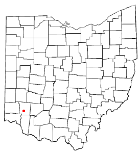
mapsize = 250x200px
map_caption = Location of South Lebanon, Ohio
mapsize1 =
map_caption1 =subdivision_type = Country
subdivision_name =United States
subdivision_type1 = State
subdivision_name1 =Ohio
subdivision_type2 = County
subdivision_name2 = Warrengovernment_footnotes =
government_type =
leader_title =
leader_name =
leader_title1 =
leader_name1 =
established_title =
established_date =unit_pref = Imperial
area_footnotes =
area_magnitude =
area_total_km2 = 38.2
area_land_km2 = 37.9
area_water_km2 = 0.2
area_total_sq_mi = 14.7
area_land_sq_mi = 14.7
area_water_sq_mi = 0.1population_as_of = 2000
population_footnotes =
population_total = 4668
population_density_km2 = 123.0
population_density_sq_mi = 318.6timezone = Eastern (EST)
utc_offset = -5
timezone_DST = EDT
utc_offset_DST = -4
elevation_footnotes = GR|3
elevation_m = 192
elevation_ft = 630
latd = 39 |latm = 22 |lats = 52 |latNS = N
longd = 84 |longm = 13 |longs = 28 |longEW = Wpostal_code_type =
postal_code =
area_code =
blank_name = FIPS code
blank_info = 39-78610GR|2
blank1_name = GNIS feature ID
blank1_info = 1087121GR|3
website =
footnotes =Union Township is one of the eleven townships of Warren County,
Ohio ,United States , located in the central part of the county. It was establishedJanuary 3 ,1815 and named Union as it was formed from parts of Deerfield and Turtlecreek Townships. The 2000 census found 4,668 people in the township, up slightly from the 4,631 in 1990. Of those, 2,230 lived in the unincorporated part of the township and 2,438 lived in the village of South Lebanon.Geography
Located in the central part of the county, it borders the following townships:
*Turtlecreek Township - north
*Salem Township - east
*Hamilton Township - south, across theLittle Miami River
*Deerfield Township - southwestThe smallest township in the county, it originally had fifteen full and six fractional sections of land totalling 11,970 acres (48 km²). However, a large portion of the township has been annexed into South Lebanon, Lebanon, and Mason. The village of South Lebanon remains within the township, but Mason and Lebanon are not and that land has been lost. The township is prone to flooding from the Little Miami and
Turtle Creek .The entire township is in the
Symmes Purchase and was surveyed in accordance with the unusual plan Symmes chose.Union is the third most popular township name statewide; only Washington (43 townships) and Jackson (35 townships) are more common.
Government
The township is governed by a three-member board of trustees, who are elected in November of odd-numbered years to a four-year term beginning on the following
January 1 . Two are elected in the year after the presidential election and one is elected in the year before it. There is also an elected township clerk, who serves a four-year term beginning onApril 1 of the year after the election, which is held in November of the year before the presidential election. Vacancies in the clerkship or on the board of trustees are filled by the remaining trustees.Economy
There is significant
gravel mining in the township.Public services
Most of the township is in the Kings Local School District, which was formerly known as the Deerfield-Union Local School District, while parts are in the Lebanon City School District, the Mason City School District, and the Little Miami Local School District.
Telephone service is provided through the South Lebanon, Lebanon, Mason, and Morrow exchanges, while the South Lebanon, Lebanon, Kings Mills, and Morrow post offices serve the township.
Interstate 71 crosses the township from southwest to northeast and State Route 48 from south to north.U.S. Route 42 clips the northwest corner of the township. Formerly, theMiddletown and Cincinnati Railroad crossed the township, but all track southeast of US 42 has been abandoned and lifted. The city of Lebanon's sewage treatment plant is in Union Township, along the Little Miami River.References
*Elva R. Adams. "Warren County Revisited". [Lebanon, Ohio] : Warren County Historical Society, 1989.
*"The Centennial Atlas of Warren County, Ohio". Lebanon, Ohio: The Centennial Atlas Association, 1903.
*John W. Hauck. "Narrow Gauge in Ohio".Boulder, Colorado : Pruett Publishing, 1986. ISBN 0-87108-629-8
*Josiah Morrow. "The History of Warren County, Ohio". Chicago: W.H. Beers, 1883. (Reprinted several times)
*"Ohio Atlas & Gazetteer". 6th ed.Yarmouth, Maine : DeLorme, 2001. ISBN 0-89933-281-1
*William E. Smith. "History of Southwestern Ohio: The Miami Valleys". New York: Lewis Historical Publishing, 1964. 3 vols.
*Warren County Engineer's Office. "Official Highway Map 2003". Lebanon, Ohio: The Office, 2003.External links
* [http://www.co.warren.oh.us County website]
Wikimedia Foundation. 2010.