- Mexican Federal Highway 2
-
Federal Highway 2
Carretera Federal 2 Route information Length: 1,987.34 km[1][2][3][4][5][6] (1,234.88 mi) Western segment Length: 1,343.14 km[1][2][3] (834.59 mi) West end:  Fed. 1 in Tijuana, B.C.
Major
junctions: Fed. 15 in Santa Ana, Son.
Fed. 15 in Imuris Fed. 45 in Cd. Juárez, Chih.
East end: El Porvenir Eastern segment Length: 644.20 km[4][5][6] (400.29 mi) West end: Cd. Acuña, Coahuila Major
junctions: Fed. 57 in Piedras Negras
Fed. 85 in Nvo. Laredo, Tamps.
 Fed. 30 in Nva. Cd. Guerrero
 Fed. 54 in Cd. Mier
 Fed. 40 in Reynosa
 Fed. 101 / Fed. 180 in Matamoros
East end: Playa Lauro Villar at the Gulf of Mexico Location States: Baja California, Sonora, Chihuahua, Coahuila, Nuevo León, Tamaulipas Highway system ←  Fed. 1D
Fed. 3 → Federal Highway 2 (Carretera Federal 2) runs along the Mexico–United States border.
Contents
Route description
Lengths km mi Western segment B.C. 244.03[1] 151.63 Son. 745.79[2] 463.41 Chih. 353.32[3] 219.54 Segment
total1343.14 834.59 Eastern segment Coah. 204.02[4] 126.77 N.L. 24.00[5] 14.91 Tamps. 416.18[6] 248.60 Segment
total644.20 400.29 Total 1987.34 1234.88 The highway is divided into two discontinuous segments. The western segment begins in Tijuana, Baja California, and terminates at El Porvenir, Chihuahua, near Ciudad Juárez. The eastern segment begins at Ciudad Acuña, Coahuila, and continues to the Gulf of Mexico at Playa Lauro Villar, Tamaulipas, near Matamoros.
Between Tijuana and Mexicali in Baja California, and again between Reynosa and Matamoros in Tamaulipas, the route is bypassed by Mexican Federal Highway 2D, a four lane controlled access toll road referred to in Mexico as an autopista. It is advised that you use pesos when paying tolls as fair currency exchange is not always given for the US dollar. Highway 2 is considered to be part of Pacific Coastal Highway from Tijuana to Highway 15 in the State of Sonora.
The highway passes through the border states of Baja California, Sonora, Chihuahua, Coahuila, Nuevo León, and Tamaulipas. The highway also has connecting access to every official port of entry into the United States with the exception of the international bridge between Ojinaga, Chihuahua, and Presidio, Texas, which is within the gap between the two highway segments. These ports of entry allow access from the highway to all four United States border states: California, Arizona, New Mexico, and Texas. As a result, customs inspection stations are common along some sections of the highway.
Even if the highway were to be extended to join the two segments, the gap between the two is more directly crossed by traveling along Interstate 10 and U.S. Highway 90 in the United States because of the course of the Rio Grande (Río Bravo del Norte) around the Big Bend region of Texas.
Federal highways in Mexico are generally designated with even numbers for east-west routes and odd numbers for north-south routes. Numerical designations usually ascend southward away from the U.S. border for east-west routes, and usually ascend eastward away from the Pacific Ocean for north-south routes. Therefore, Federal Highway 2, due to its proximity to the border, has the lowest possible even number designation, and intersecting north-south federal routes conform to this pattern.
Major intersections
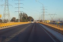 Colorado Bridge, a toll bridge over the Colorado River connecting the states of Baja California and Sonora
Western segment
- Western terminus at Fed. 1 in Tijuana, Baja California
- Fed. 3 in Tecate
- Fed. 5 in Mexicali
- Fed. 8 in Sonoyta, Sonora
- Fed. 15 south in Santa Ana
- Fed. 15 north in Imuris
- Fed. 17 in Agua Prieta
- Fed. 10 in Janos, Chihuahua
- Fed. 45 in Ciudad Juárez
The eastern terminus of this segment is in El Porvenir, Chihuahua
Eastern segment
The western terminus of this segment is in Ciudad Acuña, Coahuila
- Fed. 29 in Ciudad Acuña
- Fed. 57 in Piedras Negras
- Fed. 85 in Nuevo Laredo, Tamaulipas
- Fed. 30 in Nueva Ciudad Guerrero
- Fed. 54 in Ciudad Mier
- Fed. 40 in Reynosa
- Fed. 97 in Reynosa
- Fed. 101 / Fed. 180 in Matamoros
The eastern terminus of this segment is at Playa Lauro Villar on the Gulf of Mexico
See also
- List of Mexican autopistas
- List of Mexico–United States border crossings
- List of crossings of the Rio Grande
References
- ^ a b c "Datos Viales de Baja California" (in Spanish) (PDF). Dirección General de Servicios Técnicos, Secretaría de Comunicaciones y Transportes. 2011. pp. 5–7. http://dgst.sct.gob.mx/fileadmin/Viales_2011/02_BAJA_CALIFORNIA.pdf. Retrieved 2011-10-17.
- ^ a b c "Datos Viales de Sonora" (in Spanish) (PDF). Dirección General de Servicios Técnicos, Secretaría de Comunicaciones y Transportes. 2011. pp. 4–6, 13. http://dgst.sct.gob.mx/fileadmin/Viales_2011/26_SONORA.pdf. Retrieved 2011-10-17.
- ^ a b c "Datos Viales de Chihuahua" (in Spanish) (PDF). Dirección General de Servicios Técnicos, Secretaría de Comunicaciones y Transportes. 2011. pp. 4, 7–8. http://dgst.sct.gob.mx/fileadmin/Viales_2011/08_CHIHUAHUA.pdf. Retrieved 2011-10-17.
- ^ a b c "Datos Viales de Coahuila" (in Spanish) (PDF). Dirección General de Servicios Técnicos, Secretaría de Comunicaciones y Transportes. 2011. pp. 8, 10. http://dgst.sct.gob.mx/fileadmin/Viales_2011/05_COAHUILA.pdf. Retrieved 2011-10-17.
- ^ a b c "Datos Viales de Nuevo León" (in Spanish) (PDF). Dirección General de Servicios Técnicos, Secretaría de Comunicaciones y Transportes. 2011. p. 8. http://dgst.sct.gob.mx/fileadmin/Viales_2011/19_NUEVO_LEON.pdf. Retrieved 2011-10-17.
- ^ a b c "Datos Viales de Tamaulipas" (in Spanish) (PDF). Dirección General de Servicios Técnicos, Secretaría de Comunicaciones y Transportes. 2011. pp. 8–11. http://dgst.sct.gob.mx/fileadmin/Viales_2011/28_TAMAULIPAS.pdf. Retrieved 2011-10-17.
 Mexican Federal Highways
Highways 1 • 2 • 3 • 5 • 8 • 9 • 10 • 11 • 12 • 14 • 15 • 16 • 17 • 18 • 19 • 20 • 22 • 23 • 24 • 25 • 26 • 28 • 29 • 30 • 31 • 34 • 35 • 36 • 37 • 38 • 40 • 41 • 43 • 44 • 45 • 47 • 49 • 51 • 52 • 53 • 54 • 55 • 57 • 58 • 61 • 62 • 63 • 64 • 66 • 68 • 69 • 70 • 71 • 72 • 74 • 76 • 78 • 80 • 81 • 82 • 84 • 85 • 87 • 90 • 93 • 95 • 97 • 98 • 100 • 101 • 102 • 103 • 105 • 106 • 107 • 110 • 111 • 113 • 114 • 115 • 116 • 117 • 119 • 120 • 121 • 123 • 125 • 126 • 127 • 128 • 129 • 130 • 131 • 132 • 134 • 135 • 136 • 138 • 140 • 142 • 143 • 144 • 145 • 147 • 150 • 160 • 162 • 166 • 172 • 175 • 176 • 178 • 179 • 180 • 182 • 184 • 185 • 186 • 187 • 188 • 190 • 193 • 195 • 196 • 198 • 199 • 200 • 202 • 203 • 211 • 217 • 220 • 221 • 225 • 247 • 254 • 259 • 261 • 263 • 265 • 281 • 293 • 295 • 307Categories:- Mexican Federal Highways
- Gran Desierto de Altar
- Chihuahuan Desert


Wikimedia Foundation. 2010.