- Santa Cruz County, Arizona
-
Santa Cruz County, Arizona 
Seal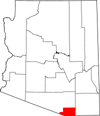
Location in the state of Arizona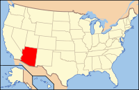
Arizona's location in the U.S.Founded March 15, 1897 Seat Nogales Area
- Total
- Land
- Water
1,238.11 sq mi (3,207 km²)
1,237.63 sq mi (3,205 km²)
0.47 sq mi (1 km²), 0.04%Population
- (2010)
- Density
47,420
38/sq mi (14.7/km²)Website www.co.santa-cruz.az.us Santa Cruz is a county in southern Arizona established in 1899. As of the 2010, its population was 47,420, an increase of 9,039 people since the 2000 census count of 38,381.[1] The county seat is Nogales.[2]
Santa Cruz County contains many vineyards.
Contents
History
Santa Cruz County, formed on March 15, 1899, out of what was then Pima County, is named after the Santa Cruz River, which was named in the late 17th century by Father Kino. Santa Cruz means "holy cross" in Spanish. After that Father Kino built the famous mission which still stands today at the Tumacácori National Historical Park.[3][4]
Geography
According to the 2000 census, the county has a total area of 1,238.11 square miles (3,206.7 km2), of which 1,237.63 square miles (3,205.4 km2) (or 99.96%) is land and 0.47 square miles (1.2 km2) (or 0.04%) is water.[5] Although Santa Cruz County is the smallest county in Arizona, it is still larger in area than the national average of 622 square miles (1,610 km2). (See County (United States).)
Major highways
Adjacent counties and municipalities
- Pima County, Arizona - west, north
- Cochise County, Arizona - east
- Nogales, Sonora, Mexico - south
- Santa Cruz, Sonora, Mexico - south
- Sáric, Sonora, Mexico - southwest
National protected areas
- Coronado National Forest (part)
- Las Cienegas National Conservation Area (part)
- Tumacácori National Historical Park
Demographics
Historical populations Census Pop. %± 1900 4,545 — 1910 6,766 48.9% 1920 12,689 87.5% 1930 9,684 −23.7% 1940 9,482 −2.1% 1950 9,417 −0.7% 1960 10,808 14.8% 1970 13,966 29.2% 1980 20,459 46.5% 1990 29,676 45.1% 2000 38,381 29.3% 2010 47,420 23.6% 2010
Whereas according to the 2010 U.S. Census Bureau:
- 73.5% White
- 0.4% Black
- 0.7% Native American
- 0.5% Asian
- 0.0% Native Hawaiian or Pacific Islander
- 2.0% Two or more races
- 22.9% Other races
- 82.8% Hispanic or Latino (of any race)
2000
As of the census[6] of 2000, there were 38,381 people, 11,809 households, and 9,506 families residing in the county. The population density was 31 people per square mile (12/km²). There were 13,036 housing units at an average density of 10 per square mile (4/km²). The racial makeup of the county was 76.00% White, 0.38% Black or African American, 0.65% Native American, 0.52% Asian, 0.09% Pacific Islander, 19.73% from other races, and 2.63% from two or more races. 80.78% of the population were Hispanic or Latino of any race. 79.71% of the population reported speaking Spanish at home, while 19.51% speak English [2].
There were 11,809 households, of which 45.60% had children under the age of 18 living with them, 61.30% were married couples living together, 15.40% had a female householder with no husband present, and 19.50% were non-families. 16.50% of all households were made up of individuals and 7.10% had someone living alone who was 65 years of age or older. The average household size was 3.23 and the average family size was 3.66.
In the county the population was spread out with 33.60% under the age of 18, 8.20% from 18 to 24, 26.60% from 25 to 44, 20.80% from 45 to 64, and 10.70% who were 65 years of age or older. The median age was 32 years. For every 100 females there were 91.70 males. For every 100 females age 18 and over, there were 86.20 males.
The median income for a household in the county was $29,710, and the median income for a family was $32,057. Males had a median income of $27,972 versus $21,107 for females. The per capita income for the county was $13,278. About 21.40% of families and 24.50% of the population were below the poverty line, including 29.70% of those under age 18 and 23.20% of those age 65 or over.
Communities
 Map of the incorporated areas in Santa Cruz County.
City
Town
Census-designated places
- Amado
- Elgin
- Rio Rico Northeast
- Rio Rico Northwest
- Rio Rico Southeast
- Rio Rico Southwest
- Sonoita
- Tubac
- Tumacacori-Carmen
Other communities
See also
References
- ^ "[1]." United States Census Bureau. Retrieved on April 5, 2008
- ^ "Find a County". National Association of Counties. http://www.naco.org/Counties/Pages/FindACounty.aspx. Retrieved 2011-06-07.
- ^ "History: Pima County". Pima County Justice Court (jp.pima.gov). September 27, 2000. http://jp.pima.gov/Pages/history/county.htm. Retrieved 2009-09-30.
- ^ "Santa Cruz County". Arizona State Library Archives and Public Records: Arizona History and Archives Division (lib.az.us). August 4, 2009. http://www.lib.az.us/archives/county_santa_cruz.cfm. Retrieved 2009-09-30.
- ^ "Census 2000 U.S. Gazetteer Files: Counties". United States Census. http://www.census.gov/tiger/tms/gazetteer/county2k.txt. Retrieved 2011-02-13.
- ^ "American FactFinder". United States Census Bureau. http://factfinder.census.gov. Retrieved 2008-01-31.
External links

Pima County Pima County 
Cochise County  Santa Cruz County, Arizona

Sáric, Sonora, Mexico Nogales, Sonora, Mexico and Santa Cruz, Sonora, Mexico Municipalities and communities of Santa Cruz County, Arizona City 
Town CDPs Ghost towns Alto | Calabasas | Canelo | Duquesne | Harshaw | Mowry | Oro Blanco | Ruby | Salero
 State of Arizona
Topics - Index
- Climate
- Delegations
- Geography
- History
- Museums
- Music
- People
- Transportation
- Visitor Attractions
Society - Culture
- Demographics
- Economy
- Education
- Politics
Regions - Arizona Strip
- Arizona Sun Corridor
- Coconino Plateau
- Colorado Plateau
- Grand Canyon
- Kaibab Plateau
- Mogollon Plateau
- Mogollon Rim
- Mojave Desert
- Monument Valley
- North Central Arizona
- Northeast Arizona
- Northern Arizona
- Oak Creek Canyon
- Phoenix Metropolitan Area
- Safford area
- San Francisco Volcanic Field
- Sonoran Desert
- Southern Arizona
- Verde Valley
- White Mountains
Counties Cities Coordinates: 31°32′16″N 110°49′35″W / 31.53778°N 110.82639°W
Categories:- Arizona counties
- Santa Cruz County, Arizona
- 1899 establishments in the United States
- Populated places established in 1899
- Counties of the United States with Hispanic majority populations


Wikimedia Foundation. 2010.