- Hinchinbrook Island
Infobox_protected_area_of_Australia | name = Hinchinbrook Island National Park
iucn_category = II
caption =
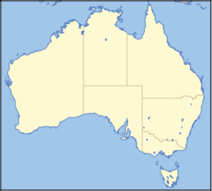
locator_x = 225
locator_y = 53
nearest_town_or_city = Cardwell
coordinates = coord|18|13|46|S|146|13|58|E|type:landmark_region:AU
area = 399 km² (154 sq. miles)
established = 1932
visitation_num =
visitation_year =
managing_authorities = Queensland Parks and Wildlife Service
official_site = [http://www.epa.qld.gov.au/projects/park/index.cgi?parkid=201 Hinchinbrook Island National Park]Hinchinbrook Island is an island in tropical north Queensland, between the mainland and the
Great Barrier Reef , and between the region's major cities Townsville andCairns (about 180km south of Cairns and 120km north of Townsville). Most of it as well as the adjacentHinchinbrook Channel and the nearbyGoold Island belong to Australia' largestisland National Park -- the Hinchinbrook Island National Park.Nature
Hinchinbrook Island came into being when after the last ice age the sea level rose and flooded nowaday's Hinchinbrook Channel which had up to then been a valley in a mountain range. Thus, Hinchinbrook Island was originally a mountain, belonging to a huge mountain range to which then also now submerged parts of the Great Barrier Reef belonged.
Today, the shores of Hinchinbrook Channel or Hinchinbrook Passage and the northwest of the isle situated
Missionary Bay are covered with extensive and very biodiversemangrove s, and thesea grass beds in the adjoining relatively shallow waters are grazed bydugong s, members of a threatened species ofseacow s.Hinchinbrook Island's eastern seaboard is mainly rocky and sandy, only around the estuaries of the largerstreams s grow mangroves. It borders theGreat Barrier Reef .The island itself is wild,
mountain ous and covered with thick bush, heath andforest s. It is a refuge for numerousendangered species of plants and animals like theGiant Tree Frog .The island's highest point is Mount Bowen, whose summit is at 1,121 metres or 3,747 feet above sea level. It was once a
volcano like many of the other peaks of the island as well. The climate is tropical, partly rather wet, partly rather dry (see diagrams).Other conservation parks nearby
A few kilometres to the north of this park are
Goold Island National Park and beyond that theFamily Islands National Park .The waters around Hinchinbrook Island are part of the
Great Barrier Reef Marine Park .History
Prior to European settlement Hinchinbrook Island was inhabited by the
Bandjin people, who also settled on the coastal strip on the other side of the Hinchinbrook Channel. They left shellmidden s, which still testify the former inhabitation of the island by the Bandjin. On ferry boat rides to the Island it is possible to see 10,000 year old fish traps laid by the Bandjin people. These man made rock formations use knowledge of the tides and fishing principles to capture and hold live fish for days. Prior to European contact, these traps were an important source of food for the Aboriginal people of the area. At times, too many fish would be caught in the traps. These fish were not killed or sold, they were left for the birds to eat as they so desired. The fish traps are not used by the Bandjin people presently, but fish continue to swim into them, get caught and feed the local birds.In 1770 A.D.
James Cook and his crew on HMS Endeavour sailed past in some distance east of Hinchinbrook Island. Its current name received Hinchinbrook Island on the 19th May 1819 A.D. from LieutenantPhillip Parker King RN (1791-1856) - naval officer, hydrographer and company manager - who then explored the north-eastern coast of Australia on the HM Colonial Cutter Mermaid, "possibly because Hinchinbrook was one of the titles held by the Montagu family, formerly Earls of Halifax, so King related the Island to Halifax Bay (named by Cook)" [http://www.nrm.qld.gov.au/property/placenames/detail.php?id=15917] .In the following decades a few European settlers came to the island who fished, farmed or mined there. However, never has a large part of the island been affected by these economic efforts.
In 1932 most of the island was declared a national park, which it is still today -- Australia's largest island national park.
Tourism
Destinations & Regulations
Apart from being an important nature reserve, Hinchinbrook Island is also an important (eco-)tourism destination. It is concentrated mainly on two parts of the isle: (1) There is a small resort on the northern tip of Hinchinbrook Island, Cape Richards, which lies outside the national park area. In it are the only remaining inhabitable buildings on the isle.
(2) Along the eastern coast of the island leads the 32 km or 20 miles
Thorsborne Trail , which has been named so in honour of the scientists and environmental activists Arthur and Margaret Thorsborne. The walk is for experienced walkers only and usually takes at least 4 days to complete.Camping on the island is bypermit only. Numbers are restricted to protect the park from environmental degradation. No open fires are permitted at any time and visitors should be aware that many crocodiles live in the islands waterways. It is possible to apply online for a camping permit at this [https://www.epa.qld.gov.au/parks/iaparks/gds/IAGDS020.do?parkId=211 EPA web page] . These steps are meant to protect the unique and delicate habitats with the aim of preservingbiodiversity .On the mainland near Hinchinbrook Island are e.g.Lumholtz National Park andEdmund Kennedy National Park .Day visitor pressure on Hinchinbrook Island is increasing due to adjacent coastal canal estate developments. Also, some feel that wilderness values across the island are being threatened because of development into Hinchinbrook Channel from Port Hinchinbrook.Travelling to & fro
There are two ferries to Hinchinbrook Island:
(1) Hinchinbrook Wilderness Safaris provides ferry services between Lucinda on the mainland and George Point on the south-eastern corner of Hinchinbrook Island. (2) Ingham Travel offer a minibus shuttle service between Lucinda and Ingham when required.(3) Hinchinbrook Island Ferries provide ferry services between the north-eastern parts of Hinchinbrook Island (Ramsay Bay, Macushla, Cape Richards) and Port Hinchinbrook on the mainland with bus connection to Cardwell.
Further Information
See also
*
Port Hinchinbrook
*Mount Bowen
*Protected areas of Queensland (Australia)
*Agnes Island - a close by island
* [http://wikitravel.org/en/Hinchinbrook_Island Wikitravel: Hinchinbrook Island]
* [http://www.missionbeachinfo.com/Hinchinbrook-Island.aspx Hinchinbrook Island]References
* Hema maps. (1997). "Discover Australia's National Parks". pp 178 - 179
Random House . ISBN 1-875992-47-2
* Matthew Fletcher et al.: "Walking in Australia". Lonely Planet 2001. ISBN 0-86442-669-0
* topographic maps of SunMap (Queensland Government: Department of Natural Resources, Mines and Water) [http://www.nrm.qld.gov.au/mapping/index.html] or Geoscience Australiawww.ga.gov.au , respectivelyAerial photos & maps
* [http://www.hinchinbrook.info www.hinchinbrook.info] - A community site documenting development pressures on Hinchinbrook Island and Channel
*wikitravel|Hinchinbrook Island
* [http://www.epa.qld.gov.au/projects/park/index.cgi?parkid=201 Hinchinbrook Island National Park] - Queensland Parks and Wildlife Service

Wikimedia Foundation. 2010.