Dhauliganga River

Dhauliganga River
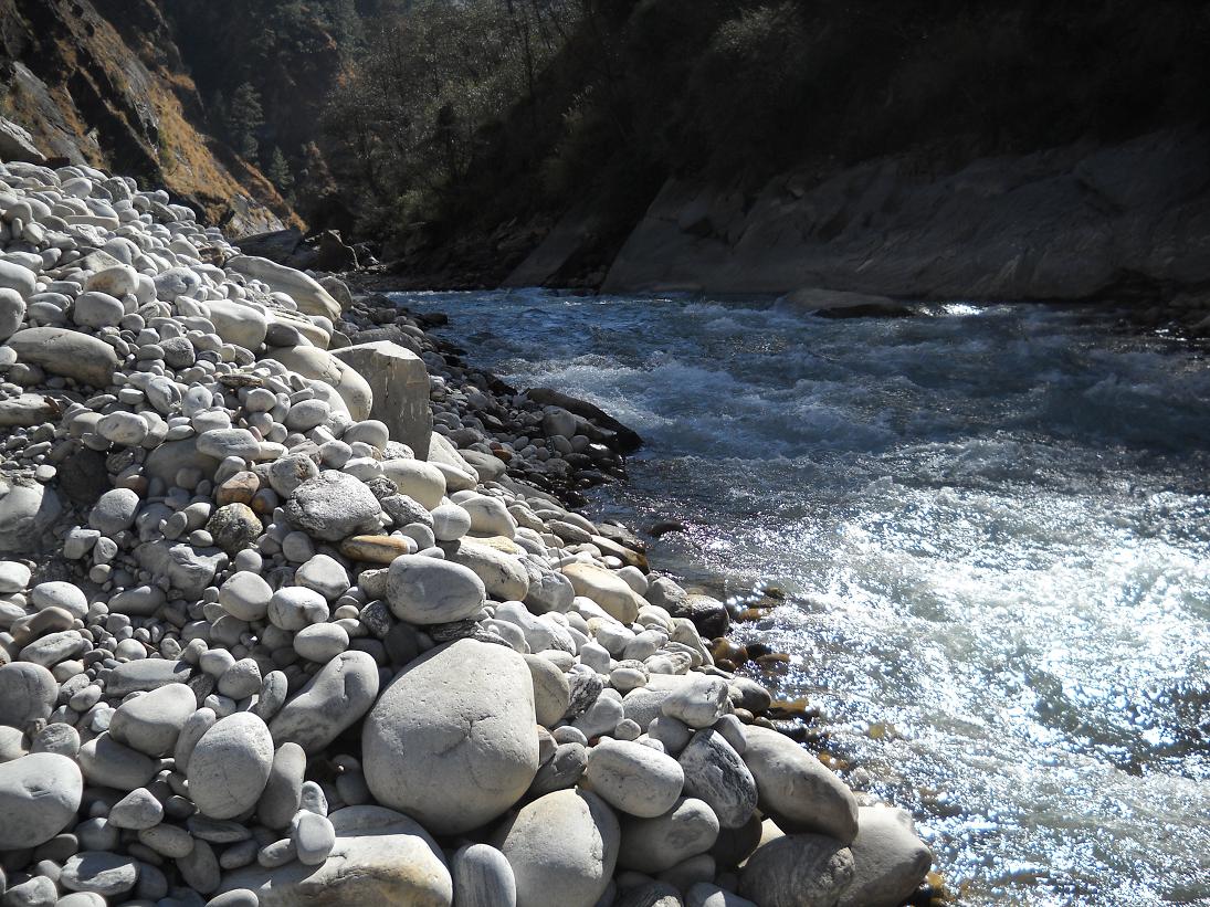
The Dhauliganga river tumbling in to meet the Alaknanda River at Vishnuprayag in the Garhwal Himalayas.

The Dhauliganga is one of the six source streams of the Ganges river. It meets the Alaknanda River at Vishnuprayag in Uttarakhand.

Path

The 82 km (51 mi)-long Dhauliganga rises at an altitude of 5,070 m (16,630 ft) in the Niti Pass in Chamoli District of Uttarakhand, and subsequently flows through Darma valley. At Raini, 25 km (16 mi) from Joshimath, it is joined by the Rishi Ganga river. The Dhauliganga ends at Vishnuprayag, when it runs into the Alaknanda River. Tapovan, known for its hot sulfur springgs, is situated on the banks of the river.[1]

References

  1. ^ [1] Himalayan rivers, lakes, and glaciers By Sharad Singh Negi

Coordinates: 29°58′N 80°37′E / 29.967°N 80.617°E / 29.967; 80.617


Wikimedia Foundation. 2010.

Игры ⚽ Нужно решить контрольную?

Look at other dictionaries:

  • Alaknanda River — The Alaknanda River is a tributary of the Ganga River that begins at the confluence of the Satopanth and Bhagirath Kharak glaciers in Uttarakhand. It merges with the Bhagirathi river near Devprayag after flowing for approx. 229 km through the… …   Wikipedia

  • Sarda River — ▪ river, Asia       river of northern India and western Nepal. It rises as the Kali River in far northern Uttarakhand state in the Great Himalayas (Himalayas) on the eastern slopes of the Nanda Devi massif. The river then flows generally south… …   Universalium

  • Sarda River — Kailash mountains Source of Mahakali and Karnali rivers Sarda River forms part of the border between the nations of India and Nepal. It is called the Mahakali River in Nepal and Kali Gad by local pahari people . This boundary was established by… …   Wikipedia

  • Ganges River — Hindi Ganga River, northern India and Bangladesh. Held sacred by followers of Hinduism, it is formed from five headstreams rising in Uttaranchal state. On its 1,560 mi (2,510 km) course, it flows southeast through the Indian states of Uttar… …   Universalium

  • Mandakini River — Mandakini (Hindi: मंदाकिनी [mənˈd̪aːkɪni]) is a tributary of the Alaknanda River. Mandakini originates from the Charabari Glacier near Kedarnath in Uttarakhand, India. Mandakini is fed by Vasukiganga River at Sonprayag. Mandakini joins Alaknanda… …   Wikipedia

  • Gorigar River — The Gorigar River originates from the Milam glacier, which in turn originates from Trisuli mountain. One kilometre downstream of the snout of the glacier, the Milam village is situated, hence the name of glacier. At the Milam, a river coming from …   Wikipedia

  • Gangotri — Infobox Indian Jurisdiction native name = Gangotri | type = city | latd = 30.98 | longd = 78.93 state name = Uttarakhand district = Uttarkashi leader title = leader name = altitude = 3753 population as of = 2001 population total = 606| population …   Wikipedia

  • Chamoli district — Chamoli चमोली ज़िला   district   …   Wikipedia

  • Bhotiya — The Bhotiya( they actually call themselves RANG tribe) are an ethno linguistic group of people living in the trans Himalayan region that divides India from Tibet. They are closely related to the Tibetans and their name, Bhotiya, derives from the… …   Wikipedia

  • List of dams and reservoirs in India — Map of the major rivers, lakes and reservoirs in India This page lists the dams and reservoirs in India. It also includes lakes. This list is incomplete; you can help by expanding it …   Wikipedia

Share the article and excerpts

Direct link
Do a right-click on the link above
and select “Copy Link”