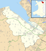
Coed Talon

Coed Talon
Former Calvinistic Methodist chapel in Coed Talon

Coed Talon (also spelt "Coed-talon") is a small, formerly industrial village between Leeswood and Treuddyn in Flintshire, North Wales. Its name is derived from the Welsh word coed ("wood") and the word talwrn, anglicised to "Talon", meaning a "hillside devoid of trees" or "threshing-floor" (perhaps referring to a wood beneath a bare hillside).[1]

The area, about four miles from the market town of Mold, was primarily agricultural until the nineteenth century, when following the discovery of coal and iron ore seams, an ironworks, collieries and brickworks were opened. There was also a silica quarry nearby at Waun y Llyn. The industries were served by a branch of the London and North Western Railway, who in 1892 introduced a passenger service to Coed Talon, running over part of the Wrexham and Minera Joint Railway to Brymbo in Denbighshire.[2]

The station closed in 1950 and the line to Brymbo was taken out of use shortly afterwards, though goods trains from Mold continued until 1963. However, the village still has a pub called the Railway Inn. The small-scale colliery workings at Coed Talon operated until 1987, and were subsequently worked by the opencast method. A brickworks also continued in operation at Coed Talon until relatively recently.

References

  1. ^ Davies, E. Flintshire place-names, University of Wales Press, 1959, p.38
  2. ^ Coed Talon, Disused Stations

Coordinates: 53°07′20″N 3°05′41″W / 53.1222°N 3.0948°W / 53.1222; -3.0948


Wikimedia Foundation. 2010.

Игры ⚽ Нужно сделать НИР?

Look at other dictionaries:

  • Coed Talon Marsh — is a Site of Special Scientific Interest in the preserved county of Clwyd, north Wales. See also List of Sites of Special Scientific Interest in Clwyd This article about a Site of Special Scientific Interest is a stub. You can help Wikipedia by …   Wikipedia

  • List of Sites of Special Scientific Interest in Clwyd — This is a list of the Sites of Special Scientific Interest (SSSIs) in the Clwyd Area of Search. For SSSIs elsewhere in Wales, see List of SSSIs by Area of Search.* Afon Dyfrdwy (River Dee) * Alyn Valley Woods and Alyn Gorge Caves * Berwyn * Blaen …   Wikipedia

  • Leeswood — Coordinates: 53°07′59″N 3°05′42″W / 53.133°N 3.095°W / 53.133; 3.095 …   Wikipedia

  • Cilcain — is a small community, near Mold in Flintshire, north east Wales. The village has an industrial history and includes the Millennium Woods, a post office, a public house, a parish church and a village hall. Cilcain borders the parishes of Rhosesmor …   Wikipedia

  • Clwydian Range — Moel Arthur, one of the Clwydian Range s hill forts. Seen from Moel Llys y Coed The Clwydian Range (Welsh: Bryniau Clwyd) is a series of hills and mountains in north east Wales that runs from Llandegla in the south to Prestatyn in the north, with …   Wikipedia

  • Maelor Rural District — Coordinates: 53°03′50″N 2°52′19″W / 53.064°N 2.872°W / 53.064; 2.872 …   Wikipedia

  • Flintshire (historic) — Flintshire Welsh: Sir y Fflint Ancient extent of Flintshire Geography Status Ceremonial county (until 1974) Administr …   Wikipedia

  • Moel Famau — The Jubilee Tower at the summit of Moel Famau. Elevation …   Wikipedia

  • Mold, Flintshire — Coordinates: 53°09′58″N 3°07′59″W / 53.166°N 3.133°W / 53.166; 3.133 …   Wikipedia

  • Mostyn — For other uses, see Mostyn (disambiguation). Coordinates: 53°18′50″N 3°16′08″W / 53.314°N 3.269°W / 53.314; 3.269 …   Wikipedia

Share the article and excerpts

Direct link
Do a right-click on the link above
and select “Copy Link”