Kukmang

Kukmang

Union Councils
name = Kukmang


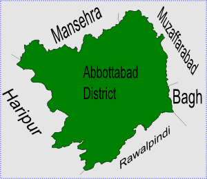
caption = Kukmang is located in Abbottabad District
province = NWFP
district = Abbottabad
tehsil = Abbottabad
nazim = Khalid Gul [http://www.abbottabad.gov.pk/Union-council/UCDetailPage.asp?name=Kukmang Kukmang Union Council] ]
naib nazim = Muhammad Akram
population = 10,843 [ [http://www.abbottabad.sdnpk.org/list_administrative.htm List of Union Councils and population in Abbottabad District] ]
coordinates = 34°16'20N 73°25'30E
Kukmang is one of the 51 Union Councils of Abbottabad District in the North-West Frontier Province of Pakistan. [ [http://www.abbottabad.sdnpk.org/adminunit.htm Administrative Units of District Abbottabad] ]

Location

Kukmang is located at 34°16'20N 73°25'30E and has an average elevation of 1208 metres (3966 feet). [ [http://www.fallingrain.com/world/PK/3/Kukmang.html Falling Rain Genomics - Location of Kukmang] ] It is situated in the north west of the district, it borders Boi to the north and Pattan Kalan to the east.

ubdivisions

The Union Council of Kukmang is divided into the following areas: Kothiala, Kukmang and Pattan Khurd, as part of the local government reforms of 2000 Pattan Khurd Union Council was merged into Kukmang.

Notable People

Yasir Hameed Qureshi [ [http://content-pak.cricinfo.com/pakistan/content/player/43656.html Crick Info - Yasir Hamid] ] was the first player of Pakistan National Cricket team who participated in international cricket with two test centuries. His family migrated to Peshawer in 1965 but has family members remaining in Kukmang Union Council.

References


Wikimedia Foundation. 2010.

Игры ⚽ Нужно решить контрольную?

Look at other dictionaries:

  • Kukmang — est l une des 51 subdivisions du district d Abbottabad de la province de la Frontière du Nord Ouest, au Pakistan[1]. Références ↑ (en) …   Wikipédia en Français

  • Abbottabad District — Abottabad District   District   Map of Hazara, Pakistan with Abbottabad District highlighted Country …   Wikipedia

  • Pattan Kalan —   Union council   Pattan Kalan is located in Abbottabad District Country …   Wikipedia

  • Nathia Gali —   Union council   Location of Nathia Gali union council (highlighted in red) within Abbottabad district …   Wikipedia

  • Namli Maira —   Union council   Location of Namli Maira (highlighted in red) within Abbottabad district, the names of the neighbouring districts to Abbottabad are also shown …   Wikipedia

  • Abbasi — ( ar. عباسی) is a prominent Muslim family name. Origin The name denotes descent from Abbas ibn Abd al Muttalib, the paternal uncle of Prophet Muhammad. The Abbasid caliphate was established by the Abbasi clan and ruled the Middle East during… …   Wikipedia

  • Dhamtour —   Union council   Dhamtore is located in Abbottabad District Coordinates …   Wikipedia

  • Circle Bakote — is a cluster of Union Councils in the eastern part of Abbottabad District in the North West Frontier Province of Pakistan. Circle Bakote is located on the upper and west bank of the Jhelum River at Kohalla Bridge. The region is somewhere between… …   Wikipedia

  • Nagri Totial — Nagri Tutial   Union council   Location of Nagri Tutial (highlighted in red) within Abbottabad district, the names of the neighbouring districts to Abbottabad are also shown …   Wikipedia

  • Dewal Manal —   Union council   Dewal Manal is located in Abbottabad District Country …   Wikipedia

Share the article and excerpts

Direct link
Do a right-click on the link above
and select “Copy Link”